Googong Foreshore Walks
Something for Everyone
The shorelines surrounding Googong Dam, one of Canberra’s and the surrounding areas main water supplies, provides ample opportunity for recreational activities. Camping is not permitted because it is a water supply area so day walks are the go. Given how close it is located to central Canberra, the NSW city of Queanbeyan and the adjacent township of Googong, it provides ample walking opportunity and much closer than the better known Namadgi National Park or Tidbinbilla Nature reserve. Surprisingly enough while Googong foreshore is located in NSW, due to its importance to Canberra’s water supply, it is managed by ACT Rangers.
The following is a list of the walks in the Googong Foreshore Region ranging from 2.5km all the way up to just on 21km. The team from Australian Hiker has undertaken all of these walks so we can provide the most accurate information and real-life assessment. There’s a walk to suit everyone’s fitness level and interest including birdwatching, heritage and fishing for those inclined.
Black Wallaby Loop Walk 2.5km
With the exception of the 200 metre Cascades Walk, this is the shortest walk in the Googong area and provides good views down to the dam with limited exertion.
Click this link for the full write up of this walk
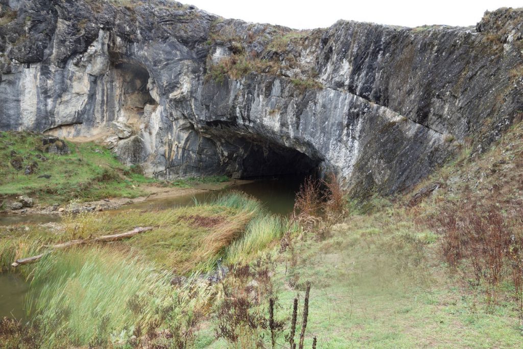
London Bridge Walk 2.7km
One of the best known walks in the region due to the instantly recognisable ‘bridge’ formed from natural stone. An easy walk that can be extended to include surrounding heritage areas.
Click this link for the full write up of this walk
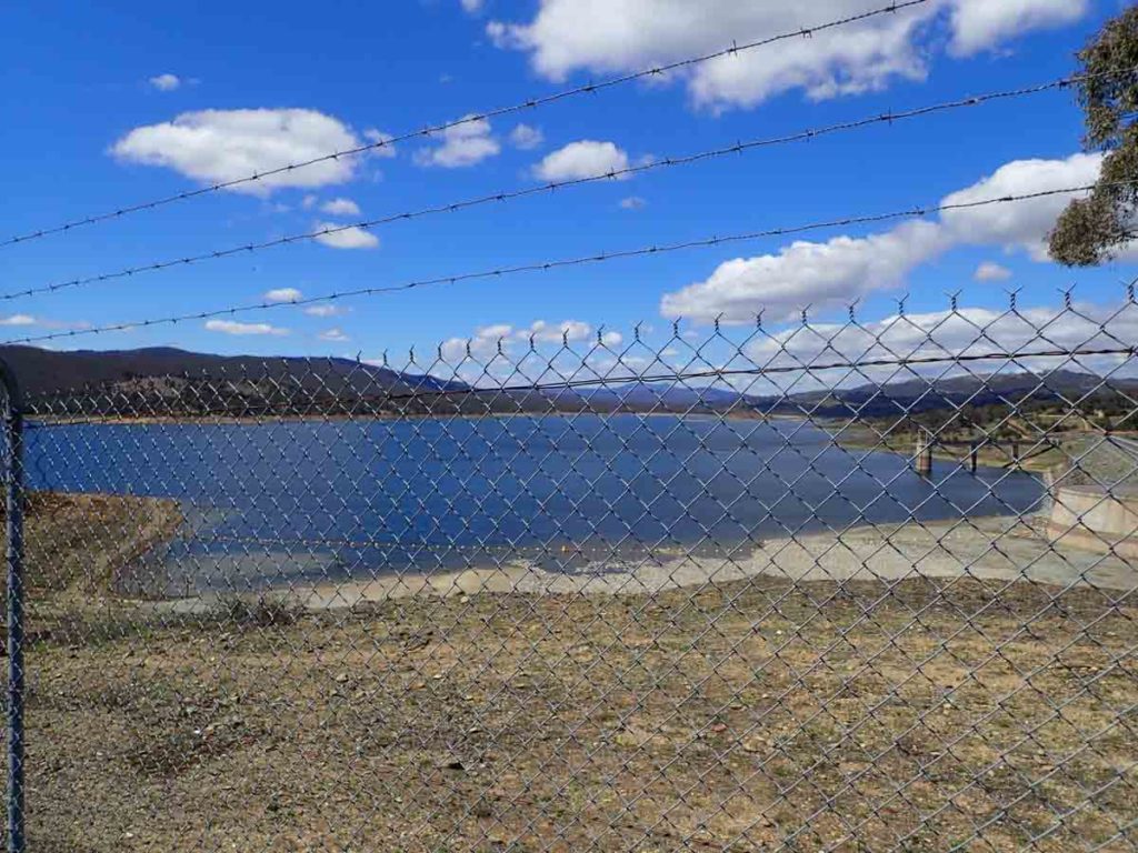
Shoreline Walk 4.9km
The Googong Shoreline Walk is as the name suggests a walk that skirts the shoreline of Googong Dam before heading back to the car park in a loop. The trail is well worn, not difficult to navigate and there is strategically placed signage and seating where you need.
Click this link for the full write up of this walk

Dhurrawarri Buranya Walk 5.7km
A medium length walk that takes you past London Bridge and then on through natural bushland for those wanting something a bit more exerting.
Click this link for the full write up of this walk
Bradleys Creek Walk 14.5km
This walk starts in the downstream car park which has ample parking for around 30 cars, a small covered picnic area, and descent toilet facilities. Depending on the fitness of the group, you can choose the much shorter and easier Black Wallaby Loop Track or if you are keen for an extended walk and have a good degree of fitness as well as 3.5-4 hours of available time, then the Bradleys Creek walk is a good option.
Click this link for the full write up of this walk
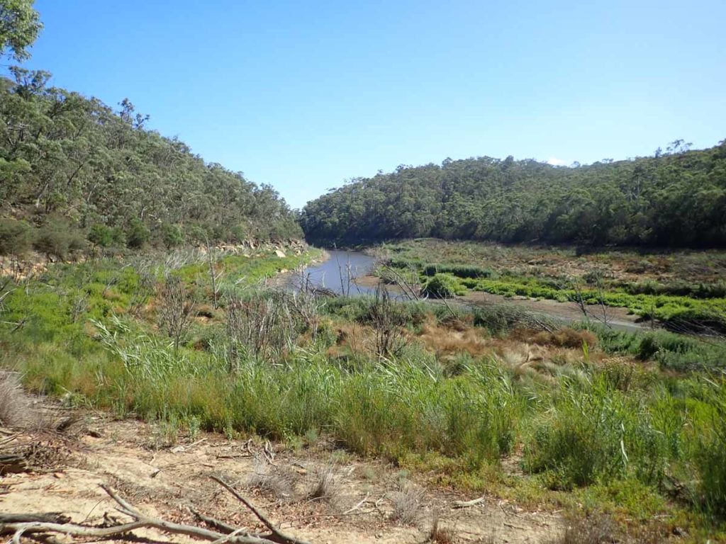
Queanbeyan River Loop Walk NSW 18.9 km
This is by far the hardest walk in this area but also our favourite walk. You can either do this walk as a loop or stick to the management road if the Queanbeyan river is running a but high. the bushland is dense and you go into the most remote areas of the region. Well worth it if you have the fitness.
Click this link for the full write up of this walk
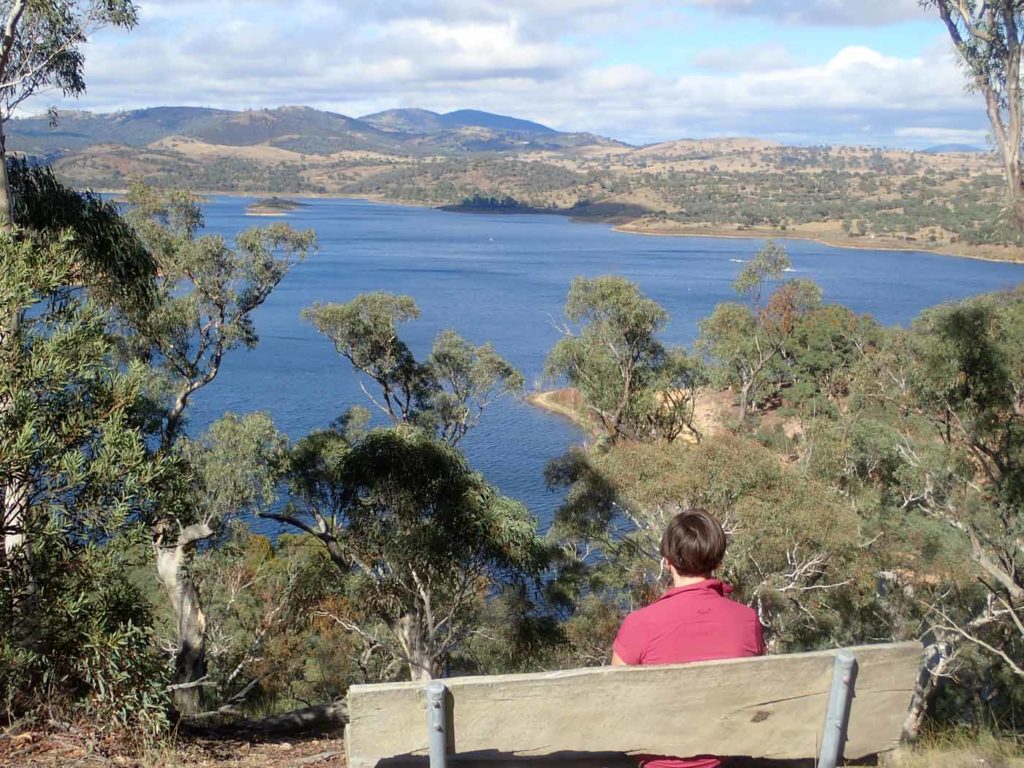
Western Foreshores Walk 20.3km
This is one of the longer walks in the Googong area at 20.3km and in fact it can be a walk/ride given its on the management trail for just about the entire way. The distance of the walk and the fact that you are walking on management road, means it can be punishing on the feet; this is a physically hard walk.
You have two options to do this walk. The first is the way I did it as an ‘out and back walk’ or you can walk in one direction and get picked up at the other end. If doing this walk from car park to car park, I would suggest starting at the Tin Hut car park and finishing at the Foreshores car park – my reasons are explained in the write up. If doing the full ‘out and back walk’, start and finish at the Foreshores car park.
Click this link for the full write up of this walk
