Bradleys Creek Walking Track NSW (14.5km)
Googong
Nearest Town
Googong via Queanbeyan
Starting Location
Downstream Picnic Area Googong
Finish Location
Downstream Picnic Area Googong
Best time to Travel
Year round although I would recommend that you avoid the middle of the day in summer
Bradleys Creek Walking Track Summary
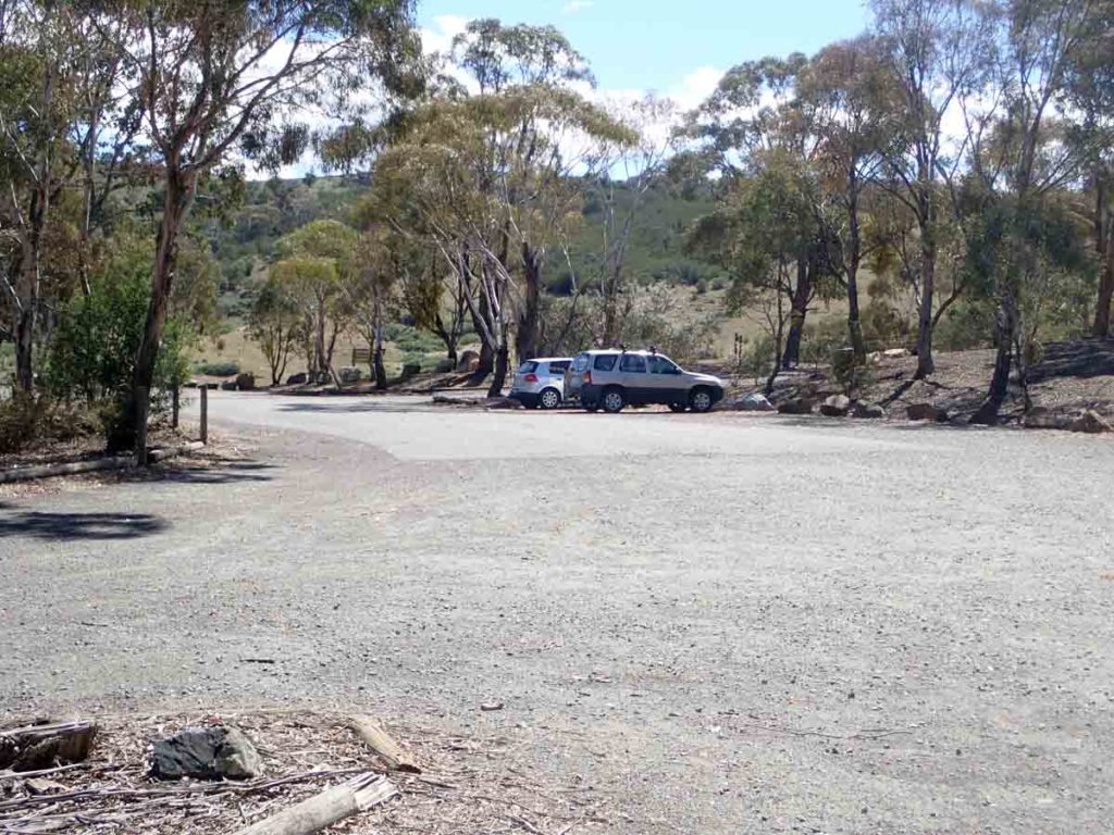
This walk starts in the downstream carpark which has ample parking for around 30 cars, a small covered picnic area, and decent toilet facilities. Depending on the fitness of the group you can either choose the much shorter and easier Black Wallaby Loop Track or if you are keen for an extended walk, have a good degree of fitness, as well as 3.5-4 hours of available time then locate the trail head signage for the Bradleys Creek walk and head off. The first part of this walk until just past the turn off point at around the 1km didn’t fill me with high expectations as to what to expect however this soon changed as we headed along the management road into the more heavily wooded parts of the trail. Jump to the end of this walk and this trail has become one of my favourites in the Googong region. It just had that certain something about it that both Gill and I enjoyed.
As we walked along this trail and started to head ever so slightly up hill the thought came to me that the two main stopping points of Gormon’s Trig would be at the high point, and Bradleys Creek would more than likely be located in the bottom of the valley. This ended up being exactly what happened. The first half of this walk is pretty much all up hill and some of the sections are reasonably steep leading up to Gormon’s Trig. What this does do though is afford some great views down onto Googong Dam below, the Googong Township, and even provides glimpses into Canberra itself with Black Mountain Tower being visible through the trees. The cover image for this write up is a seat located at the end of the first half of the steep climb that allows you to take in the views below and to have a rest before continuing on.
As you approach the high point on this trail two signs will come into view. The first directing you off to Gormon’s Trig which is about 40 metres off the trail and which surprisingly enough isn’t located on the summit of the hill but rather just off the crest itself. From Gormon’s trig you have just under 2.3km to go and its pretty much all down hill. All down a steep hill, that makes you realise that you have to walk back up again to return. As you continue to head down you will cross a couple of small culverts before you come to the final small valley in which Bradleys Creek is located and while the water level was almost non existent at the end of summer it was still worth the walk. It would be truely spectacular after a period of rain. As you approach the creek itself which runs across the road you will come across a sign that tells to that you are at the turnaround point. We chose to walk down the dry creek bed about 40 metes and sit and have a break before heading back to the car park. The walk then became the reverse of our trip there and made me realise that my fitness level is at its lowest for the past year and that I have a bit of training to do before my next long hike.
Wildlife was limited on this trail with there being only a few kangaroos as well as a fair number of birds but as mentioned this trail just had that ‘certain something’ about it that made me come away thinking that I would do this walk again in both the dead of winter with lots of fog around, as well as in mid spring after a bit of rain has refreshed the whole area. This hike is definitely only for fit hikers!
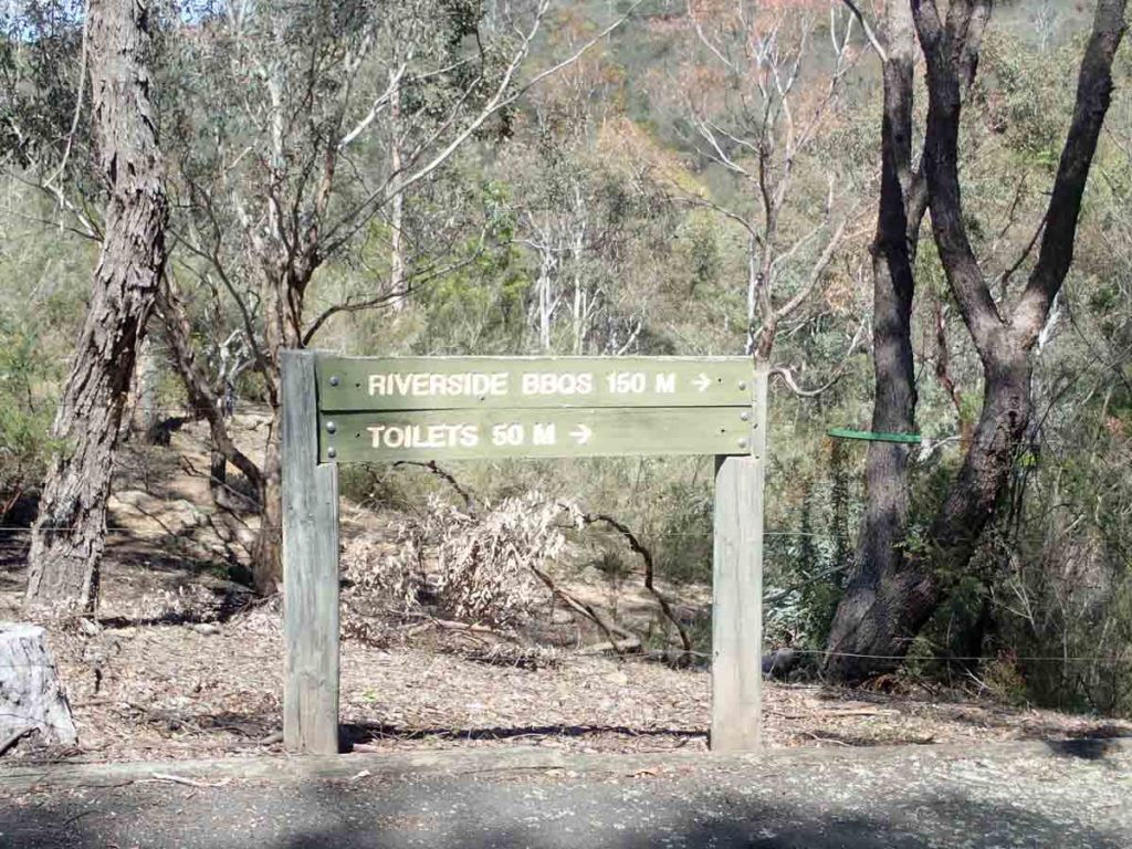
Directions to the toilets and an alternative picnic area
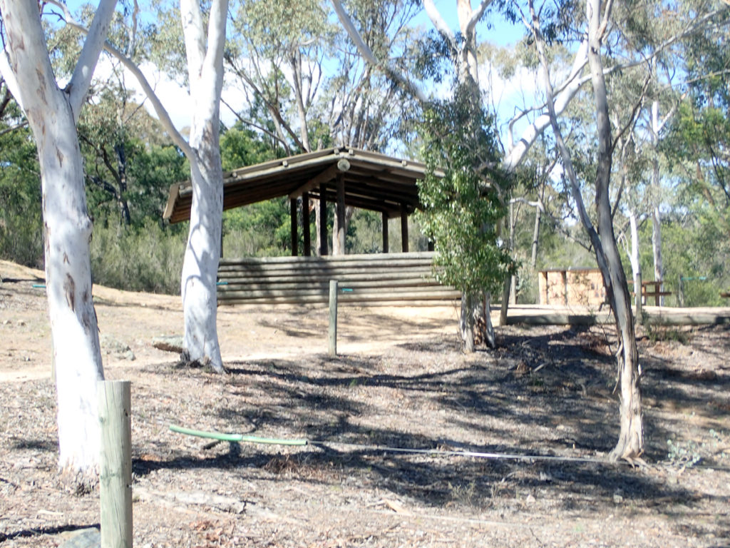
Picnic area at the trail head car park

Bradleys Creek Walking Track Trail head

Cross the road to start the trail

Turn off to the right the incline starts slowly

Low tide! Its been a long time since this dam has been totally full

Views of the dam get better the higher you go

This is one steep and sustained hill pretty much all the way to the high point at Gormon’s Trig

Views down to Googong Dam wall and Googong township
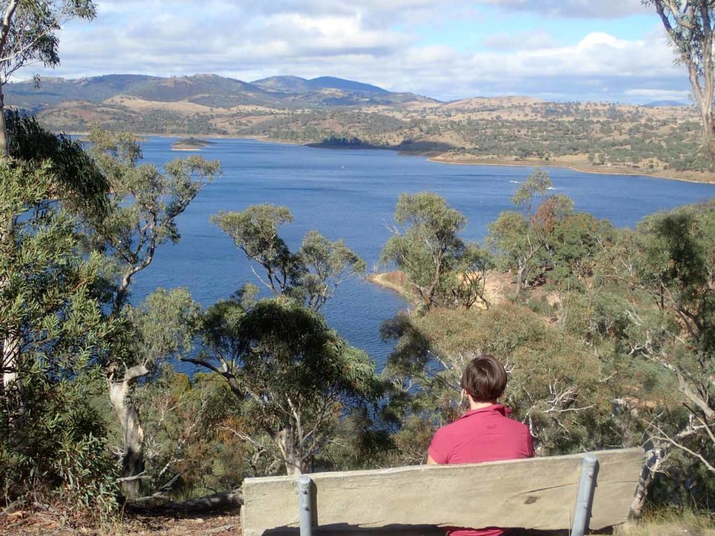
What a view from the seat. This is also a good time to break up the hill and have small rest

Signage as you approach Gormon’s Trig

Gormon’s Trig. The stick in the foreground is the summit

And down we go

Bradley creek down in the valley below

Bradleys Creek, time to turn around

Back up we go

Turn right back towards the car park

Back to the trail head, walk over

This is your walk. Uo down, up down
Getting There
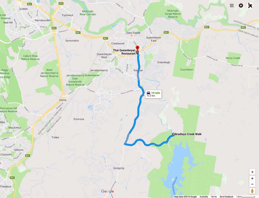
Google Map to the Downstream Picnic Area at Googong
How to get There: Head through Queanbeyan then on towards Googong. In early 2019 extensive road works were being undertaken to provide a major upgrade to this road so depending on when you travel the road may look a lot different
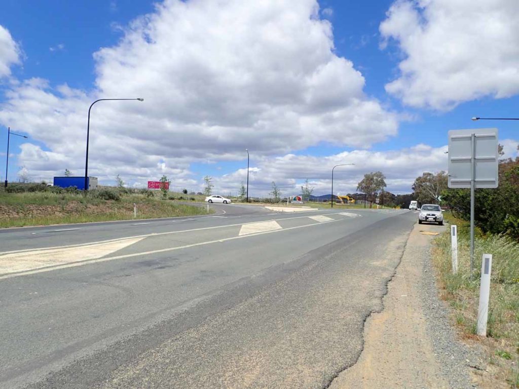
Turnoff to Googong
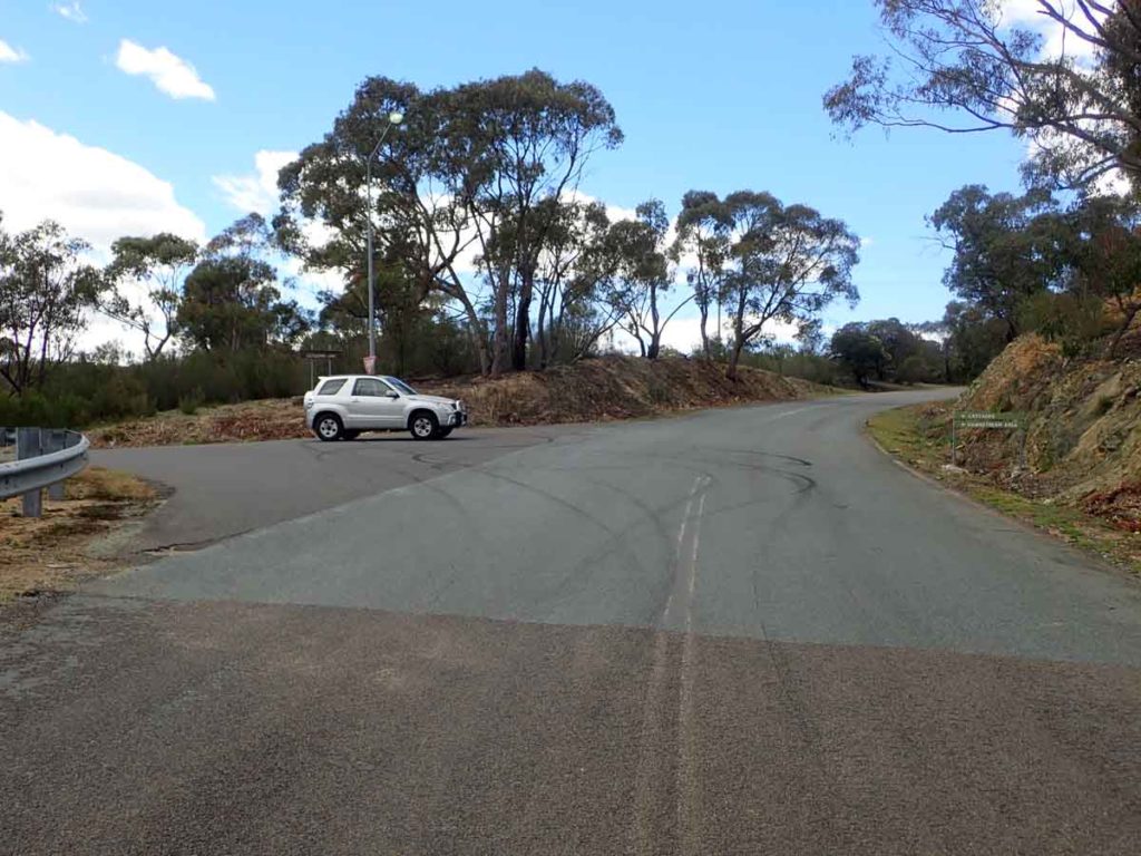
Turnoff to the Downstream Picnic Area
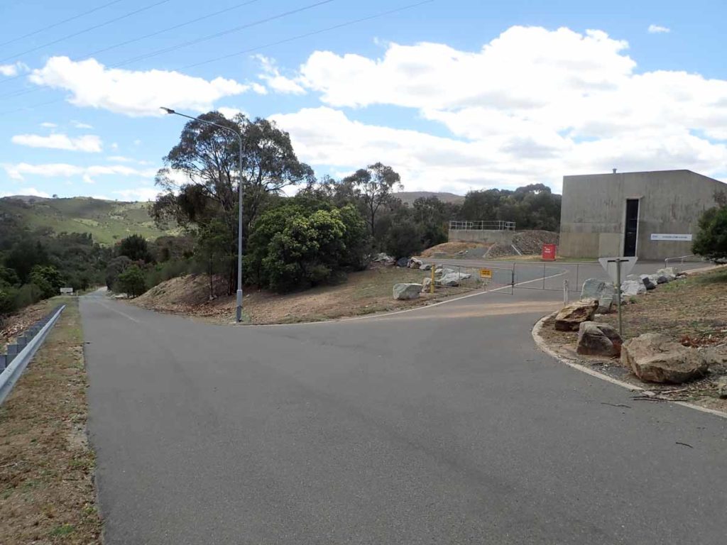
Dam pump house
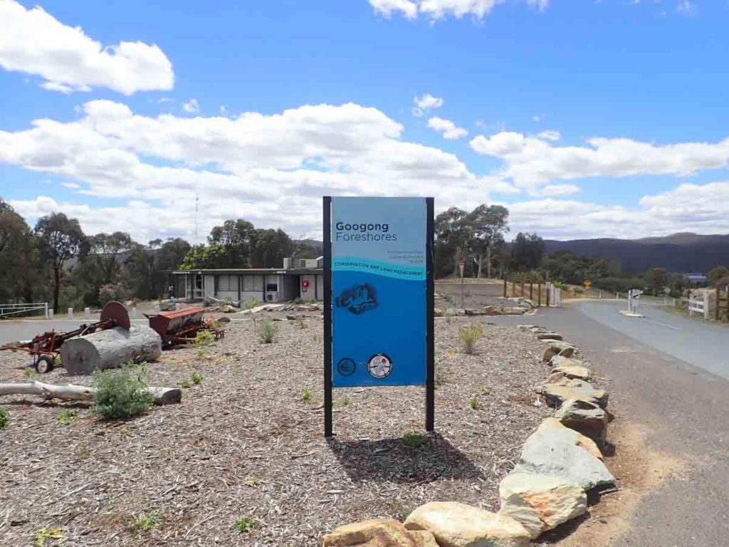
Visitor Centre
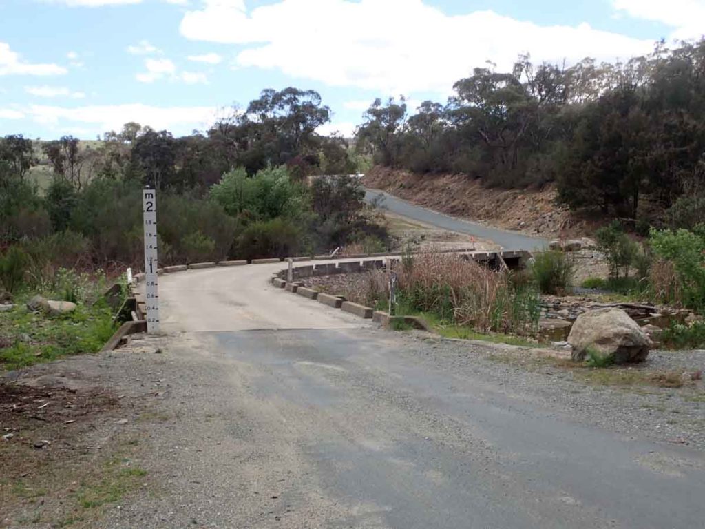
Creek crossing just before reaching the Downstream Picnic area that is the start of a number of walks including the Black Wallaby Loop Track and the Ridleys Creek walk, and the Bradley Creek walk
Downstream Picnic Area car park. There is enough space for around 30+ cars, a picnic are, and toilet facilities
Things to Know
- Phone: There is very good phone signal on most of this trail (Telstra). The data signal is not so crash hot in the valleys
- Water: You need to bring your own water
- Toilets: There are toilets located in the at the c ar park trailhead
- Trail: This trail consists mainly of formed management trail
- Dogs: No dogs allowed
- Other:
- This walk is done as an out and back walk
- Avoid the summer months – it is very, very hot at that time
- Although this area is managed by the ACT Government you are actually in NSW
- Opening hours are 8:00am-6:00pm but check on the ACT Government website prior to going
Disclaimer
This walk was undertaken by the team from Australian Hiker
Last Updated
17 June 2026