Mount Gingera ACT (14.9 km)
ACT
Nearest Town
The carpark for this walk is just off the Mt Franklin Road and is 75 km from the Canberra GPO with a large section of dirt road included. Travel time to the trail head is about 1.5-2 hours from the centre of Canberra
Best Time of the Year to Travel
October-March/early April
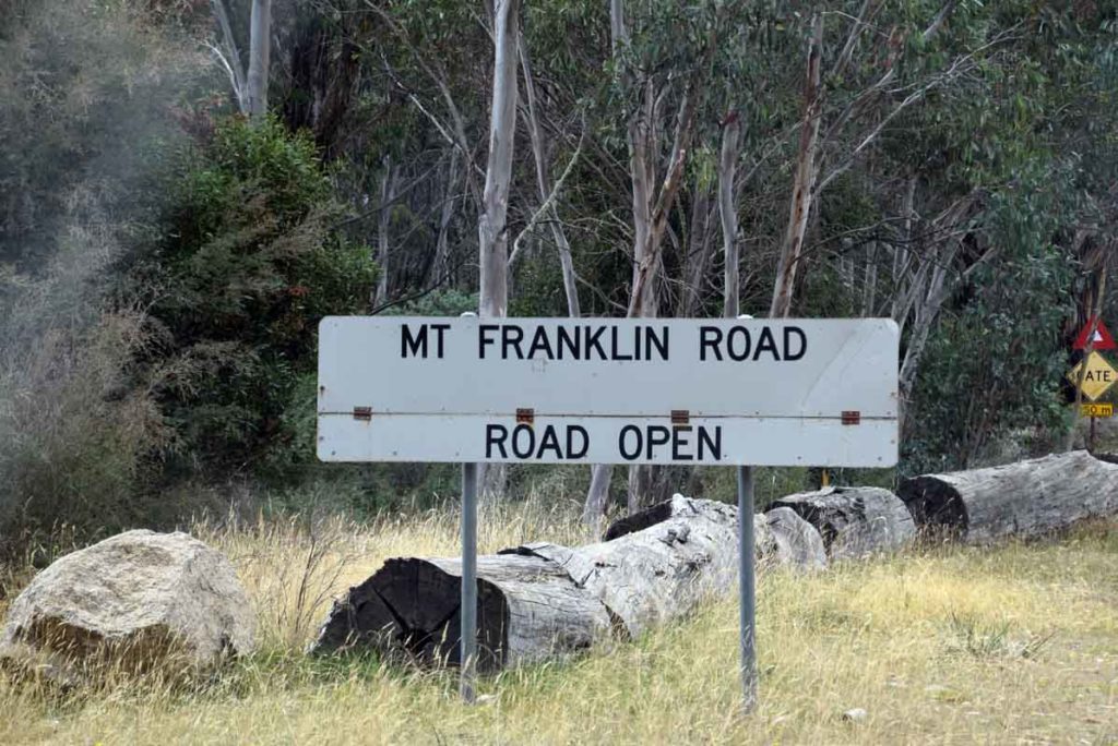
- Please note that in periods of high fire danger or heavy snow the Mount Franklin access road to the Mount Gingera trail head may be closed. Pay attention to the road condition signs on the way there
Starting Location
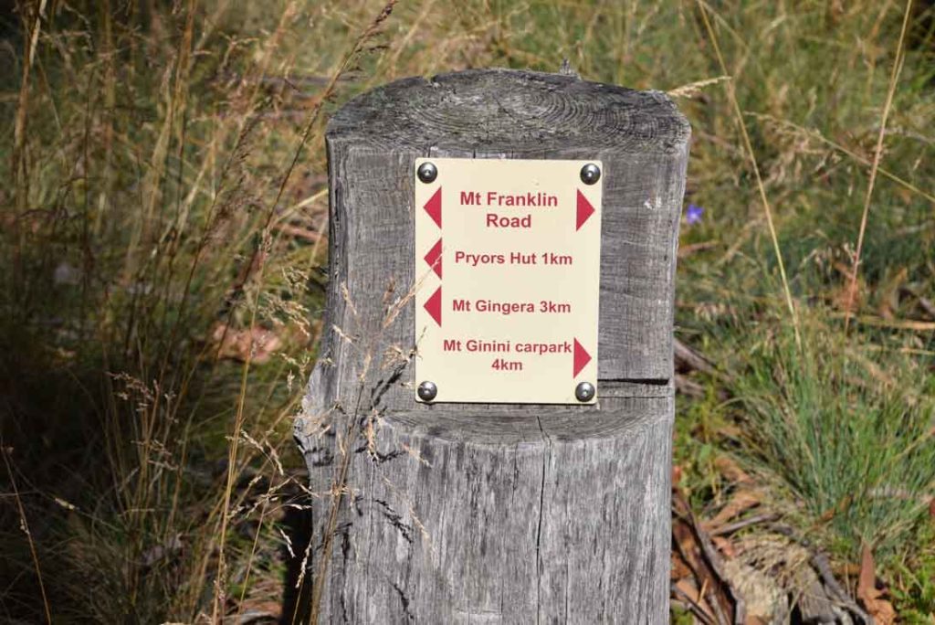
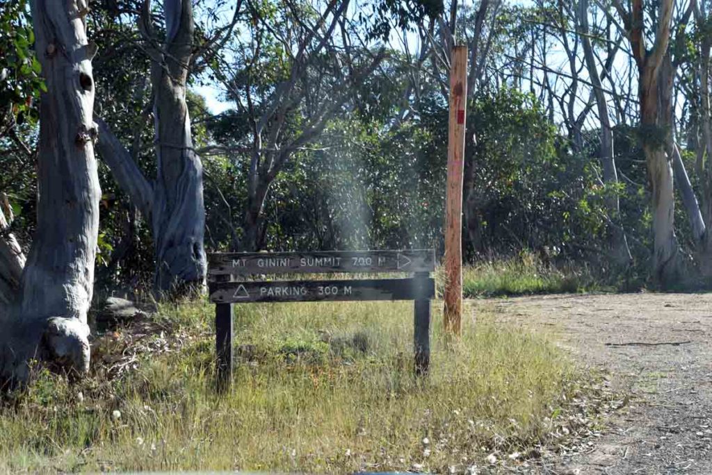
The Mount Gingera trail head is on the left side of Mt Franklin Road and is immediately adjacent to a locked gate. The trail head signage is just through the gate. The distance from the Mt Franklin trail head is just over 5km. You will also pass a road on the right to the summit of Mount Ginini. At this point you have about 300 metres to travel.
Finish Location
The Mount Gingera trail head is also the finish point for this walk
Mount Gingera Walk Review
If you feel like going a bit more remote then head towards the northwestern border of the ACT. Travelling on roads that quickly become dirt and are really only guaranteed to be passable in the warmer months. This road provides access to four main walks:
- Mt Gingera
- Mt Franklin,
- Mt Aggie and the
- Bendora Arboretum
Pay close attention as you pass the road condition signs to ensure the road is open as it can be closed in periods of extreme fire danger as well as heavy snow. The signage on this road is good so you will have no problem getting to the Mount Gingera trail head provided you pay attention.
Once you turn off onto the Mount Franklin Road you very quickly enter the Bimberi Wilderness and as you travel along the road there are a number of heavy gates that may be locked in bad conditions (fire danger/heavy snow). The Mount Franklin Road crosses the ACT/NSW border on a number of occasions but this walk is in the ACT.
Each of the walks in this area has something unique and the Mount Gingera summit walk is no different. In fact having having worked my way through most of the formed trails in the ACT, the Mount Gingera summit walk now has pride of place as my favourite walk and I’ll explain why.
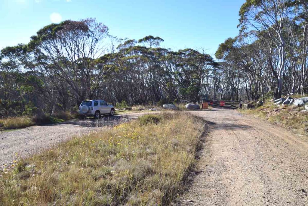
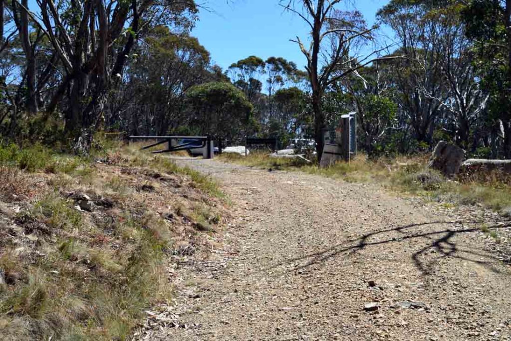
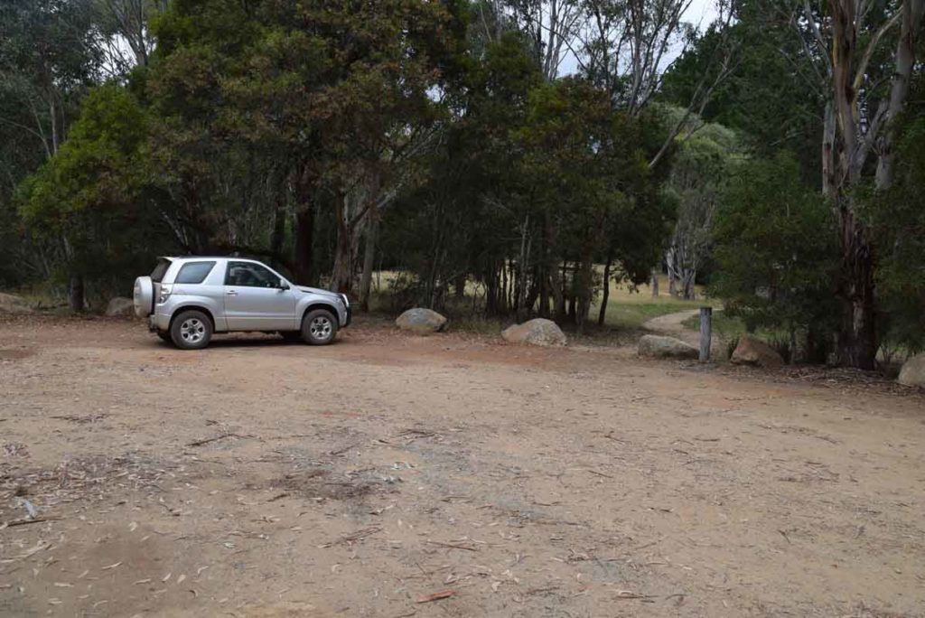
The Mount Franklin Road is shut to private vehicles at the trail head car park so you know you’ve reached your destination point for the start of the walk. The car park is on the left of the locked gate and will accomodate about ten cars.
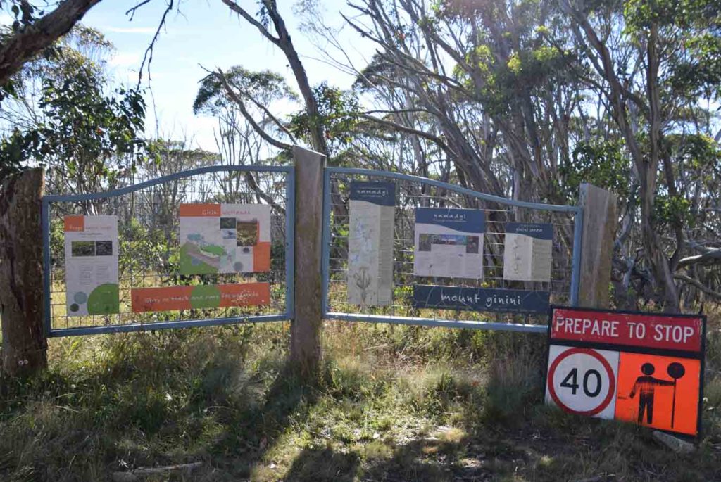
Walk around the locked gate and there is some interpretive signage just as you start the walk. The majority of this walk is along management trail and the trail register is about 100 metres down the road on the right hand side so don’t forget to sign in/out as you pass. This walk is really only guaranteed to be accessible during the warmer months of the year and while people do walk it in winter time, you have to pick the weather to ensure the road isn’t closed due to heavy snow. A better option in winter is to do the the Mount Gingera walk via Corin Dam.
Having lived most of my life in Canberra I tend not to think about snow too much but the entirety of this walk is over 1500 metres in altitude and the summit of Mount Gingera itself is almost 1900 metres so decent snow on the ground is to be expected in mid winter. If you are trying to walk this trail in winter and the road isn’t closed due to heavy snow, please ensure your vehicle and your driving skills are up to scratch. I would also suggest considering snow shoes if doing this walk in mid winter.
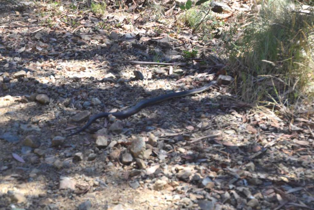
PLEASE NOTE: One other warning I would give here is that out of any walks in the ACT this is the one you can be pretty well be guaranteed to see snakes if travelling during the hotter months. On one of the days I did this walk in early March I came across two Brown Snakes and a Death Adder and heard a number of others just off the trail; boy do they move fast when they want!
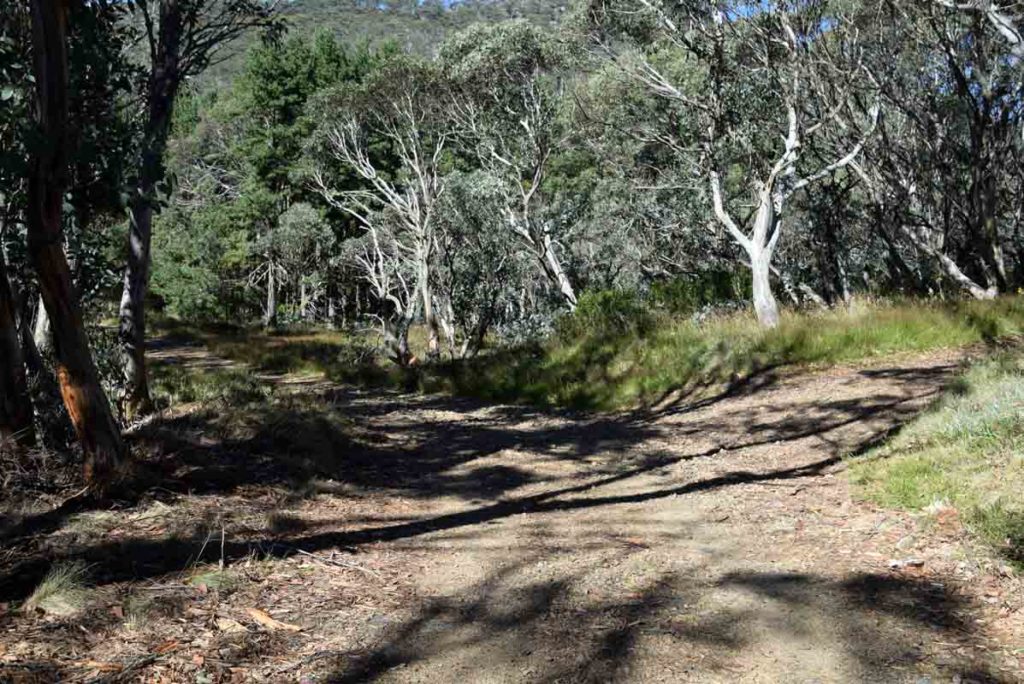
I started this walk just past 9:00am in the morning and the road to the base of Mount Gingera is an ‘OK’ walk but nothing spectacular in itself. In fact the old saying of ‘its the journey not the destination’ doesn’t apply to this walk. This walk is all about the destination! The management road is well maintained, occasionally rocky under foot but easy to navigate. You need to pay a bit more attention when there is snow because trail can be a bit obscured. One thing I did find disheartening on this trail was that the first 2 km involved walking down hill, in fact it involved a 200 metre descent. All I could think of at this stage was I had to make up this altitude loss.
Follow the road and keep an eye out for the minimal signage and you will eventually arrive at Pryor’s Hut which is about 5 km into the walk. This is an old working hut which can be used in an emergency to get out of the weather and the interpretive material in the hut is well worth a look. There is also a toilet just off to one side which is quite handy.
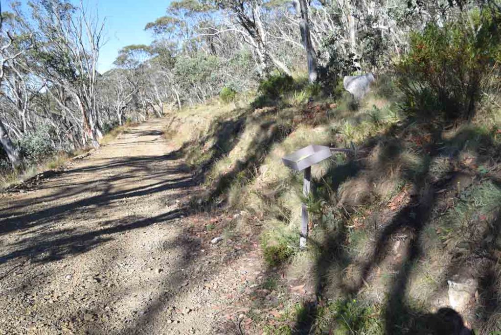
From Pryor’s Hut keep on walking up the management road and you will come to a tight hairpin bend and this is where you start your ascent of Mount Gingera itself. There is some very minimal signage here (see images below) so pay attention. The first time I did this walk it was in mid winter with about 40 cm of snow on the road so the trail was more difficult to spot particularly.
The trail up to the summit of Mount Gingera is heavily overgrown and very narrow and not long after the start of the walk I went through an old gate and was thinking about snakes and sure enough, I came across an extremely colourful Death Adder looking for food in a damp area in the middle of the trail. It had stopped foraging and was facing me as I approached and even though I had my camera in my hand it shot off so quickly I didn’t even have time to take a photo. I was paying attention at this point but it made me hyper aware for the rest of the relatively short distance to the summit making sure every time I put my foot down there was nothing there. As result the walk up to the summit took me a long time as I wasn’t wearing gaiters and didn’t have trekking poles, both of which I would strongly recommend to anyone doing this walk in the warmer months. While I didn’t see more snakes on the way to the summit I did hear a number just off the trail.
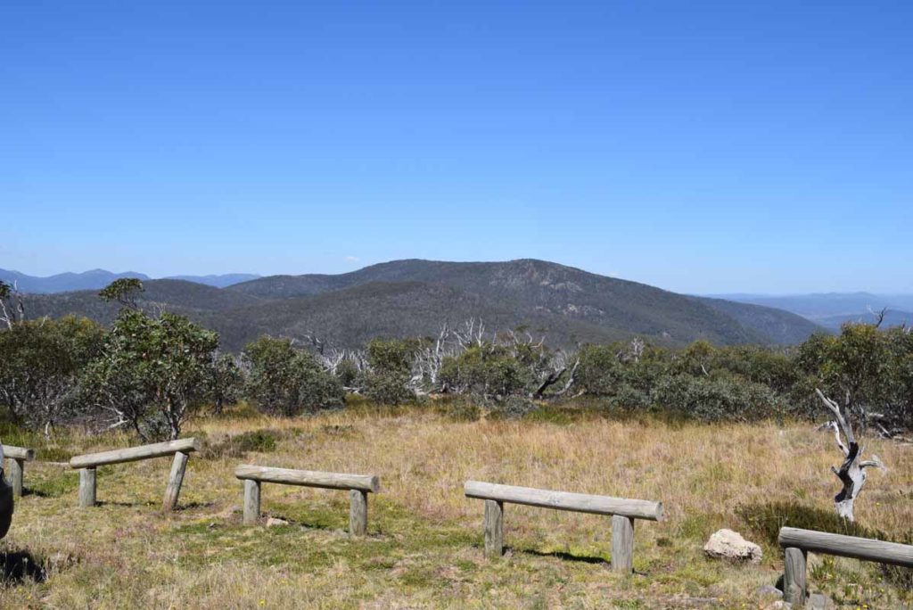
Once you reach the summit there are some large rock outcrops and you can pick your vantage point. I would suggest picking the highest point which requires a relatively easy rock scramble as this gives views both into NSW as well as the ACT. On my first summit to Mount Gingera, I decided this is my new favourite ACT walk because I was alone, the weather (apart from the wind) was mild and sunny, and the sky was reasonably cloudless providing panoramic views. In addition there is sense of wilderness so engrossing that it’s hard to describe. I have done a lot of walks into the Bimberi Wilderness but this just had everything going for it and can only be described as ‘special’. I may well have had a different opinion if there had been a number of other hikers or the weather hadn’t been so good but I was just lucky on the day.
The trip back down Mount Gingera was easy, if slow, as I kept an eye out for snakes and I made it back to the management trail without seeing any more. The return journey to the car park is the same route as the way to the summit. By the time I had gone past Pryor’s Hut I had pretty much gone into autopilot and had gone into my own thoughts. Given I was walking on a wide clean management trail I had put any thoughts of snakes aside and this was a mistake. My return journey was around midday and I came cross two Brown Snakes in the space of 1 km. Both were lying in the middle of the road sunning themselves. The first was about 1.5 metres in length and I didn’t see it until I was about five metres away. It was already rapidly on the move and had its head raised in a way the the Australian Museum describes as ‘mild threat’ mode (head raised-side on). I did manage to get photos of at least the rear half (see below). The second snake was smaller (just under one metre in length) and after seeing the first one, I was on the lookout. This smaller snake was sunning itself also and as I saw it from about ten metres away I managed to get some good photos, at least from that distance. As I moved closer it also shot back into the bush on the side of the road. The rest of the return journey was uneventful.
Even at just on 15 km this was not a difficult walk. It is possible to do this walk from Corin Dam which is the best choice in mid winter as the trail head is easier to access. The Corin Dam version of this walk is physically longer and more difficult so if you don’t mind the drive then doing this walk from the Mount Franklin Road is the way to go. Overall a spectacular walk and one I am looking forward to doing at least on an annual basis; all be it with trekking poles and gaiters.
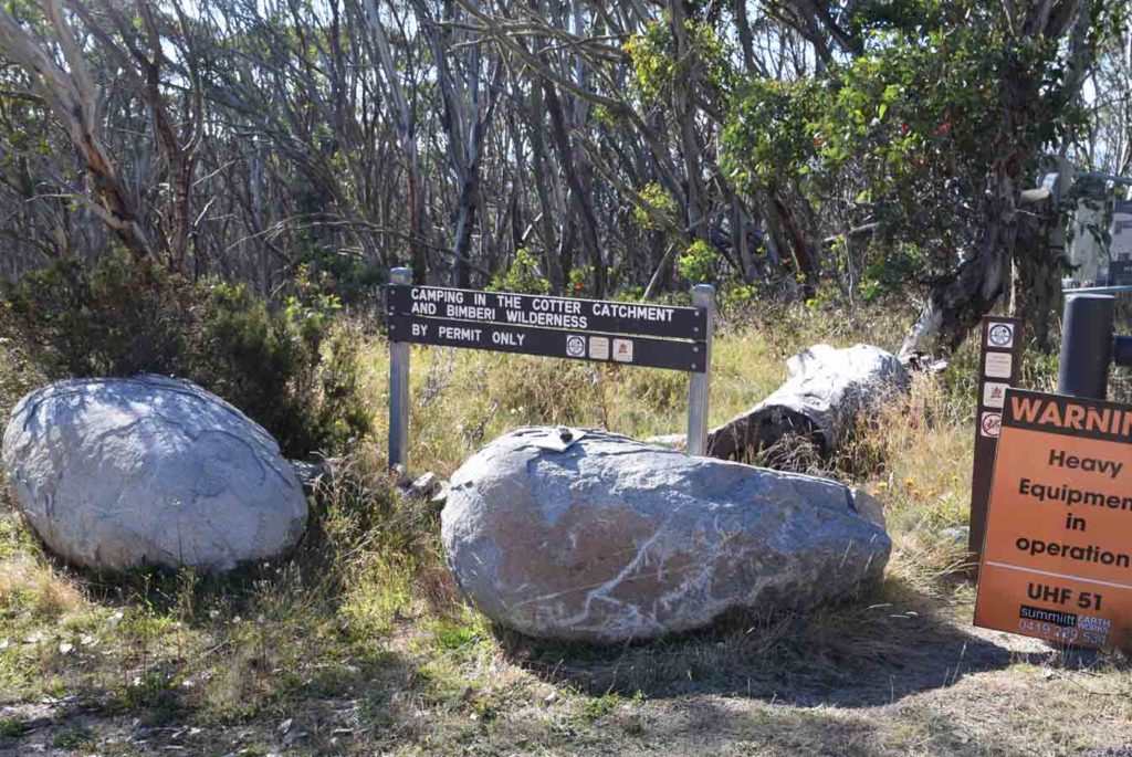
If you’re planning to camp in this area, you need a permit which is available from ACT Parks
Trail head signage just through the locked gate
Trail head signage with the walking register on the right
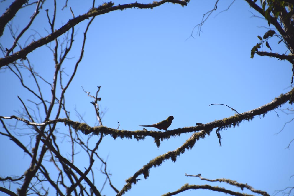
Rosella silhouetted in a tree
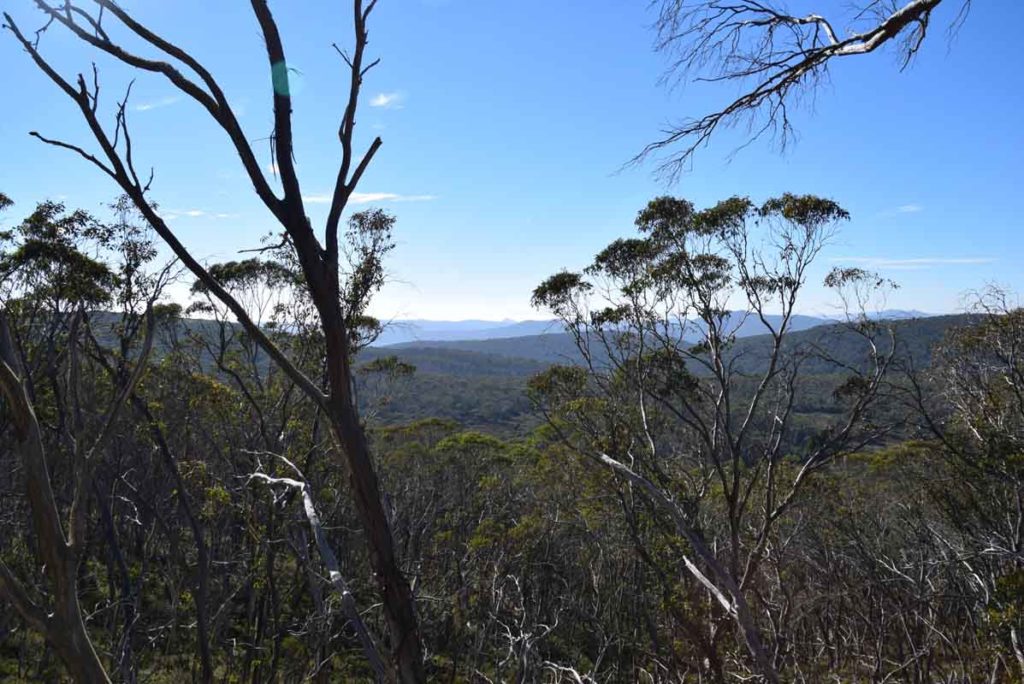
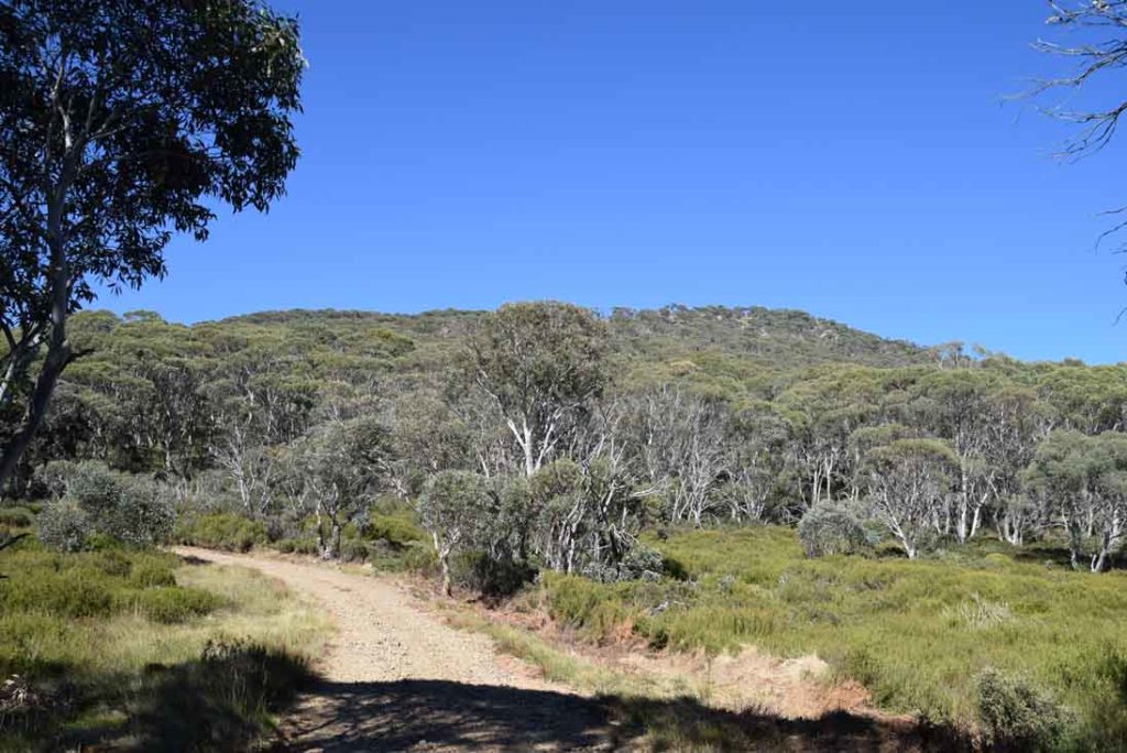
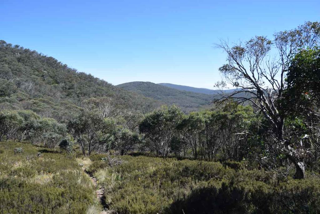
Views from the trail
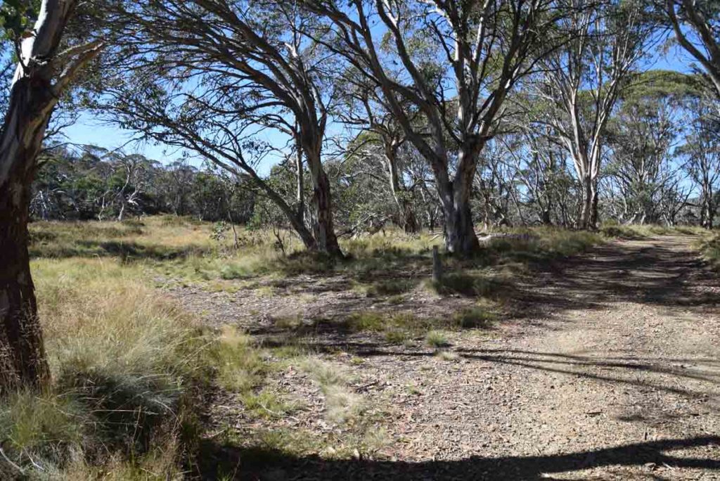
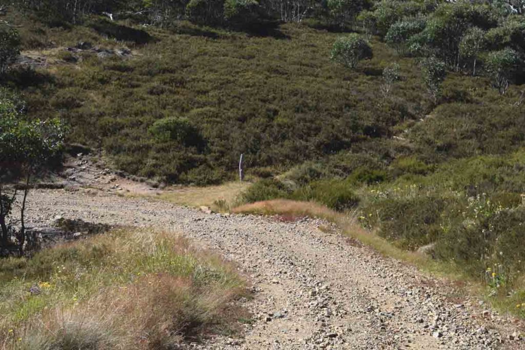
Keep right at this turn off. If you go left you are heading towards Stockyard Spur and Corin Dam
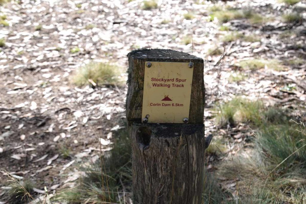
Route to Corin Dam and Stockyard Spur. This trail from Corin Dam to Mount Gingera is about 6 km longer and physically much more demanding
Stay on Mount Franklin Road and head towards Pryor’s Hut. There is limited directional signage on this trail as you are following the management trail
Turn off into Pryor’s Hut
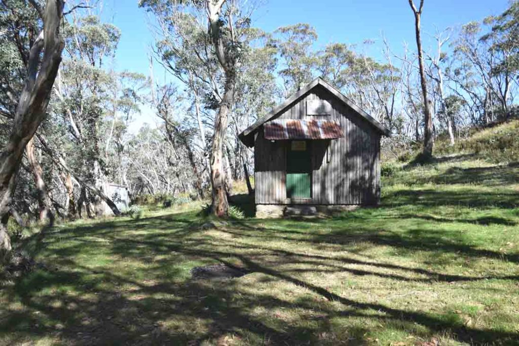
Pryor’s Hut with toilet in the back left of the image
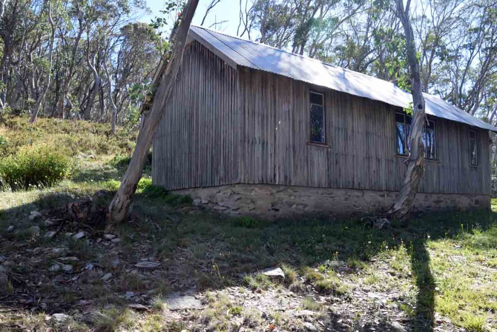
Rear view of Pryor’s Hut
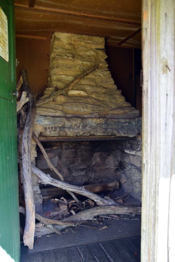
Fire place just inside Pryor’s Hut
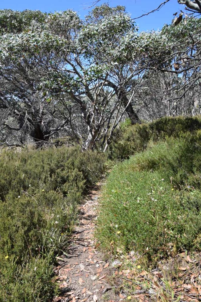
Back on the trail again after leaving Pryor’s Hut
As you walk down the road you will come to a hairpin bend. You can just see the trail marker post in the centre of this image
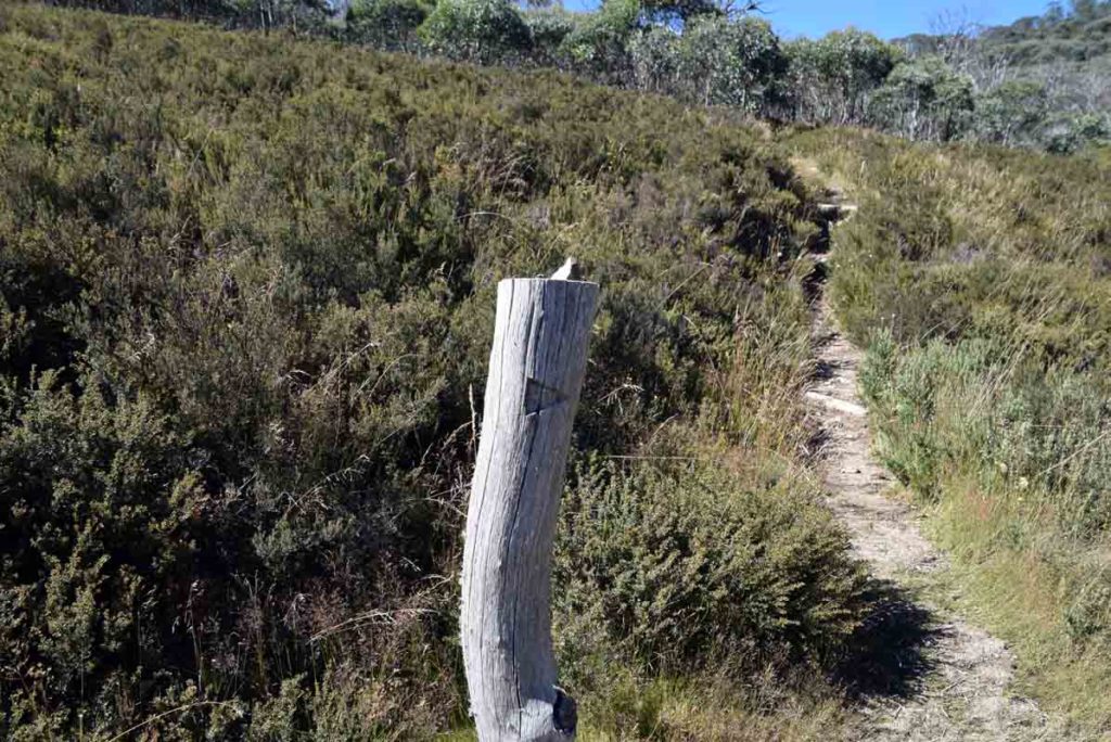
Trail marker onto Mount Gingera
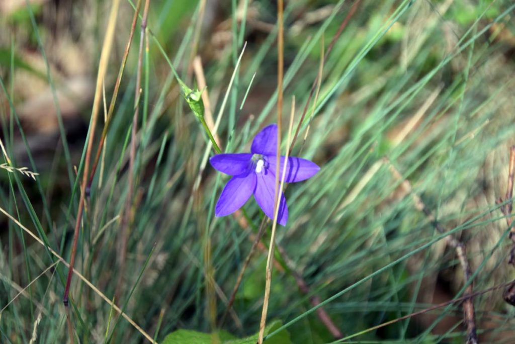
Royal Bluebell in flower on the trail
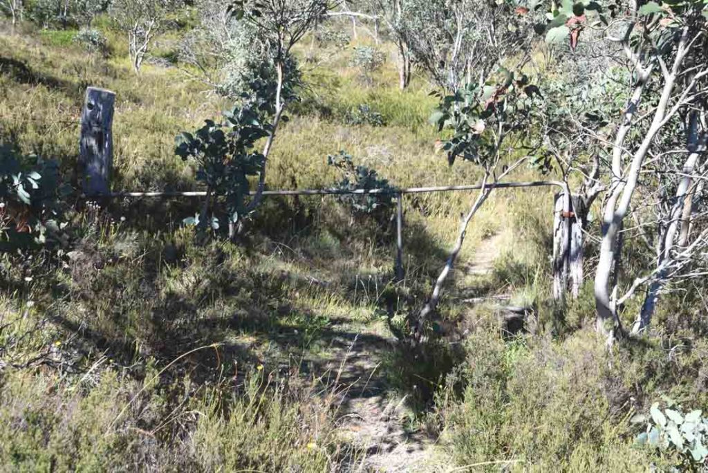
Through the gate
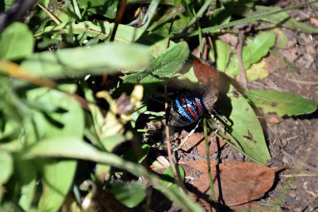
On the day I did this walk (March) there was a Death Adder in the wet area looking for food. He/she shot off very quickly and wasn’t there when I returned
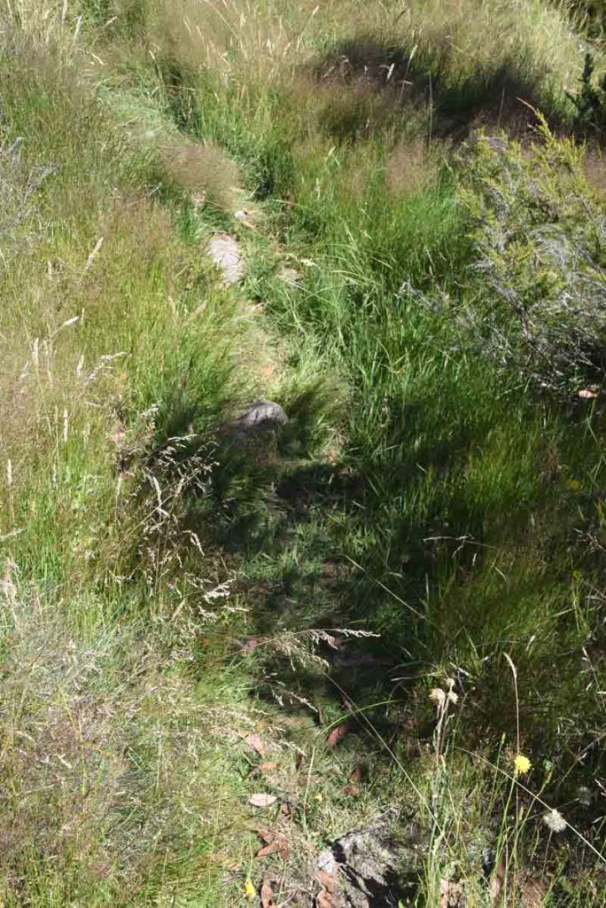
Trail example on Mount Gingera. This is a good example however a lot of the trail was more overgrown than this. Wear gaiters and bring trekking poles to make a bit of noise
The things you see when you are looking for snakes on the trail. A lovely Mountain Katadyn on the ground
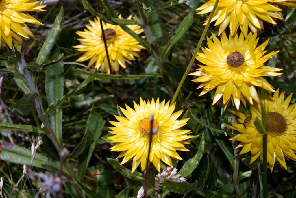
Paper daisy on Mount Gingera
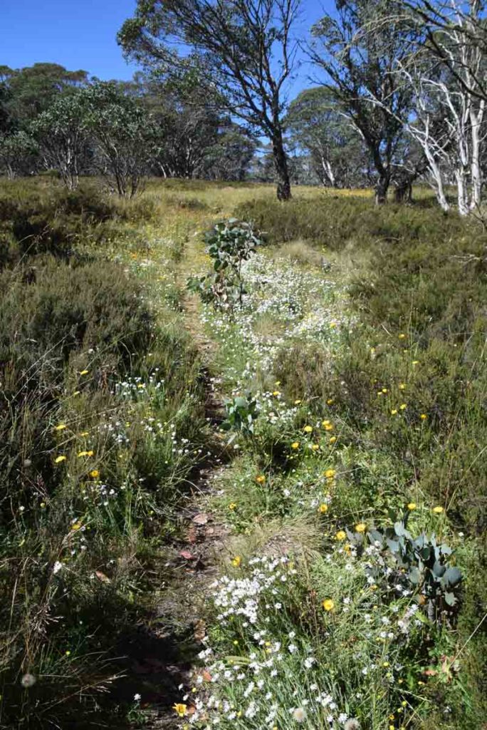
Wildflowers on the trail
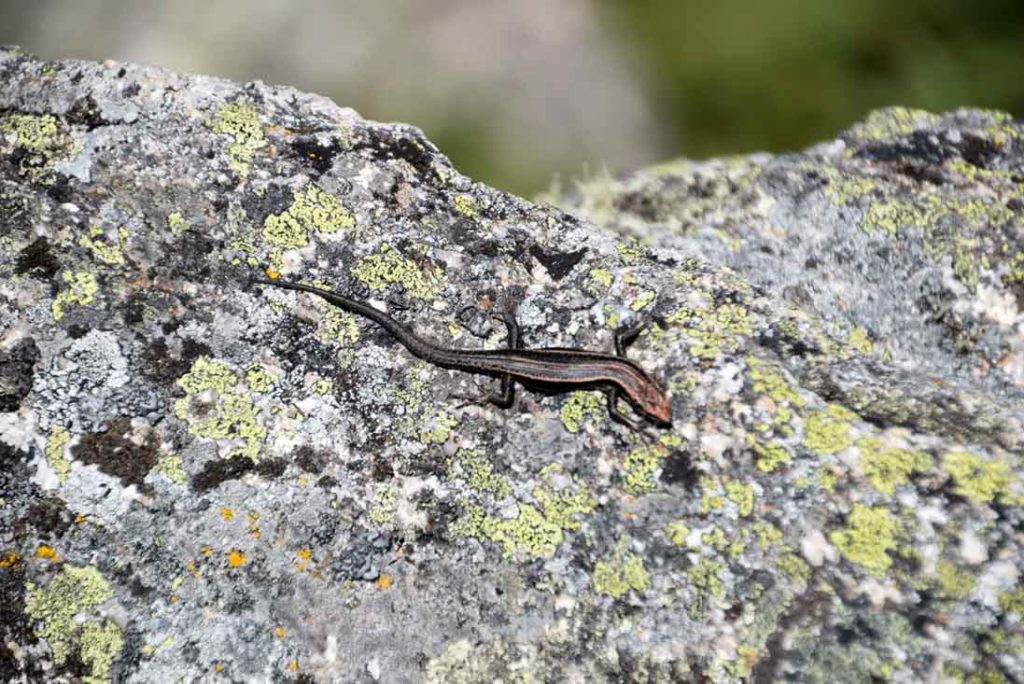
Skink on the summit of Mount Gingera
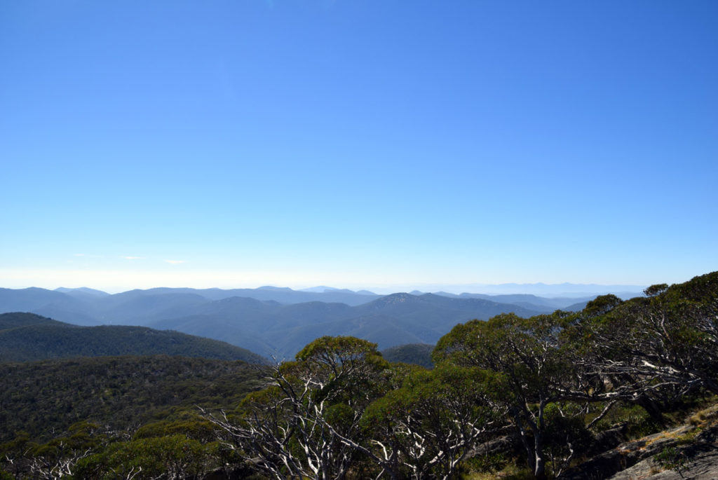
One of the many spectacular views from the summit of Mount Gingera

Mount Gingera panorama shot
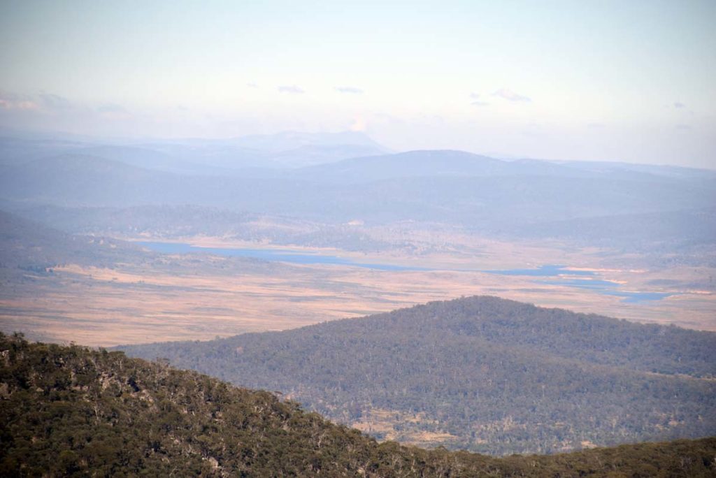
Tantangara Dam in the distance as viewed from Mount Gingera
On the way back down

Brown Snake sunning itself on the road. Keep an eye on the road during the warmer months particularly during the middle of the day
Another snake going bush. This one was about 1.5 metres in length and did raise its head in mild threat mode as it headed off
Back to the start at the carpark
Mount Gingera as viewed from the summit of Mount Ginini. Drive up to the summit of Mount Ginini after your walk – the views are great. You need a car with good ground clearance on this road
Getting There
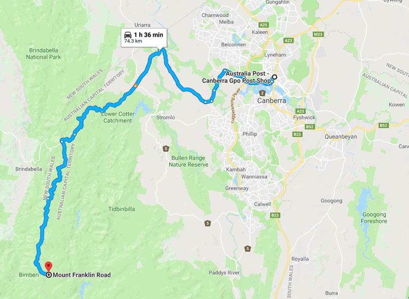
The Mount Gingera Google map showing the distance from the Canberra GPO to the trail head car park on the Mt Franklin Road:
- Head to the Weston Creek area in southwest Canberra and take the road to Uriarra Crossing. Once you cross Uriarra Crossing turn left and head towards Mt Franklin Road. The road changes from bitumen to dirt and from the end of the bitumen you have 16.5km to travel to the Bendora trail head.
- You will pass a road condition sign that will show which areas are open or closed. The road will be closed in periods of high fire danger as well as in winter during periods of heavy snow
- Turn left at Picadilly Circus onto Mt Franklin Road
- The first stop is the Bulls Head Picnic Area which has a good place for lunch or a break as well as toilet facilities
- From the Bulls Head Picnic Area head down the road until you reach the bender Arboretum on the left hand side of the road
- The dirt road at this point is narrow so keep an eye on your speed and for vehicles coming the other way. Note the 2.4 metre tall orange road marker posts. This shows you what the snow can be like in winter
- The whole trip from the Canberra GPO to the trail head is just on 75 km.
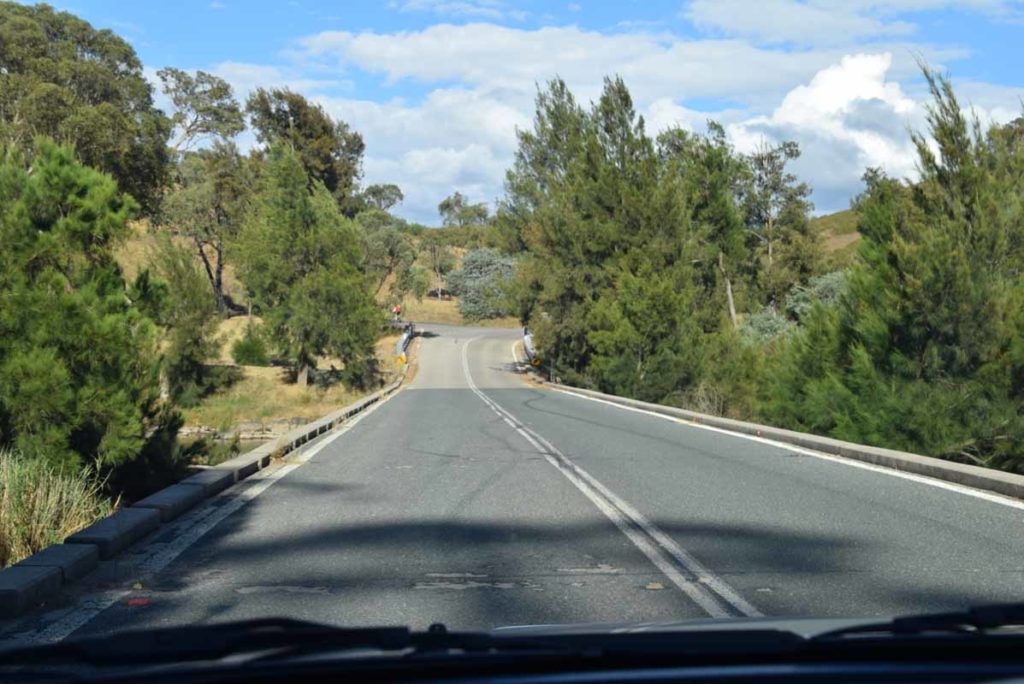
Uriarra crossing. Turn left if coming from Weston Creek just after you go over the crossing
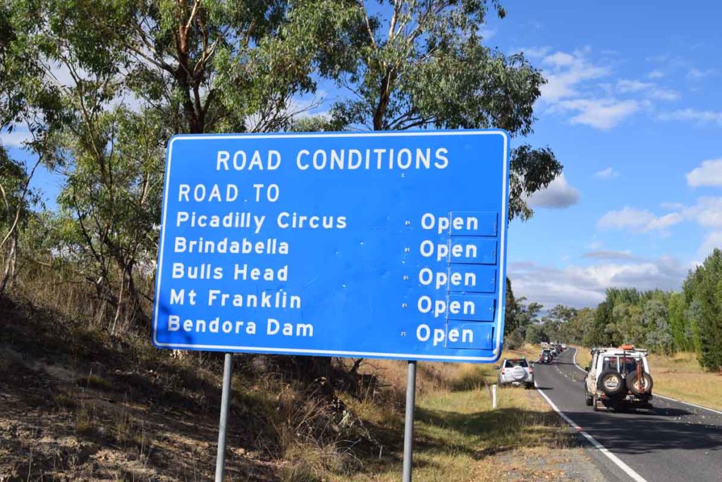
Road conditions sign. If doing this walk make sure that the Mount Franklin Road is open
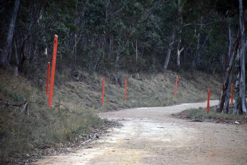
Note the orange 2.4 metre tall road markers. This gives you an idea of the possible snow conditions in winter time
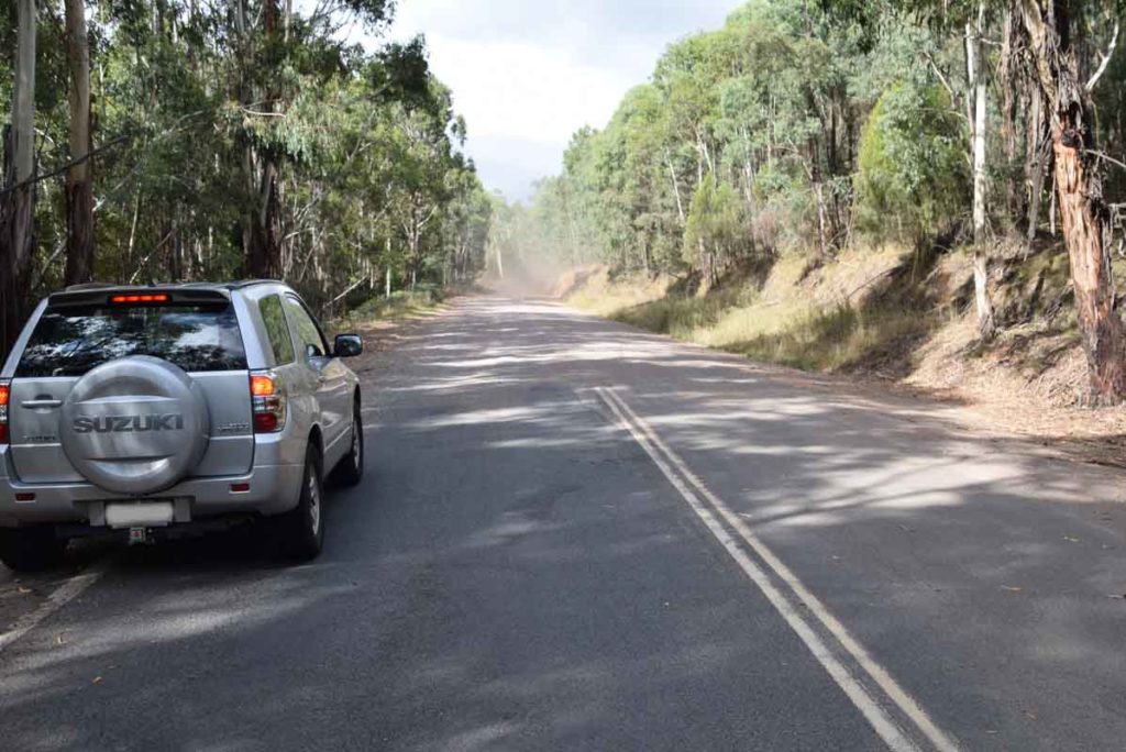
Bitumen road changing to dirt. From here the Mount Gingera car park is around 30 km
Follow the turnoff sign and head along Mt Franklin Road
Mt Franklin Road
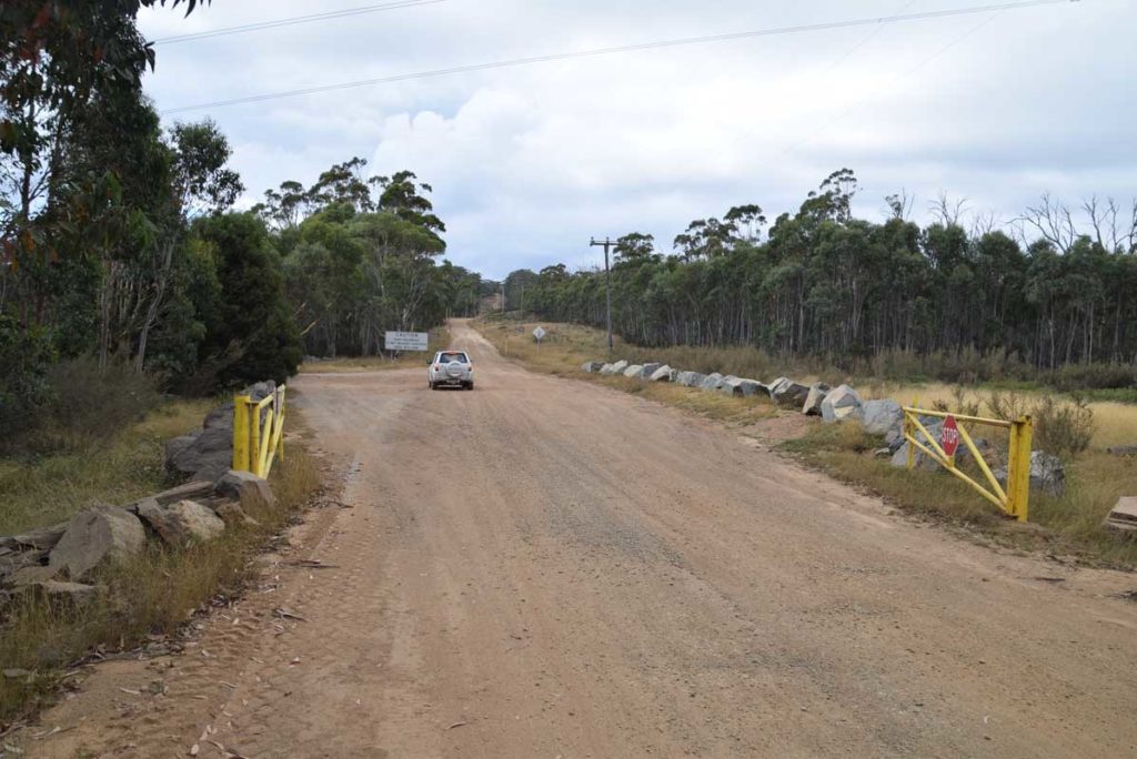
Just after you turn on to the Mount Franklin road there is a road condition sign which will indicated if the road is open or not
Car park at Bulls Head
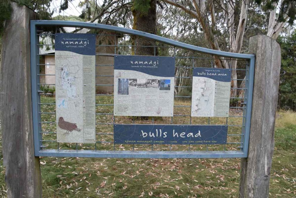
Information signage at Bulls Head picnic area
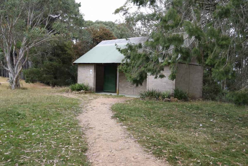
Toilets at Bulls Head picnic ground
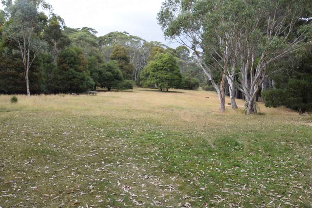
Bulls Head Picnic area
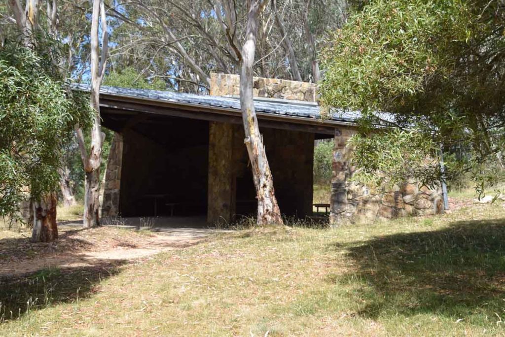
Weatherproof shelter at Bulls Head picnic area
Just after you leave the Bulls Head Car park you will see the turnoff to the Bendora Dam. Keep following the signs and head past the car park for Mount Aggie and Mount Franklin, and Mount Ginini. You have reached your destination when you reach a locked gate
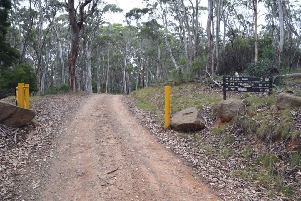
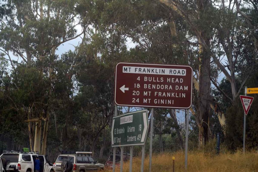
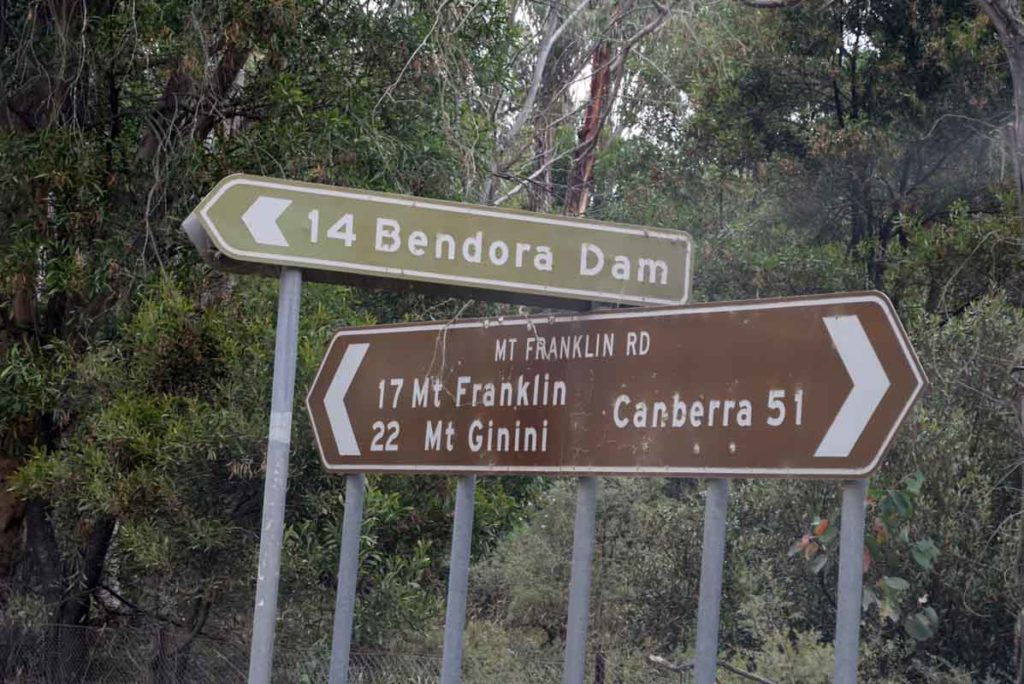
More signs and gates. There are a number of gates you will need to access. If the conditions are bad then the gates will be closed. When you see this sign you have approximately about 15.3 km to go to reach the trail head to Mount Franklin then another 5 km to the start of the Mount Gingera walk
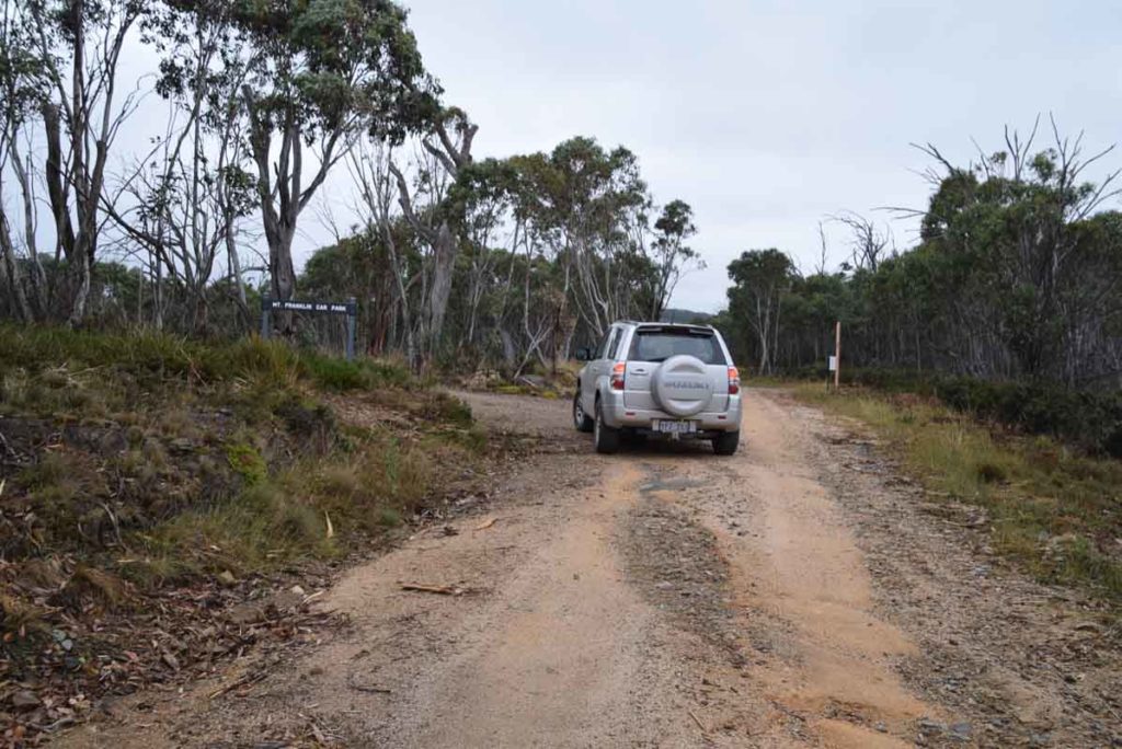
Mount Franklin car park. Drive past and keep on heading past the turn off to Mount Ginini to the trail head car park for Mount Gingera
Turn off to Mount Ginini. Once you see this sign then your nearly at the start of the walk for Mount Gingera
Trail head car park at Mount Gingera
Things to Know
- Phone: There is no mobile phone coverage on this trail except possibly (variable) at the summit of Mount Gingera (Telstra)
- Water: You need to bring your own water
- Toilets: There is a toilet facility at the Bulls Head picnic area. There is also a toilet at Pryor’s Hut 5 km into the walk
- Trail: This walk is an ‘out and back’ experience
- This trail consists mainly of management road and some formed track
- Dogs: No dogs allowed
- Other:
- Once you pass the Mount Franklin car park the road deteriorates. Its not a bad road but I would highly recommend an AWD or 4WD vehicle.
- Keep an eye on the road once you reach the unsealed section as there is can be a lot of 4WD traffic and blind corners
- This road can have snow on it so make sure you are driving a vehicle that can cope with the conditions if doing the walk during the cooler months
- Once you reach Mount Gingera proper the trail is heavily overgrown. Expect to see both Brown Snakes, Death Adders as well as the occasional Red Bellied Black snake either sunning themselves on the management road or on the trail itself. This is one of those rare trails I strongly suggest wearing gaiters in addition to paying close attention to the trail ahead of you
- This is in the Bimberi Wilderness so you need a camping permit which you can arrange with the Namadgi Visitors centre
Disclaimer
This walk was undertaken by the team from Australian Hiker