Bendora Arboretum ACT (3.7km)
Namadgi National Parsk
Nearest Town
The carpark for this walk is just off Mt Franklin Road and is 59km from the Canberra GPO with a large section of dirt road included
Best Time of the Year to Travel
October-March.
- Please note that in periods of high fire danger or heavy snow that the access road to the Bendora Arboretum may be closed. Pay attention to the road condition sign
- If there is no early snow head out around mid April for the Autumn colour that the deciduous trees will be displaying
Starting Location
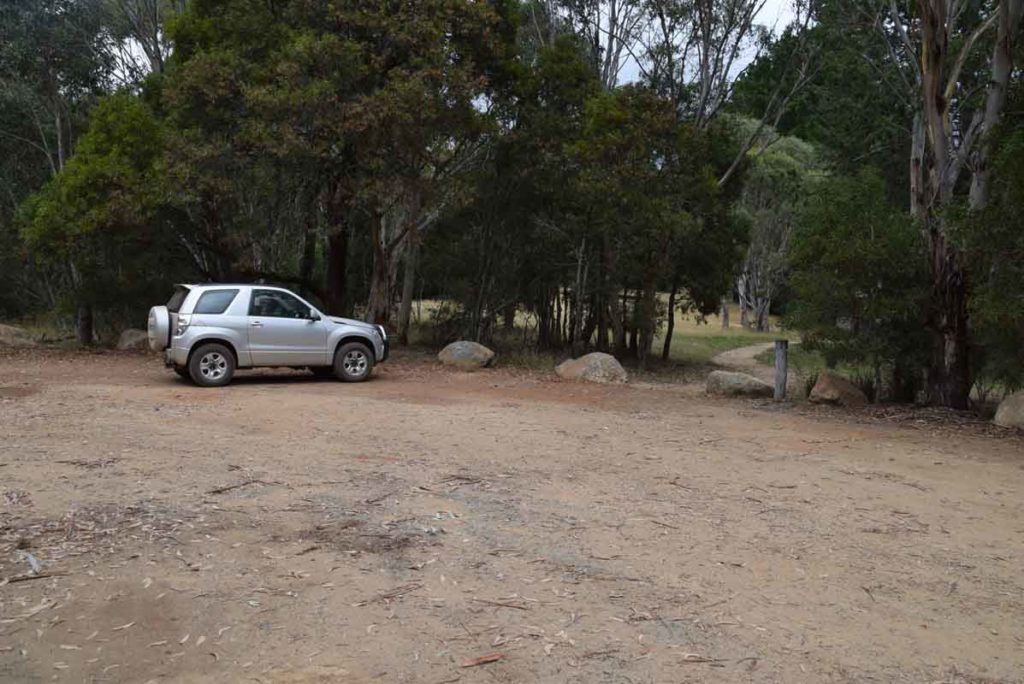
Trail head carpark just off Mt Franklin road on the left hand side
The Trailhead is on the left side of Mt Franklin Road and is obvious from the road so you won’t miss it with the large trail head sign
Finish Location
Trail head carpark just off Mt Franklin road
Bendora Arboretum Walk Review
If you feel like going a bit more remote then head towards the northwestern border of the ACT. Travelling on roads that quickly become dirt and are really only passable in the warmer months. This road provides access to four main walks:
- Mt Gingera
- Mt Franklin,
- Mt Aggie and the
- Bendora Arboretum
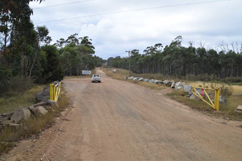
Pay close attention as you pass the road condition signs to ensure that this road is open as it can be closed in periods of extreme fire danger as well as heavy snow. The signage on this road is good so you will have no problem finding this road so long as you pay attention. once you turn off onto the Mount Franklin road you very quickly enter the Bimberi Wilderness and as you travel along the road there are a number of heavy gates that may be locked in bad conditions.
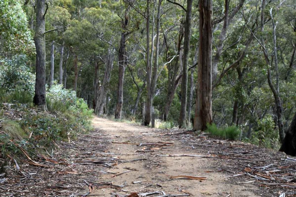
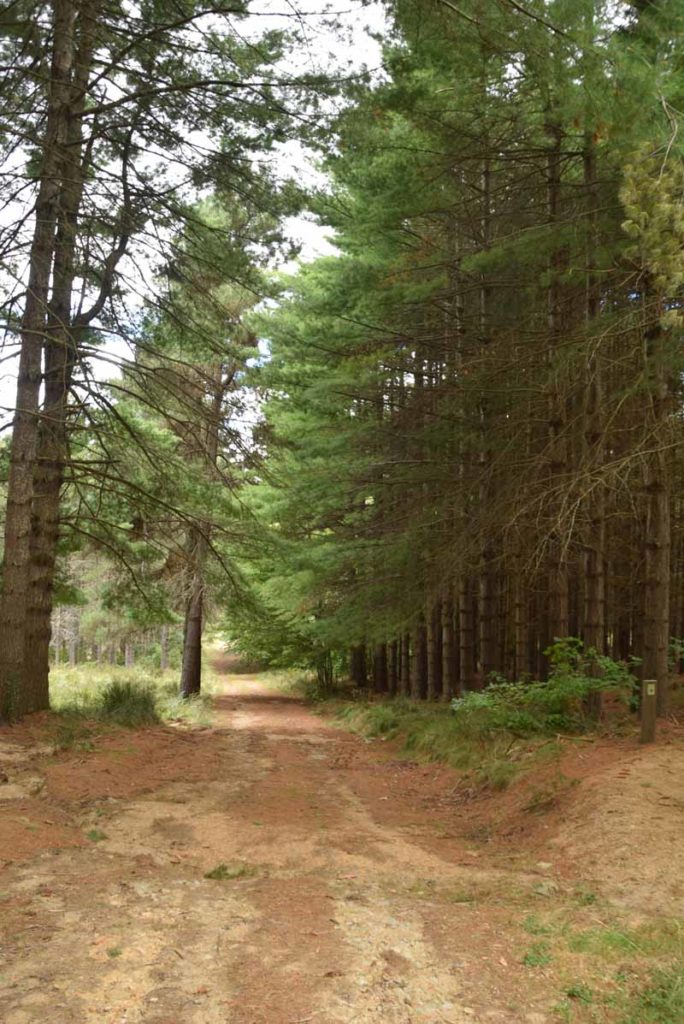
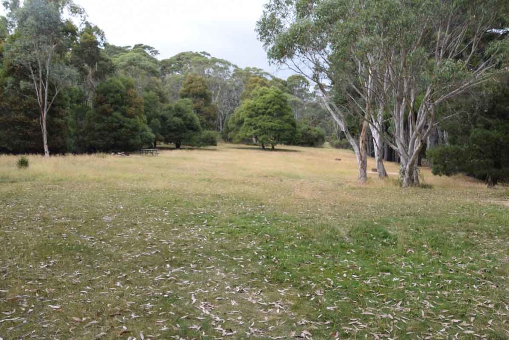
The Bendora Arboretum walk is the first walk that you will come across on the Mount Franklin Road and by far the easiest. This walk is reasonably flat with the walk to the arboretum being on a locked management road. The road is lined with large trees and much of it is tucked into the hills so even on a sunny day you have some degree of shelter.
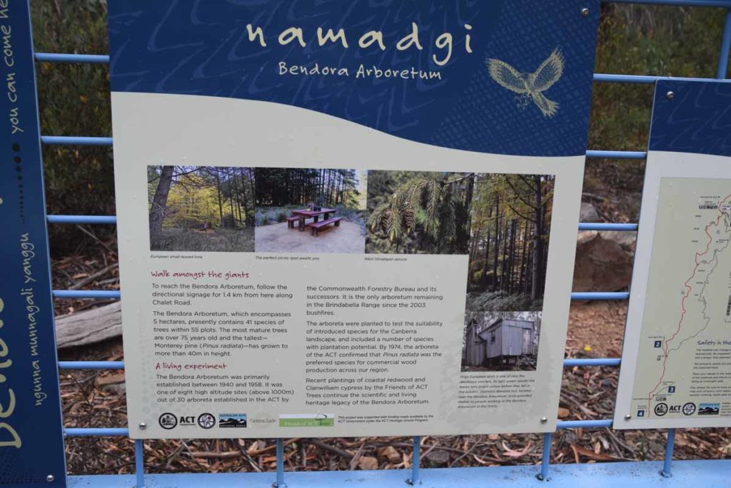
Once you reach Bendora Arboretum itself you are presented with the old Bendora Hut. This hut was used by the management staff as well as researchers but has now been relegated to a day use and emergency overnight hut. There are good interpretive signs that explain the history of the area so have a look at these first before having a look at the hut. Once you come out of the hut head back to the interpretive signage and head down a short set of stairs before turning right onto a short road that takes you to the arboretum itself.
The interpretive signage that explains the walk itself (as opposed to the history of the area) is really confusing so its best that you just go for a wander and follow the small arrows that take you though the collection of trees. All the trees are European or northern American with the native forest forming an artificial boundary to the plantings. I have a horticultural background and found this arboretum which was planted around 1940 to be quite interesting. Most of the trees have good interpretation signage that explain what you are seeing and there are a number of trees that I have never seen before.
This is a great family walk and in the centre of the arboretum is a decent picnic table that would be an excellent spot for a break. You could easily spend half a day wandering around the arboretum and having lunch or alternatively do a quick walk in a little over an hour, its really up to you.
The most difficult part of this walk is the drive and as this walk is short enough that it could be combined with with one of the other shorter walks close by or if you want to make a long day look at doing all three of the sub 4km walks (Bendora Arboretum, Mt Aggie, and Mt Franklin. to get the best out of this and the other walks in this area choose a sunny clear day.
Trail head carpark just off Mt Franklin road on the left hand side
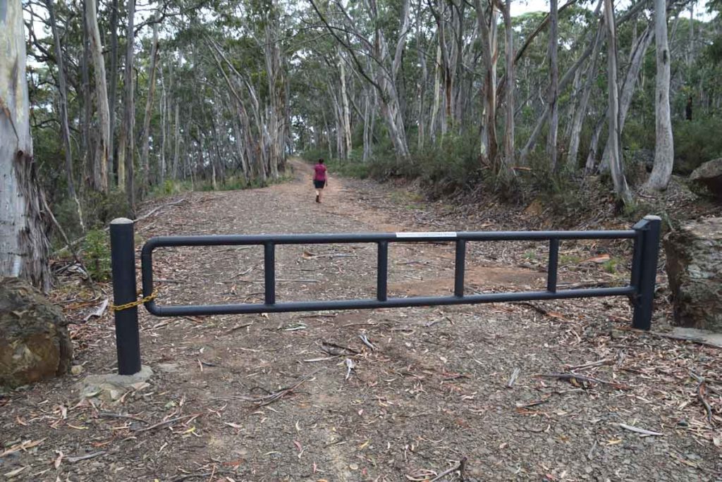
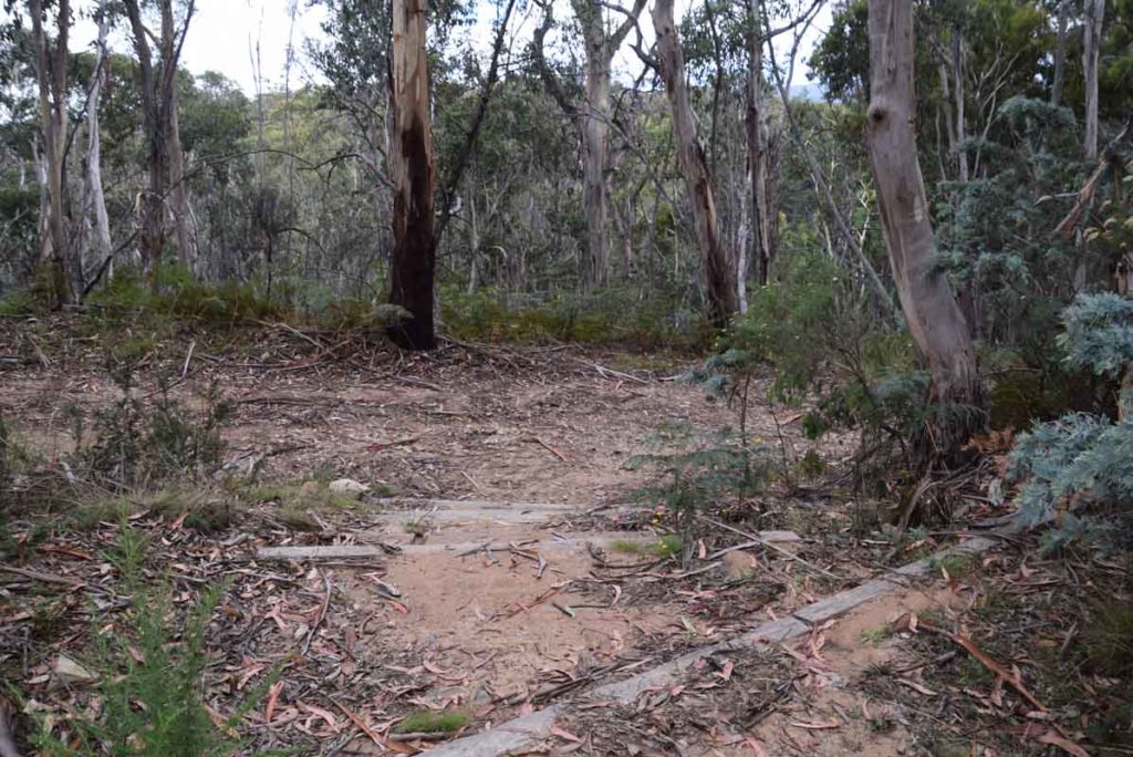
The walk to the Bendora Arboretum walk is on management road. This road will show up on the map at Chalet Road but is not accessible to vehicles, only hikers and cyclists
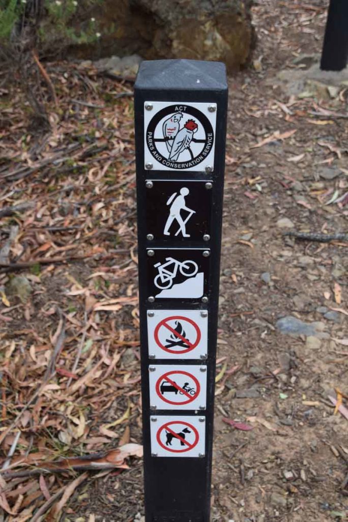
This trail is accessible to both hikers and cyclists
Entrance road into arboretum
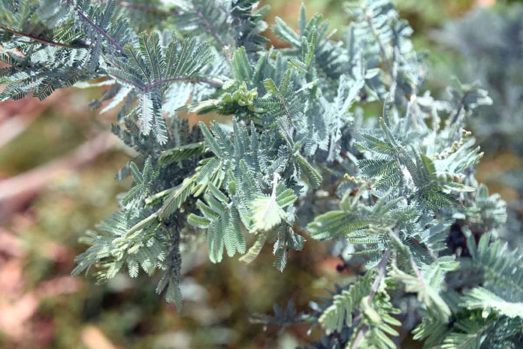
Wattle leaf on the side of the access road
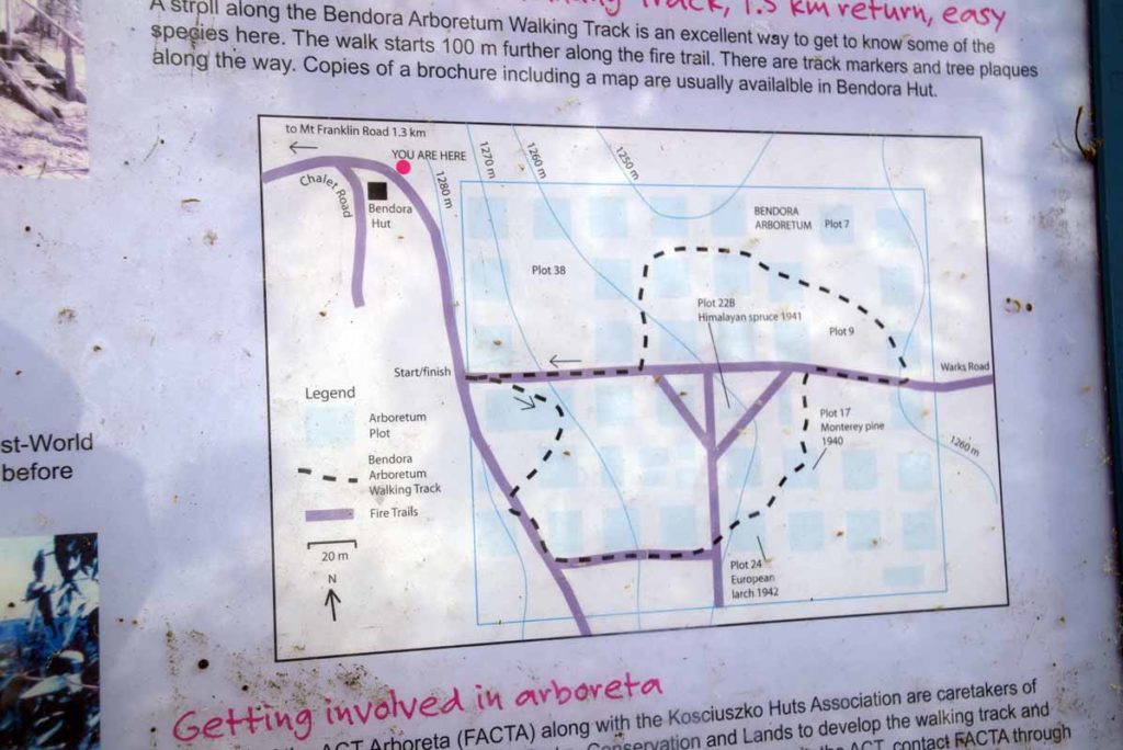
Once you reach the arboretum there is a map showing the layout
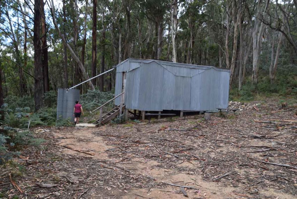
Bendora Hut which was used as an emergency hut as well as a base for arboretum workers
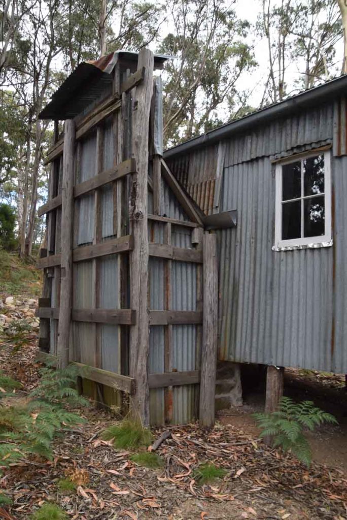
Chimney on Bendora Hut
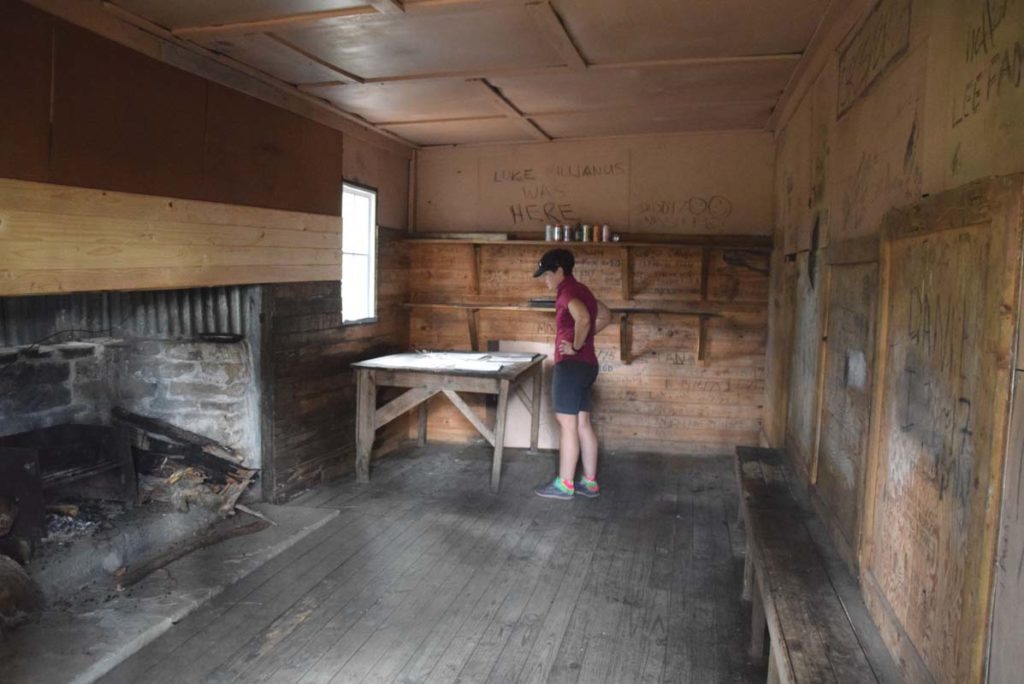
Inside Bendora Hut
Once you reach Bendora Hut have a look around before you head down the steps and turn right down the road. The main directional signage at the Arboretum is confusing. Follow the small arrows instead once you enter the arboretum proper
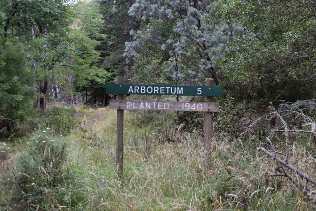
Arboretum signage. These trees are almost 80 years old
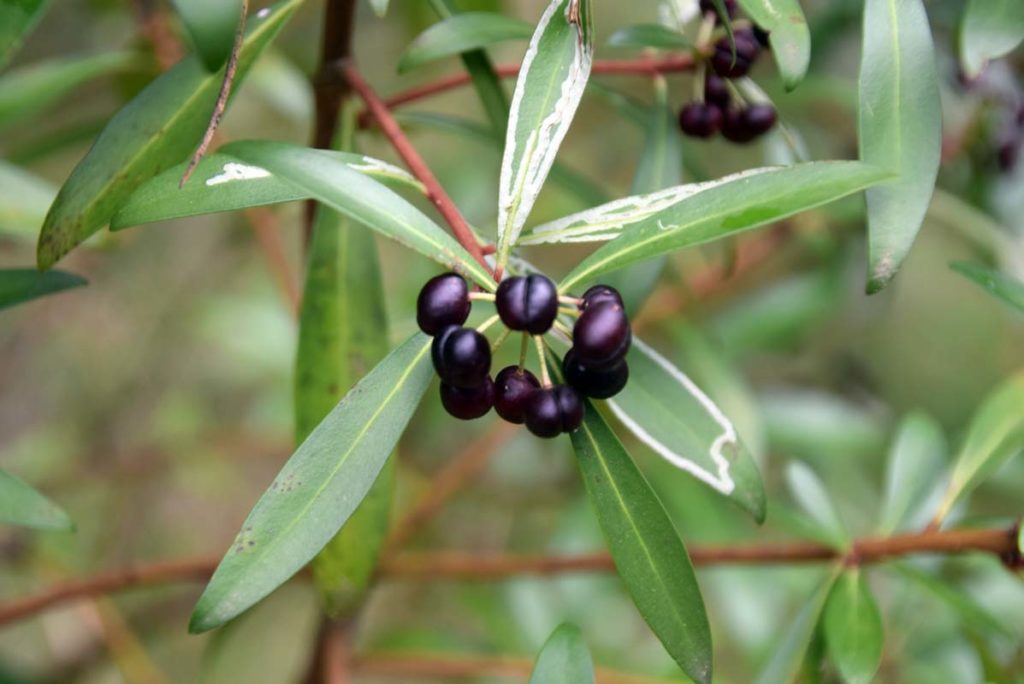
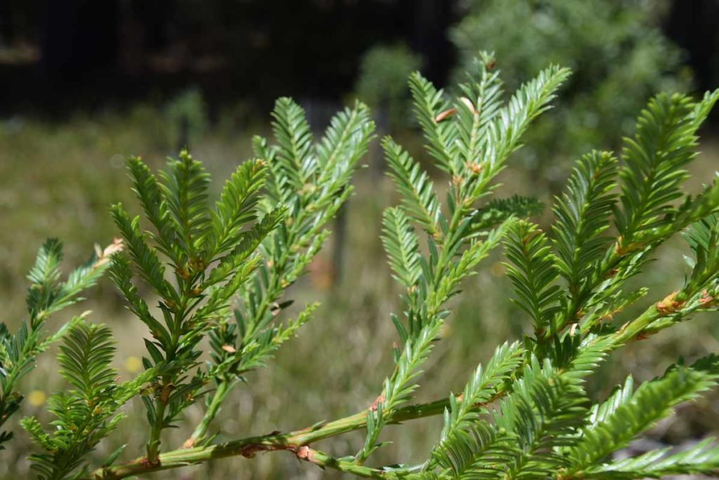
Mountain Pepper. Both the berries and the leaves are edible and also used for traditional medicine
Just some of the any tree plantings at the arboretum
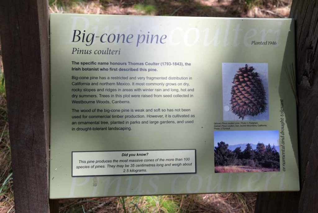
Pinus coulteri – big cone pine. This sign is typical of the many descriptive signs throughout the arboretum
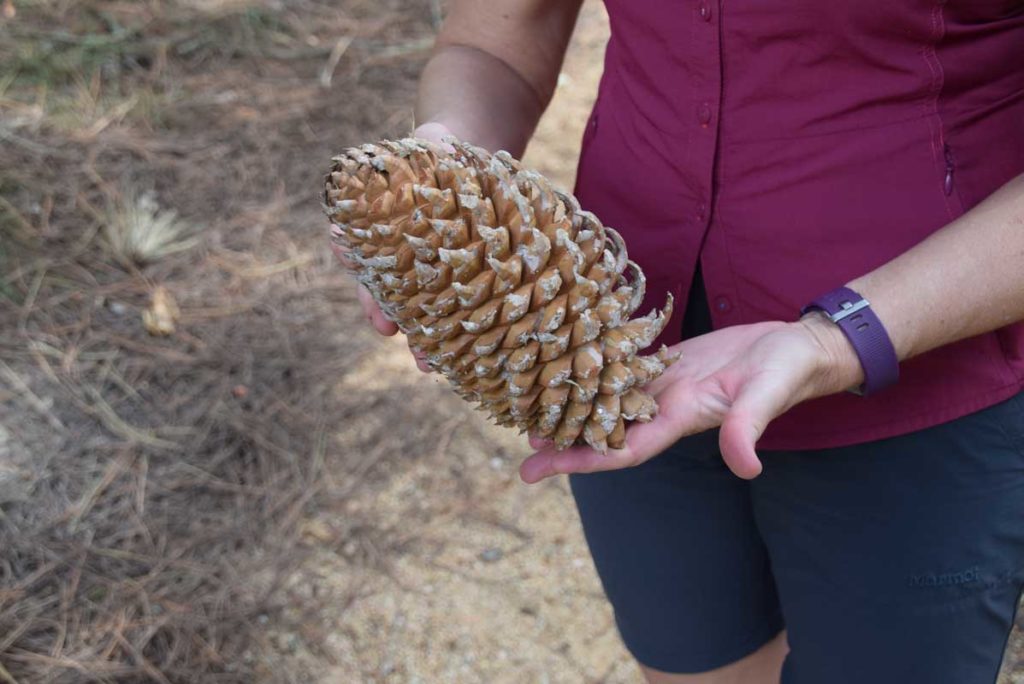
Big-Cone Pine. As the name suggests this is the pine tree with the biggest pine cones
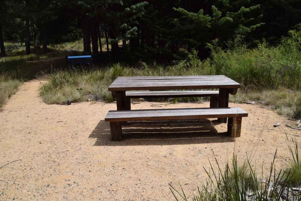
Not a bad place for lunch. This table and chair setting is in the middle of the arboretum
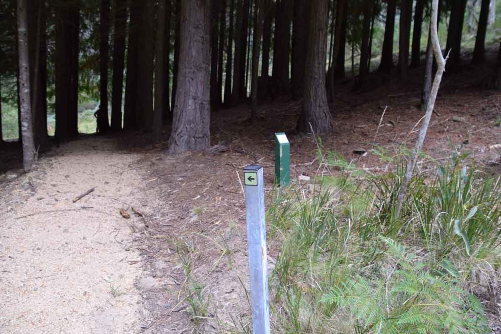
Internal directon signage. Follow these little directional arrows around the arboretum
Coastal Redwood. these trees were only been planted in 2012
Getting There
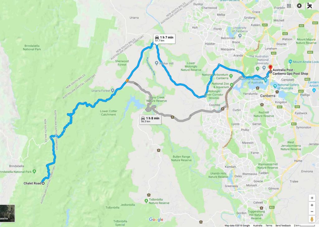
The Bendora Arboretum Google map showing the distance from the Canberra GPO to the trail head car park on Mt Franklin Road:
- Head to the Weston Creek area in southwest Canberra and take the road to Uriarra Crossing. Once you cross Uriarra Crossing turn left and head towards Mt Franklin Road. The road changes from bitumen to dirt and from the end of the bitumen you have 16.5km to travel to the Bendora trail head.
- You will pass a road condition sign that will show which areas are opened and closed. The road will be closed in periods of high fire danger as well as in winter during periods of heavy snow
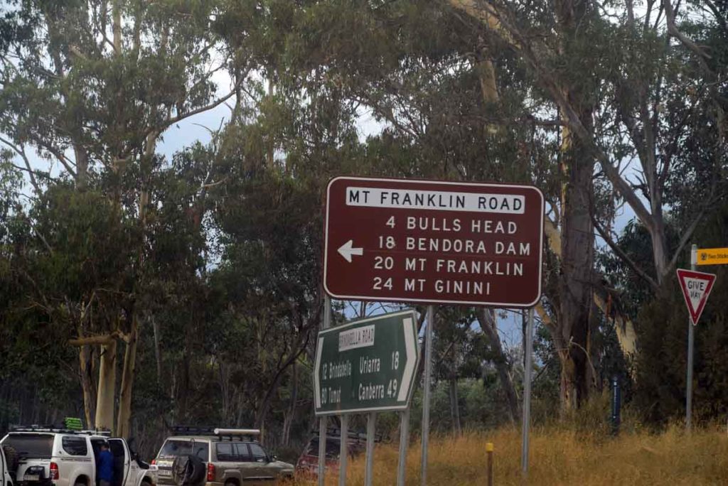
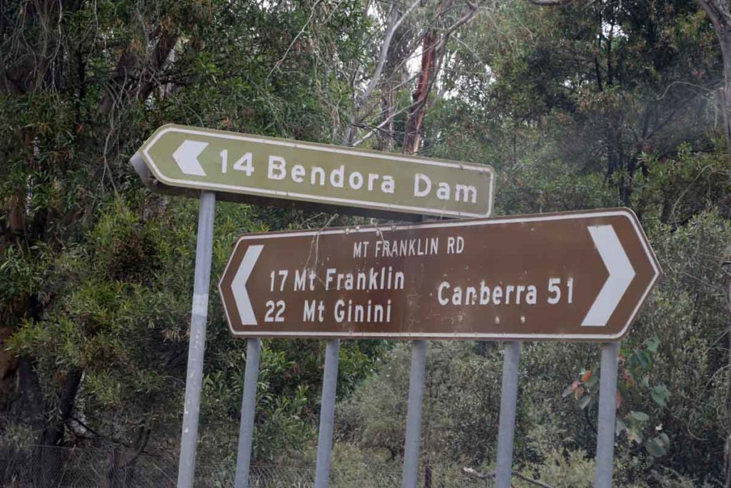
- Turn left at Picadilly Circus onto Mt Franklin Road
- The first stop is the Bulls Head Picnic Area which has a good place for lunch or a break as well as toilet facilities
- From the Bulls Head Picnic Area head down the road until you reach the bender Arboretum on the left hand side of the road
- The dirt road at this point is narrow so keep an eye on your speed and for vehicles coming the other way. Note the 2.4m tall orange road marker posts. This shows you what the snow can be like in winter
- The whole trip from the Canberra GPO to the trail head is just on 59km.
Urriarra crossing. Turn left if coming from Weston Creek just after you go over the crossing
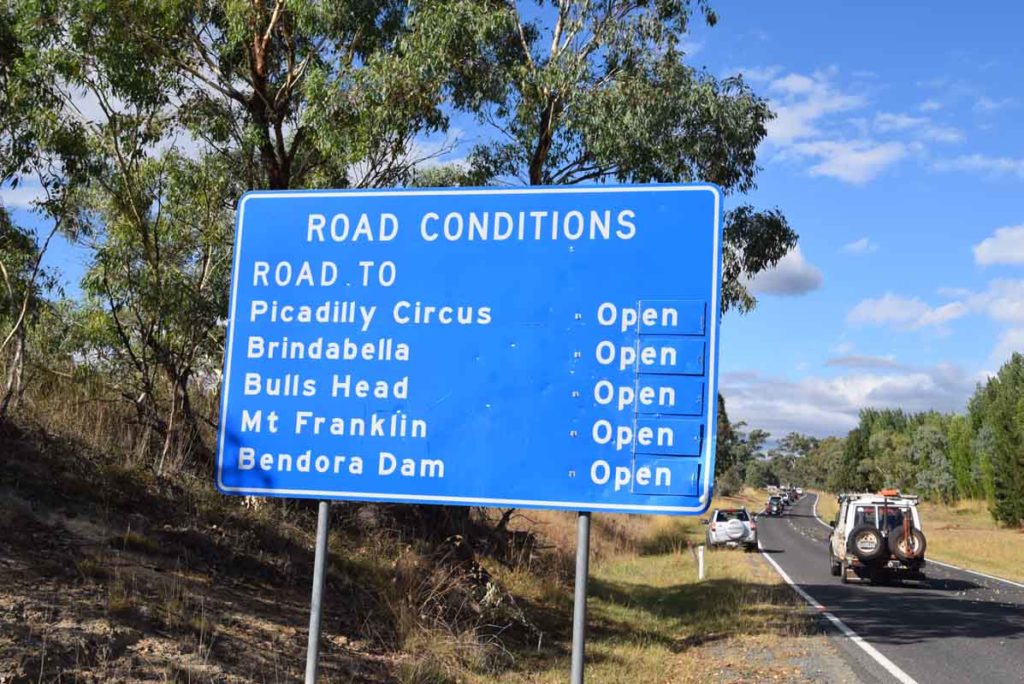
Road conditions sign. If doing this walk make sure that the Mount Franklin Road is open
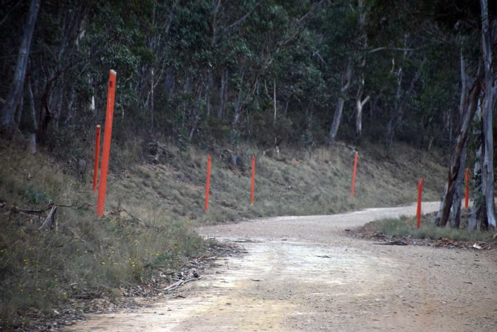
Note the 2.4meter tall orange road markers. This gives you an idea of the possible snow conditions in winter time
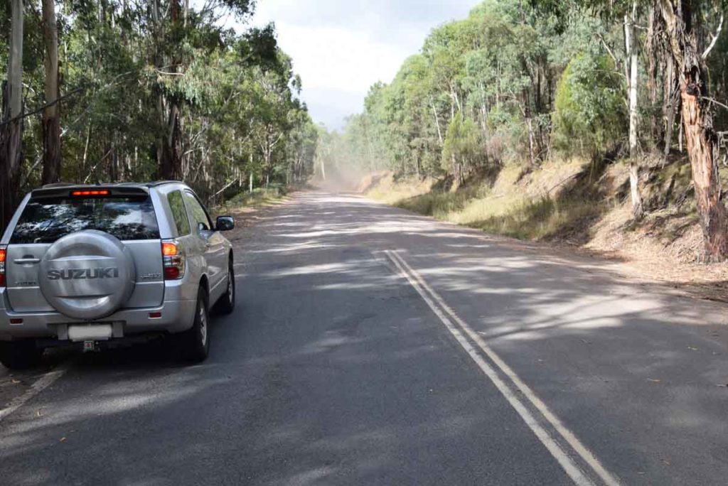
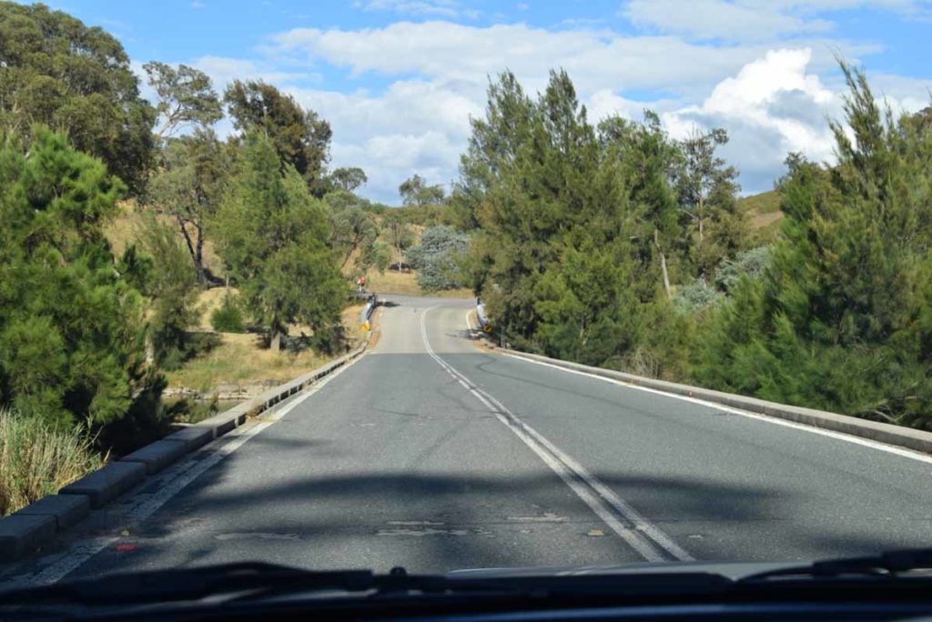
Bitumen road changing to dirt. From here the Bendora Arboretum is 16.5km
Follow the turnoff sign and head along Mt Franklin Road
Mt Franklin Road
Car Park at Bulls Head
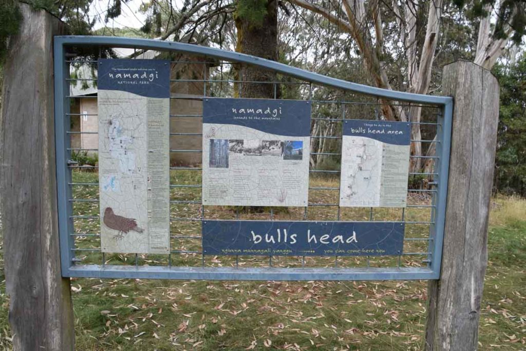
Information signage at bulls head picnic area
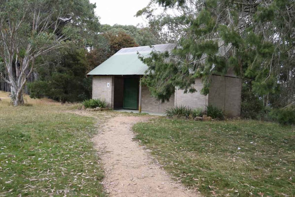
Toilets at Bulls Head picnic ground
Bulls Head Picnic area
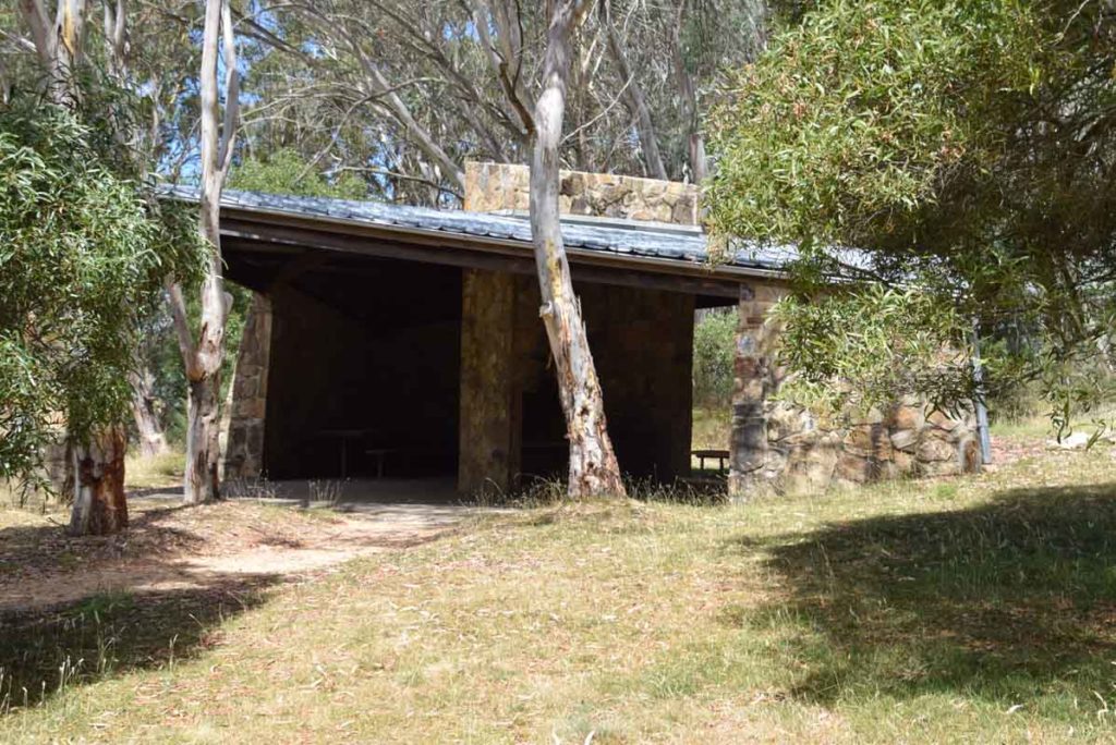
Weatherproof shelter at Bulls Head picnic area
Just after you leave the Bull Head Car park you will see the turnoff to the Bendora Dam. Keep following the signs and head towards Mt Franklin.
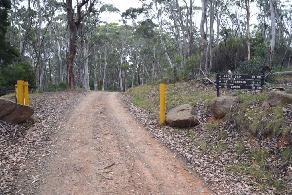
More signs and gates. There are a number of gates you will need to access. If the conditions are bad then the gates will be closed. When you see this sign you have approximately about 4km to go to Reach the trail head to Bendora Arboretum
Things to Know
- Phone: There is no mobile phone coverage on this trail
- Water: Bring your own water
- Toilets: There is a toilet facility at the nearby Bulls Head picnic area
- Trail: This trail consists of formed track and management road
- Dogs: No Dogs allowed
- Camping: If you are camping in the Bimberi Wilderness area then you will need a permit so we suggest that you contact the Namadgi visitor centre first to confirm any requirements
- Other:
- Keep an eye on the road once you reach the unsealed section as there is can be a lot of 4WD traffic and blind corners
- This road can have snow on it so make sure you are driving a vehicle that can cope with the conditions if doing the walk during the cooler months. during periods of heavy snow the road can be closed
- The road up until Bendora Arboretum is in reasonably good condition but it can be a bit slippery after heavy rains so keep this in mind if you are heading out there after it has been raining
Disclaimer
This walk was undertaken by the team from Australian Hiker