Mount Franklin ACT (3.6 km)
Namadgi National Park
Nearest Town
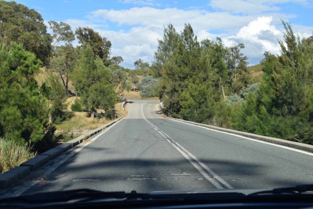
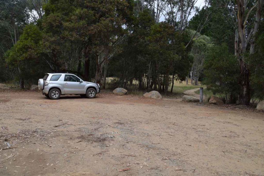
The carpark for this walk is just off Mt Franklin Road and is 66km from the Canberra GPO with a large section of dirt road included
Best Time of the Year to Travel
October-March/Early April.
- Please note that in periods of high fire danger or heavy snow that the access road to the Mount Franklin trail head may be closed. Pay attention to the road condition signs on the way there or check on line for any road closures
Starting Location
The trailhead is on the left side of Mt Franklin Road and isn’t as obvious from the road as the other trails that you have already passed. The distance from the Mt Aggie trail head is 2.4km and the carpark is off the road just prior to a large yellow gate
Finish Location
Trail head carpark just off Mt Franklin road
Mount Franklin Walk Review
If you feel like going a bit more remote then head towards the northwestern border of the ACT. Travelling on roads that quickly become dirt and are really only passable in the warmer months. This road provides access to four main walks:
- The Mt Gingera
- Mt Franklin,
- Mt Aggie and the
- Bendora Arboretum
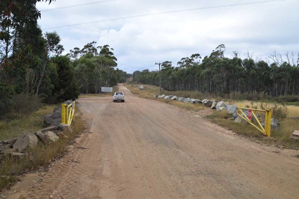
Pay close attention as you pass the road condition signs to ensure that this road is open as it can be closed in periods of extreme fire danger as well as heavy snow. The signage on this road is good so you will have no problem getting to the Mount Franklin trail head provided you pay attention. Once you turn off onto the Mount Franklin road you very quickly enter the Bimberi Wilderness and as you travel along the road there are a number of heavy gates that may be locked in bad conditions. The Mount Franklin Road crosses the ACT/NSW border on a number of occasions but this walk in in the ACT. Each of these walks in this area has something that in unique and the Mount Franklin summit walk is no different.
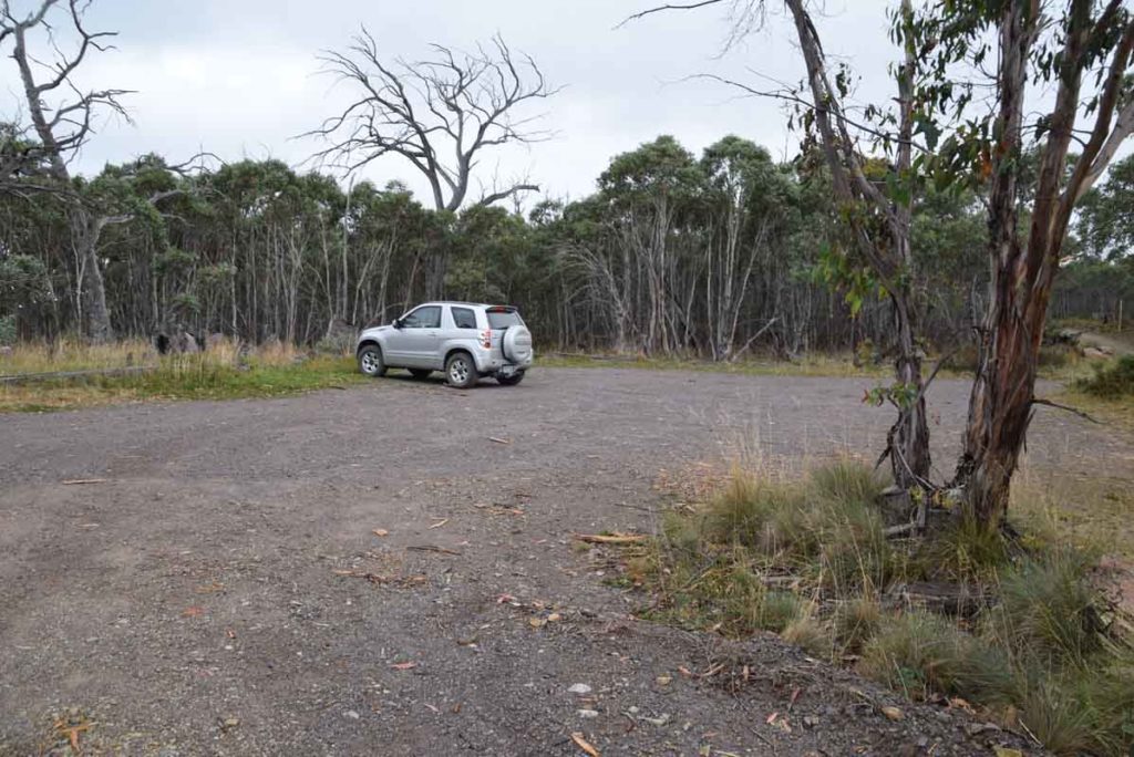
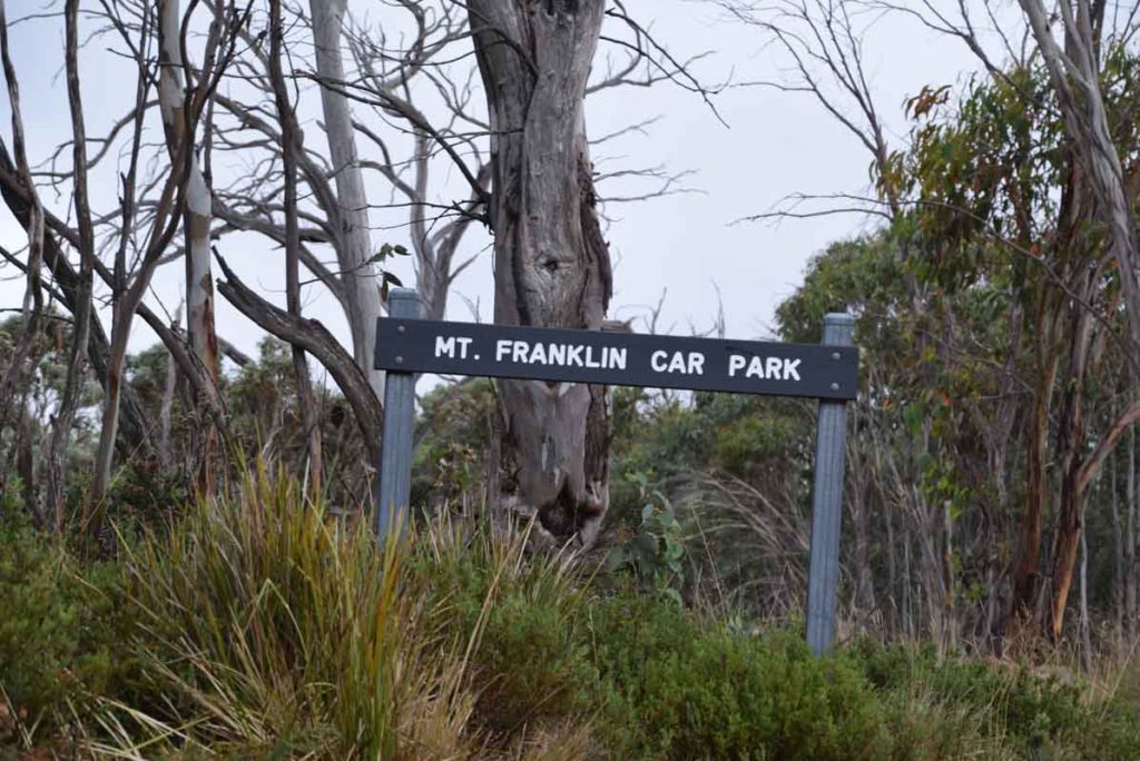
This trail head is unique along this road and unlike the Bendora Arboretum, Mount Aggie, and even the Mount Gingera Walks on which you pull off the road and park this walk has a dedicated off-road car park.
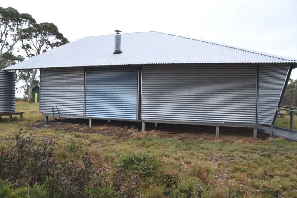
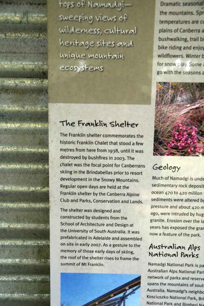
Head up the marked trail on the left hand side of the carpark and about 200-300 metres up the trail you will come to an open area that has a large shelter and toilet facilities off to one side. This was the site of the old Mount Franklin Ski lodge which burnt down in the 2003 Canberra fires. In fact this walk is based around the old ski runs and has some old infrastructure still remaining. Spend some time here looking at the interpretive signage before continuing on up the trail. Its also a great location for a break.
As mentioned the trail is part of the old ski runs which are now largely overgrown but you will come across a ski tow just as you leave the shelter area and as you oak your way up the old ski run you will come across interpretive signage and old infrastructure. As you reach the summit you will come to a Trig station but you haven’t reached the turn around point just yet. When you reach the trig station follow a small trail to the right about 80 metres down the hill and you will come across another ski run with the remains of and old Austin 40 car that was used to run the ski tow.
This relatively short walk is not that difficult and has some interesting old heritage to keep you interested. In addition there are some spectacular views. As short walks go this is one of the best on this side of the ACT border. In fact the Mount Franklin walk has a ‘wilder’ feeling about it than Mount Aggie and if you do both in the same day you will very easily tell the difference. The views into the surrounding valley just has that wilderness feel about them.
This rates as one of my favourite walks in the ACT and is easy enough that just about anyone can do this. Allow around 1.5-2 hours to take in all the interpretation signage and the views.
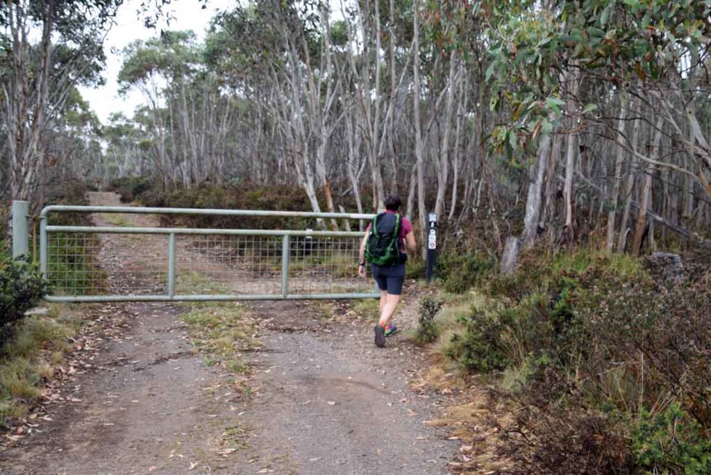
Off we go. This gate is the start of the walk and is located on the left hand side of the car park
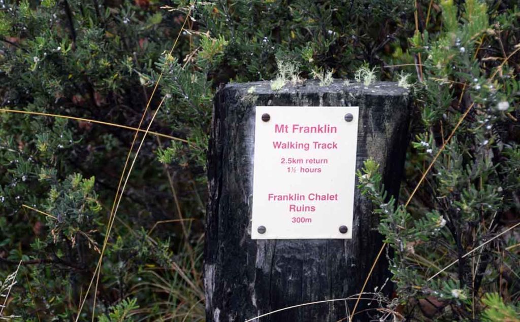
Trail sign for Mount Franklin. while the sign says 2.5km the actual trail including a visit to the shelter and the Austin A40 near the summit is 3.6km
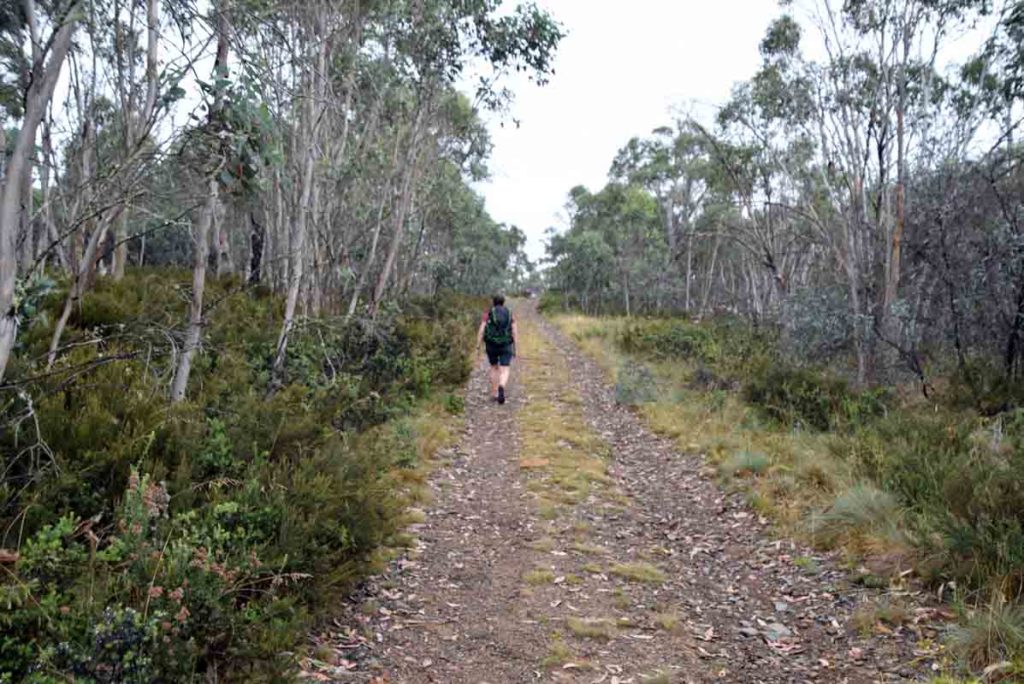
The first couple of hundred metres of this trail is management road
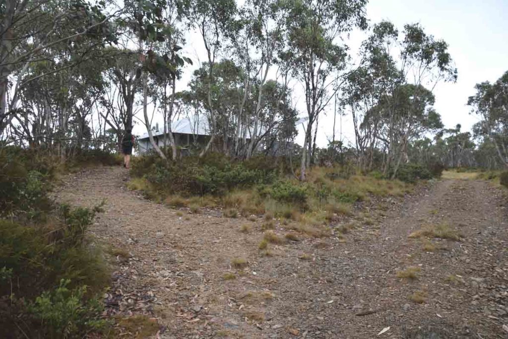
Mount Franklin Shelter turnoff
Mount Franklin sheleter from the trail
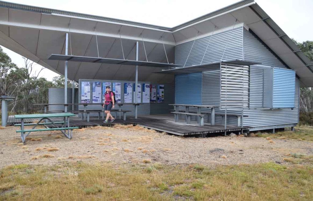
Mount Franklin shelter. There is a lot of interpretive signage here so spend a little while reading whats on offer
Toilet facilities, there is a male and female toilet
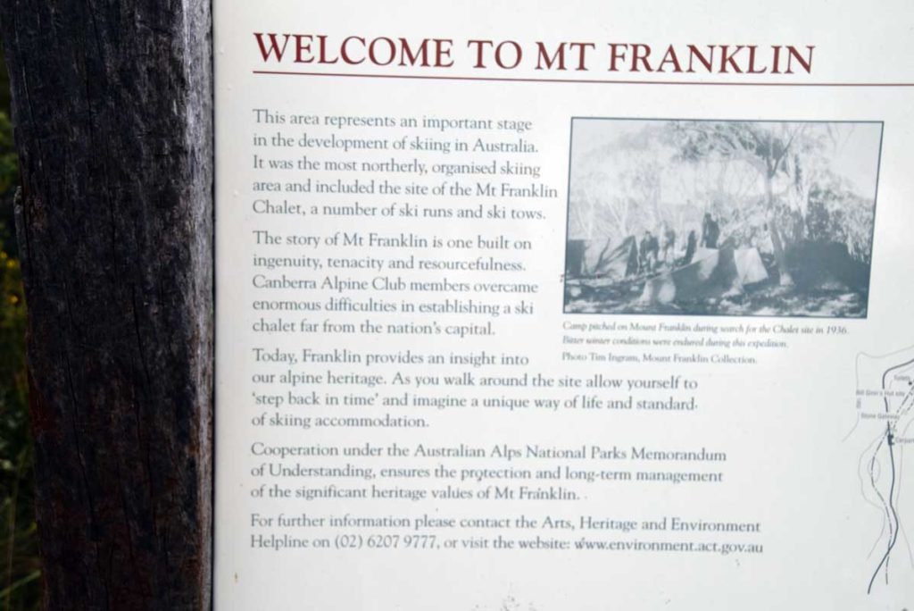
Interpretive signage
Why is this area here?
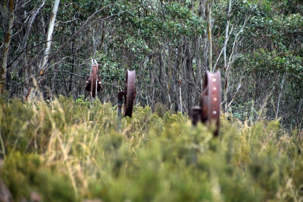
Ski Tow remains
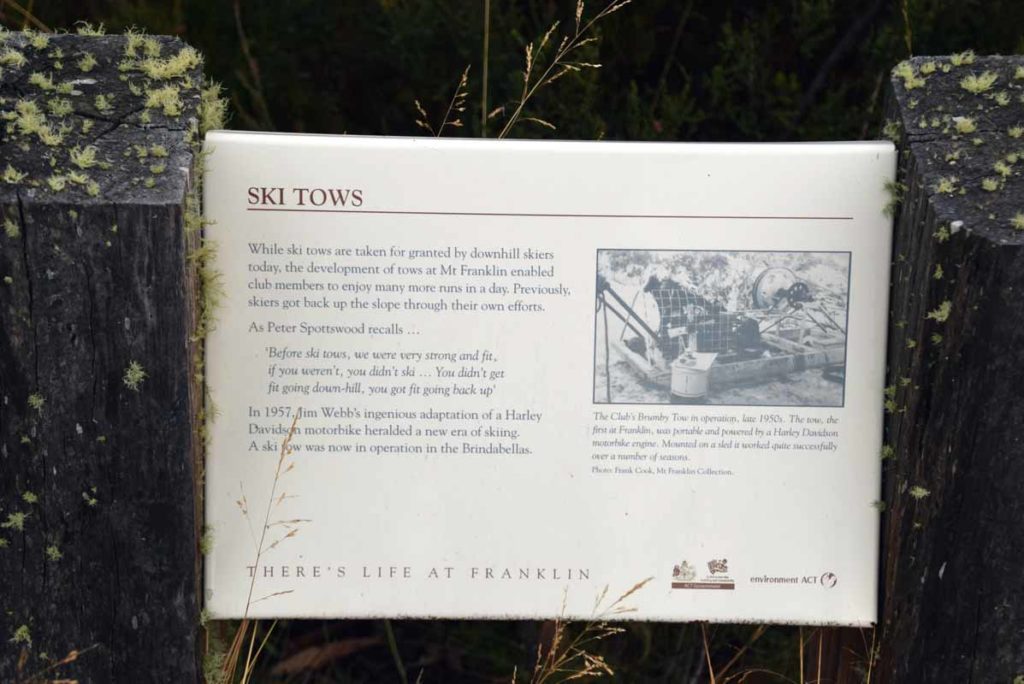
Ski tow interpretation signage. there is a lot of signage along the trail that explains what you are seeing
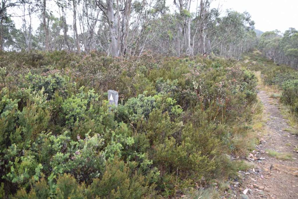
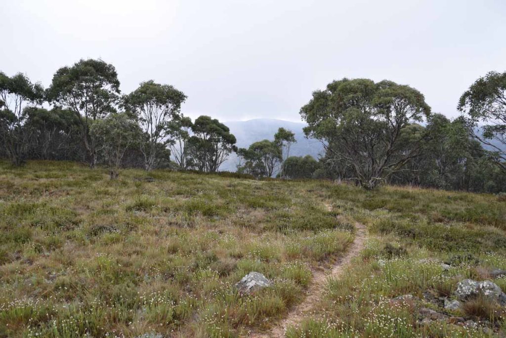
The second half of the trail is narrower
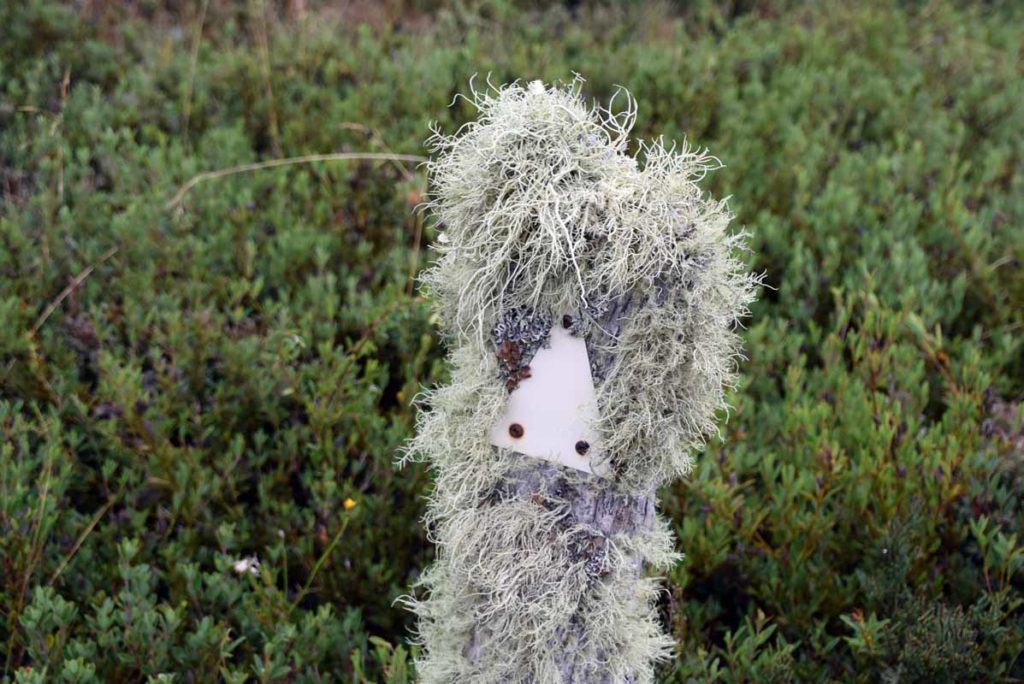
This trail marker has been here for a while

Royal Bluebell, Canberra’s floral emblem
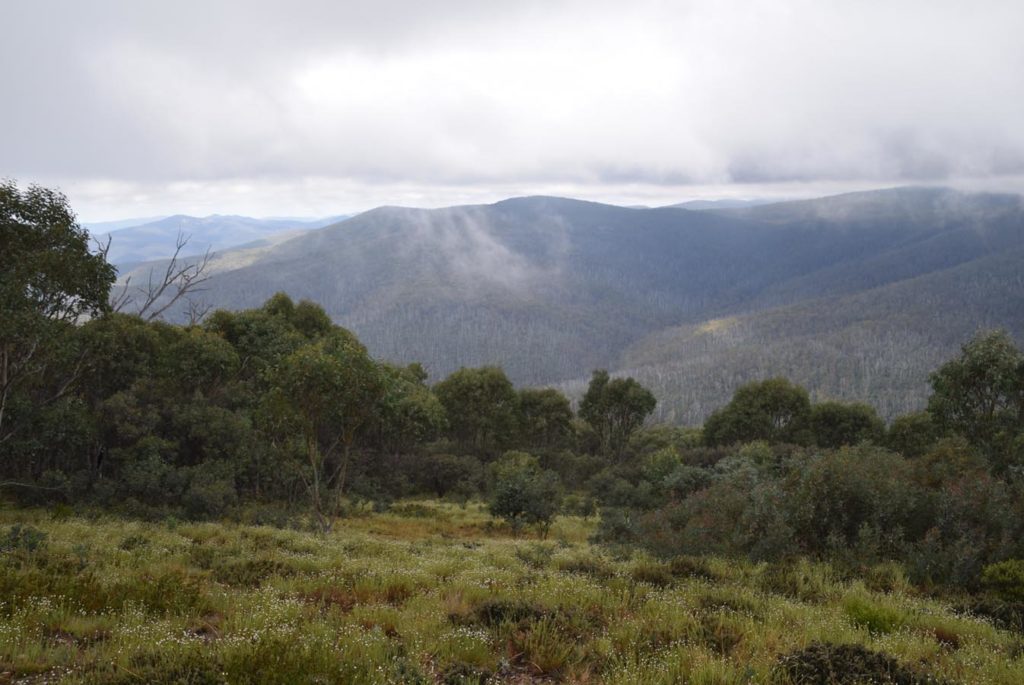
I just can’t get enough of these views
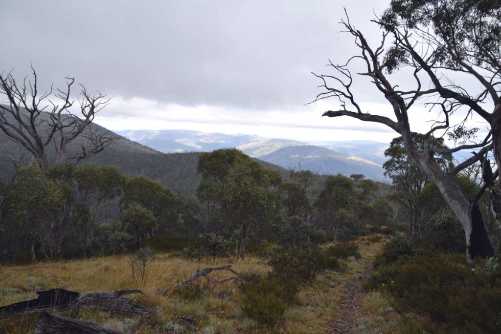
View looking back down the trail
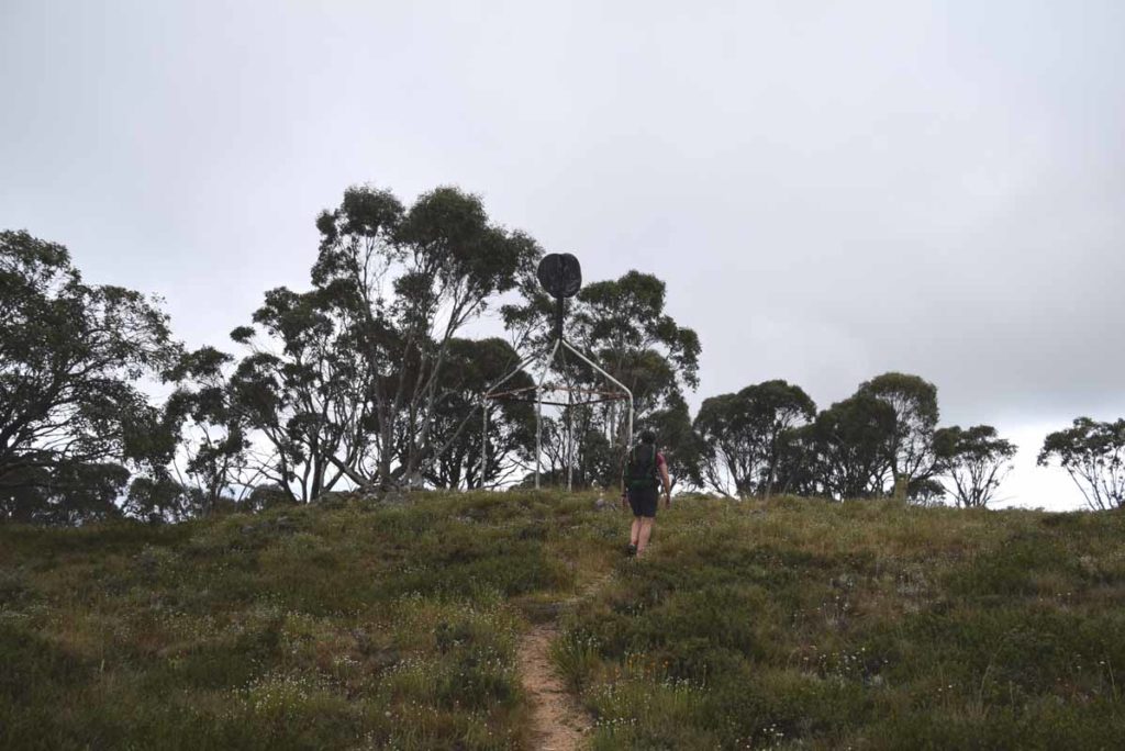
Mount Franklin Trig station
While the trig station is at the summit follow this small trail about 80 metres down the hill to the final treasure
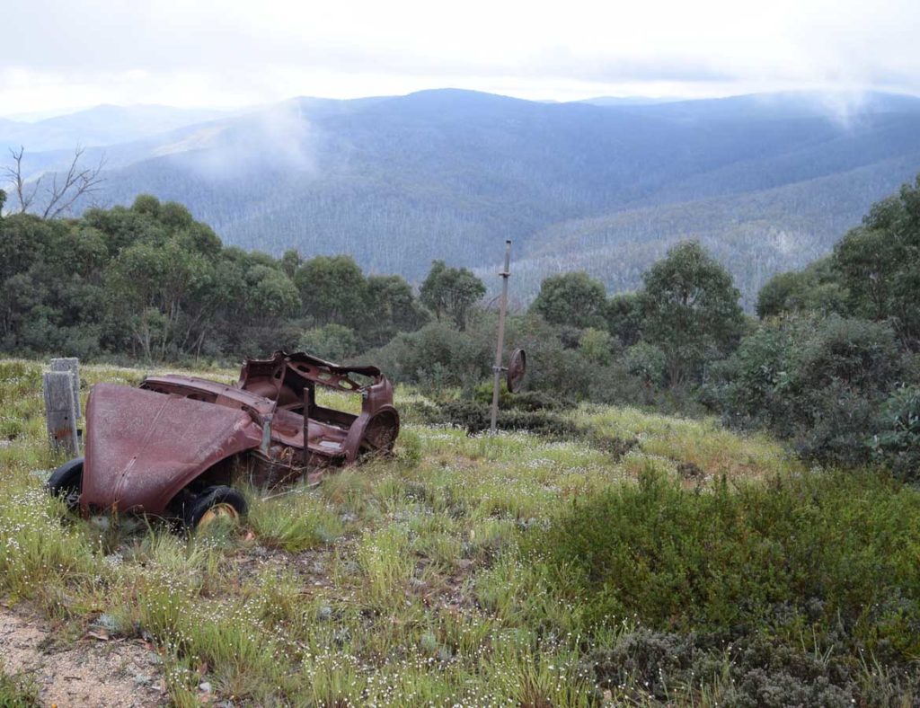
Remains of and Austin A40 car used as a ski tow engine. From here turn around and head back the way you came
Getting There
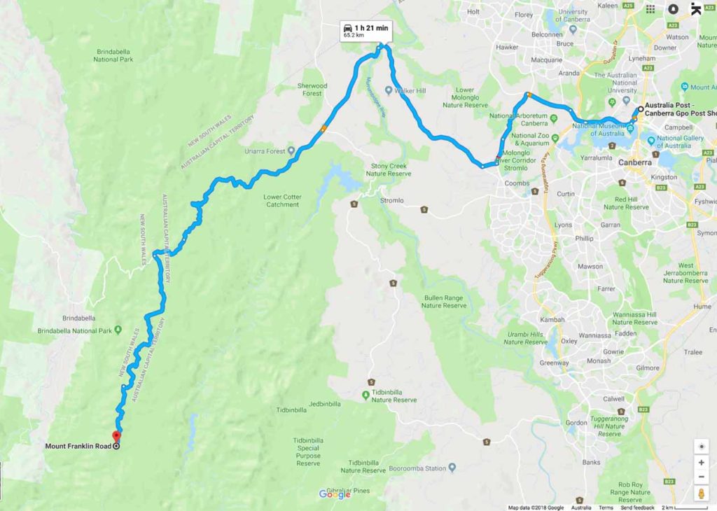
The Mount Franklin Google map showing the distance from the Canberra GPO to the trail head car park on Mt Franklin Road:
- Head to the Weston Creek area in southwest Canberra and take the road to Uriarra Crossing. Once you cross Uriarra Crossing turn left and head towards Mt Franklin Road. The road changes from bitumen to dirt and from the end of the bitumen you have 16.5km to travel to the Bendora trail head.
- You will pass a road condition sign that will show which areas are opened and closed. The road will be closed in periods of high fire danger as well as in winter during periods of heavy snow
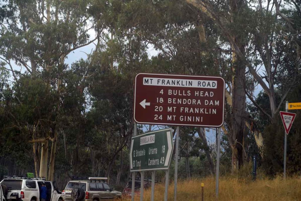
- Turn left at Picadilly Circus onto Mt Franklin Road
- The first stop is the Bulls Head Picnic Area which has a good place for lunch or a break as well as toilet facilities
- From the Bulls Head Picnic Area head down the road until you reach the bender Arboretum on the left hand side of the road
- The dirt road at this point is narrow so keep an eye on your speed and for vehicles coming the other way. Note the 2.4m tall orange road marker posts. This shows you what the snow can be like in winter
- The whole trip from the Canberra GPO to the trail head is just on 66km.
- Please note: That the last section of this road is on dirt management road so best avoid travelling too this location on a low slung vehicle. The Mount Franklin road may be closed in winter due to snow
Urriarra crossing. Turn left if coming from Weston Creek just after you go over the crossing
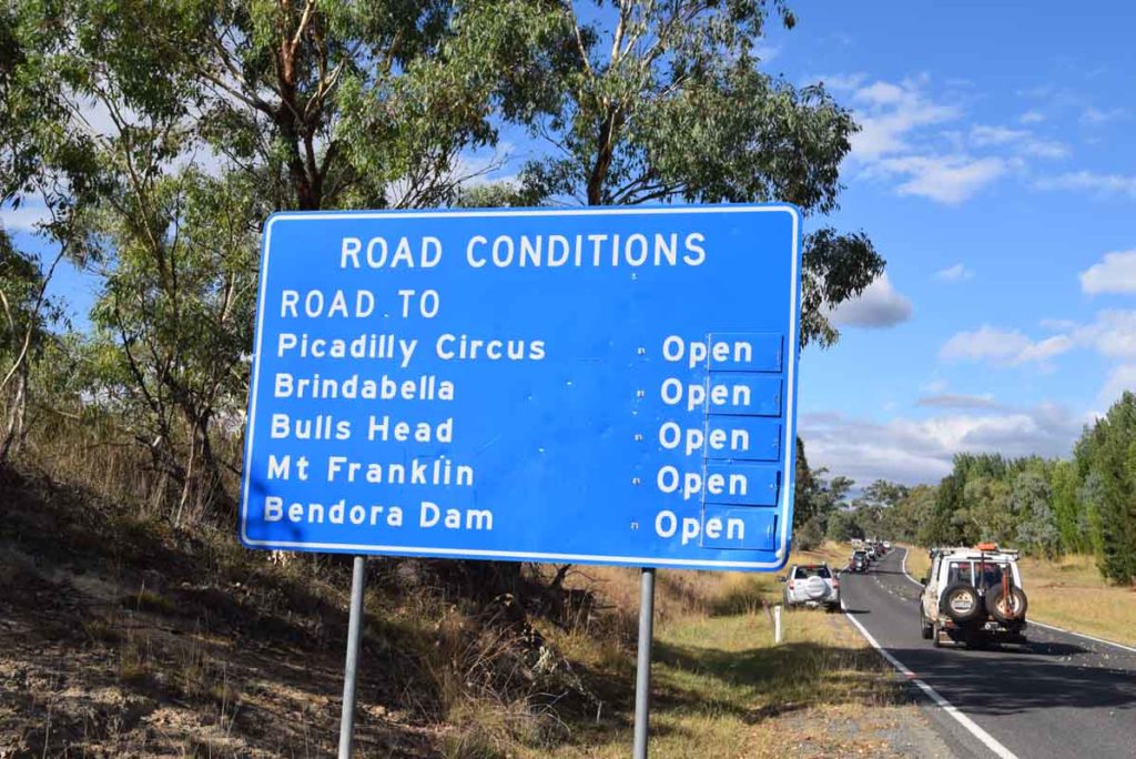
Road conditions sign. If doing this walk make sure that the Mount Franklin Road is open
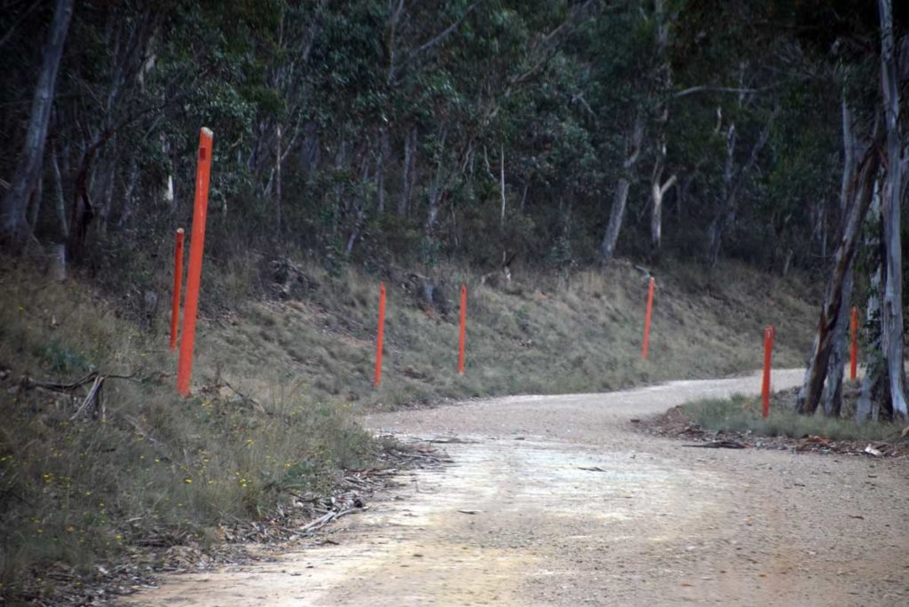
Note the 2.4meter tall road markers. This gives you an idea of the possible snow conditions in winter time
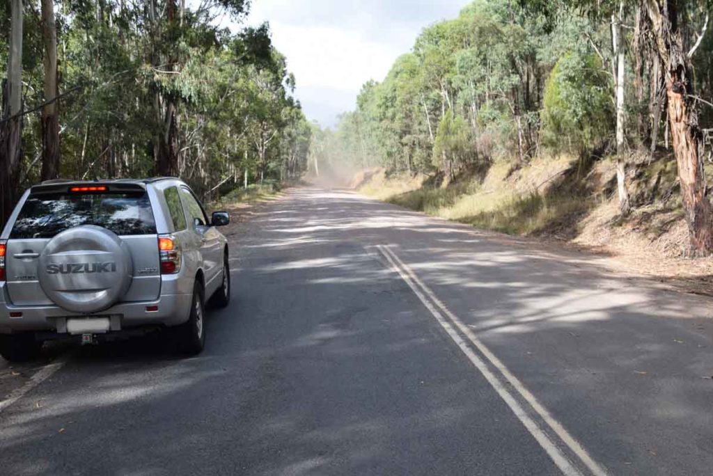
Bitumen road changing to dirt. From here the Mount Franklin car park is 25km
Follow the turnoff sign and head along Mt Franklin Road
Mt Franklin Road
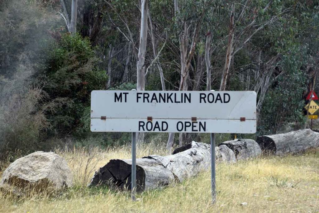
Just after you turn on to the Mount Franklin road there is a road condition sign which will indicated if the road is open or not
Car Park at Bulls Head
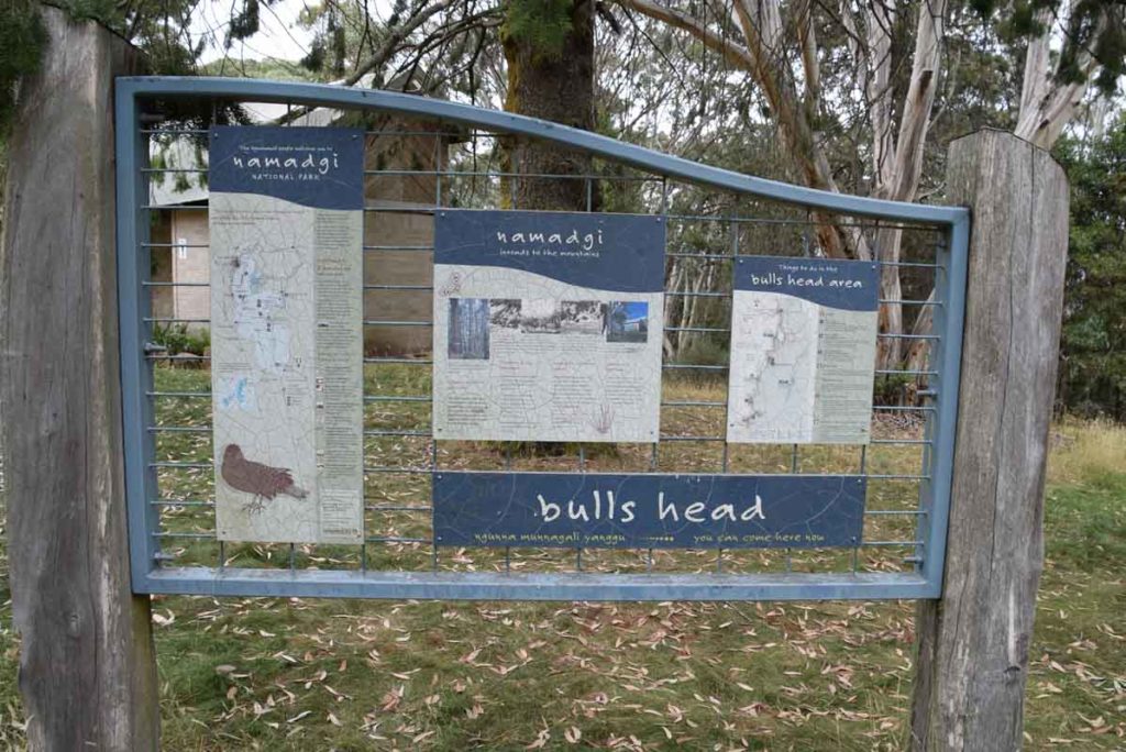
Information signage at bulls head picnic area
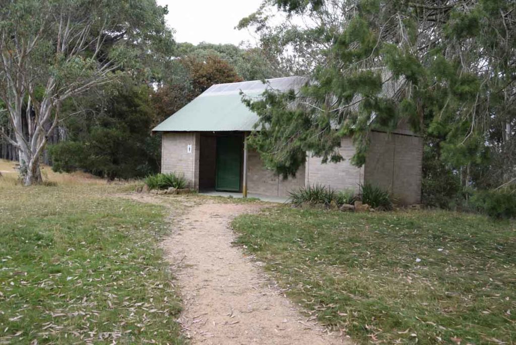
Toilets at Bulls Head picnic ground
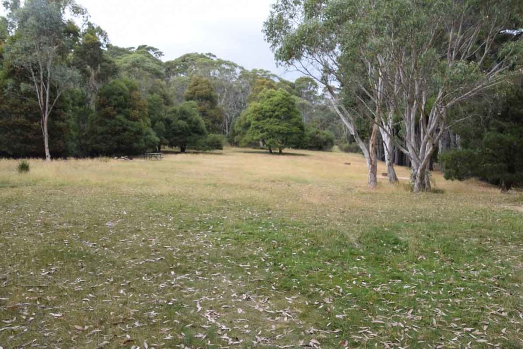
Bulls Head Picnic area
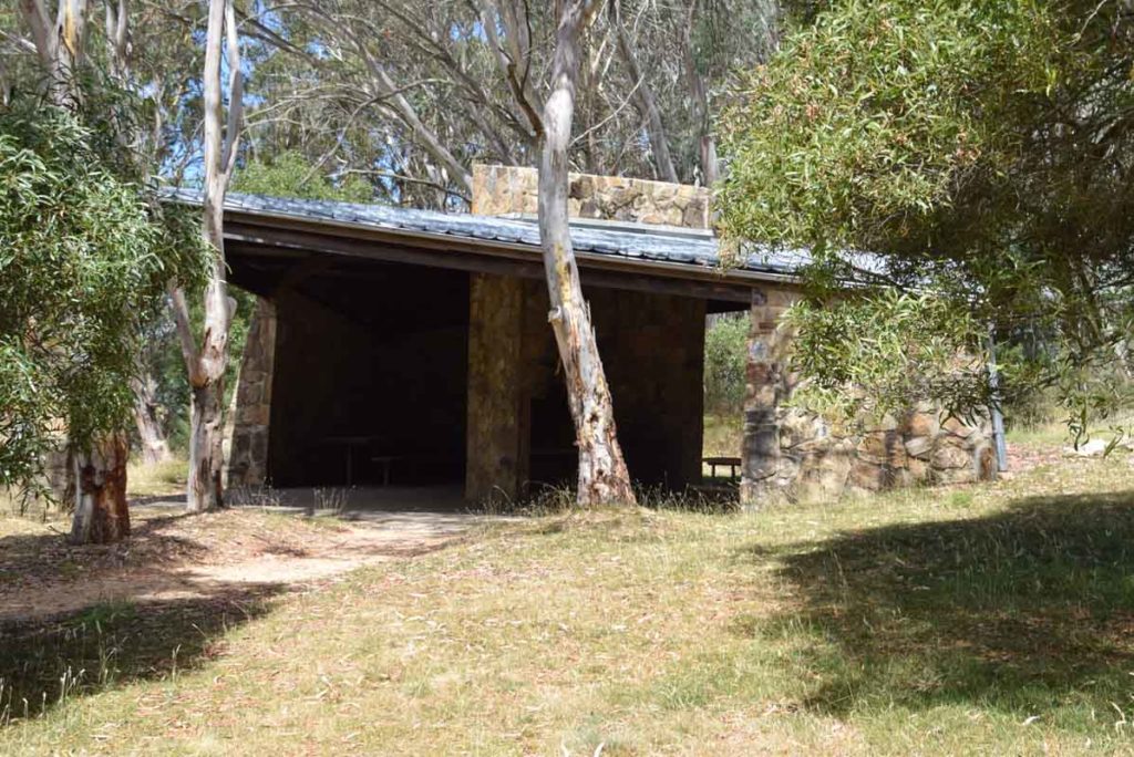
Weatherproof shelter at Bulls Head picnic area
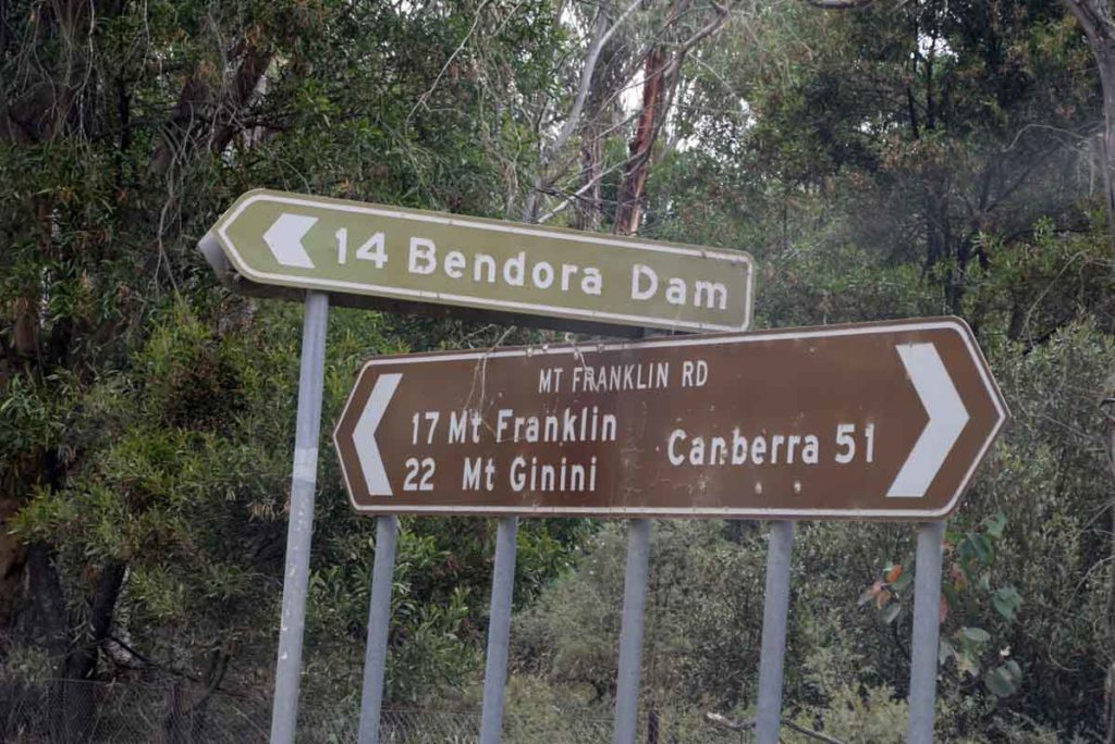
Just after you leave the Bull Head Car park you will see the turnoff to the Bendora Dam. Keep following the signs and head towards Mt Franklin.
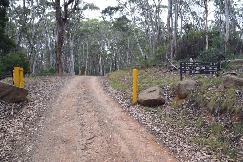
More signs and gates. There are a number of gates you will need to access. If the conditions are bad then the gates will be closed. When you see this sign you have approximately about 15.3km to go to reach the trail head to Mount Franklin
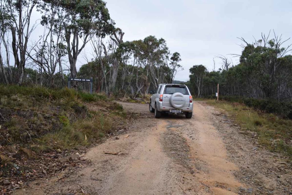
Mount Franklin Car park turn in
Keep an eye out for this sign as the car park is just off the road and not as visible as other walks pin this road
Things to Know
- Phone: There is no mobile phone coverage on this trail
- Water: You need to bring your own water
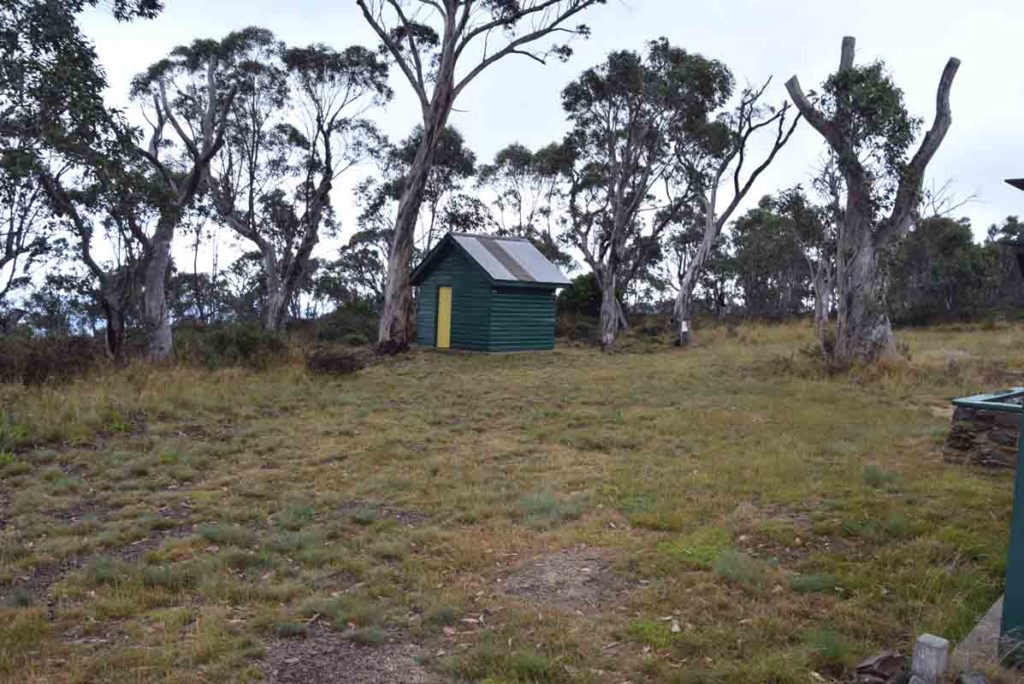
- Toilets: There is a toilet facility at the car park at the Bulls Head picnic area. There are also toilet facilities just after you start the Mount Franklin walk about about 200meters into this trail
- Trail: This walk is on steel mesh and natural trail
- Dogs: Dogs not allowed
- Camping: Camping allowed within selected areas
- Other:
- Check the snow conditions if hiking outside of summer
- This road may be closed in winter
- Keep an eye on the road once you reach the unsealed section as there is can be a lot of 4WD traffic and blind corners
- The road up until the Mount Franklin car park is in reasonably good condition but it can be a bit slippery after heavy rains so keep this in mind if you are heading out there after it has been raining. If you plan on going past this walk to do Mount Gingera definitely look at an AWD or a 4WD vehicle.
- Check the snow conditions if hiking outside of summer
Disclaimer
This walk was undertaken by the team from Australian Hiker