Mount Gingera via Corin Dam ACT (21.28 km)
Namadgi National Park
Nearest Town
Canberra
Starting Location
Corin Dam car park
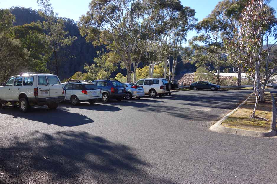
While this walk is in Namadgi National Park the starting location is well away from the central park itself and crosses into the Bimberi Wilderness. The road to the Corin Dam car park is well signposted but may be closed due to snow in the wintertime so look out for the warning sign when you turn off Tidbinbilla Road onto Corin Road. While there is good parking and picnic facilities in the area below the car park, including toilet facilities there are no water facilities (yes it is a dam). The car park will comfortably take about 12-15 cars but if by some chance the car park is full, there is another car park on the Canberra side of the dam about 150 metres away
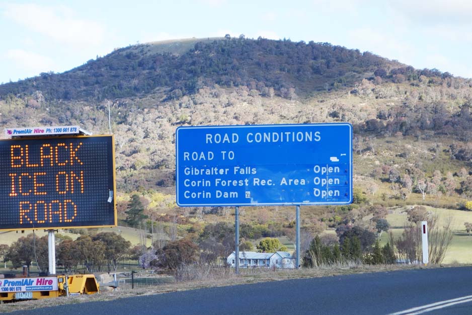
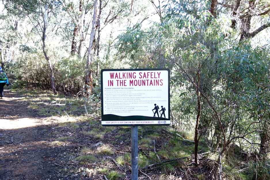
There are good warning signs for road conditions so pay attention to ensure that you can access the dam if doing this walk during the winter months
Finish Location
Corin Dam car park
Best Time to Travel
For experienced hikers, year round given the snow conditions during Winter. Summer is the best time for inexperienced hikers or those who lack snow experience
WARNING 1: If you are doing this hike in Winter then snow shoes will make the walk much easier in the upper section of the walk. You also need to keep an eye on the weather forecast in winter as heavy snow/blizzards are always a possibility
WARNING 2: If you are doing this hike in Summer then expect to see snakes; in fact it’s almost a guarantee
Mount Gingera via Corin Dam ACT Review
Summiting Mount Gingera from the Corin Dam trailhead is one of the most physically demanding walks in the Canberra region and if you aren’t up for this as a one day trip you may want an easier option by summiting Mt Gingera from the Mount Franklin road trailhead. Alternatively you could make this a two day walk and camp overnight; more about this later.
The walk starts at the Corin Dam car park and heads up on the right-hand side of the management trail. We have done this walk previously and were prepared for the first two kilometres which is very steep. It is REALLY steep, about 580 metres in the first 2 km with a series of winding walkways interspersed by stone and railway sleeper steps – lots and lots of steps! About 200 metres along the first part of the trail, there is a seating area where you can take in the amazing view down over Corin Dam and catch your breath! The next spot to catch your breath is at the top of the steep rise – congratulations, you’ve completed the first two kilometres.
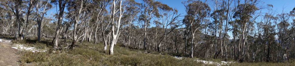
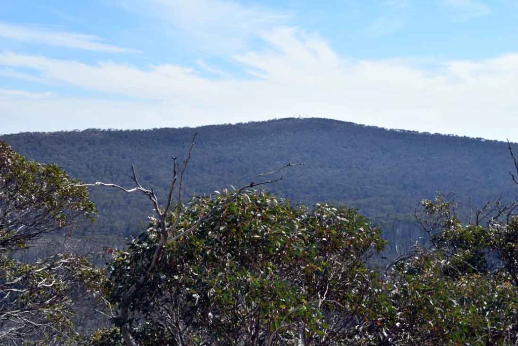
The bush at the top of the rise opens up and this is the start of ‘Stockyard Spur’. Continue along the trail for around 3-5-4km. The track undulates upwards and while there are a few inclines, they are short and not nearly as steep. You will reach the summit and the turnaround point for the Stockyard Spur walk. Turn slightly to the right at this point and head about 50 metres and you will reach a rocky outcrop which offers stunning views of Mt Ginini. Stockyard Spur is an ideal place to take a break for either lunch or morning tea before walking the extra distance to Mount Gingera.
The other option is to head along the trail to Mount Gingera for around 80 meters and you come across another outcrop over to the left offering sweeping views down across the Bimberi Wilderness. Walk a bit further to the left and you will clearly view Mt Gingera. The trail heads downwards from here before starting a steady but slight incline until you approach Pryor’s Hut which is located at a low point on the trail. The first time you do this walk you may think you have gone off trail but providing you pay attention to the worn trail and the markers you just need to trust the trail loops back hard to the left and takes you towards Pryor’s Hut and then on to Mount Gingera.
Stop in at Pryor’s Hut and have a look around. This is an old working hut which can be used in an emergency to get out of the weather and looking at the interpretive material in the hut is well worth a visit. There is a toilet just off to one side which is quite handy.
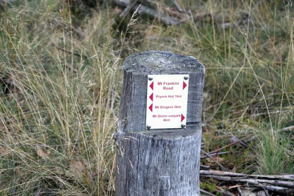
From Pryor’s Hut keep on walking up the management road and you will come to a tight left hand hairpin bend and this is where you start your ascent of Mount Gingera itself. There is some very minimal signage here (see images below) so you do need to pay attention. The first time I did this walk it was in mid winter with about 40cm of snow on the road so the trail was more difficult to spot particularly if you haven’t done it before.
The trail up to the summit of Mount Gingera is heavily overgrown and very narrow and in the hot weather can be prone to snakes so while I usually don’t wear gaiters on my hikes I will always don them for the walk up to the summit. The walk up to the summit is actually quite pleasant and has a unique feel about it that’s just different.
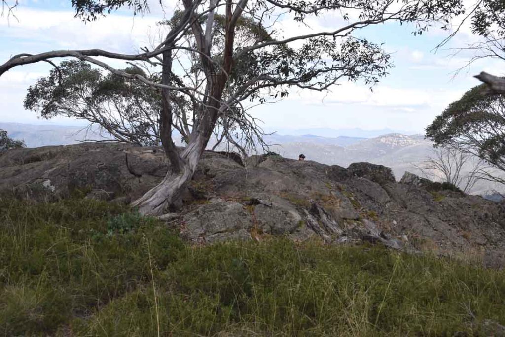
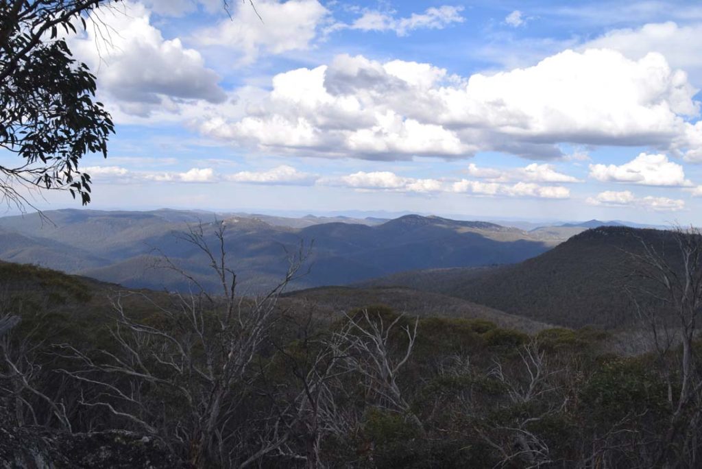
Once you reach the summit there are some large rock outcrops to seek different views and if you look carefully there are easy access points to these so don’t necessarily take the most direct route. I would suggest picking the highest point which requires a relatively easy rock scramble at the summit as this gives views both into NSW as well as the ACT. Previously when I came up here I had the summit to myself but on this day a number of other hikers had the same idea on this day so it was a bit busier but by no means crowded. My time at the summit rather than the rest of the trip was the reasoning for me considering this my favourite ACT walk. Again on this visit I had great weather conditions, and the usual panoramic views and while there was some during off occurring in the distance this just added to the scenery.
The trip back down the summit of Mount Gingera was easy and given that I hadn’t seen any snakes this trip (to cold) and was wearing gaiters I moved a bit faster than on my previous trip. The return for this walk is the way you came so its a simple matter of doing a U-turn. While the upwards incline is a challenge, for me I definilty need trekking poles on the way day, particularly from the Stockyard Spur section due to my knees.
We have previously done this walk in September and were surrounded by heavy snow which can be an issue in wintertime if you aren’t prepared for it. This is a very popular hike, year round, but by no means an easy walk. If you are planning on doing this walk in a single day, even as a fit hiker I would allow an average pace of 3km/hour so allow 7-8 hours just to be safe. What this means is unless you plan on camping overnight or turning around early I would start this walk by around 9:00am at the latest to ensure that you return to the carpark in daylight.
If you feel that the 21km distance is too far for you in a single day then look at camping overnight and turning this into two day walk. You will be camping in the Bimberi Wilderness so will need to contact the visitor centre at Namagi National Park for a permit. Permits are minimal in price but it ensures that the area is not being overused. Camping close by Pryor’s Hut would be a good area to aim at.
Overall an excellent, if difficult walk and well worth doing for fit walkers as a day walk or taking a more leisurely walk over two days.
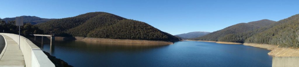
Corin Dam. You cross over the dam to reach the car park
Trail head signage. The car park and trail head to Mt Gingera follows the Stockyard Spur walking track and is very obvious at the end of the car park – it is located almost dead ahead after you drive into the Corin Dam car park. Head towards the right and down the hill to the picnic area.
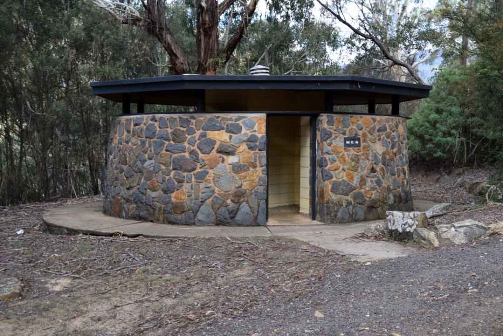
Toilets facilities at the Corin Dam car park
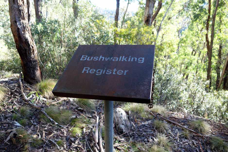
Don’t forget to fill out the trail register at the start of your walk. It helps the emergency services in case of any problem
You will reach just over 1700 metres altitude on this walk so expect snow in the colder months of the year
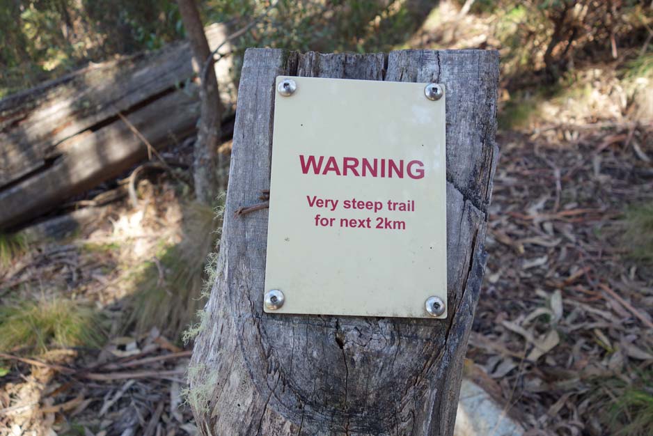
You’ve been warned! This is a very challenging walk for the first two kilometres
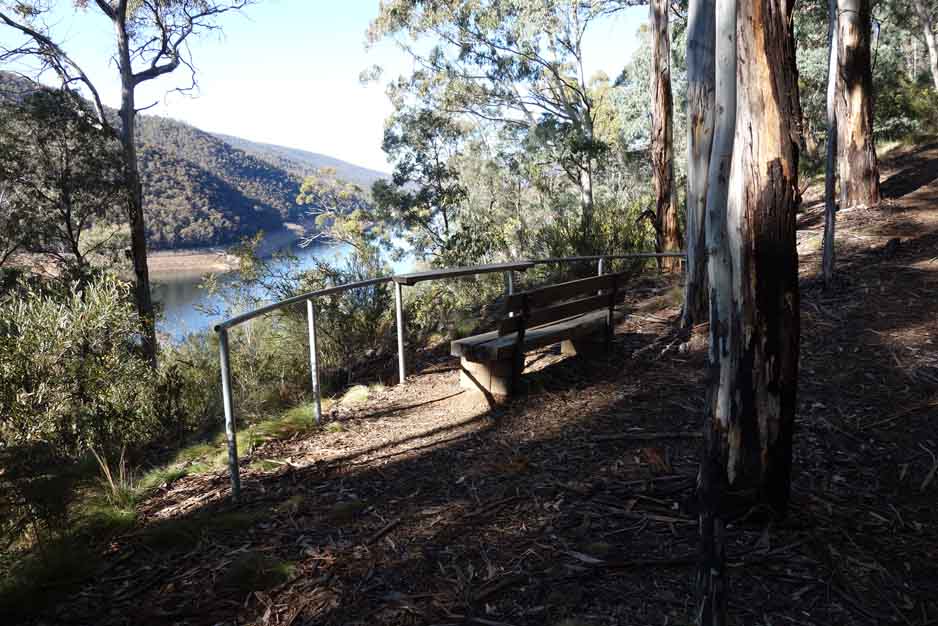
Lower lookout about 200 metres into the walk provides good views of the dam
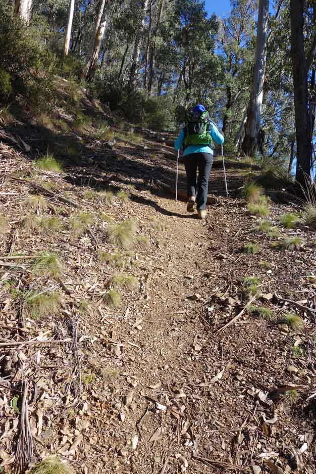
A view of the start of the trail. Its steep and gets worse from here.
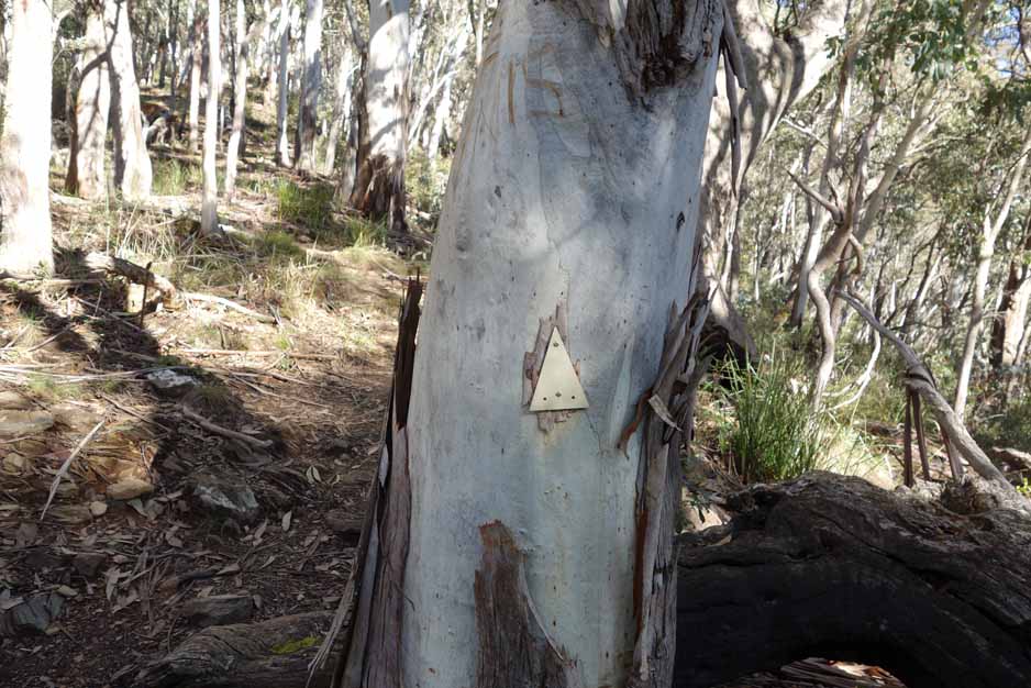
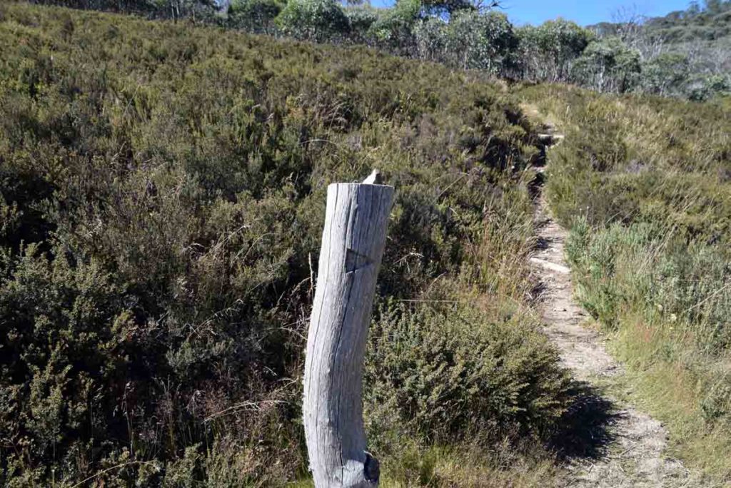
Trail markers are limited. This is one of the few we saw. There is no interpretive signage on this trail except as Pryor’s hut
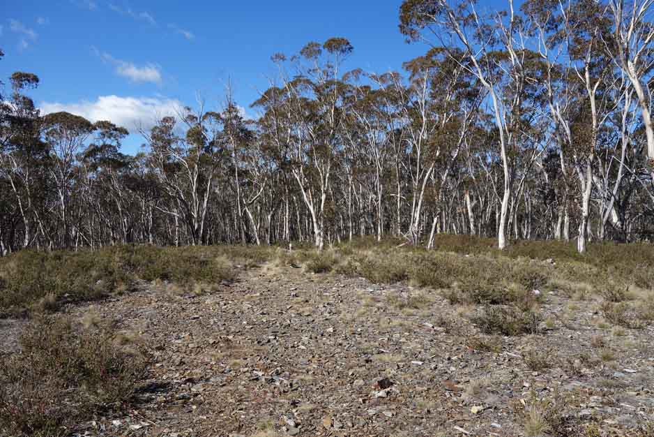
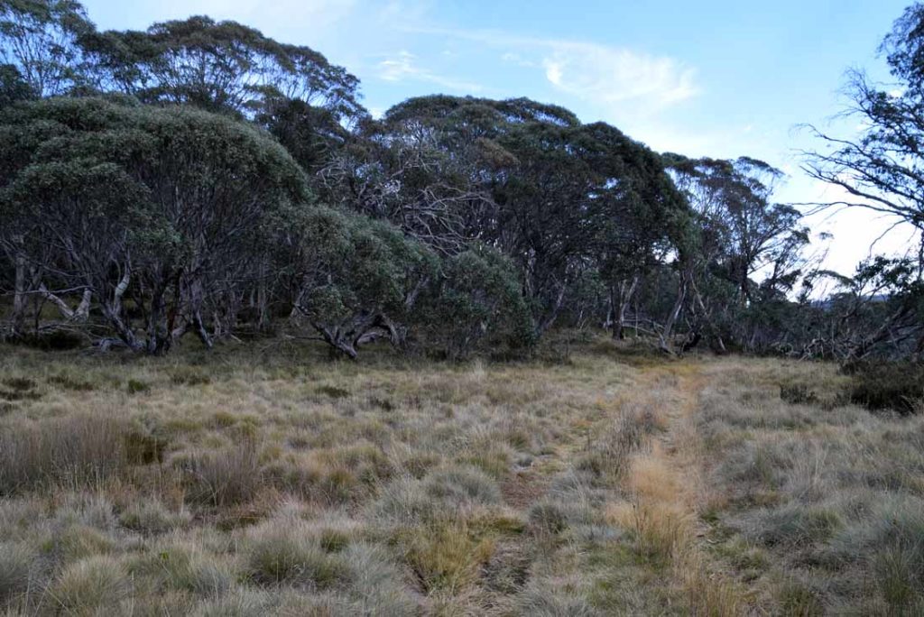
Start of Stockyard Spur completely with helipad if needed
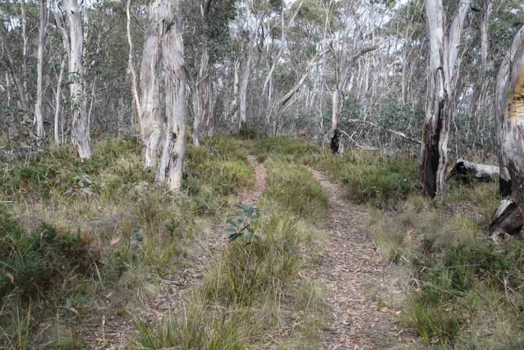
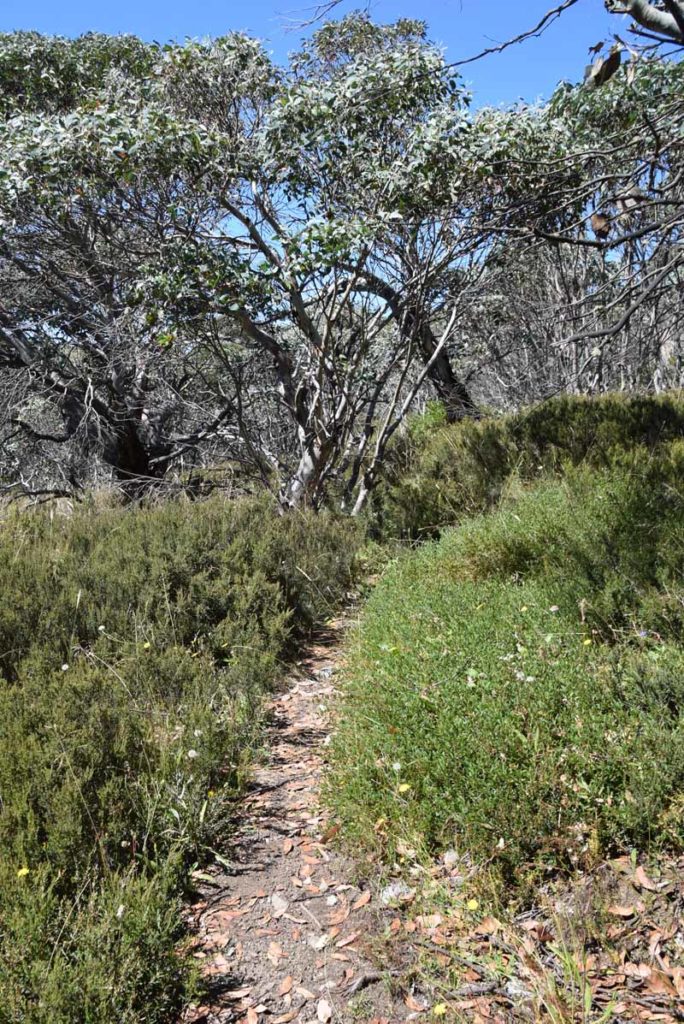
Example of the trail once you reach Stockyard Spur
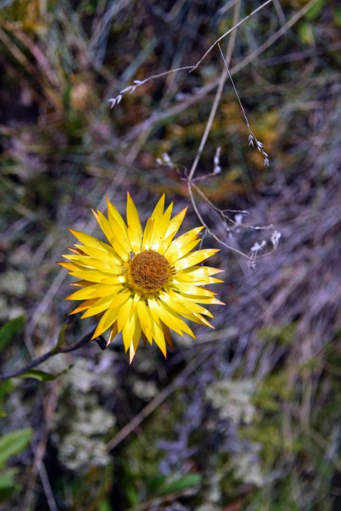
Paper Daisy. There is always something flowering on this trail in the warmer months
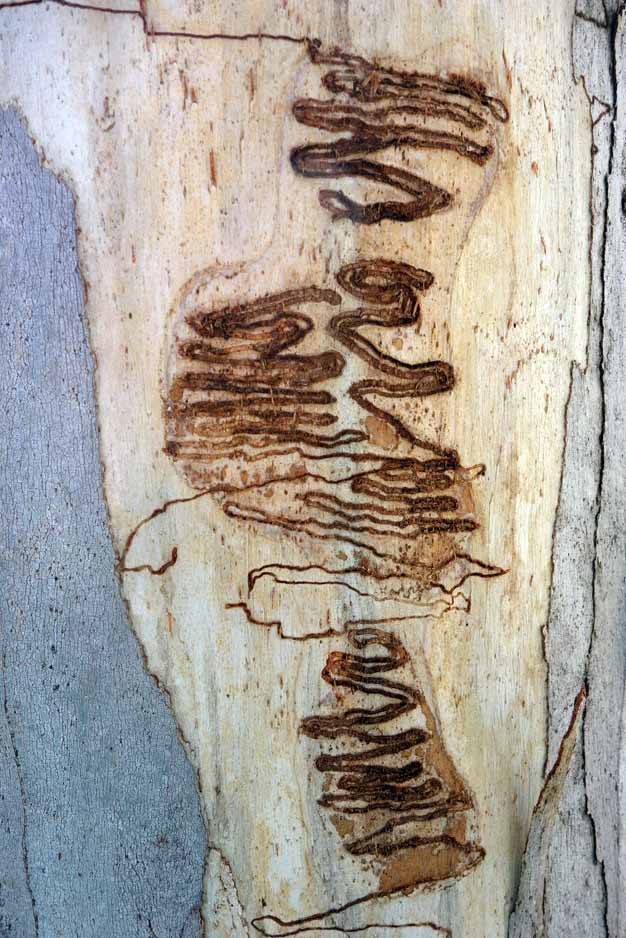
Scribbly Gum. I love these and they are all over the lower part of the track
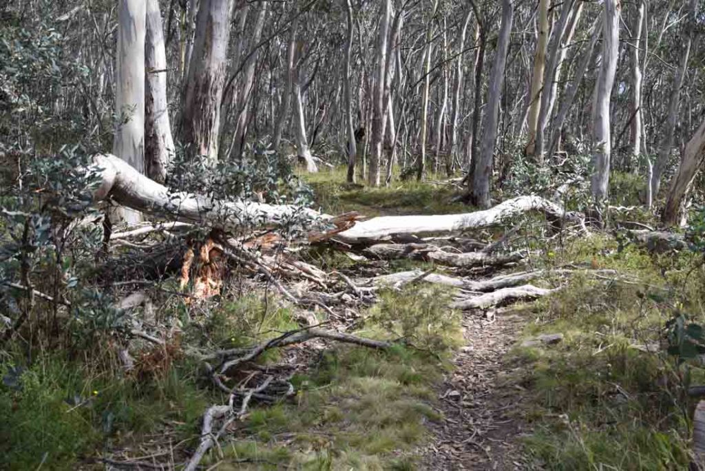
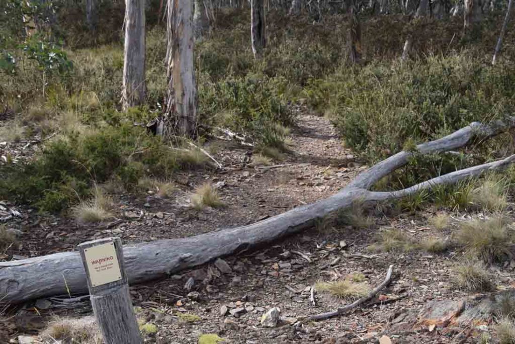
A tree had fallen across the trail and given the remoteness this is not unusual
This is a wilderness area and it looks like it
I love the almost skeletal trees on this section of the trail
From stockyard Spur you continue to head up hill for around another 3.5-4km and reach another spur which is the recommended turn around point for the Stockyard Spur Walk. From here you have good views to nearby Mt Ginini and the surrounding area
As you head towards Mt Gingera you will pass another vantage point on the left which is a good place to take a break and take advantage of the views
There are great views from this lookout located just past the midway summit point
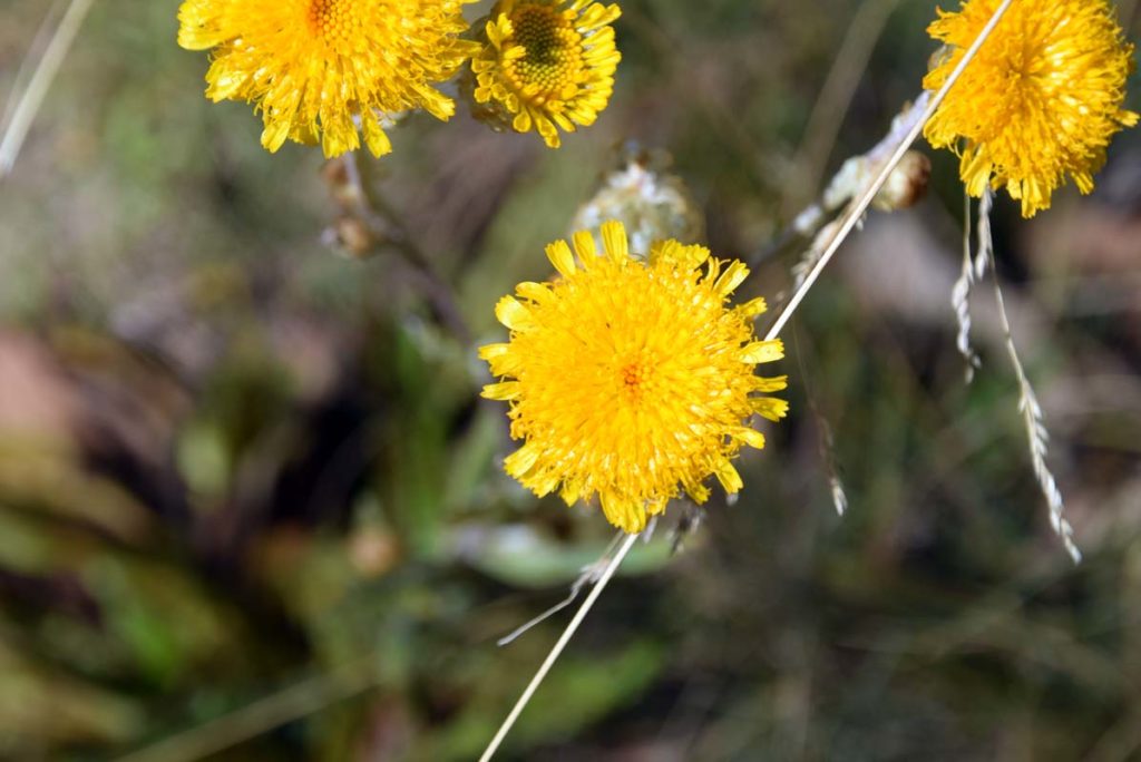
More wildflowers even in late Autumn
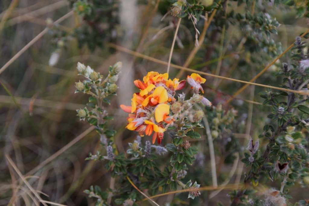
Pea Flower on the trail
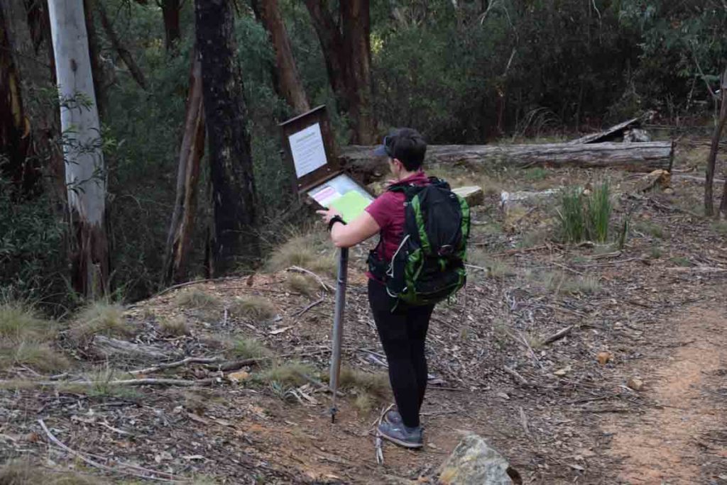
You will come to a ‘T’ intersection not far past the midway lookout and lookout for the signage post. Follow the signs to Pryor’s hut and Mt Gingera
Turn left here
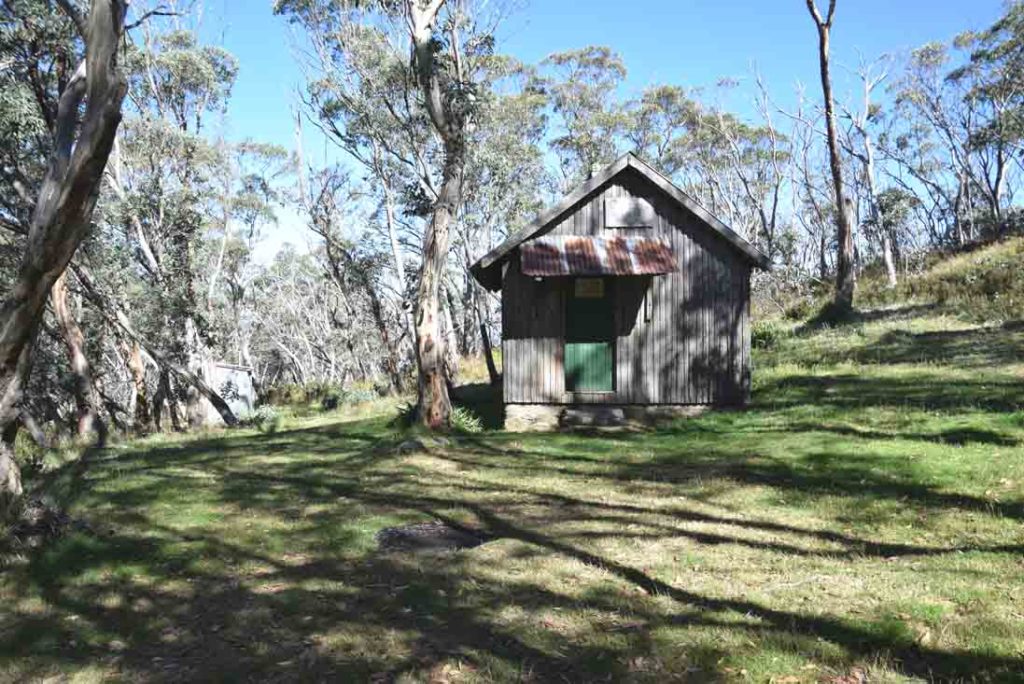
Pryor’s Hut is located on the trail to Mount Gingera on the left side of the management road. There are basic toilet facilities here which can be seen in the back left of the image
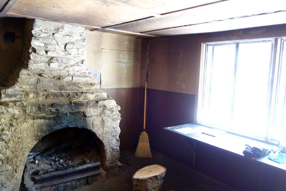
Inside Pryor’s Hut
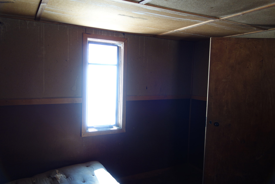
Interior of Pryor’s Hut
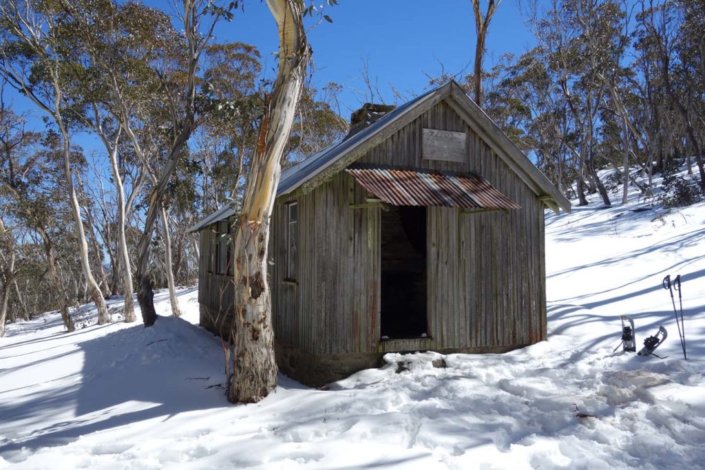
This image of Pryor’s hut was taken in September when snow is a real possibility
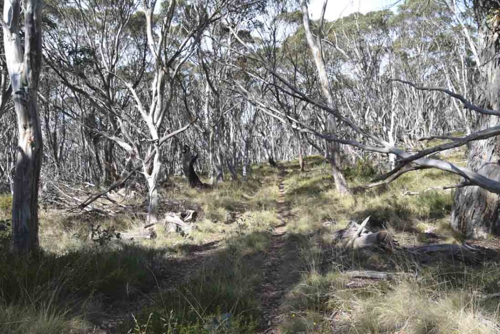
The trail up Mt Gingera is not far now
Trail marker onto Mount Gingera
Trail example Mt Gingera
The trail on Mount Gingera itself can be very dense and if hiking this in summer wear gaiters and keep an eye out for snakes. you may not see them but you will probably hear them

Just one of the amazing views from the top of Mount Gingera
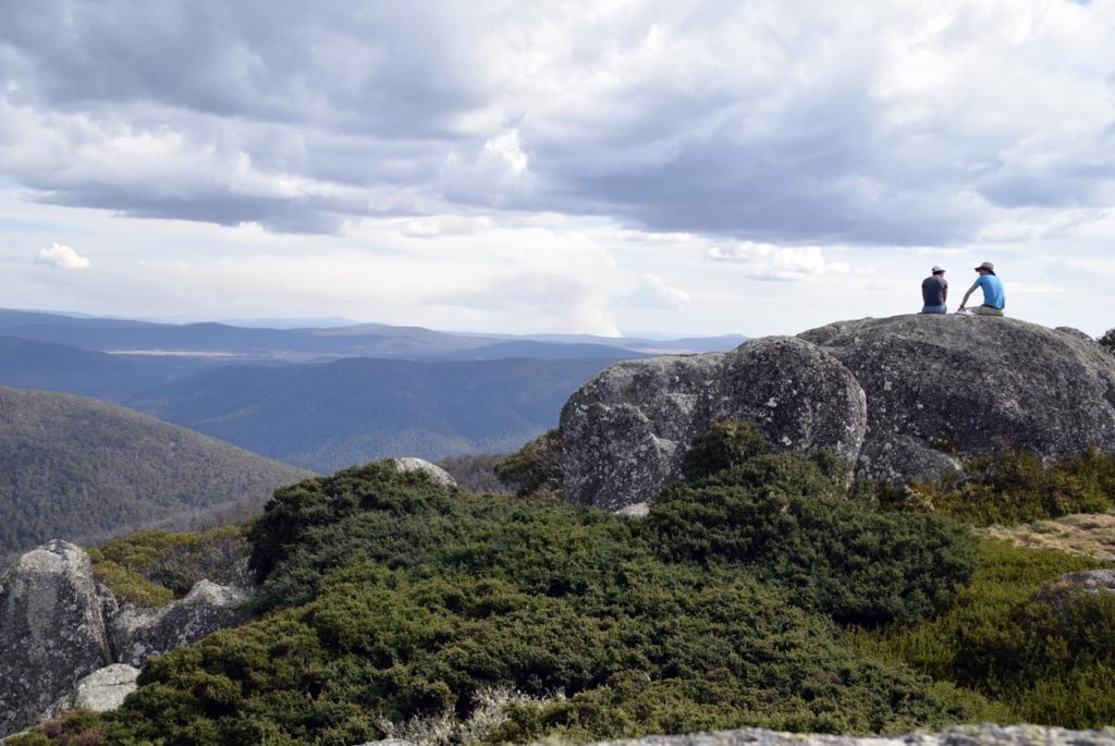
Mt Gingera Summit
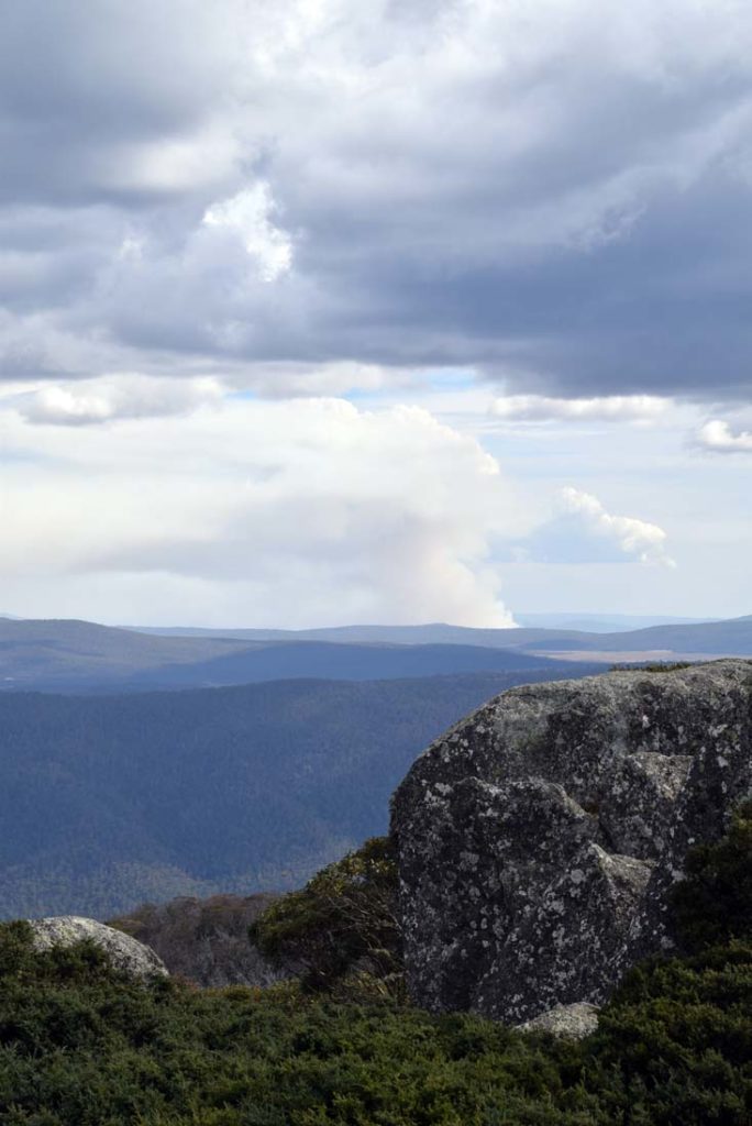
Burning off in the distance
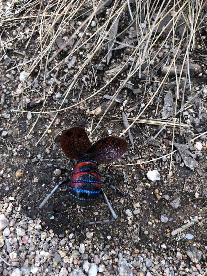
Mountain Katydid in display mode. Bright blue colouration in nature is often associated with poison even if there is none there
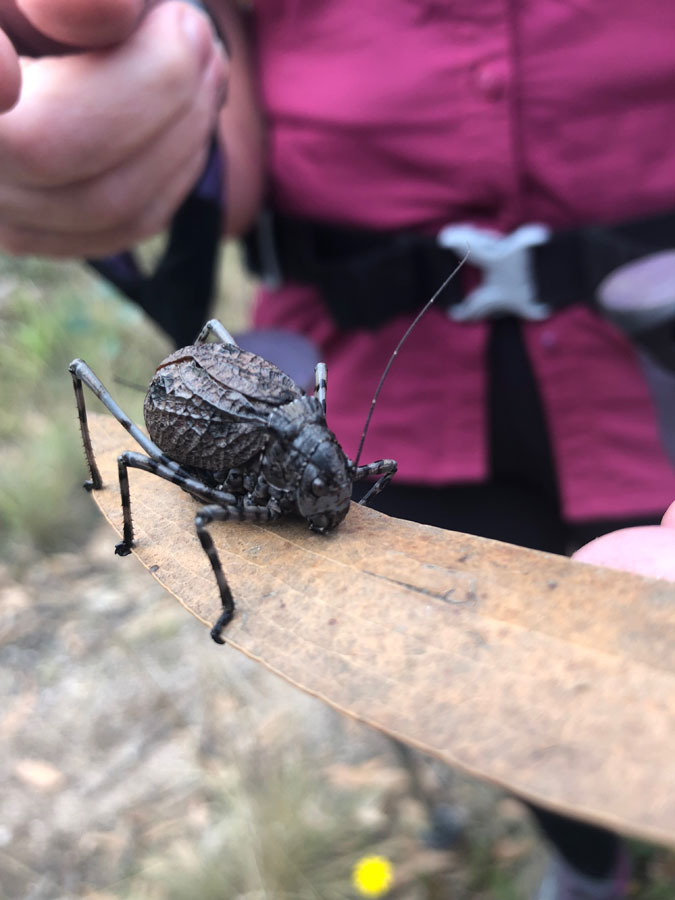
Female Mountain Katydid front on. When we put this on our hands it rolled over and played dead
The start of the descent from Stockyard Spur. The downhill section is what kills my knees so I would advise taking trekking poles
Don’t forget to sign out of the trail register on the way back
Getting There
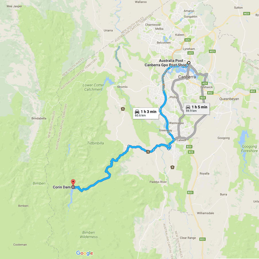
The trip from the centre of Canberra is approximately 1 hour and 60 km from the centre of Canberra. Turn off Tidbinbilla Road onto Corin Road and travel to the very end of Corin Road where you’ll park your car.
Corin Road is a sealed road but is prone to frost and ice, and can be closed during periods of snow and Total Fire Bans. Make sure you review the whether forecast before you head off.
As you travel down Corin Road, you’ll pass the turn off to Gibraltar Falls on the left, as well as Square Rock and Smokers Flat car park. You’ll know you’re getting close when you see the sign advising you are entering the Namadgi National Park. Corin Road ends at the Stockyard Spur car park and trail head.
Things to Know
- Phone: There is variable phone signal (Telstra) on this track, mostly on the upper reaches with minimal/no signal lower down)
- Water: You should bring your own water. Occasionally you may come across water in the roadside drains or seasonal creeks but don’t count on it
- Toilets: There are toilets located at the car park at Corin Dam and at Pryor’s Hut
- Trail: This walk is an ‘out and back’ experience
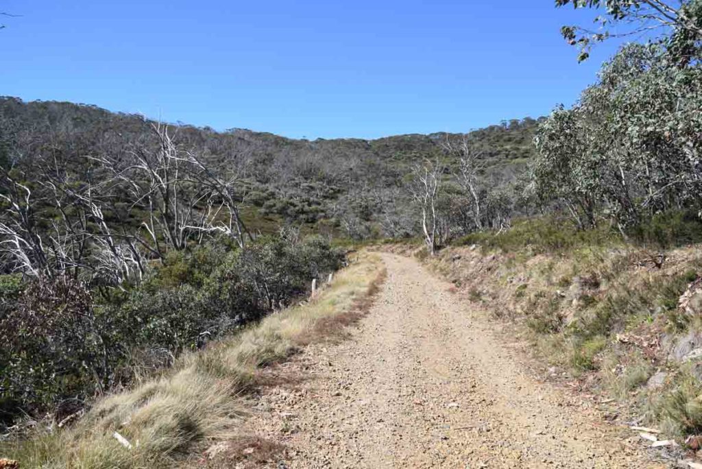
- This trail consists of formed track and management road
- The return can be very slushy and slippery if doing this walk in late Winter
- If you aren’t into snow consider doing this in Summer time
- Dogs: No dogs allowed
- Camping: Allowed (Staying in Pryor’s Hut is for emergencies only)
- Other:
- This hike is not an easy one, particularly the first two kilometres which is a steep 580 metre climb with lots of steps
- If hiking this trail in Summer expect to see snakes so bring gaiters, particularly once you leave the management road and start the summit section of Mount Gingera as you leave the management road
- Always check the weather forecast before you go to ensure that storms and blizzards aren’t forecast. If you do this walk between late April to late September, snow is a possability on this trail. We have walked this track in September and had up to 50 cm of snow on the trail which becomes very slushy and slippery in the afternoon. If doing this as a winter walk look at using snowshoes
Disclaimer
This walk was undertaken by the team from Australian Hiker
Last updated
14 April 2026