Previous Post
Today saw me head the just over 22km to Wilpena Pound and even though I had only been walking for a few days, I am looking forward to a rest and to pick up my food resupply. I was last out of camp which is not surprising as I do my videos and take respective photos for social media. Another sunny mild day after a cool night and while there was frost on the timber platform outside, it was far colder during the night.
I left Yanyanna at 7:21am (so much for my 7:00am start). It didn’t take long for the sun to crest the surrounding hills. I must admit that the large mountain range behind forms a spectacular backdrop in the morning as the light creates all sorts of vibrant colours.
The first half of the walk was up and over a couple of hills but it was the down that was the problem. The descent on the second hill down to the creek bed was steep in some sections and if it had been raining it would have been be a bit treacherous and slippery.
I finally reach the creek bed below and for about 10 minutes the trail was confusing. After checking my online maps I knew that I shouldn’t go up the hill again but it’s not really clear that the creek bed is the route. I travel back about 30 metres and sure enough, there is small text at the bottom of the directional sign that says to use the creek bed. I’ve already mentioned this but the rampant growth is creating havoc with the signage so you really do need to make sure to check the fine print.
I made my way down the creek bed which at the start had water flowing but there was enough dry ground to hop about and stay dry. Eventually the creek widens and it was much easier going. One advantage on going last was that I have footprints to follow and it’s interesting to see what I consider to be logical is what other hikers did as well. One thing to consider was that at some point the trail leaves the creek bed requiring the need to scan about for the ‘off ramp’. Once I left the first creek walking section I came across two section hikers. The first was relatively new to multi-day hiking and was walking from Wilpena Pound to the trailhead at Parachilna. The other was walking from Quorn to Parachilna. In all honesty while I expected to see people on the trail, I didn’t except to see so many people so soon.
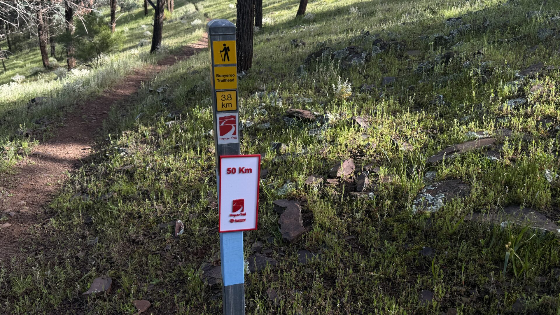
After seeing the first hiker it was up and over another hill and on the down hill slope I came to a sign that said I have done 50km of the entire trail. This is a really good feature and one I hope continues down the trail!
The trail pattern continues until about 10:00am when I reached management road which was the bulk of the walking for the rest of the day. While management road sounds boring, the terrain was anything but. I am really surprised and loving the change and the different landscapes over a relatively short distance.
Animal life was again limited to birds but this time they were more noticeable. Corellas, and what turned out to be Red Cape Robins. In addition I got swooped by a wattlebird (?) or at least something that looked like one. Oh and don’t forget the obligatory Emu. In this case the first I knew was there was a large thudding coming from behind me and all I could think was where is this going to end up? I finally saw it as it ran past about 5 metres to my right. I wasn’t sure what was going on here because it did the same thing a second time and I would not have seen it if I hadn’t moved.
Not long after lunch I came across Wilcolo Campsite which is a paid site. People often use this camp when they don’t want to spend much time in Wilpena which is a further 7km on. Eventually the road walking gave way to walking through a fairly open forest in what looked like old farm land and after one last stint open hillside walking, I made it to Wilpena Pound.
You first enter the resort caravan park area and then onto the information centre and the supermarket, before heading down to the motel style accommodation another 100 metres away. I checked in and had a shower before going down to the supermarket for a snack. I ran into Michael who was one of the hikers I had been travelling with as he was checking his emails and making calls. The website states that there isn’t wifi in the rooms but certainly there was in my room and I had good 4G-4 bars wherever I checked. I also had phone reception when I checked 5km out.
Micheal reminded me about my resupply box so I headed back to reception to pick it up only to discover that it was still in the nearby town of Hawker so I decided to check in the morning to see what’s going on.
I had dinner at the local pub/restaurant and while not cheap it was good hearty food. On the reverse side, the food at the supermarket was reasonably priced which given it’s in a remote area was a surprise.
I spent the rest of the day being working my way through just on 200 emails and starting my social media catch up before eventually heading to sleep.
Follow Me
One thing I do on my long distance hikes is share my location through Garmin Mapshare. Through this online map you will be able to see where I am, with a time delay built in, and how I’m progressing. If you are out on-trail and have internet access to use this map, say hi if I’m nearby. The farther apart the pins, the faster I am moving! In addition if you zoom in you can see the terrain from close up however it doesn’t really reflect the lush state of this area at this stage. On occasion I am taking a rest day so if I don’t appear to be moving then that’s where I’ll be.
You can see where I am at via the following link:
https://aus-share.explore.garmin.com/HeysentrailAH
If you have any questions about my journey drop me an email at info@australianhiker.com.au and I will reply when I can within the whims of the internet signal which will be erratic on the northern end of the trail so it may be several days before I can respond.
Next Post
Previous Post Today saw me head the just over 22km to Wilpena Pound and even though I had only been walking for a few days, I am looking forward to a rest and to pick up my food resupply. I was last out of camp which is not surprising as I do my videos and […]