The Settlers Track ‘Long’ ACT (10.2 km)
Namadgi National Park
Nearest Town
Tharwa is 49 km away and Adaminaby is 30 km in the opposite direction
Beast Time of the Year to Travel
Year round although snow can impact this area in mid winter
Starting Location
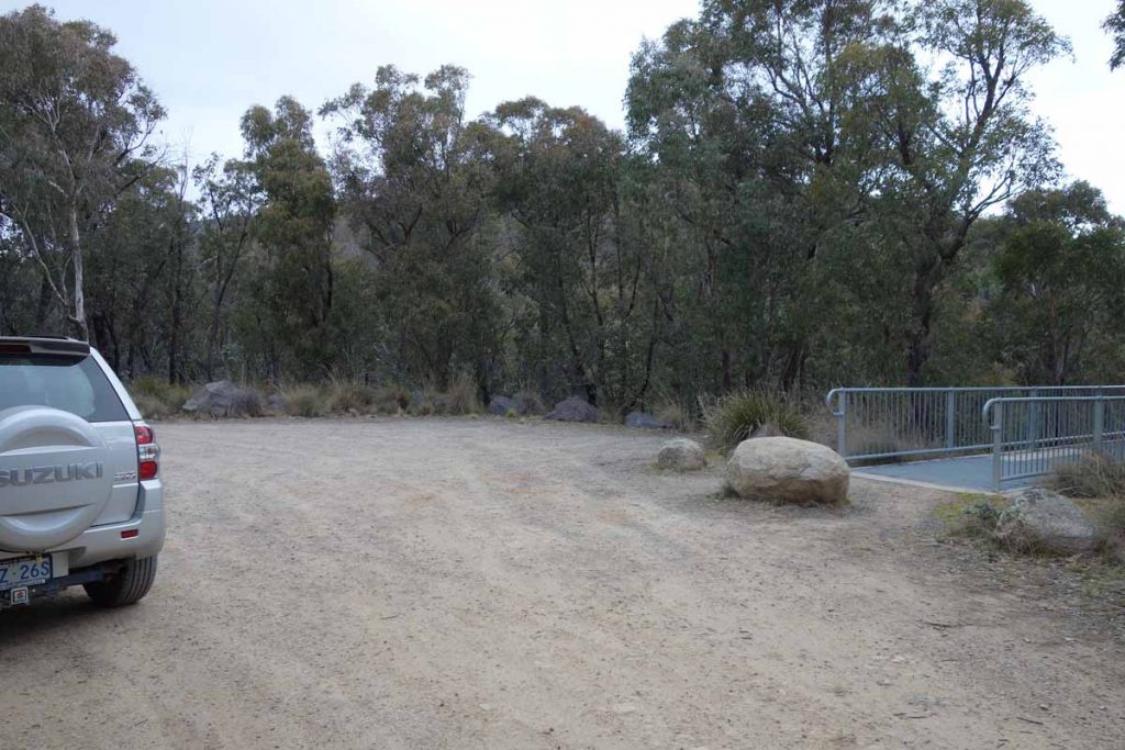
Brayshaws Hut car park

Brayshaws Hut car park is located on the right hand side of the road if you are coming from Tharwa and is very obvious. The hut becomes visible before you see the car park. The car park will cater for about 12 cars comfortably
Finish Location
Brayshaws Hut car park
The Settlers Track-'Long' Review
The Settlers Track ‘Long Walk’ is another of the walks located at the southern end of the Namadgi National Park on the way to Adaminaby. This track can be done as ether a ‘long’ version (approximately 10 km) or ‘short’ version (approximately 7 km) depending on your available time and/or fitness level.
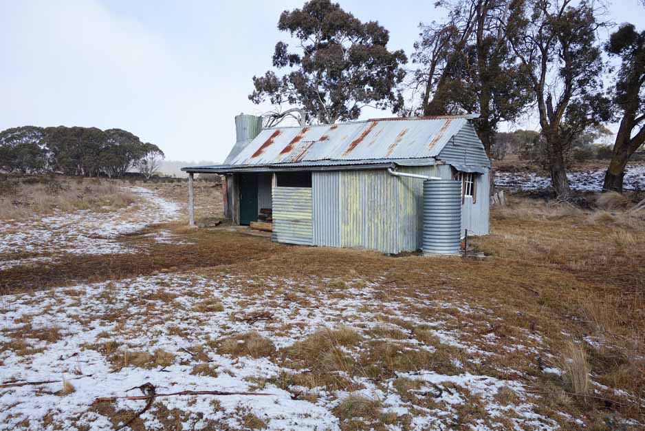
This track is the next main hiking track on from the Mt Shanahans Walk and Yerrabi Track walk and while it lacks the mountain views of the two nearby walks, it makes up for this by showcasing local heritage including three huts ranging in age from 70+ years. These huts, like many throughout the Australian Alps, fell into disrepair but have now been restored.
On your way to the Settlers Track walk you should stop off at the Hospital Hill lookout which you drive straight past – it is well worth the visit for the views over the valley below. Once you leave this lookout you will reach the trail head a further 13.8 km down the road where there is a small signposted car park on the right hand side that will fit about 12 cars. The car park is immediately off the road and is almost impossible to miss. You will see Brayshaws Homestead before you see the car park and this will let you know you are almost there. All up, the trail head is just on 49 km from the Tharwa Bridge.
Although the walk is well known, it is a long drive for most people. From the centre of the city the drive down, the walk and the drive back takes approximately 5.5 hours. As a result it is rare to see large numbers of people on this walk unless you have brought them with you. Having said that this is a a great walk and different enough most others so well worth doing. The walk starts off at the Brayshaw Hut and you are directed in an anti clockwise direction to Waterhole Hut just over 4 km into the walk. The walk then loops back around to Westermans Homeastead before returning to the start point.
The trail itself is reasonably natural and in very good condition. The day we travelled there had been snowfall overnight and for the first half of the track we were walking through about 20 mm of snow cover. By half way through the walk much of the snow had melted. The second half of the track consists of a large section of unsealed dirt management trail. The trail is very well signposted and even with the snow, the track was obvious with marker posts placed in areas that left no doubt as to where you should be heading. There are a couple of mesh sections to get you over high creek crossings.
The trail head contains a pit toilet and there is a second toilet located at Westermans Homestead. The first hut is at the trail head and you will reach this after about an 80 metre walk from your car. All three huts have their own unique character and it is worthwhile dropping in to have a look at these examples of bush huts from the past.
The bushland is recognisably alpine with many of the trees being fairly low set. Kangaroos and wallabies are everywhere but unlike the walks closer in to the centre of Namadgi, they are skittish and will hop away as soon as you get close enough to take their photo. About 3 km into the walk you have the option to continue on to Waterhole Hut making this walk around 9-10 km or bypassing Waterhole and going to Westermans Hut making the walk around 6 km in length. We visited all three huts on this day and even came across a possum which had moved in to Waterhole Hut and was quite happy to have it’s photo taken.
The interpretation signage is very well done along this trail and includes a track brochure which you can pick up at the trail head. The brochure and signage explain what you are seeing. There is also plenty of seating along the trail to take a rest and just take in the views. We did the optional extras on this walk and visited the stockyards at the Waterhole Hut as well as the Tim Dish/Boboyan Subsidised School which is located across the road from the trail head car park about 80 meters up the slope. These side trips gave us a total of just on 10 km for the walk for the day. I must admit this walk for us was at a slower pace than usual, partly because of the snow and the extra time we took looking at the huts.
This trail is well worth doing and if you want to make a full day of it look at doing either the Yerrabi or Mount Shanahans walking tracks after lunch on the same day. Be prepared for snowfall between May-October on this trail and make sure you have adequate clothing just in case.

Brochure holder at the trail head

Trail head signage

Brayshaw’s Hut is located right next to the car park and you will see this hut before you see the parking area

Trail example after an early morning snowfall in August

The snow was about 20 mm deep on this day in early August. Much of the snow had melted by the end of the walk

Early morning trail example

Trail markers are frequent and easy to follow

The bushland is quite dense in this area due to the 2003 Canberra fires

Scribbly gum

The tree bark looks spectacular after rain or snow

Trail option sign. Short or long option, you choose

Fireplace at Brayshaws Homestead
Waterhole Hut

Possum sleeping (trying to) in Waterhole Hut. This little guy/girl seems to be a permanent resident

Management trail along the return half of the track

Seating along the trail

Approaching Westermans Homestead

Water tank on each hut. Drinkable but I would still filter it

The bridge after Westermans Homestead
Getting There

The Settlers Track Google map showing the distance from Tharwa Bridge to the trail head car park:
- From the Tharwa Bridge head done Boboyan Road towards the Yankee Hat rock art site
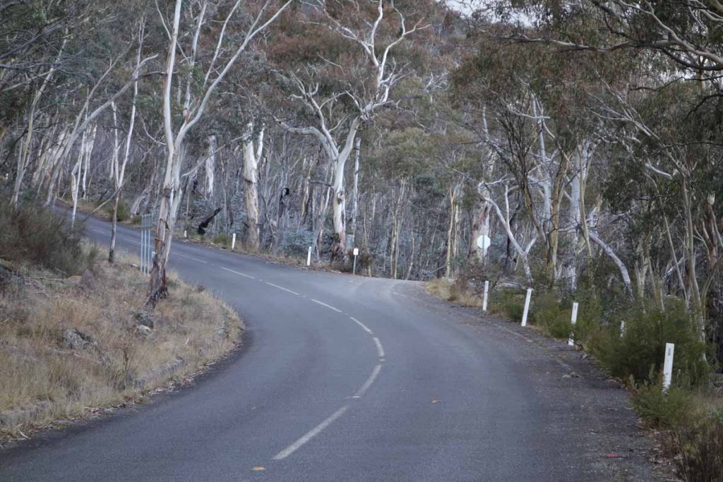
- Instead of turning off to the the right towards the Yankee Hat car park, keep on going. The bitumen ends not far from the Yankee Hat turnoff and the road is usually in good condition for an average car
- The road edges can be a bit soft and in cold conditions there can be snow and ice on the road so drive carefully. WARNING: sometimes the road may be closed so if doing this walk mid-winter, check with the Namadgi Visitor Centre prior to driving to this site
- At the end of the bitumen road travel about 2.6 km until you come to the Hospital Hill lookout on the right hand side of the road. This lookout is signposted and the lookout is adjacent to the road so a stop off is well worth the great views
- From the Hospital Hill lookout travel a further 13.8 km and the Settlers Track Walk car park is on the right
The whole trip from the Tharwa Bridge is just on 49 km.
Yankee Hat turnoff. Keep to the left and head towards Adaminaby
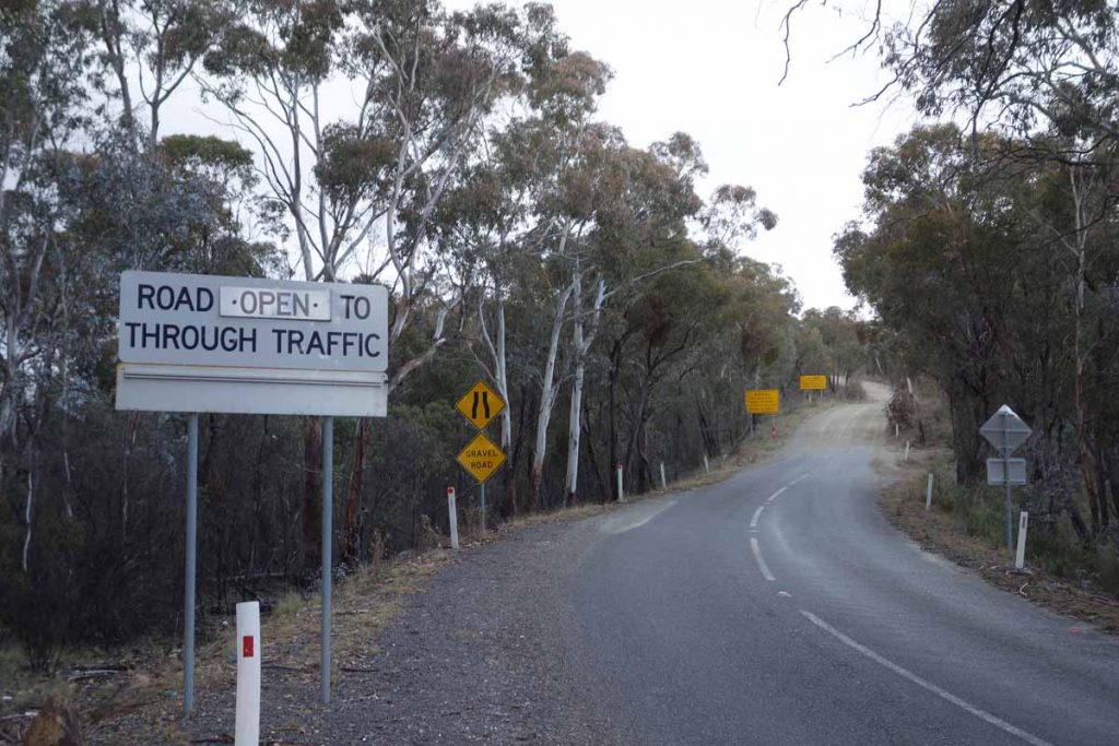
End of the bitumen road. The dirt road from here on is usually in good condition
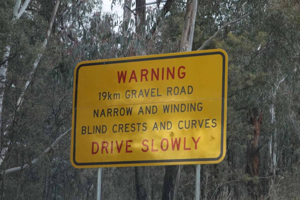
Road warning sign. You’ve been warned!
Hospital Hill lookout car park
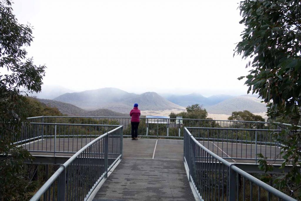
Hospital Hill lookout. Stopping here is worth the trip itself either on the way to your walk or on the return trip
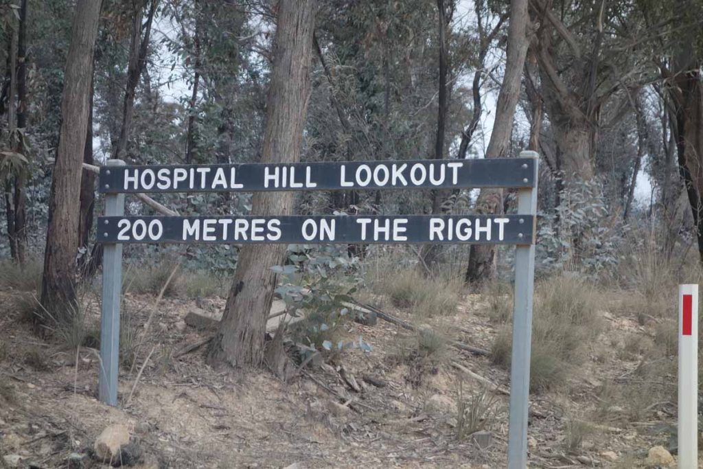
Hospital Hill lookout signage
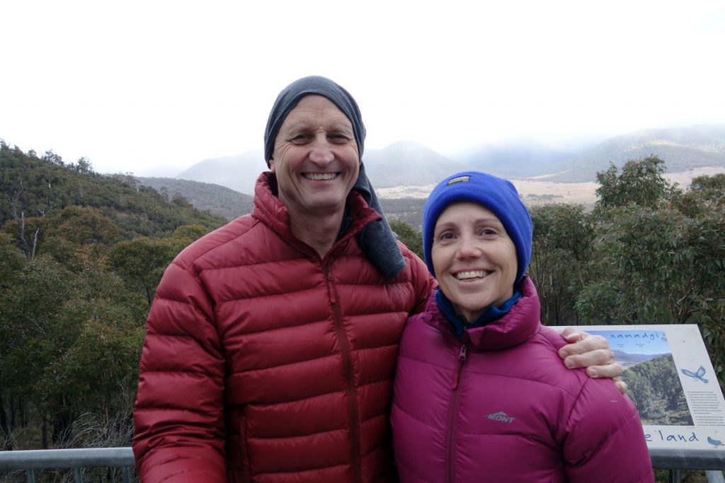
Tim and Gill at Hospital Hill lookout. The views from here are well worth the stop; and yes its cold
Things to Know
- Phone: The is very limited phone signal is a bit sketchy on this trail (Telstra)
- Water: You need to bring your own water however there is a water tank at each of the huts but recommend you filter/sterilise the water before using
- Toilets: There is a toilet facility at the car park for this walk as well as another at Westermans Hut
- Trail: This trail consists of formed track
- Dogs: No dogs allowed
- Camping: Allowed
- Other:
- Keep an eye on the road once you reach the unsealed section as there is a lot of 4WD traffic and blind corners
- This road can have snow on it during winter and may sometimes be closed so make sure you are driving a 4WD vehicle that can cope with the conditions if doing the walk during the cooler months
- If doing this walk in Summer time the flies are aggressive so wear long pants and long sleeves as well as carrying insect repellent
Disclaimer
This walk was undertaken by the team from Australian Hiker