Ashbrook Fire Trail ACT (6.3 km)
ACT
Nearest Town
Tharwa, Canberra
Starting Location
Hanging Rock car park

Entry to the Hanging Rock car park is well signposted. While there is good parking and a couple of picnic tables at the car park, there are no toilet or water facilities

The car park will comfortably take about 15 cars and is well maintained even though it is unsealed
Finish Location
Hanging Rock car park
Best Time to Travel
Year round
Ashbrook Fire Trail Review
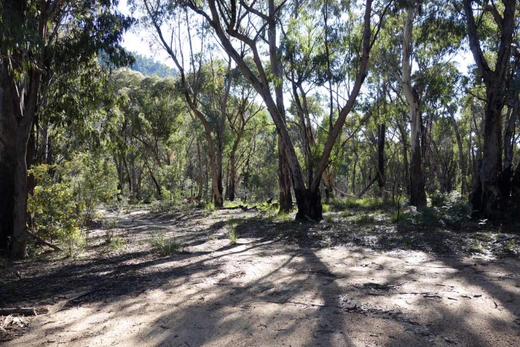
I’m usually not a big fan of walking on fire trails preferring the narrower tracks through the bush however one big advantage is ease of access and the fact that you really have to try very hard to lose you way. The Ashbrook Fire Trail Walk is never going to make my list of Australia’s best walks but it provides variation to the typical bush trail and the wide fire trail allows you to ‘see the woods for the trees’. This trail is framed by large trees (mainly Eucalyptus) for almost its entire length and as such you are walking through dappled shade for much of the trail. This makes for a cool to cold walk in wintertime so come prepared, however in mid summer the landscape will provide protection from the oppressive heat and intense sun and is a great choice for that time of the year.
The trail starts about 9 km from the visitor centre at the Hanging Rock car park. This car park is home to two walks, the Ashbrook Fire Trail Walk as well as the much shorter Hanging Rock walk . The car park has limited facilities but this means you’ll be able to avoid the crowds at the more well known walks.
The trail itself is a reasonably well maintained fire trail and apart from a couple of creek crossings you have a good trail surface to deal with. While not physically challenging the trail starts off with a steady but slight incline and once you reach the first creek crossing, you have a steepish ascent. Just past the crest of the first hill are two scar trees that have had shield-shaped cuttings taken from them and you will notice one walking from each direction.
This pattern of ups and downs repeats and will keep you interested. The turn around point is when you reach Mountain Creek Road and at this stage you have a view of ‘Camels Hump’ which is one of the longer harder walks which we will review in the coming months. Even in late winter there are native plants flowering so while this trail lacks the spectacular views of the nearby Gibraltar Peak Walk there is still enough to keep your attention. Like most of Tidbinbilla you will usually see kangaroos on the trail and on this walk they are lazy, preferring to hop ahead of you rather than going bush to get away.
This walk will take the average person about 90 minutes and is not overly taxing so providing you are comfortable with the distance it shouldn’t present a difficult challenge. Allow an extra 30 minutes to walk the short Hanging Rock loop that starts at the same carpark.

Picnic tables in the car park. Apart from these tables there are no other facilities. Its only a short trip back to the bigger car parks where there are toilets and water
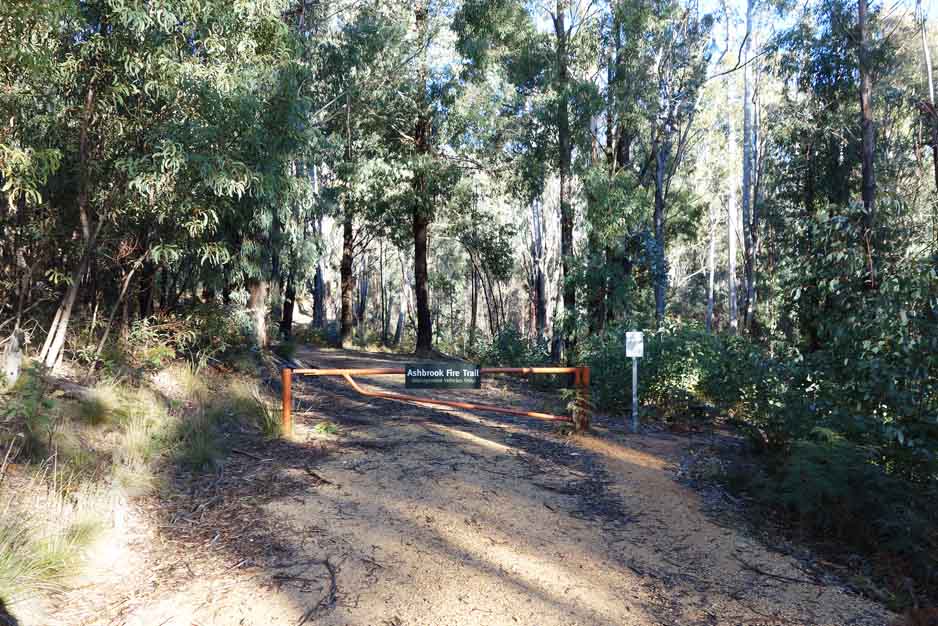
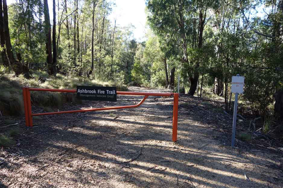
The trail head to the Ashbrook Fire Trail is located almost dead ahead after you drive into the Hanging Rock car park
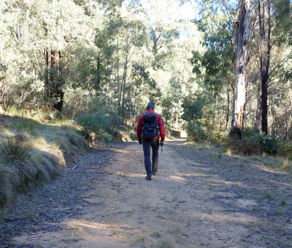
Tim walking on the fire trail not long after we started the walk. This is a really rare image because Tim is usually the person taking the photos
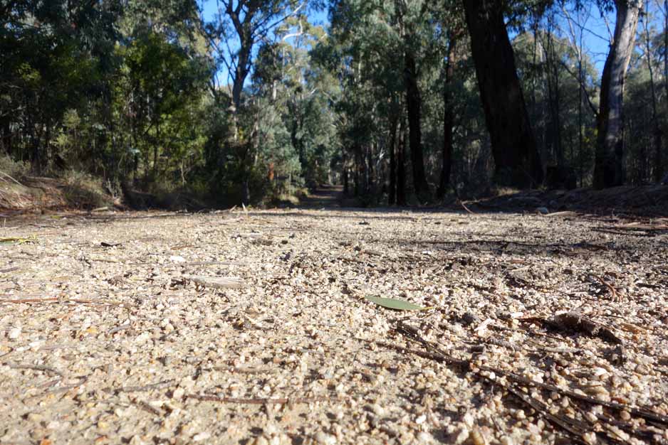
The fire trail is well maintained with an even surface however latter parts of the trail have vegetation which is not common in this area
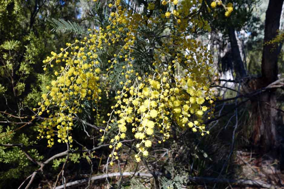
I always love Spring in Canberra with the Wattle species taking turns to flower
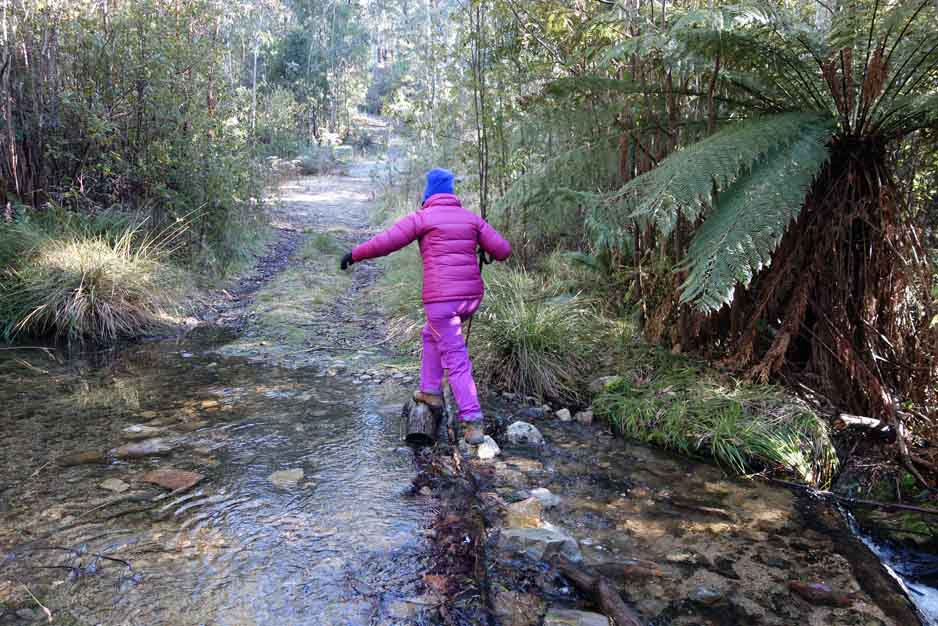
Depending on the rainfall there are a couple of creeks you will need to cross. If you have good balance and/or walking poles you can get across with feet dry otherwise come prepared to walk through ankle deep water. During hotter parts of the year there will be little water in these creeks making crossing easier
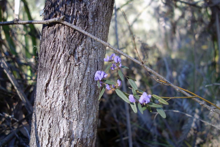
Even in late Winter there are still some native plants in flower and this only increases in Spring
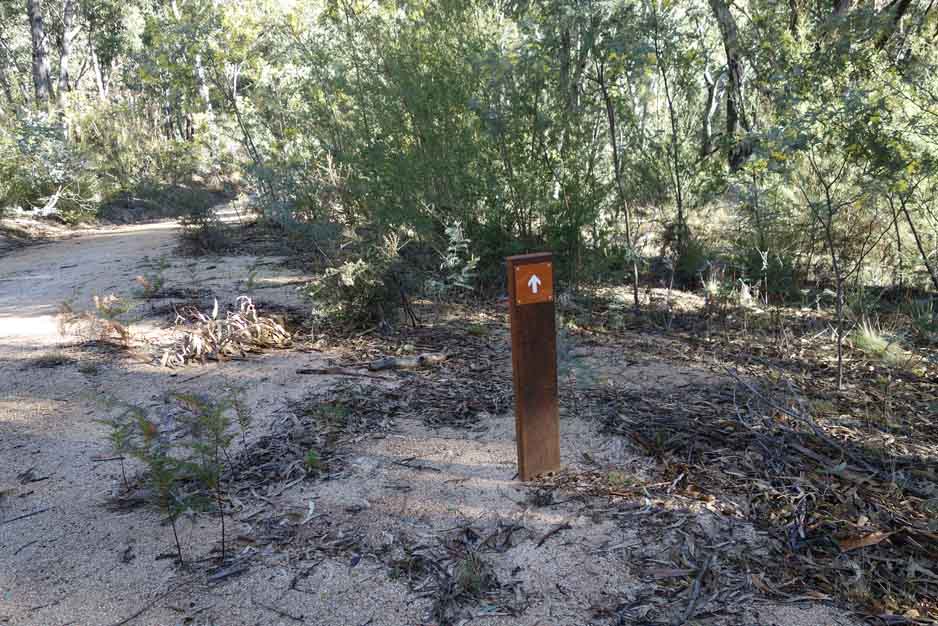
Trail markers are limited. This is the only one we saw and was placed in a location that it was needed. There is no interpretive signage on this trail
Although not a long trail at 6.3 km, the walk through the mixed Eucalyptus forest is a great way to spend a few hours
Turn around point at Mountain Creek Road looking back down the trail. From here you head back the way you came
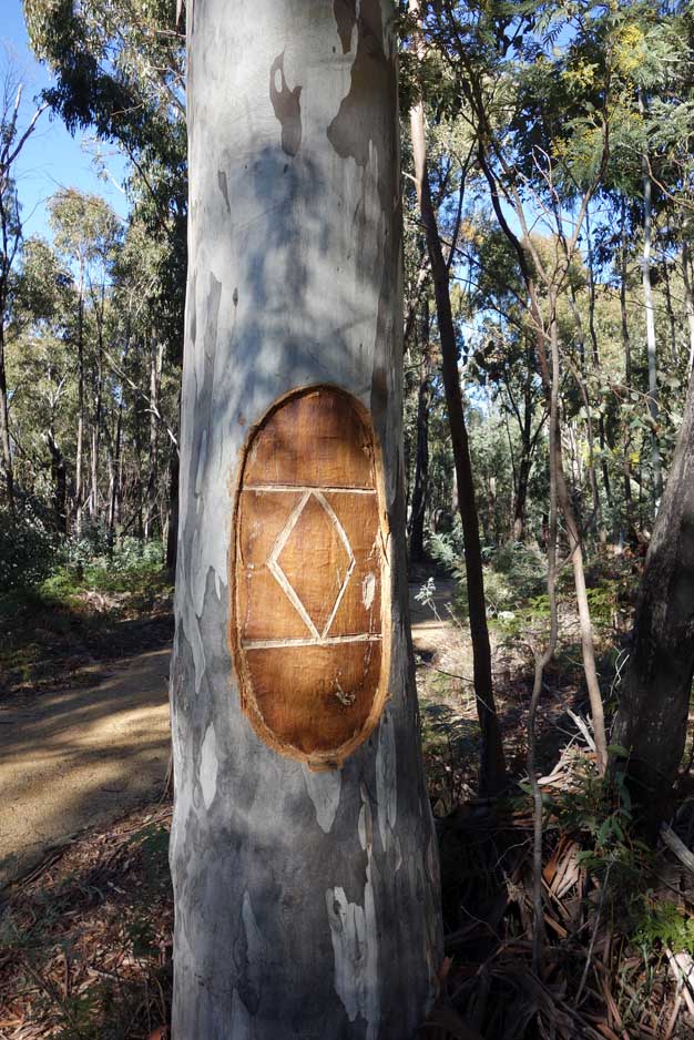
Scar tree
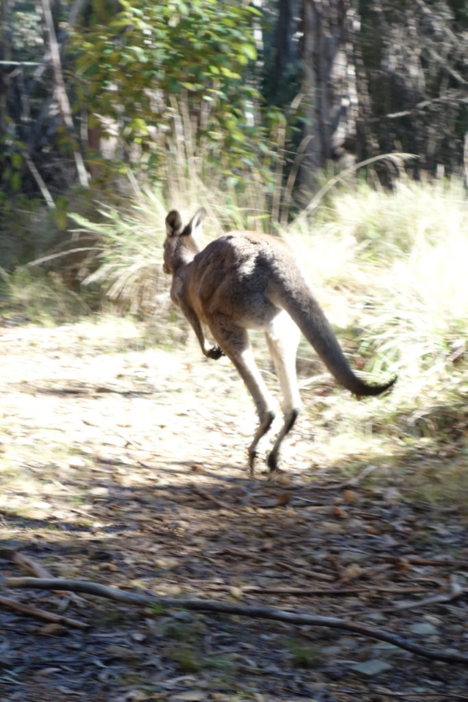
The kangaroos are a bit lazy here. We followed this guy for almost 1 km as he didn’t want to go bush but instead just hopped ahead of us until we pulled over to the side of the trail to let him get past
Getting There

The trip from the centre of Canberra is approximately 51 minutes and 50 km. Once you enter the Tidbinbilla Nature Reserve travel to the Hanging Rock car park to start your walk. The car park is approximately 9 km from the visitor centre and is on the right hand side of the loop – it is clearly signposted. Don’t worry too much if you go the wrong way as the road loops as you will eventually come to this trailhead which ever way you go.
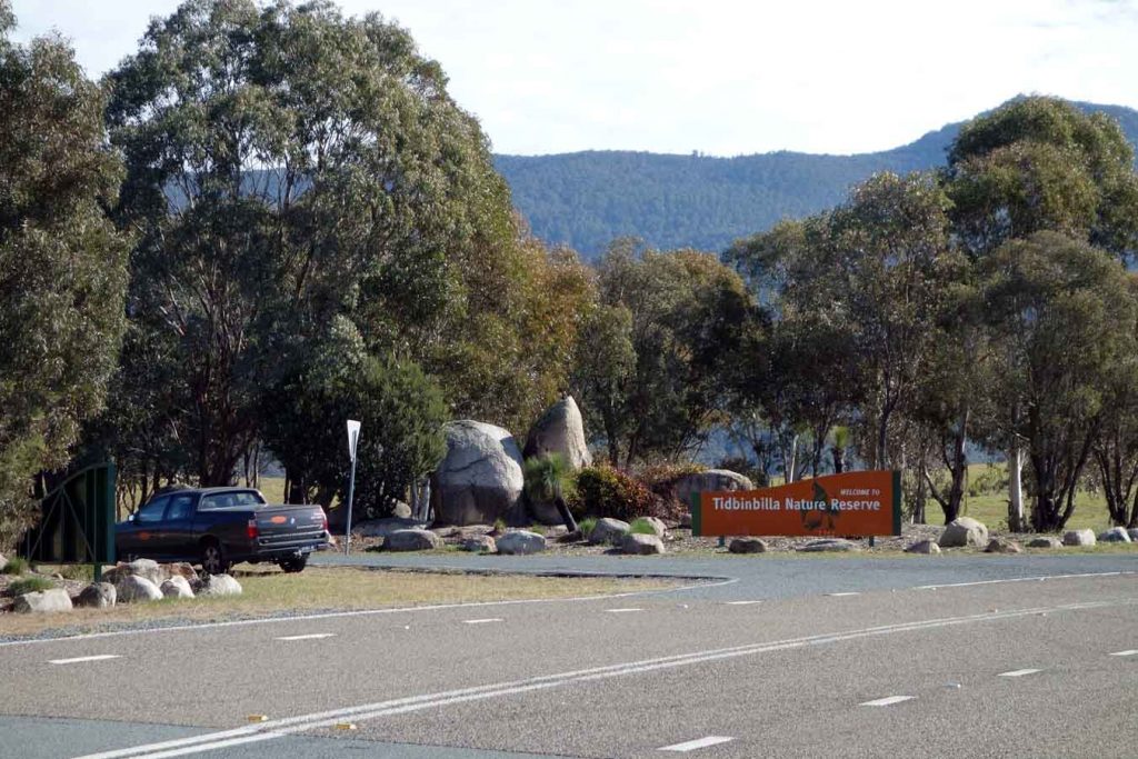
Tidbinbilla Nature Reserve entry
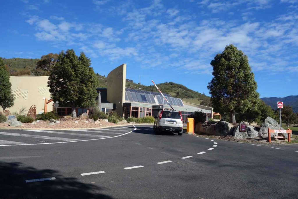
Tidbinbilla Visitor Centre and boom gate. If you have an annual pass you can just swipe your card for access without having to enter the visitor centre
Things to Know
- Phone: There is variable phone signal on this track
- Water: You need to bring your own water although you can filter from the adjacent creeks if you come prepared
- Toilets: There are no toilets on this trail
- Trail: This trail consists mainly of management road
- Dogs: Dogs not allowed
- Other:
- This walk is done in an out and back fashion l
Tidbinbilla Nature Reserve requires a pass to enter with your car (with up to eight passengers)
- The annual pass is $38 and if you plan on doing at least three visits over the year is the cheapest option
- A day pass is $14.00
- The reserve is accessible before the visitor centre opens so long as you walk in or have an annual pass
- The visitor centre sells snacks if you need
The Tidbinbilla Nature Reserve contains a series of walks that are closer to Canberra than those at the nearby Namadgi National Park. Many of the Namadgi walks, particularly those that go into the Bimberi Wilderness Zone, are more remote requiring a higher level of skill but with it a higher degree of seclusion whereas the Tibinbilla walks are easier to access but you are unlikely to be alone on the trail.
If you have an annual pass you can enter the park via the boom gate by scanning your pass from as early 7:30am and you will need to be out by 6:00pm at the latest (8:00pm in summer). If you are buying a single entry into the park you will need to wait until the visitor centre opens at 10:00am (9:00am in the summer).
Disclaimer
This walk was undertaken by the team from Australian Hiker