Shanahans Mountain Track ACT (3.4 km)
Namadgi National Park
Nearest Town
Tharwa 44 km. Please note that Adaminaby is 37 km in the opposite direction
Starting Location
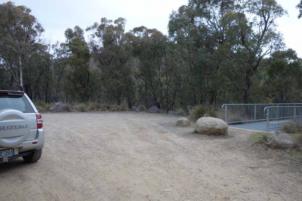
Shanahans Mountain Walking Track car park

Shanahans Mountain Walking Track car park located on the left hand side of the road if you are coming from Tharwa. Note the car park sign situated on the left of the image
Finish Location
Shanahans Mountain Walking Track car park
Shanahans Mountain Track Review
The Shanahans Mountain Walk is another of the walks located at the southern end of the Namadgi National Park on the way to Adaminaby. Located a further 3.6 km on from the Yerrabi Track walk this shortish walk is worth while doing as the second walk of the day after you have done the Yerrabi Track walk. The climb up to the summit is steady but not overly steep so it is suitable for most walkers. While only a short way away from the Yearrabi Track, the vegetation definitely has a very different feel about it – you feel you are in a totally different region.
On your way to Shanahans Mountain walking Track you should stop off at the Hospital Hill lookout which you drive straight past – it is well worth the visit. Once you leave this lookout you will reach the trail head a further 8.1 km down the road where there is a small signposted car park on the left hand side that will fit about 6six cars. Turn off the road and the car parking is about a further 40 metres in. All up that is just on 44 km from the Tharwa Bridge. Although the walk is well known, it is rare to see large numbers of people on this walk unless you have brought them with you.
This trail has limited signage with the trail head sign being the only text; there are a number of arrows on posts that keep you on track. Follow the trail up the hill and keep to the left when you come to a fork in the trail as this trail is actually a loop and you will return back to the car park on the opposite fork. When you reach the top of the trail, you will parallel the management road and as the trail flattens out, again keep towards the left as the trail arrow is not so easy to find. From here its a short walk to the first viewing area. This area provides good views of the valley below but is not the main peak. From here you appear to start heading down but in actuality you are heading along the ridge line and after another 100 m+ the trail opens out onto the main viewing areas with views to the south east.
The trail then loops down around the hill and returns you to the starting point. The vegation on the return trip is again different from the first half of the trip so it is worthwhile having a good look around particularly in spring when much of the native wildflowers will be out in bloom.
This is a nice, relatively easy walk and worthwhile doing in conjunction with the Yerrabi Track. If you only have time to do one short walk in this area of the park do the Yerrabi track walk which has more variety and better views (towards the Snowy Mountains) on offer.

The small car park will cater for about six cars

Trail head sign. The only other signage on the trail is direction arrows

Heading to the summit you will come to a fork in the trail. Keep to the left as you will circle around and come down from the other direction. Note the trail direction arrows on the left of the image

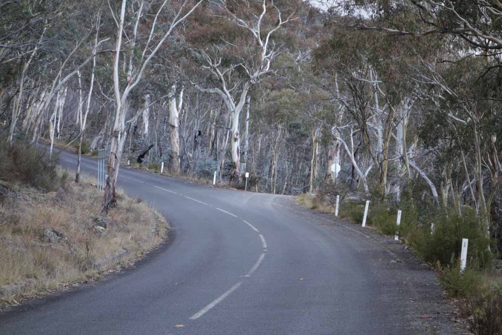
Trail example

Trail example

Trail example

The bushland is quite dense in this area due to the 2003 Canberra fires

I always love the patterns on the scribbly gums which are made by a moth larvae

Dense lichen on a small tree

These random fire places seem to be everywhere in this area of the park
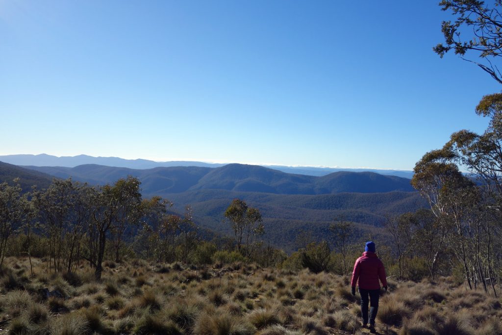
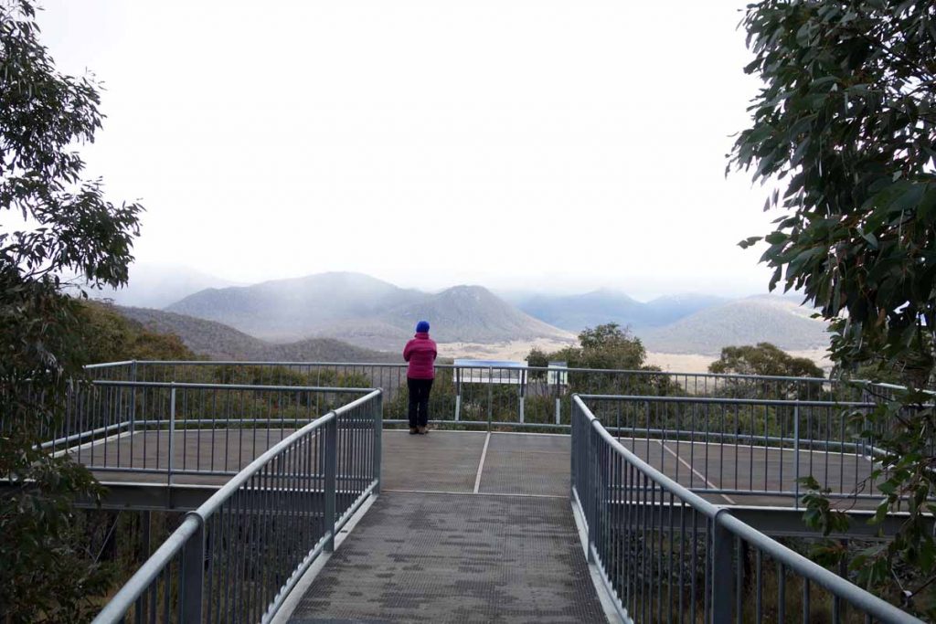
Shanahans Mountain first summit area

First viewing area panorama. The main area is another 100 metres further along the ridge line

Looking down into the valley below

Getting There

Shanahans Mountain Track Google map showing the distance from Tharwa Bridge to the trail head car park.
- From the Tharwa Bridge head done Boboyan Road towards the Yankee Hat Rock art site
- Instead of turning off to the the right towards the Yankee Hat car park keep on going. The bitumen ends not far from the Yankee Hat turnoff and the road is usually in good condition for an average car
- The road edges can be a bit soft and in cold conditions there can be snow and ice on the road so drive carefully. WARNING: sometimes the road may be closed so if doing this walk mid Winter check with the Namadgi Visitor Centre prior to driving to this site
- At the end of the bitumen road travel about 2.6 km until you come to the Hospital Hill lookout on the right hand side of the road. This lookout is signposted and the lookout is adjacent to the road so a stop off is well worth the visit and has some great views
- From the Hospital Hill lookout travel a further 8.15 km and the Shanahans Mountain Walk car park is on the left. This car park is also sign posted
The whole trip from the Tharwa Bridge is just on 44 km
Yankee Hat turnoff. Keep to the left and head towards Adaminaby
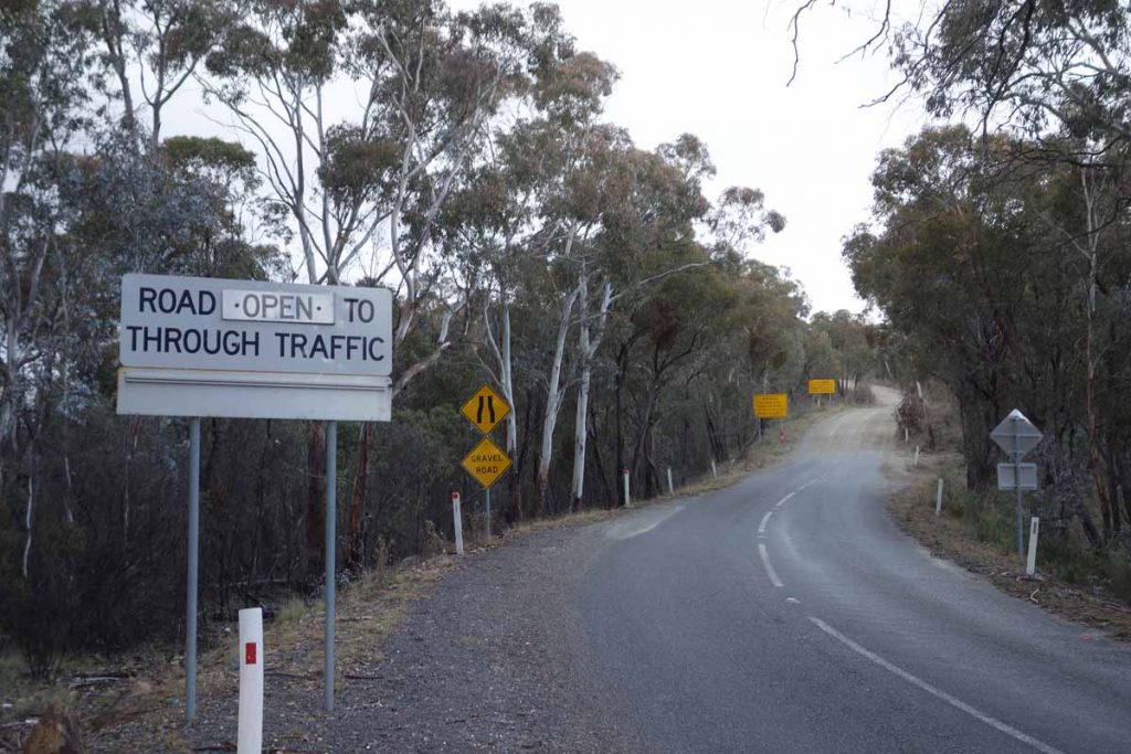
End of the bitumen road. The dirt road from here on is usually in good condition
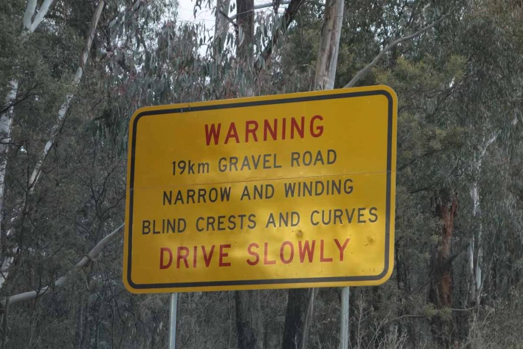
Road warning sign. You’ve been warned!
Hospital Hill lookout car park
Hospital Hill lookout. Stopping here is worth the trip itself either on the way to your walk or on the return trip
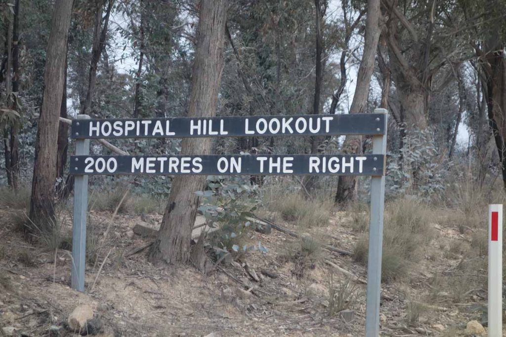
Hospital Hill lookout signage
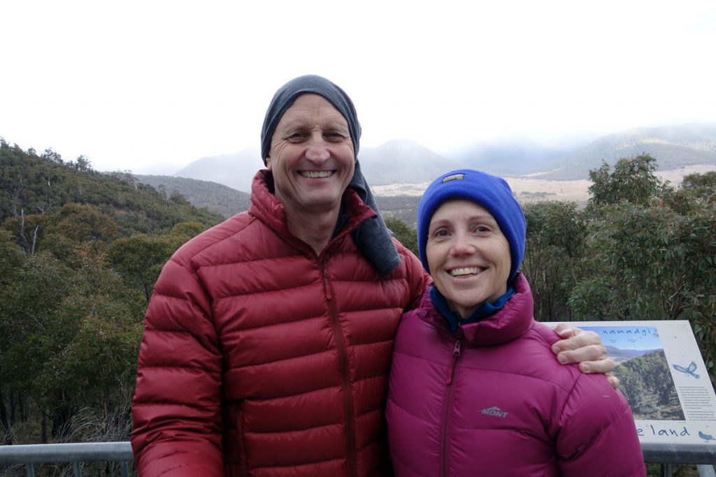
Tim and Gill at Hospital Hill lookout. The views from here are well worth the stop; and yes its cold
Things to Know
- Phone: There is intermittent mobile phone coverage on the ridge line on this trail (Telstra)
- Water: You need to bring your own water as there is none unless you go looking for a creek
- Toilets: There is a toilet facility at Glendale which is approximately 20 km on the Tharwa side of the Shanahans Mountain Track so this is a good place to stop off if you need to use the facilities or want to have lunch on the way back
- Trail: This walk is on formed natural trail
- Dogs: No Dogs allowed
- Camping: Camping allowed (Check with Kosciusko National Park on prohibited camping zones)
- Other:
- This trail is best walked outside of winter to avoid the snow
- This road may be closed by heavy snow so check road conditions in the cooler months of the year
- Keep an eye on the road once you reach the unsealed section as there is a lot of 4WD traffic and blind corners
- Bring a 4WD or AWD vehicle for this walk
Disclaimer
This walk was undertaken by the team from Australian Hiker