Mount Taylor ACT (3.8 km)
Canberra Nature Reserve
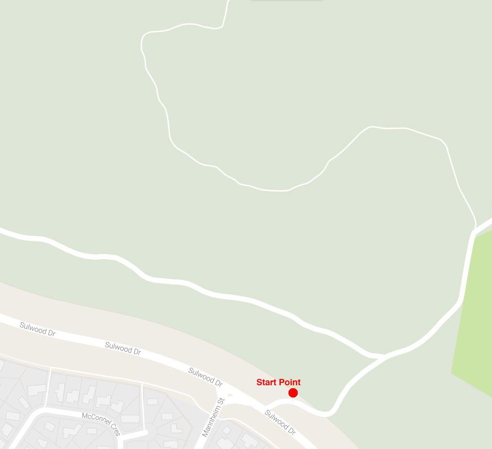
Starting Location
Parking area along Sulwood Drive at the Mannheim Street intersection
Finish Location
Parking area along Sulwood Drive at the Mannheim Street intersection
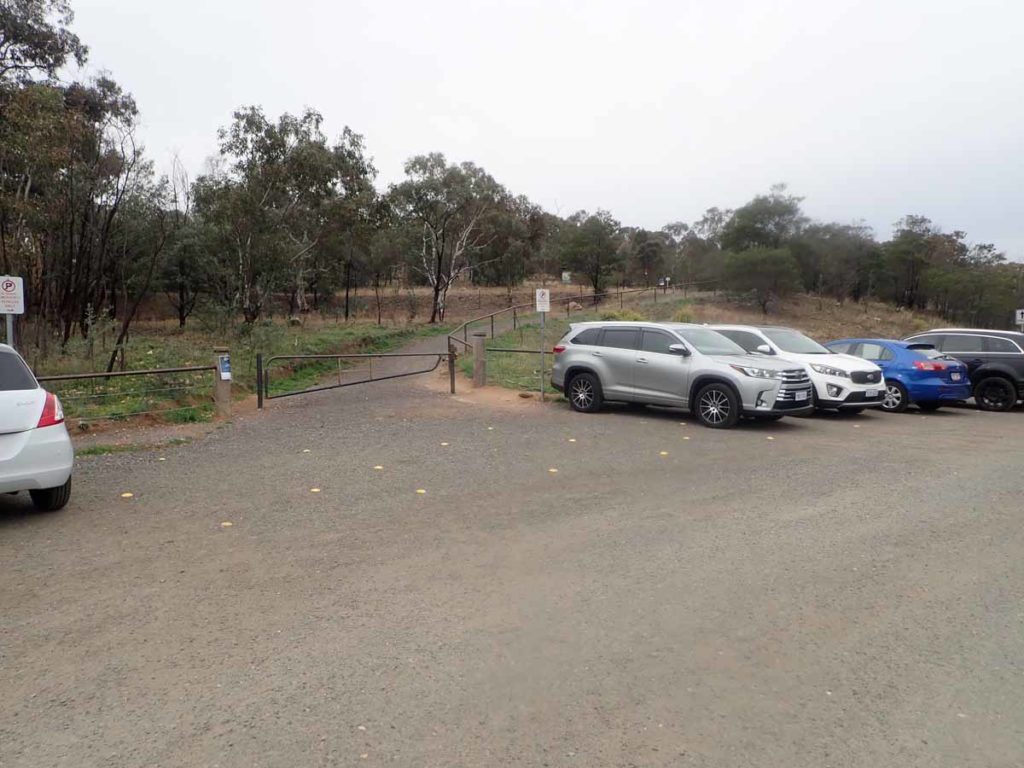
Car park just off Sulwood Drive near the Intersection of Mannheim Street in Kambah. This car park was revamped in mid 2019
Best Time to Travel
Year round
Mt Taylor Walk Summary
This hike is another of Canberra’s urban hikes contained within the planned green space of the city. Easily accessible by foot from a number of different starting points in the suburbs that surround the mountain the Sulwood Drive starting point in Kambah is the best option for those travelling by car.
I have done this walk over 300 hundred times but in doing so for this write up after a break of several years it was easy to notice the success of the revegetation program and trail upgrades. This has turned this walk into something more than just a form of exercise. The start point of the walk is through a gated access road just next to the carpark and from there the trail has a steady ascent almost along the entire distance. The trail itself is sealed for most of its length turning to gravel towards the summit.
This walk provides views to the south over the Tuggeranong Valley and to the north over Woden Valley – it is the only peak in the area that will allow you to do this. There are a number of seats along the trail to allow you to rest and take in the views. Near the base of the walk where the interpretive signage is located, it is not unusual to see mobs of Kangaroos. You may see snakes on this walk from time to time but with the number of walkers around, it is usually rare.
As you reach the summit there are large panoramic interpretive signs that identify all the peaks on the south side of the summit looking towards the Brindabella Range and Namadgi National Park. Another sign is on the summit itself looking over the northern half of the city.
Mt Taylor is situated on the south side of Canberra between the suburbs of Torrens (Woden) and Kambah (Tuggeranong). If you drive along Sulwood Drive, there is a dirt area that you can park on, which is located opposite the intersection with Manheim Street about 1.8km from the Tuggeranong Parkway. If you are coming from the Athllon Drive side, the carparking area is about 1.7km. At this location you walk along a well-defined access road for about 400 metres and you will be at the base of Mt Taylor.
Alternatively, there is an entry road from Athllon Drive to the horse agistment paddocks (about 300 metres from Sulwood Drive northbound). From here, you can take a well-defined dirt access road and it is 1.4km to the base of Mt Taylor. If you drive further along the agistment access road beforte parking, you could halve this distance.
While not creating the same feeling of remoteness that a number of other walks within the city have, I would suggest this walk for people who are not regular walkers or for those who have limited time. It is also an excellent walk at sunset and sunrise.
Please note that this trail was updated in late 2021.
Getting There
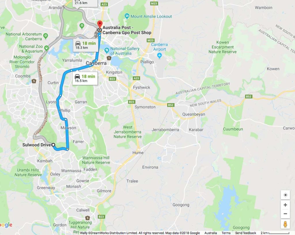
Google Map to Mount Taylor from the Canberra GPO which is 18km away
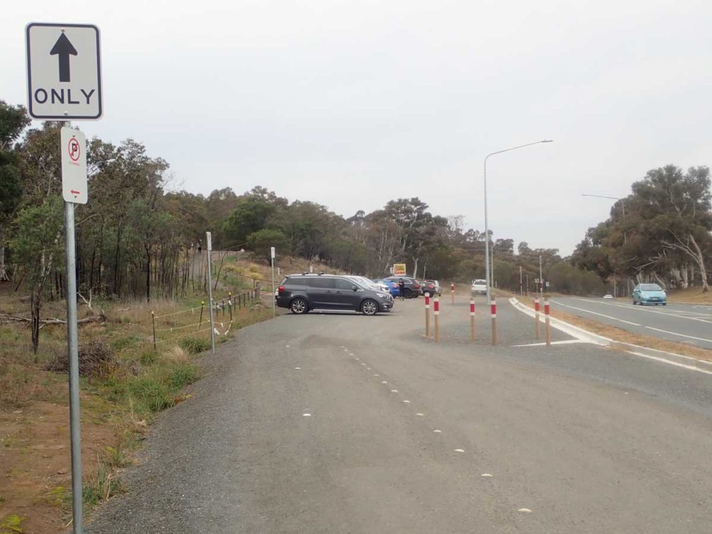
Mt Taylor is located between the Woden and Tuggeranong Valleys in southern Canberra with access to the main walk starting point located on Sulwood Drive. The unsealed carpark located at the start point is at the intersection of Sulwood Drive and Mannheim Street in Kambah. There is plenty of parking space available for at least 20 cars.
Car park located off Sulwood Drive
Starting point for the walk
Things to Know
- Phone: There is excellent phone coverage on this trail (Telstra)
- Water: You need to bring your own water
- Toilets: There are no toilets on this trail
- Trail: This trail consists of formed track
- Dogs: Dogs allowed on leash
- Other:
- The car park located at the intersection of Sulwood Drive and Mannhim Street in Kambah was redone in mid 2019 and is now a one way excess
- This is a very busy walk so if you want some privacy you will need to walk very early in the morning
Starting point for the walk
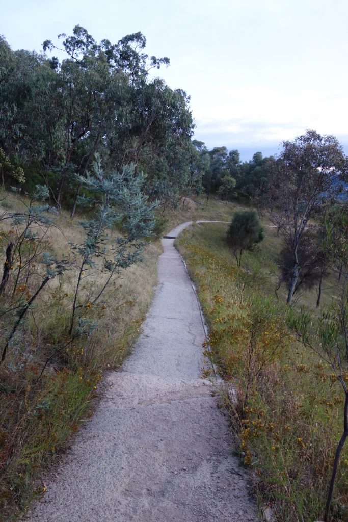
The well formed path is easy underfoot
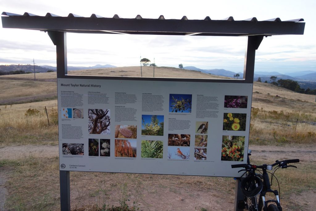
Interpretive signage part way up the hill
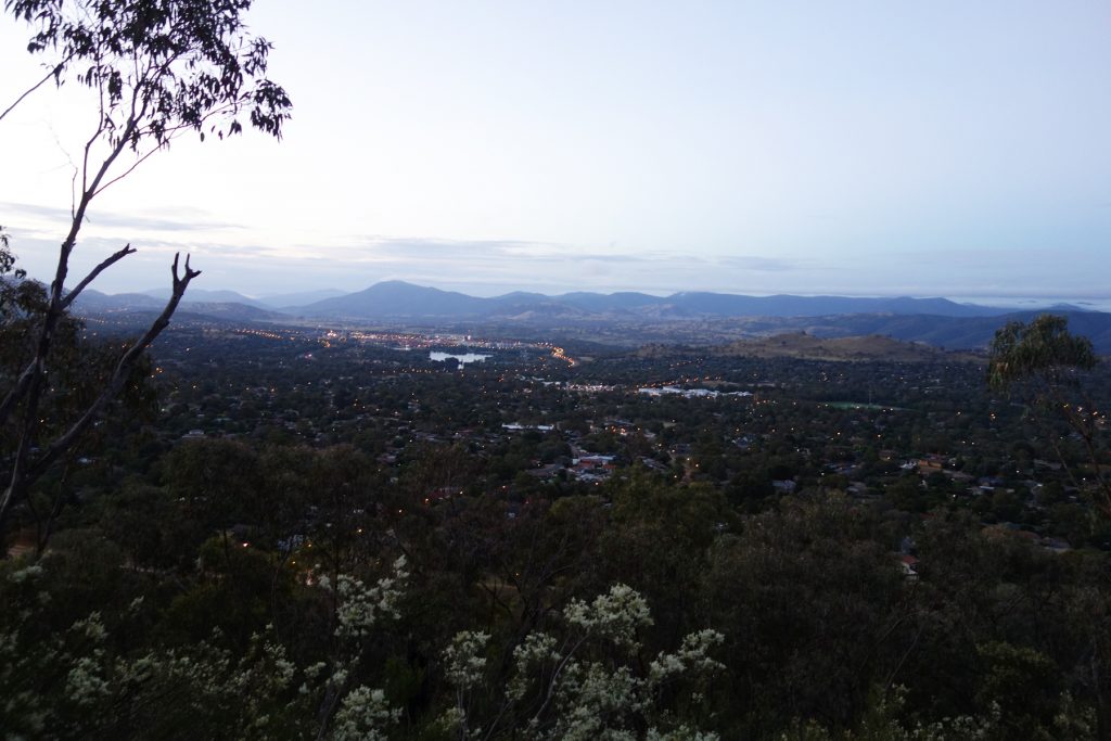
View down Tuggeranong Valley. The larger mountain in the distance on the left is Mount Tenant
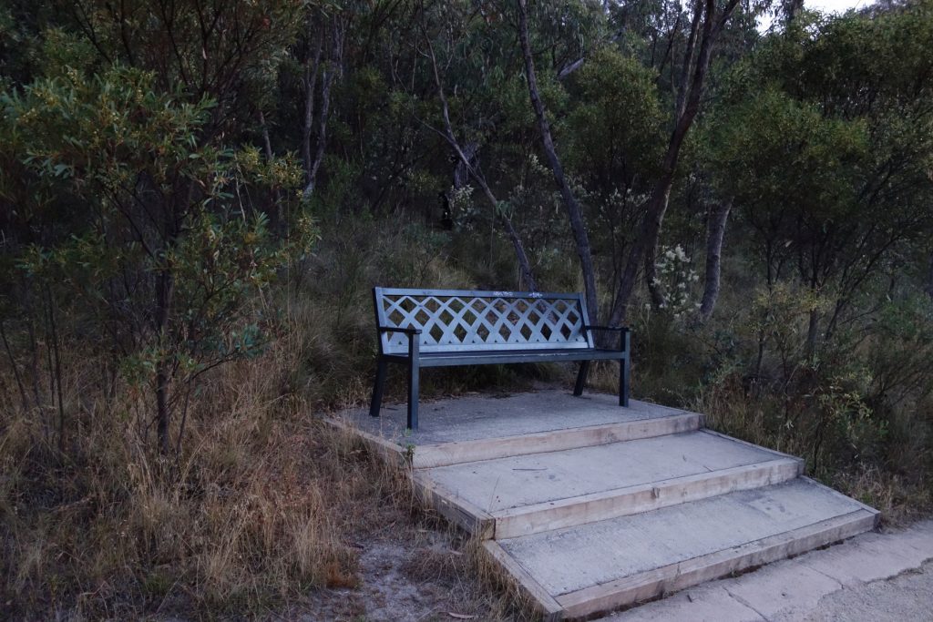
Seat along the trail
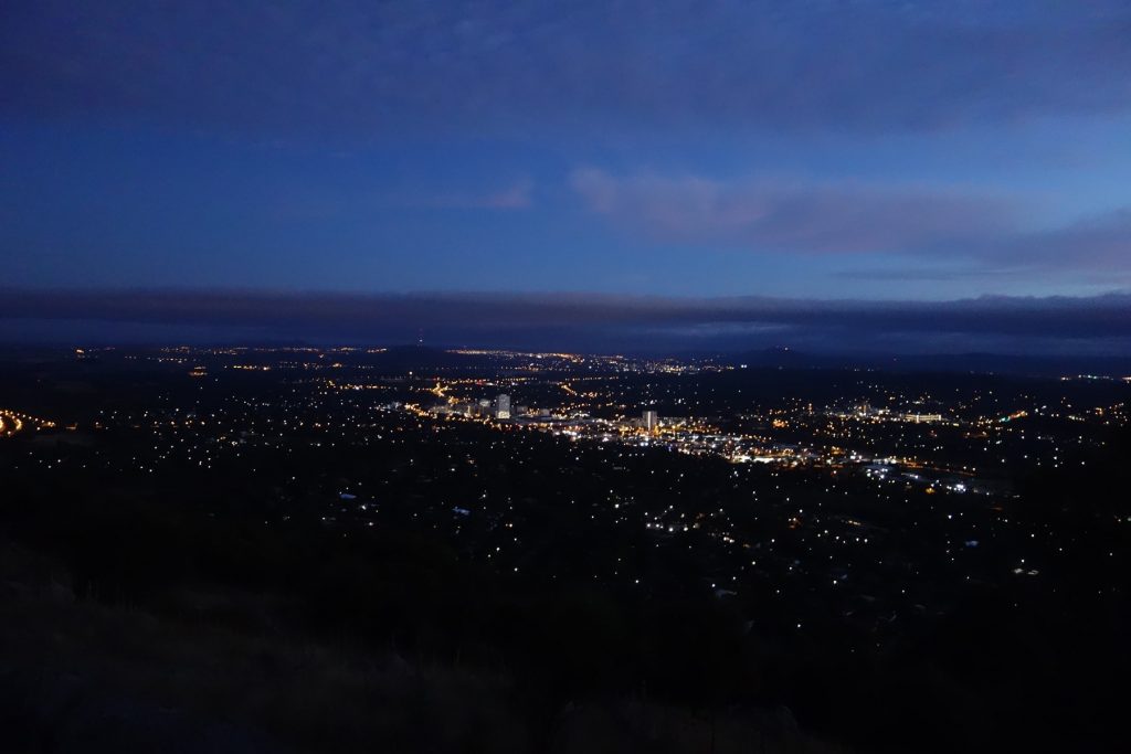
Pre-dawn view over Woden Town Centre
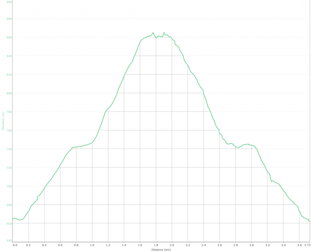
A reasonably steady incline and decline with limited flat sections