Granite Tors ACT (8.6 km)
Namadgi National Park
Starting Location
Orroral Valley Tracking Station (former) carpark
Finish Location
Orroral Valley Tracking Station (former) carpark
Best Time to Travel
Year round
Granite Tors Walk Summary
One of a number of walks that commences from the old Ororral Valley Tracking Station and this one is pretty much a hill climb. The track itself is reasonably well maintained and while not very steep, the climb is almost constantly uphill until you come to the summit for a short walk along the hill to reach the lookout. The top and summit of the hill are littered with large granite boulders (or tors) that are common to this area and this is where the walk’s name comes from.
The views from the summit are excellent with the added bonus of being able to view the obsolete astronomy equipment and thus providing an insight as to the importance of this site and others at Orroral Valley and nearby Honeysuckle Creek to the space program.
Walkers with good fitness levels will easily complete this walk in 2.5-3 hours including a rest stop at the top to take some great panoramic photos.
This is one of the most popular walks in the valley and you will usually see other walkers.
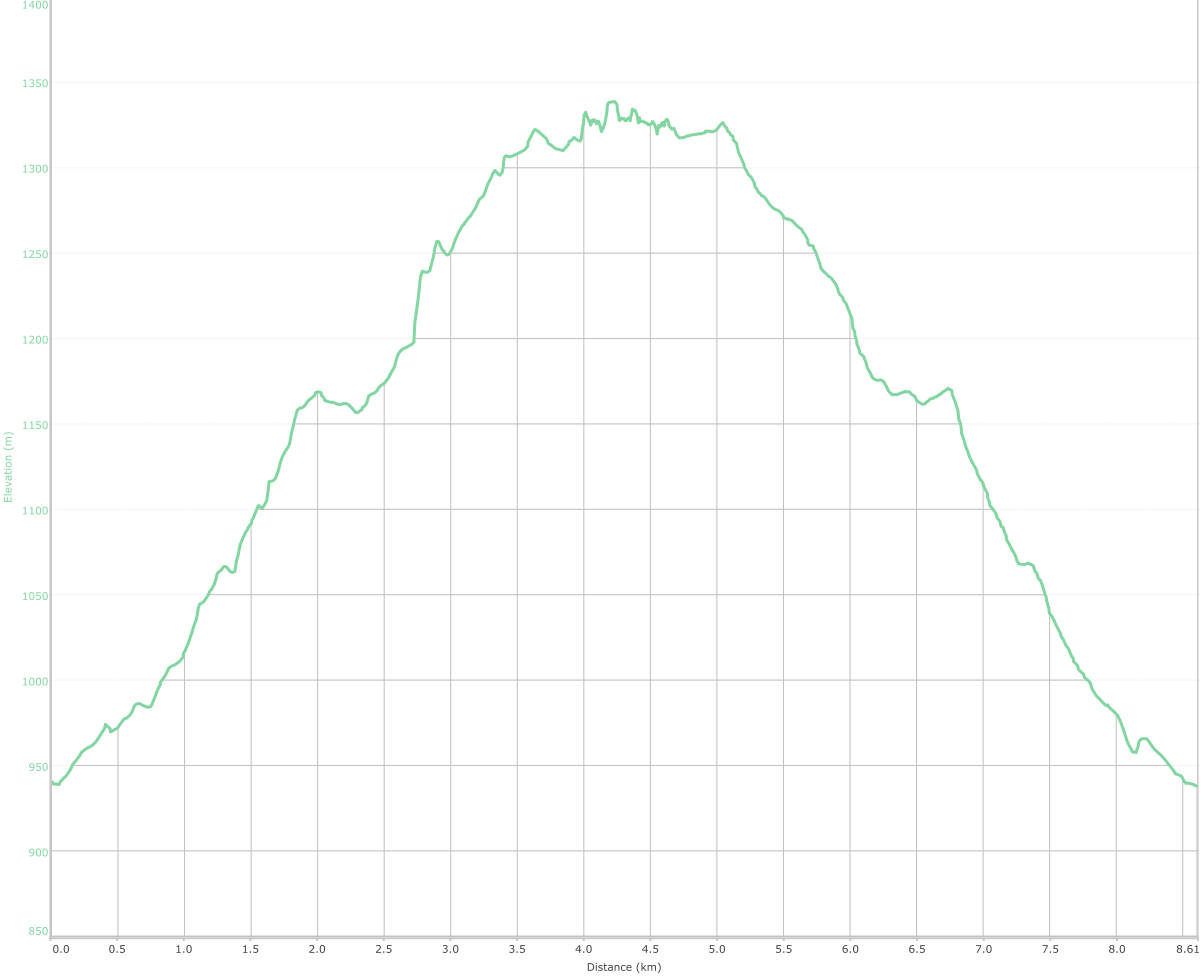
This walk is a steady incline and decline with limited flat areas
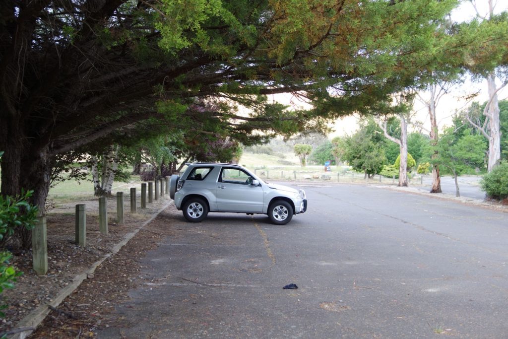
Ample carpark with plenty of shade
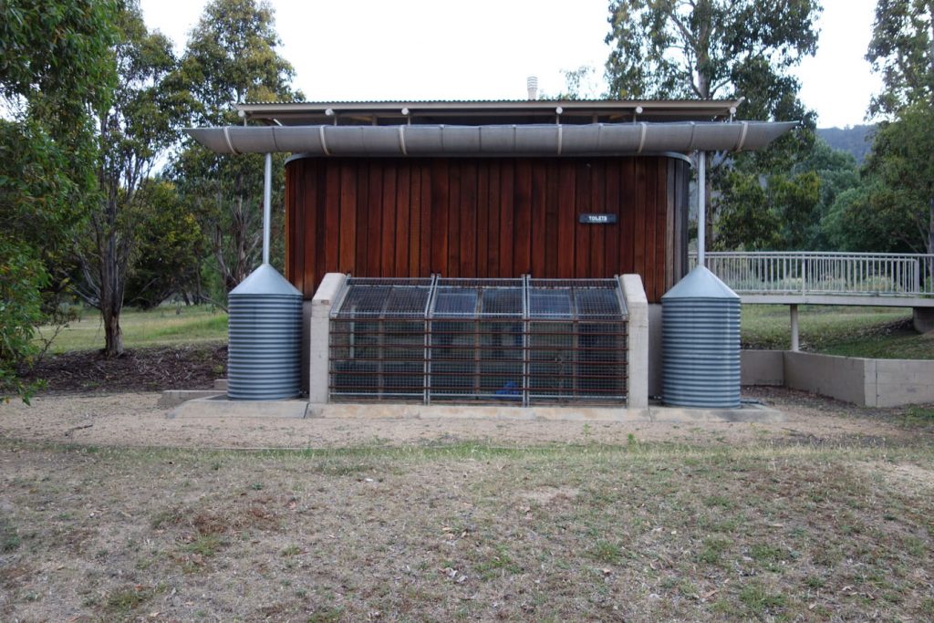
Good quality composting toilets available at the carpark
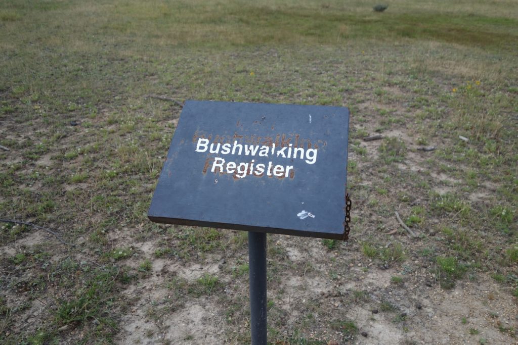
Bushwalking register at the start of the walk
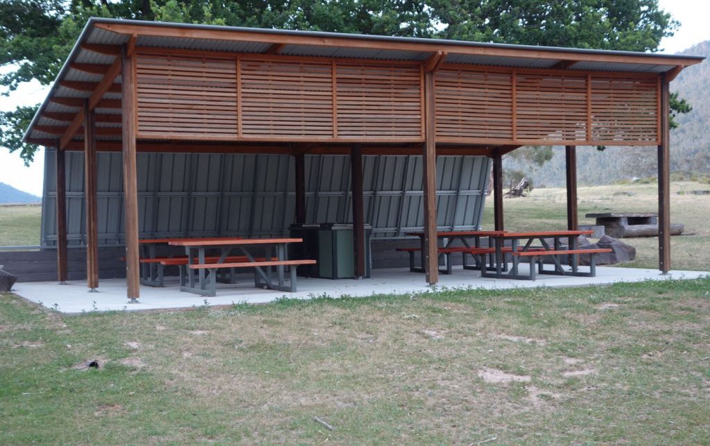
Picnic and BBQ facilities at the carpark
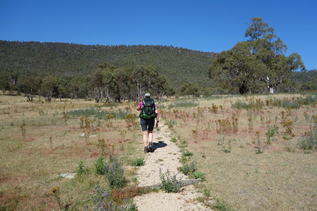
The trail start
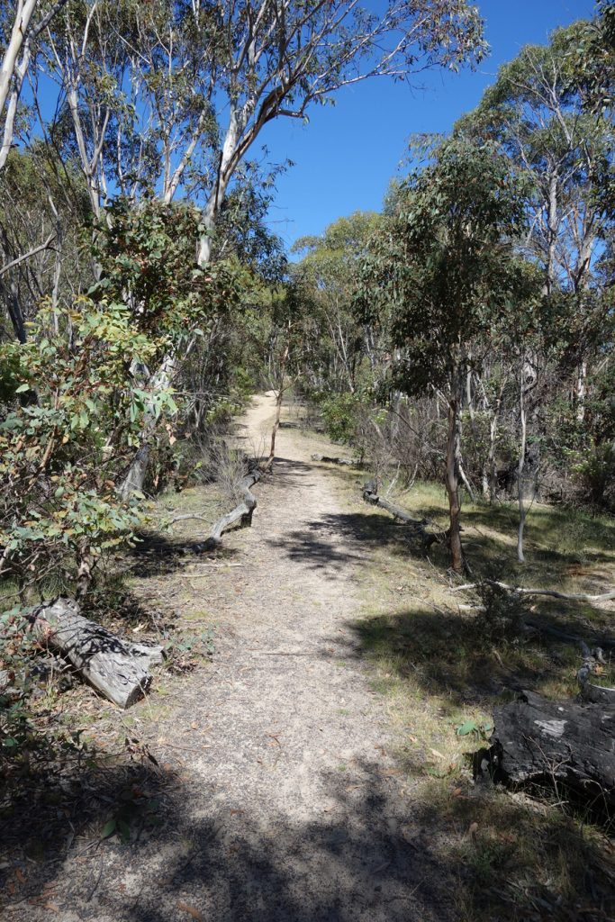
A typical section of the trail
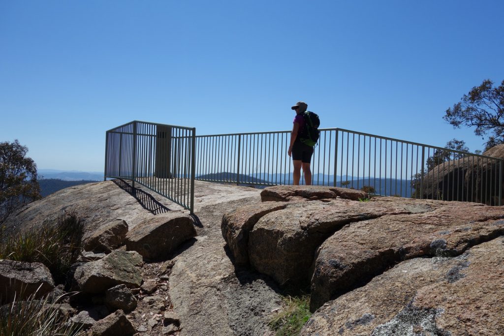
A protective barrier at the summit. There is a good rock shelter to rest on in front of this barrier but be very careful about going anywhere near the edges as there is a steep drop off
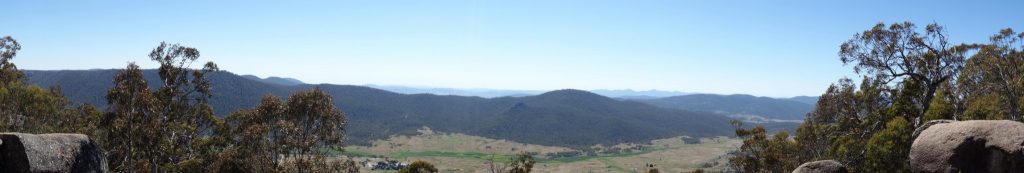
There are excellent views over the Orroral Valley
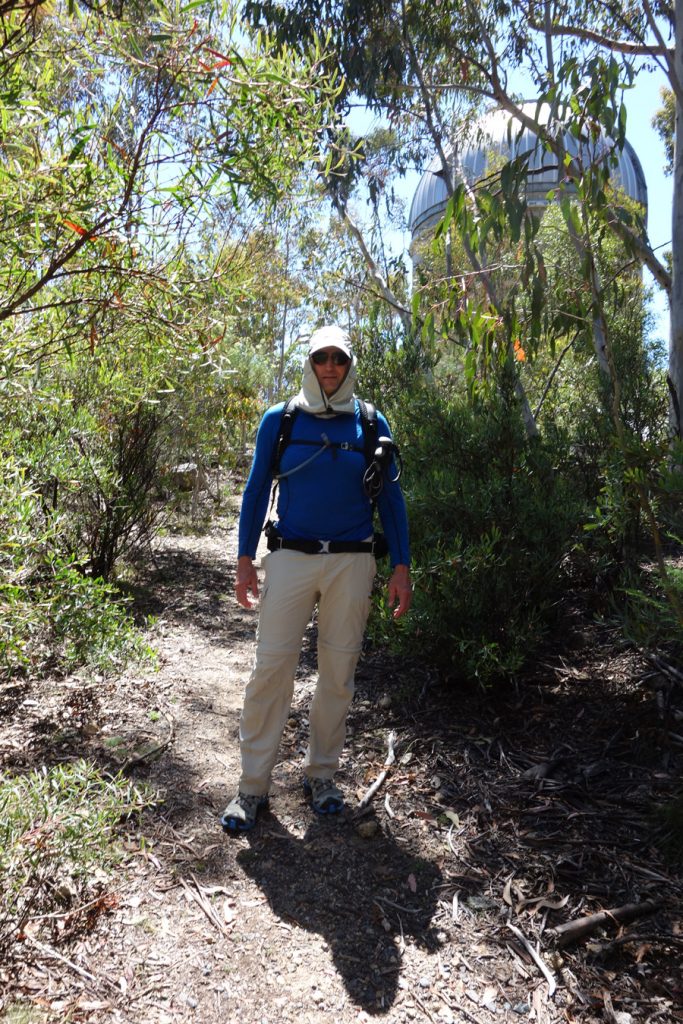
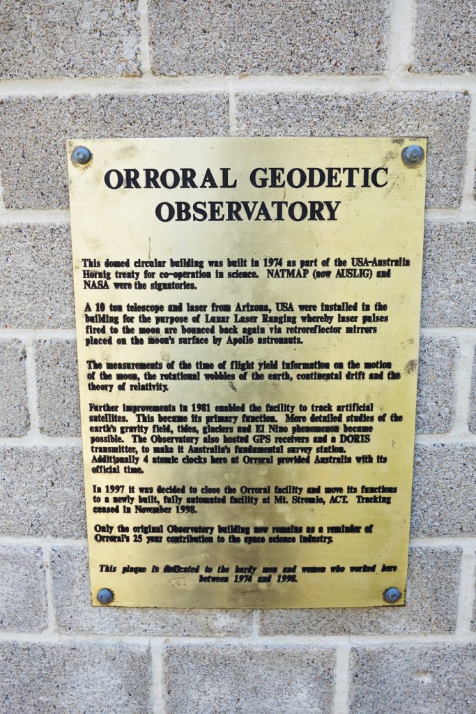
The domed building at the summit was used to house astronomy equipment however this facility ceased operation in 1998 when facilities were moved to Mount Stromlo. See the the image of the plaque below for more details
Getting there
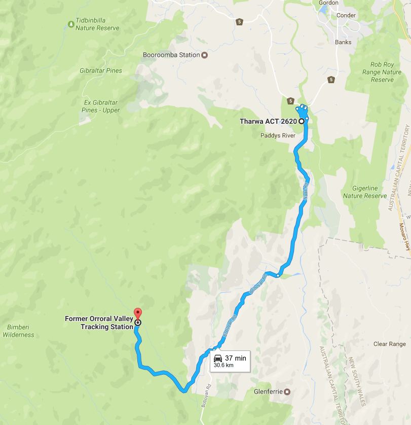
The former Orroral Valley Tracking Station complex has an excellent carpark from which to base a number of walks in this region. To get to the tracking station drive from Tharwa approximately 30 km from the Tharwa Bridge along the Naas Road to the former Orroral Valley Tracking Station.
From Tharwa travel along Naas Road (this road changes to Boboyan Road) past Apollo Road and turn off onto Orroral Road which is approximately 18 km from Tharwa on the right. Continue on Orroral Road past the campground and the road will finish in the tracking station carpark approximately 10 km from the turnoff. If you arrive early in the morning there are a few heavily shaded carparks that will keep the car cool for the day.
Things to know
- Phone: Phone signal is variable on this trail (Telstra), data signal is variable
- Water: Bring your own water
- Toilets: There are toilets at the trail head
- Trail: This walk is on formed trail
- Dogs: Dogs not allowed
- Camping: Camping allowed
- Other:
- The Horse flies are present in the hotter months in this area and are serious about trying to bite you. They will bite through your leather boots, are capable of biting through a merino top, and don’t care one little bit about 80% DEET. Shorts and short sleeves tops are best avoided unless you want to spend much of the trip battling these flies. They are bigger and nastier during periods of drought
Disclaimer
This walk was undertaken by the team from Australian Hiker