Johns Peak ACT (15km)
Tidbinbilla Nature Reserve
Nearest Town
Canberra
Starting Location
Mountain Creek car park, Tidbinbilla Nature Reserve

Entry to the Mountain Creek car park is well signposted. There is parking for about 25 plus cars as well as a solitary picnic table
Finish Location
Mountain Creek car park
Best Time to Travel
Year round. If you go in Summer be advised that this walk is closed if there is a total fire ban. The walk is best done when there is no cloud or fog to take advantage of the views. Snow is possible on the ground during Winter
Johns Peak Walking Track Review
Please note that this is a physically demanding walk that requires some rock scrambling as you approach the summit
The Johns Peak Walk, located in the Tidbinbilla Nature Reserve is Canberra’s newest designated walking track officially opening with little fanfare in early 2021. Having said that this walk has been accessible to bushwalkers in-the-know for many years but it now appears in the offical walks list and changes to trailhead and trail signage. Up until we had done this walk the Camel’s Hump Walk, which shares much of the same trail was from our perspective, Canberra’s hardest signposted walking track. Not anymore with Johns Peaks now just pipping Camel’s Hump. Johns Peak is shown to be 14km track but on the day we did it our GPS measured it as spot-on 15km.
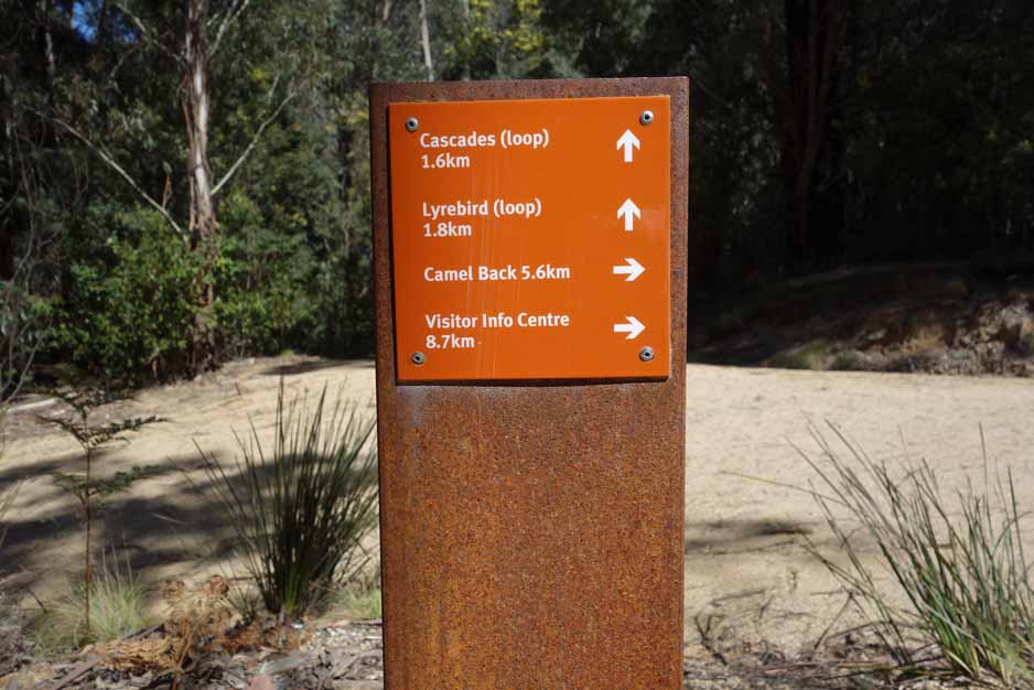
Once you enter the Reserve drive past the Dalsetta and Flints car parks (the best chances for a toilet stop) and keep travelling on the loop keeping to the right on the two times there is a branch off. The walks starts at the Mountain Creek car park and from a facilities point of view there is not much there. Apart from a solitary picnic table there is a trailhead sign which details the various walks you can do from this location including the Camel’s Hump and the much shorter Lyrebird Trail and the Cascades Trail.
This walk is supposed to take up to 7 hours and we managed it in under 5.5 hours including snack breaks and a 30 minute break at the summit. You do need to be fit to do this walk otherwise allow the full seven hours and take it easy. Come prepared for changes in the weather and bring plenty of water.
This trail has limited directional signage but there is enough to keep you on track except at the summit. Given that this is a new walk you will be following the trail signage to the Camel’s Hump and as you approach the hump you will see some temporary signage pointing you towards the left onto an almost hidden management road that backs up the hill almost in the direction you’ve come. Once you have turned off the main management trail, the signage to Johns Peak consists of a series of temporary brown and orange directional arrows and is enough to to keep you on track to the summit. The trail is very basic and while experienced hikers have been doing this walk over the years its obvious that it needs some more work.
This walk is almost entirely uphill with some short steepish sections and takes you through snow gum forests which is unique as far as marked trails go in Tidbinbilla Nature Reserve. Where it gets difficult is the final ascent to the summit with the last few hundred metres requiring some rock scrambling both on the way up and back down again. Trekking poles won’t help in this section and in all honesty, you are better off putting them away at this stage. In addition to the scambling there are a couple of very short sections that are very exposed putting you close to steep drop offs so pay attention. As such, this track is not suitable for young children.
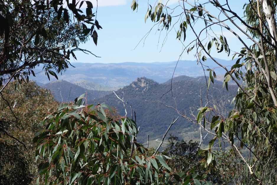
The summit is a small rocky knob covered in low growing Snowgums that provides excellent views towards Camel’s Hump and over the the valley behind Tidbinbilla. Once you reach the summit you will follow the last of the trail as it winds its way about 50 metres through the stunted Snowgums until you reach your destination as a rocky outcrop that has all the views. Where this walk was a bit of a surprise packet is that the views are just breathtaking. I’m usually not the sort of person that sits at a summit once I’ve reached it but this is one of the few exceptions. In many respects its like the the summit of Mount Gingera and has a remote primal feel about it that just takes your breath away.
Once we had our fill we started to make our way back to the trailhead. The return trip is almost all downhill with a couple of very short uphill sections and while the return can be a bit monotonous it does provide some fabulous views to the valley below that you tend not to notice as you wind your way through some tall forests that line the road.
While the birdlife was reasonably good on the day we did this walk, we didn’t see any other animal life apart from the odd small lizard but given the overgrown state of the last half of the trail I was expecting to see snakes but saw none. We started this walk fairly early in the morning and on the walk up didn’t see any wildflowers in bloom however on the way back down there were small colourful wildflowers that had opened up with the sun and the heat.
If you have a fear of heights and don’t feel like doing a mountain goat impersonation you may not want to do the summit as the trail is narrow, overgrown and requires scrambling. There is a spot about 70 metres from that summit and before the worst of the scrambling that will give you some very good views and the walk is worth it even for that location.
On the day we did this walk we only saw one other hiker with the rest doing the better known Camel’s Hump. This walk is one of those hidden gems that will see more and more traffic as people discover it. If you are going to walk it try to get to the Reserve just after the gates open at around 7:30 am to not only beat the crowds but to also avoid the heat on hot days.
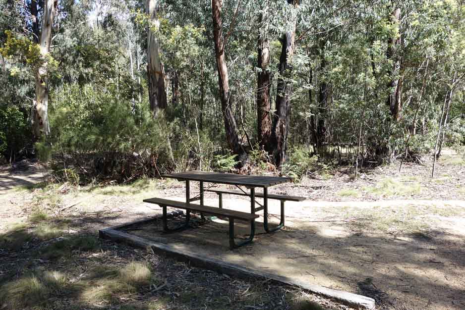
There are limited facilities at this car park – one picnic table
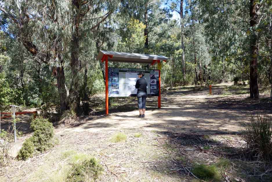
Interpretive sigange at the trailhead explains the walk and others that leave from this area

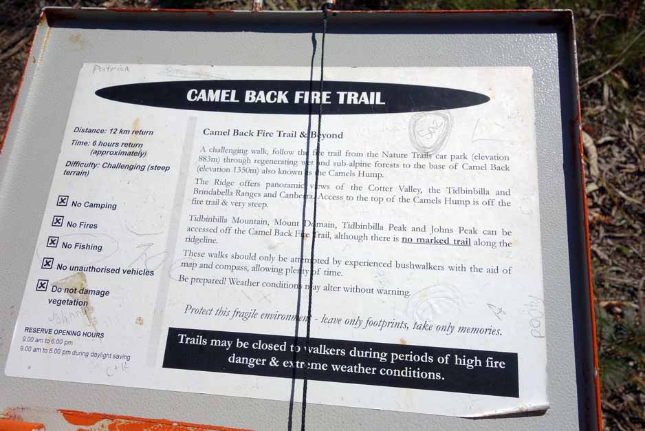
The trailhead signage has been temporarily amended to show Johns Peak

Indicative map to Johns Peak

There is a trail register just after you start the walk, please fill it out, and sign back out when you have finished
A warning sign on hiking in this area. With a warning like this, the trail has to be rated a 5 on the Australian trail grading system
Follow the signage to the Camel’s Hump

The forest is lush and dense at the moment particularly on the first half of the walk. The first couple of kilometres is also steep

Trail example

Still going

Camel’s Hump in the distance
View down to Gibralter Peak

Sawfly larvae. We used to call these ‘Spitfires’ as kids

Trail example. The trail varies to being treeless and open

Start of the temporary signage. Turn hard left here

The trail is almost unnoticeable at this stage

This first section from the turnoff is overgrown and vehicle wide but it soon changes into a single-width walking track

Dense trees on the side of the trail

Temporary trail markers

There is a trail in there

Natural rock seat before the final assault on the summit

Johns Peak, our destination

Getting steep

And the scrambling begins

Optional stopping point. The worst of the scrambling which isn’t long starts from here, its only about 50 metres to the summit. If you don’t feel like making the climb, the views at this point are spectacular and we found some nice rocks to sit on

Oh the views

Panorama view from the lower lookout point looking towards the Camel’s Hump

The summit at Johns Peak

The end of the line and the lookout point

View to Camel’s Hump

Heading down

Across the grassy area

Turn right onto the main road

Native fern on the side of the road

Trigger plant, my favourite

Heading back

Whalenbergia glosiosa, Royal Bluebell. Canberra’s Floral Emblem

Paper Daisy

Turning back to the car park

Signing out
Trail video
This short video contains photos and video from our walk to show you the walk from start to finish including videos at the summit of Johns Peak
Getting There
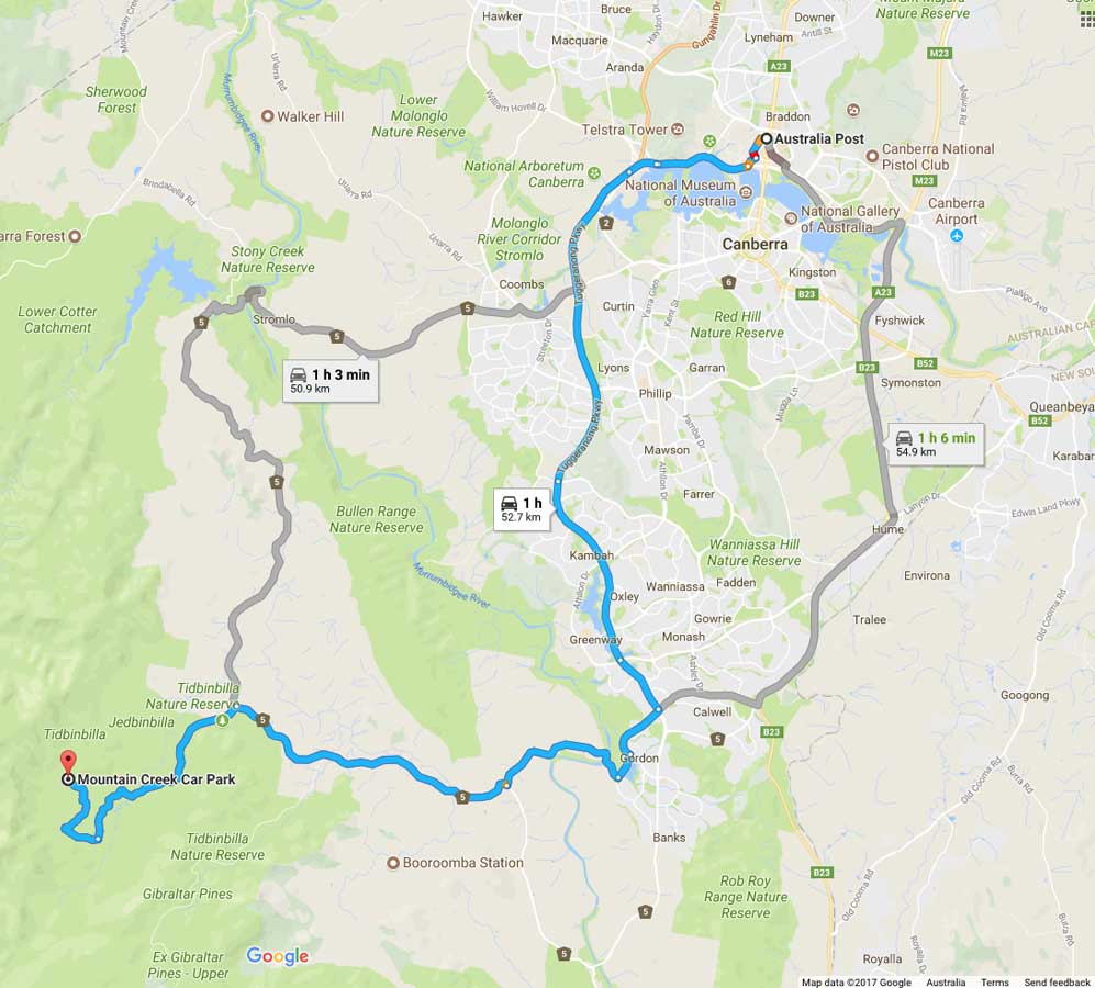
Image from Google Maps
The trip from the centre of Canberra is approximately 45 minutes and 50 km. Once you enter the Nature Reserve itself travel to the Dalsetta car park (stop here for a toilet break if you need) then continue on the loop road taking the right branch each time you have the option. Mountain Creek is well signposted so as long as you are reading the signs you won’t have any problems.
The Tidbinbilla Nature Reserve contains a series of walks that are closer to Canberra than those at nearby Namadgi National Park. Many of the Namadgi walks, particularly those that go into the Bimberi Wilderness Zone, are more remote requiring a higher level of skill but with it a higher degree of seclusion whereas the Tibinbilla walks are easier to access but you are unlikely to be alone on the trail.
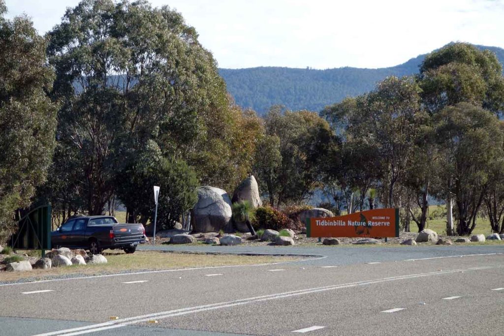
Entrance to Tidbinbilla Nature Reserve
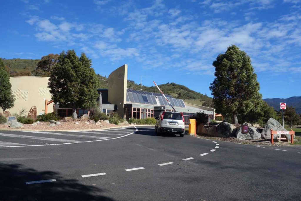
Tidbinbilla Visitor Centre and boom gate.
Things to Know
- WARNING: Ascending to the summit of Johns Peak requires you to be comfortable with very steep inclines and treacherous declines. Some rock scrambling is required and you come close to steep edges on a couple of occasions
- Phone: There is variable phone signal on this track but its good at the summit
- Water: You need to bring your own water
- Toilets: There are toilets throughout the Reserve but none at the Mountain Creek car park
- Dogs: No dogs allowed
- Other:
- The reserve is currently free to enter (21 June 2024
- This trail is closed when there a total fire ban
Disclaimer
This walk was undertaken by the team from Australian Hiker