Lyrebird Trail ACT (2.0 km)
Tidbinbilla Nature Reserve
Nearest Town
Canberra
Starting Location
Mountain Creek car park, Tidbinbilla Nature Reserve
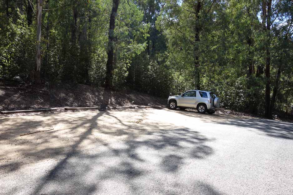
Entry to the Mountain Creek car park is well signposted. There is parking for about 25 plus cars as well as a solitary picnic table
Finish Location
Mountain Creek car park
Best Time to Travel
Year round. If you go in Summer be advised that this walk is closed if there is a total fire ban
Lyrebird Trail Review
The Lyrebird Trail walk is only 2 km but is well worth doing in its own right, as a second walk of the day, or combined with the Cascades Trail that would make this about a 3-4 km walk if you do both. Once you enter the reserve you drive past the Dalsetta car park (the best chance for a toilet stop) and keep travelling on the loop keeping to the right on the two times there is a branch off. There is signage directing you to the car park so even if you go the wrong way on the loop, you will end up in the right spot. Be warned here that the road will be closed during periods of total fire ban.
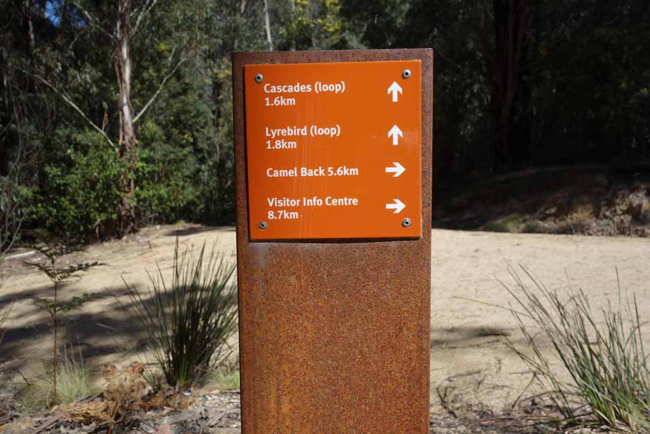
The walk starts at the Mountain Creek car park and from a facilities point of view there is not much there. Apart from a solitary picnic table there is a trail head sign which details the four walks you can do from this location including the shorter Cascades Trail and the much longer and much more difficult Camels Hump. This trail has good directional signage and there is really no chance of getting yourself lost. Sign in at the trail logbook about 20-30 metres into the walk and off you go. There is less altitude change on this trail and its much more gradual so its actually easier than the adjacent Cascades Trail even though it is slightly longer.
You start this walk by signing in at the bushwalking register and walking uphill to the fire trail about 80-100 further on. At this point you turn right to do the Camels Hump walk or veer left to do the Cascades Trail and Lyrebird Trail.
The trail is quite wide at this stage so it’s one of those rare trails that allows you to walk side by side with a partner. Once you cross over a bridge you come to the directional marker that points you on to the Cascade Trail loop (veer right) or turns you to the left to walk on the Lyrebird Trail. The Lyrebird Trail gets its name from the potential to see Lyrebirds (winter). We didn’t see any but did hear them and every time I got my recorder out they would stop singing.
Having previously done the Cascades Trail I didn’t think that this trail would be as good and even though the first part of the trail is shared, they are both very different trails. The Lyrebird Trail is drier as it doesn’t hug the southern side of the mountains so you almost feel like you are in a totally different location. The trail itself follows around the hills and while it has about an 80 metre incline you hardly notice the rise. There is a lot of little stuff to see and as I was carrying my SLR and macro lens for the first time in months, I had lots of photographic opportunities.
The Lyrebird Trail is a loop trail and if you feel so inclined you can easily do both the Lyrebird Trail and Cascades Trail on the same walk which will mean a distance of about 3-4 km.
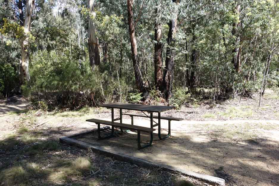
There are limited facilities at this car park – one picnic table
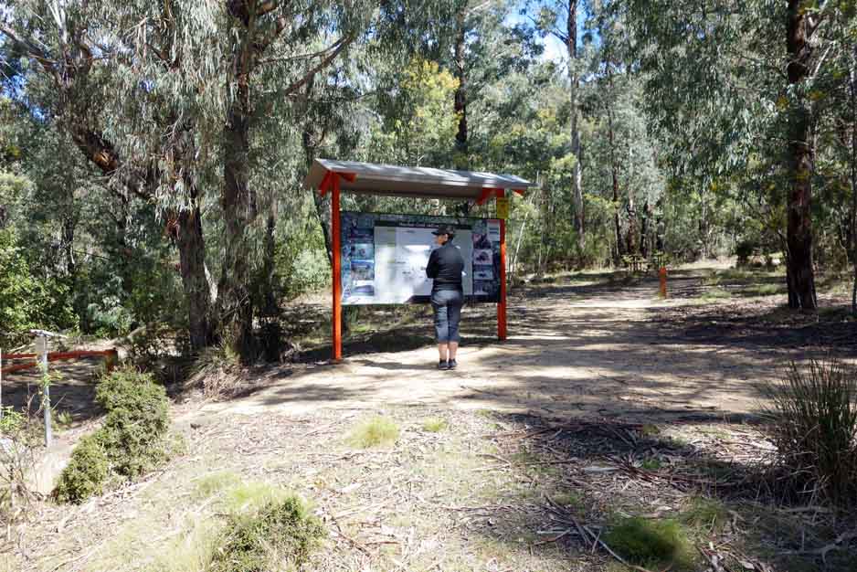
Interpretive sigange at the trail head explains the walk and others that leave from this area
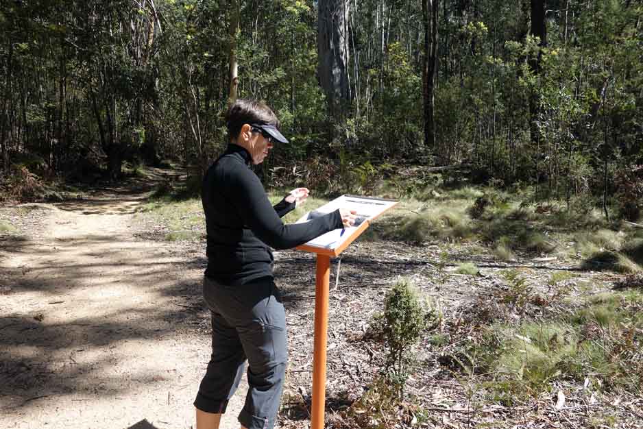
There is a trail register just after you start the walk, please fill it out, and sign back in when you have finished
This trail signage is located about 100 metres into the walk. Veer to the left slightly, crossing the fire trail before continuing on the trail

Veer to the left and cross over the fire trail. The path across the road is not signposted but is obvious

This trail has small sections of dryish trail but most of it is dense and moist. This trail is also a rarity as you can walk side by side for large sections

There is limited signage information signage on this trail but this one notes the possibility of lyrebirds (mainly winter). On our walk we could hear them but we didn’t see any

There are a couple of small bridges along this well maintained trail

The trail branches at this sign. You can either go to the left as we did in this case to do the Lyrebird Trail or to the right and do the Cascades Trail

Walk past the Cascades Trail loop and keep on going on the Lyrebird Trail

This little trail also has a couple of mesh bridges

On the Lyrebird Trail

Pea flower

Moss on the Trail

Wildflower just starting to open up

Lichen

I love the sap that some Eucalyptus trees put out, the colour is spectacular

Very young flower buds

Seat on the trail

Views into the valley

Almost back to the trail head. The road into the car park is just visible on the right
Getting There
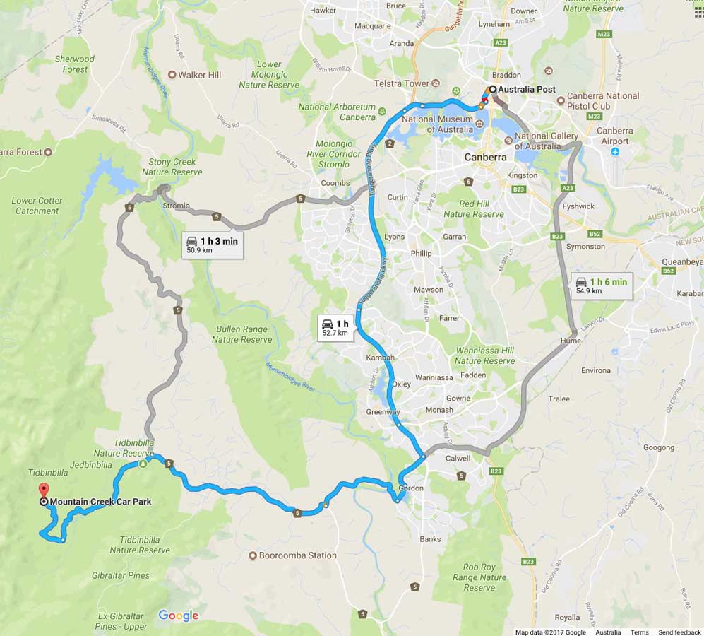
Image from Google Maps
The trip from the centre of Canberra is approximately 1 hour and 50 km. Once you enter the nature reserve itself travel to the Dalsetta car park (stop here for a toilet break if you need to) then continue on the loop road taking the right branch each time you have the option. Mountain Creek is well signposted so as long as you are reading the signs you won’t have any problems.
The Tidbinbilla Nature Reserve contains a series of walks that are closer to Canberra than those at nearby Namadgi National Park. Many of the Namadgi walks, particularly those that go into the Bimberi Wilderness Zone, are more remote requiring a higher level of skill but with it a higher degree of seclusion whereas the Tibinbilla walks are easier to access but you are unlikely to be alone on the trail.
If you have an annual pass you can enter the park via the boom gate and scan you pass from as early 7:30 am in the morning and you will need to be out by 6:00 pm at the latest (8:00 pm in summer). If you are buying a single entry into the park you will need to wait until the visitor centre opens at 10:00 am (9:00 am in the summer).
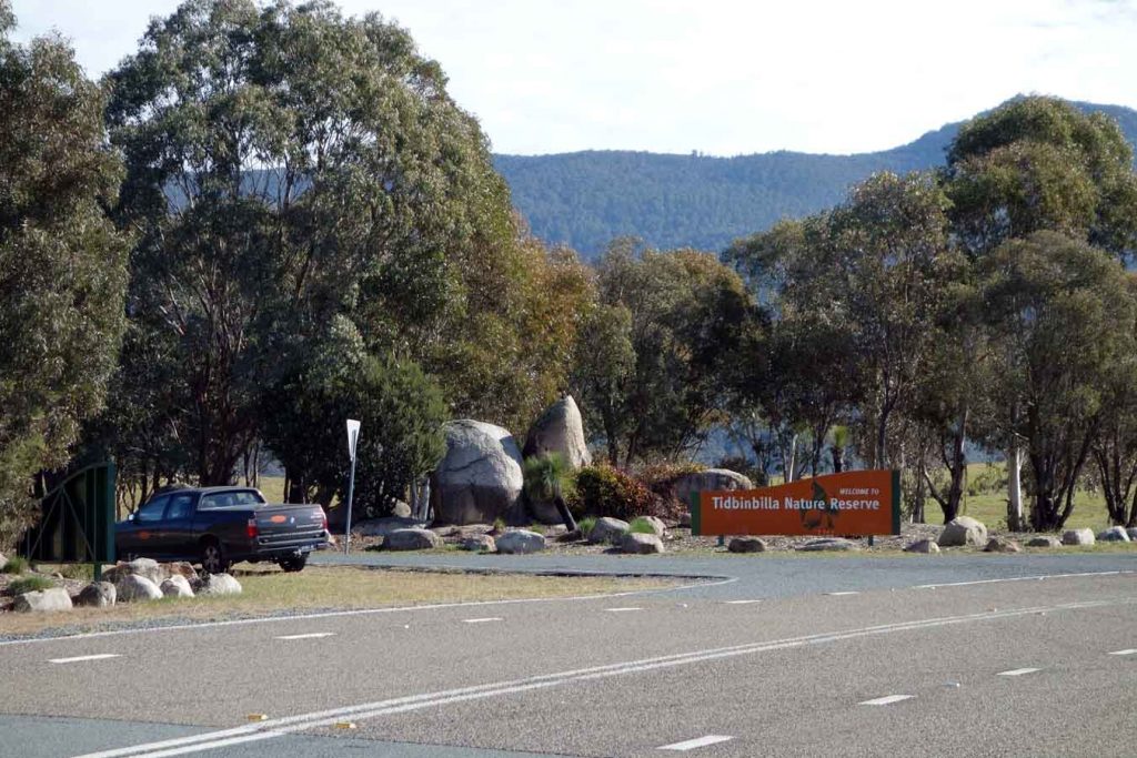
Entrance to Tidbinbilla Nature Reserve
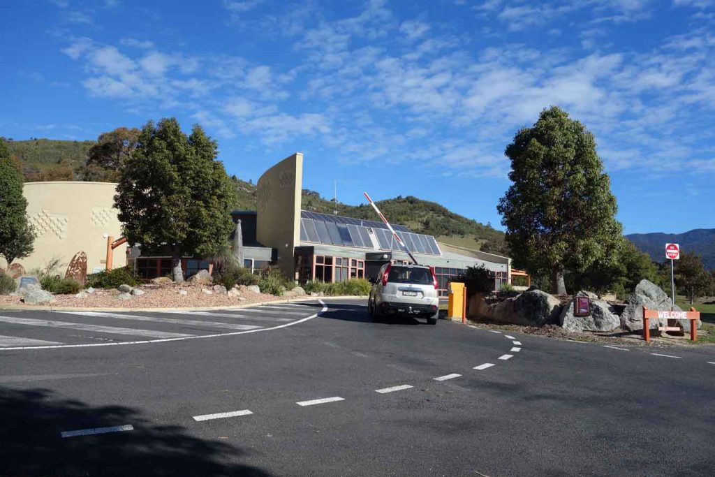
Tidbinbilla Visitor Centre and boom gate. If you have an annual pass you can just swipe your card for access without having to enter the visitor centre
Things to Know
- Phone: There is no phone signal on this trail (Telstra)
- Water: You need to bring your own water
- Toilets: The closet toilet is at the Dalsetta car park which you pass on the way to the Mountain Creek car park
- Trail: This walk is on a former hiking trail
- Dogs: No Dogs allowed
- Other:
- This trail is closed when there a total fire ban
- The visitor centre sells snacks if you need
- The reserve is accessible before the visitor centre opens so long as you walk in or have an annual pass
Disclaimer
This walk was undertaken by the team from Australian Hiker