Glenburn Heritage Trail ACT (10.4km)
Heritage Walk
Nearest Town
Queanbeyan, NSW
Best Time of the Year to Travel
Year round. Avoid this walk in the afternoon in mid summer as it’s a bit exposed
Starting Location
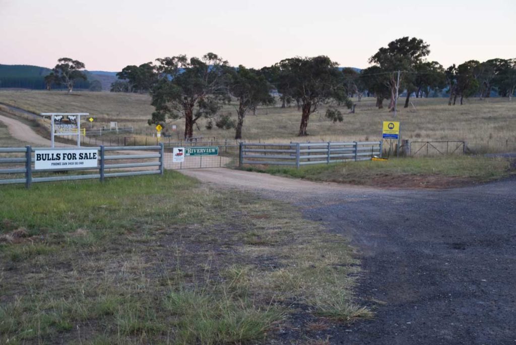
Glenburn Precinct Carpark
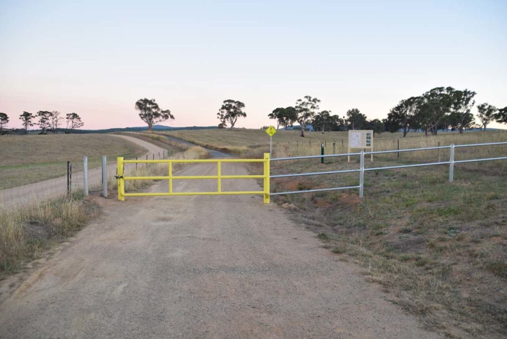
Trail head. Either nose in or park along the road if your car doesn’t have much clearance
Car park looking back out towards the highway
Finish Location
Glenburn Precinct Carpark
Glenburn Heritage Trail Review
The Glenburn Heritage Precinct consists of a series of three interconnected walks. Two stand alone walks that include the Glenburn Heritage Trail (10.4km) and the Burbong Heritage Trail (10km), and the longer Glenburn Loop Trail (12km) that combines both of the stands alone walks. The hardest thing about these walks is finding them. I drove past this trail head for eight months and because it is so close to Canberra I am usually doing final social media updates or reading the paper on the way down the coast for the day and aren’t looking up (no I’m not driving). It was only when I decided to do these walks that I realised exactly where they are. As part of this write up I submitted this location to Google Maps as a site to help others find them which shows how new they are.
These trails are a good opportunity to take in local settler history that I didn’t really know existed and they provide a bit of variation to traditional bush or urban walking that is very close to the city. The Glenburn Heritage Trail can’t really be described as a bushwalk as you are walking through old farmland, on management trail, and through pine forest to take in some of the Canberra Regions early history. One thing that really surprised me was the grave site that forms part of this trail which dates back to 1837 and would have to be some of the oldest in the Canberra Region. The trailhead is very informative and also has a small pamphlet holder that clearly points out what you will see on the trail.
The trail markers are well set out and you just need to pay attention at the right times to ensure that you follow the colour coded trail markers. I competed this trail on a day that was forecast to be 38°celsius (100°F) so started my walk at 6:15am. This was a good choice an meant that I avoided the heat that eventuated in the afternoon and the adjacent shooting club had started up as yet. The majority of this trail has no shade so start early if you are doing this walk in summertime.
Heritage Sites on this trail include the old woodshed and shearers quarters that was still operating in the 1990’s, a small cemetery, remnants of the farm area the include the Glenburn Homestead, hay shed and machinery area, the old sheep yards and remnants of the old school site. Some of the old structures have fallen into disrepair and warning signs keep you out of some areas for your own safety.
This is a great walk with lots to see and for me this was one of the slowest 10km walks I have done in ages as I was quite content to stop and look around. I’m looking forward to doing the remaining two walks in this area in the coming month.
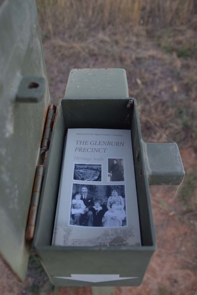
Brochure holder at the trail head
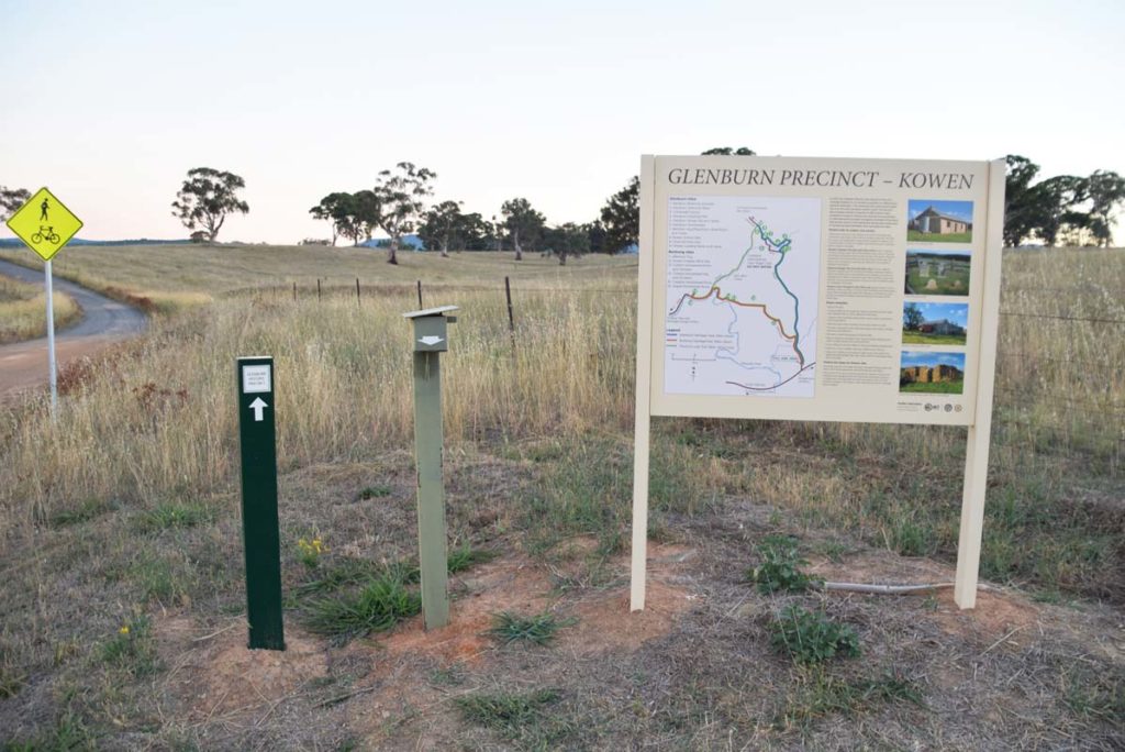
Trail head signage
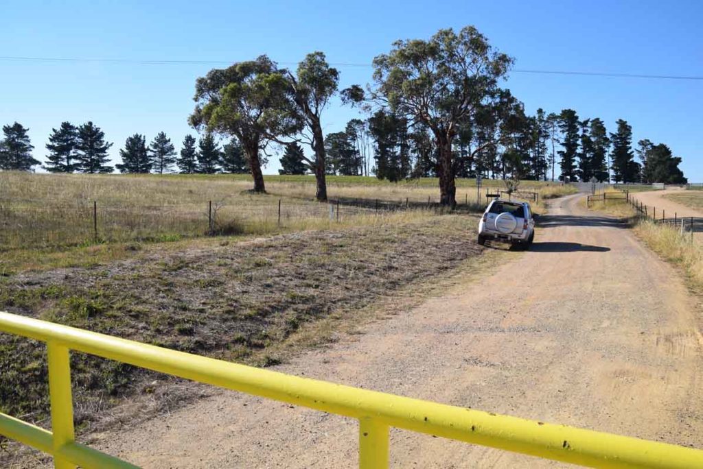
Trail head. There is a small open gateway on the left of the yellow gate
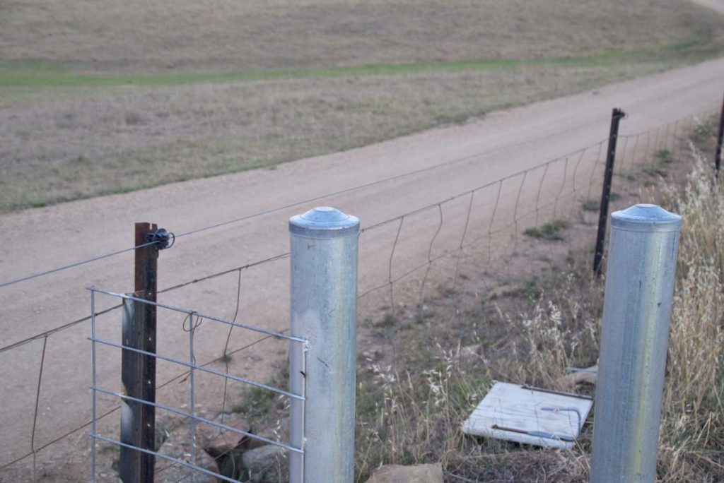
Keeps your hands away from the side property fence as you walk through the gate as the fence is electric
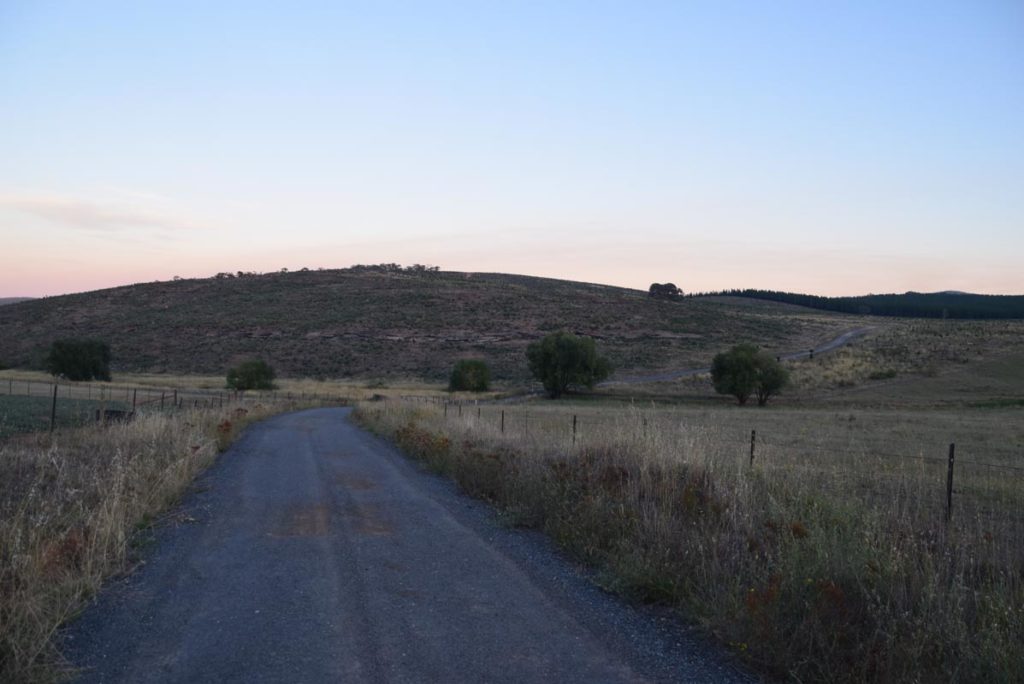
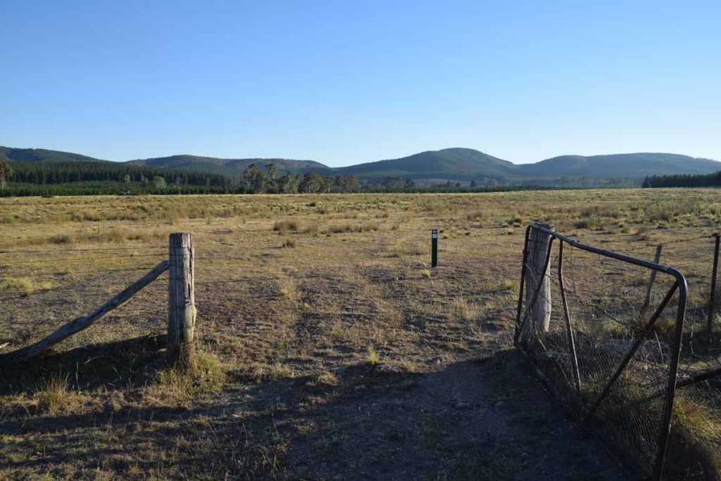
Much of this trail is management road with smaller sections on open grassland. The trail is not heavily used, mainly because no-one knows its there
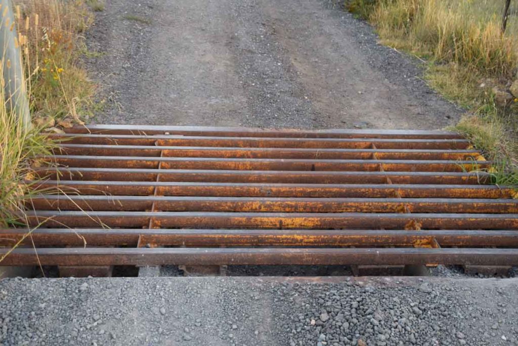
You will have a couple of cattle grates to cross on this trail
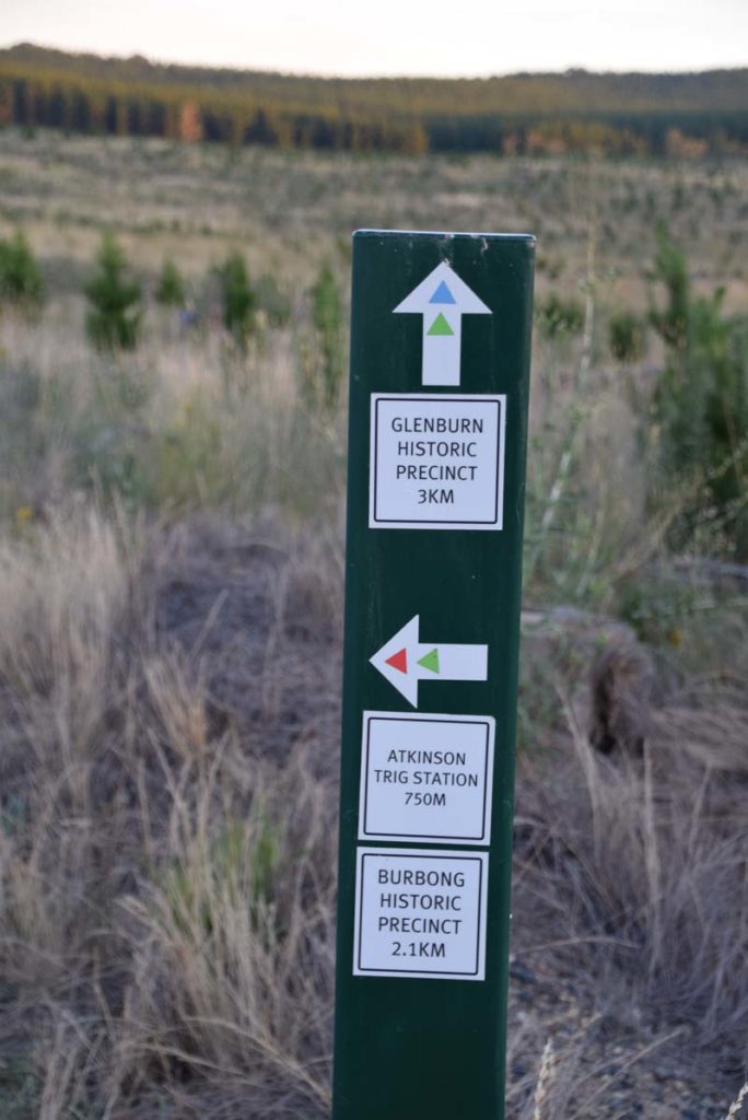
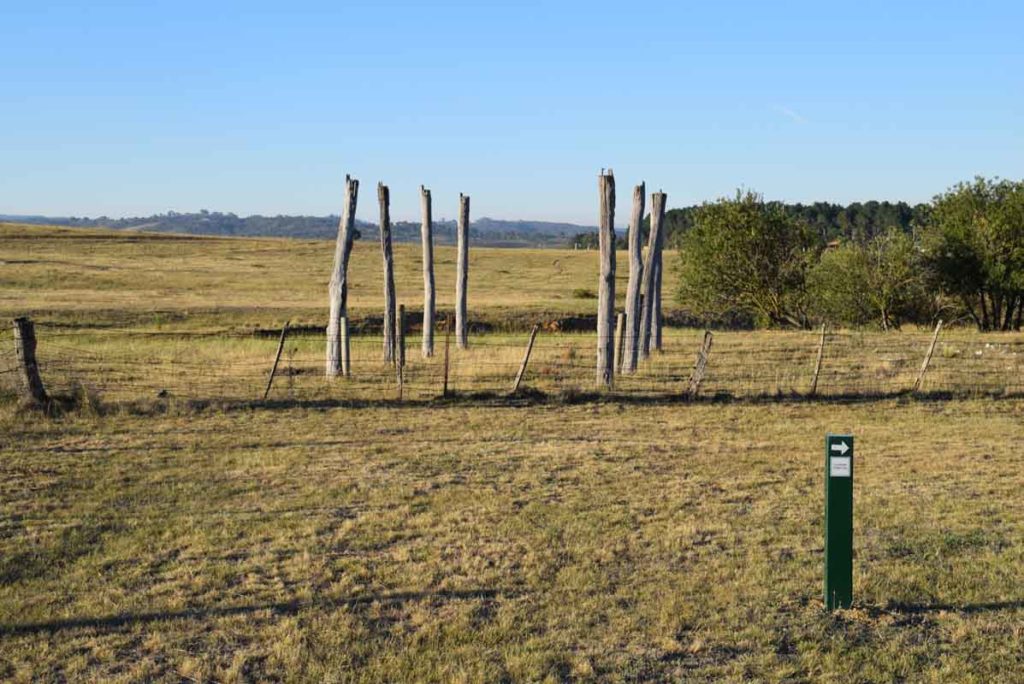
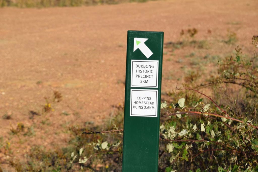
The three trails that make up this precinct are colour coded. Follow the correct colour for your chosen trail. The Glenburn Heritage Trail uses blue Blazes. The green trail (the Glenburn Precinct Loop Trail) is a loop that combines the other two trails
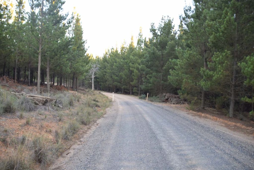
Part of the walk is through pine forest
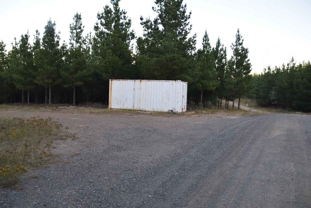
Keep walking past this container
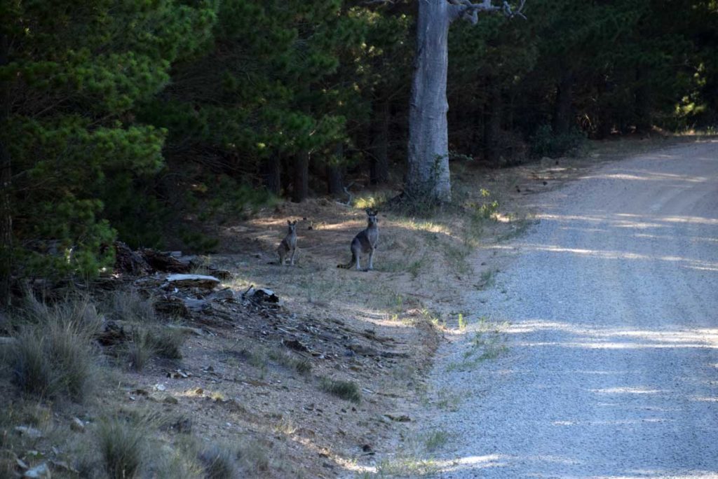
The Kangaroos are very timid and if you want yo take photos then do it from a long distance
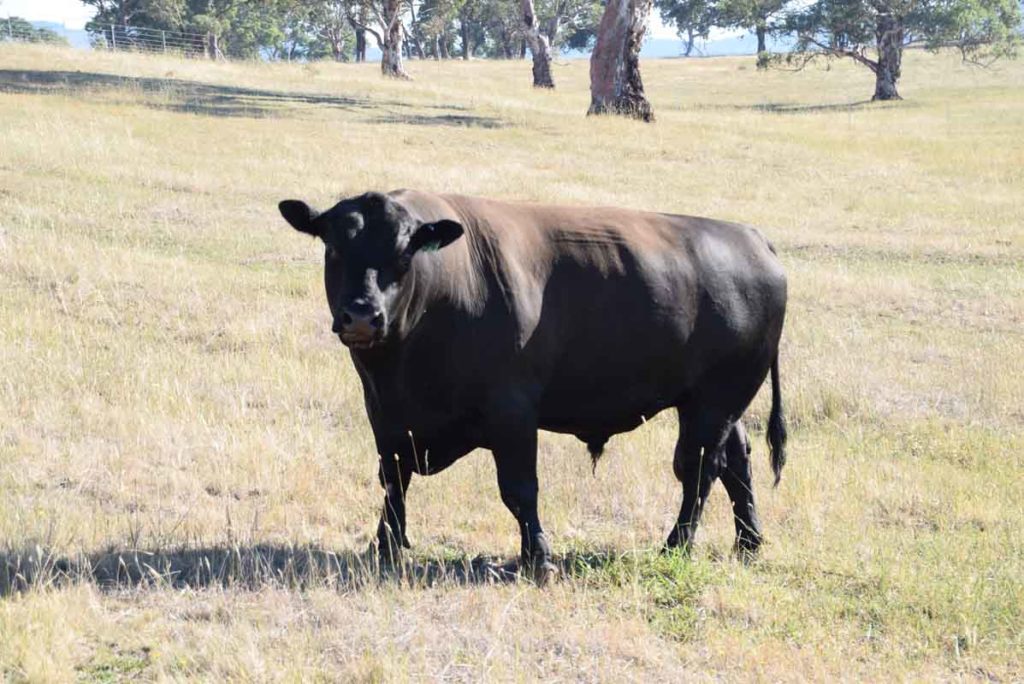
On the other hand the large bulls on the farm next door are quite happy to have their photo taken
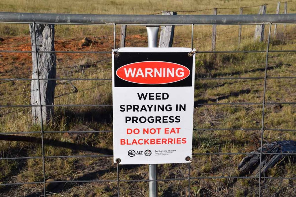
Being an old farm area there are plenty of blackberries but don’t eat them as there is a spraying program in progress
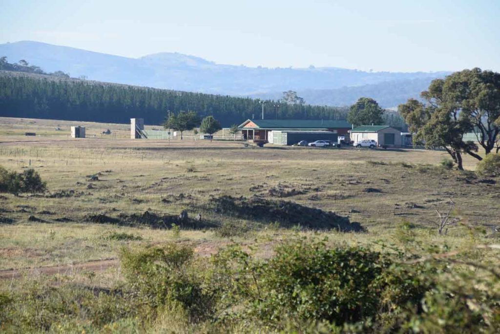
Shooting club. Keep out!
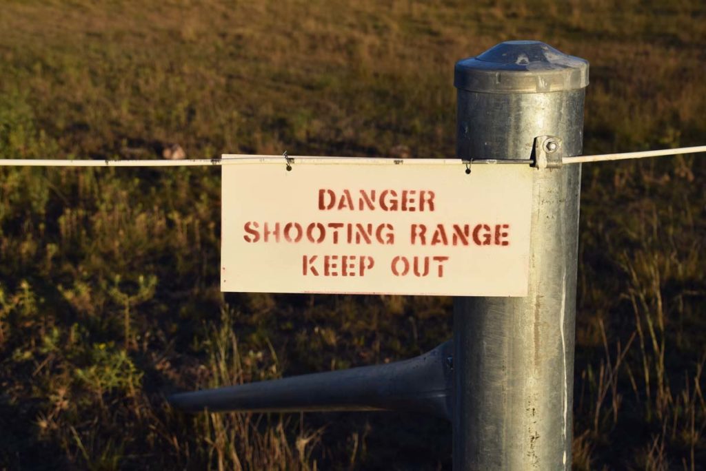
Keep out, shooting range! This walk skirts the shooting range
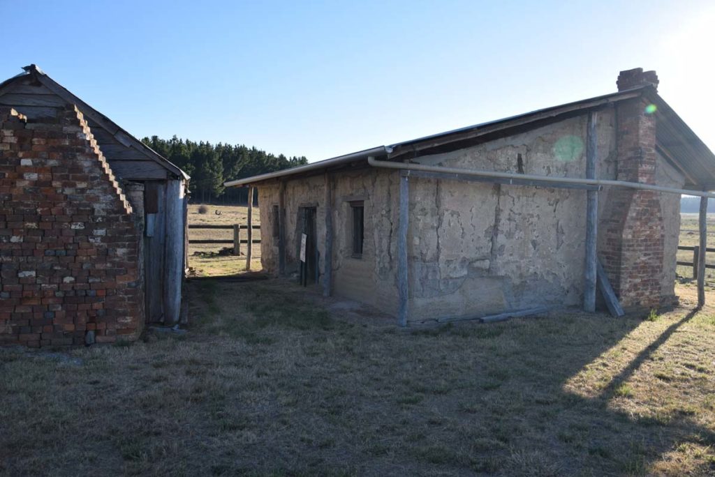
Shearers quarters and woolshed
Shearers quarters
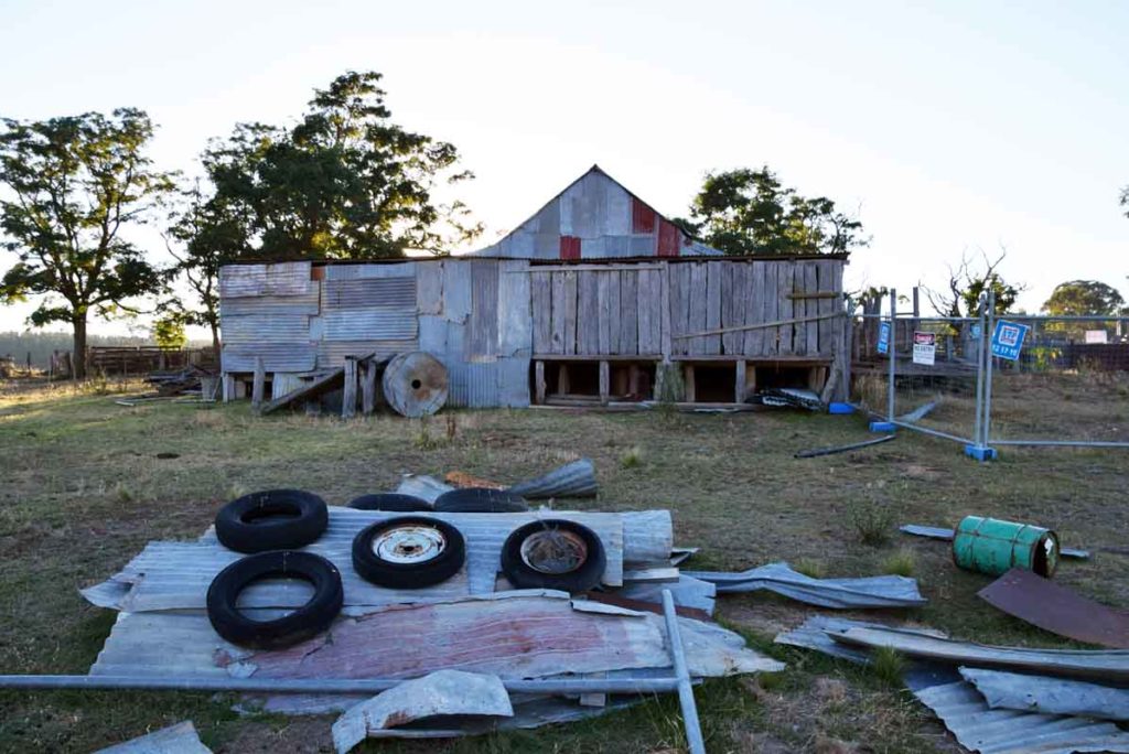
Woolshed
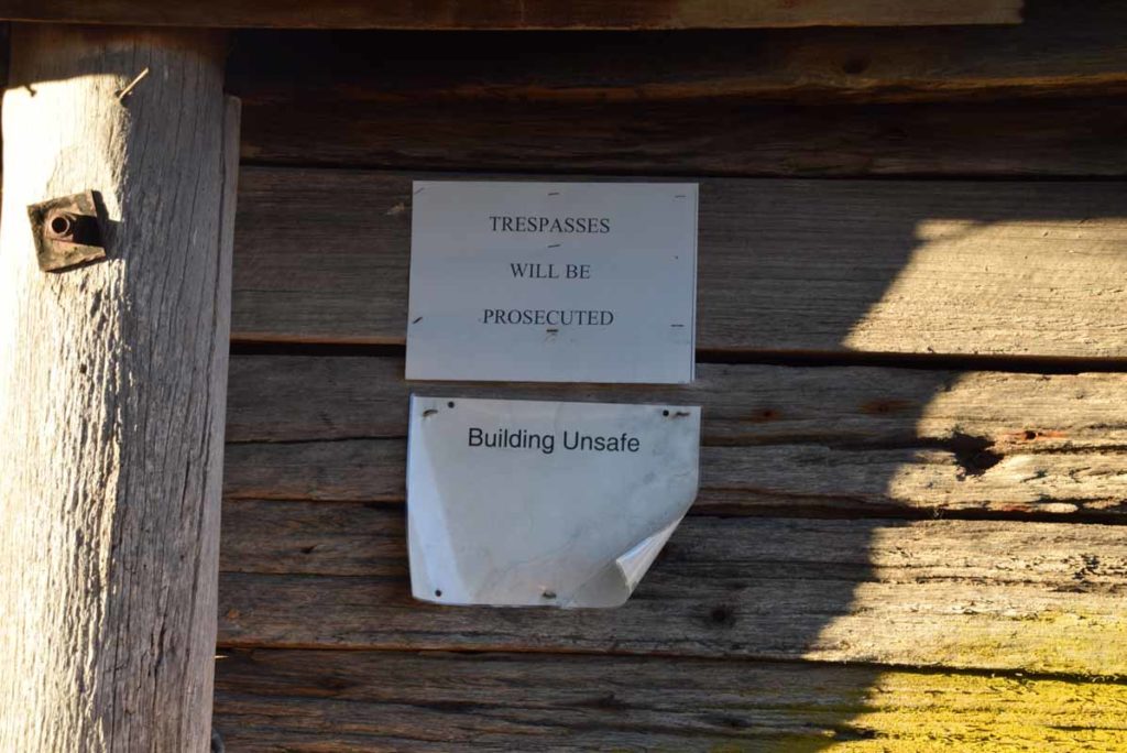
Warning sign on the woolshed. Keep out as its unsafe
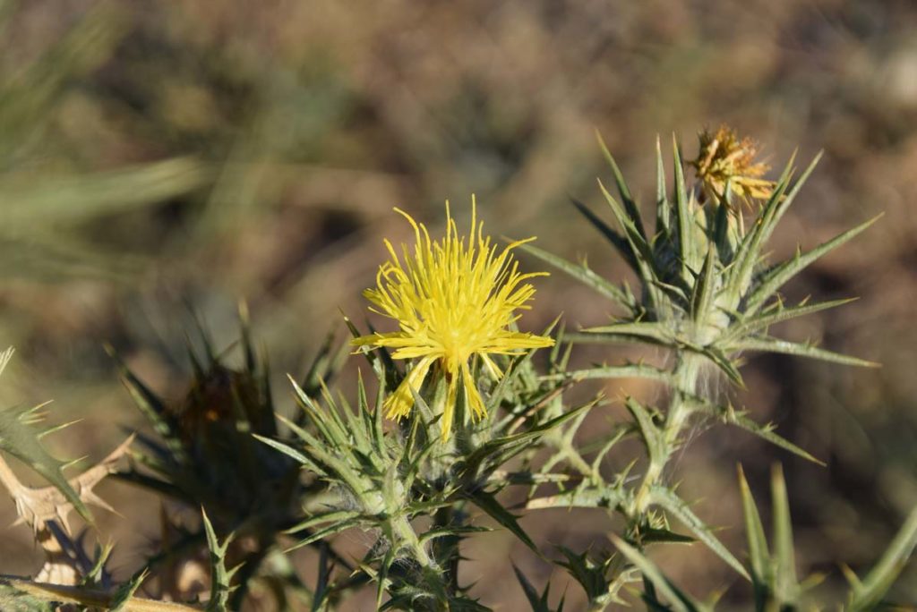
Thistle in flower. It’s a weed but pretty all the same
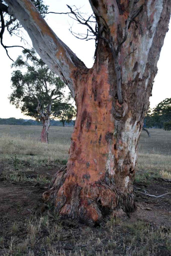
Colourful tree bark
Walk past the woodshed and head towards the paddock and though the gate and you will see a sign directing you to the graves
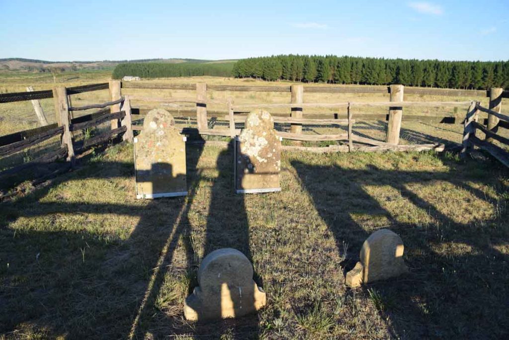
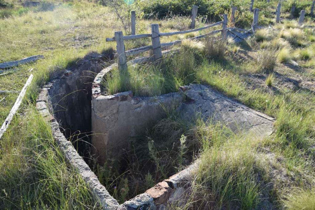
Grave site
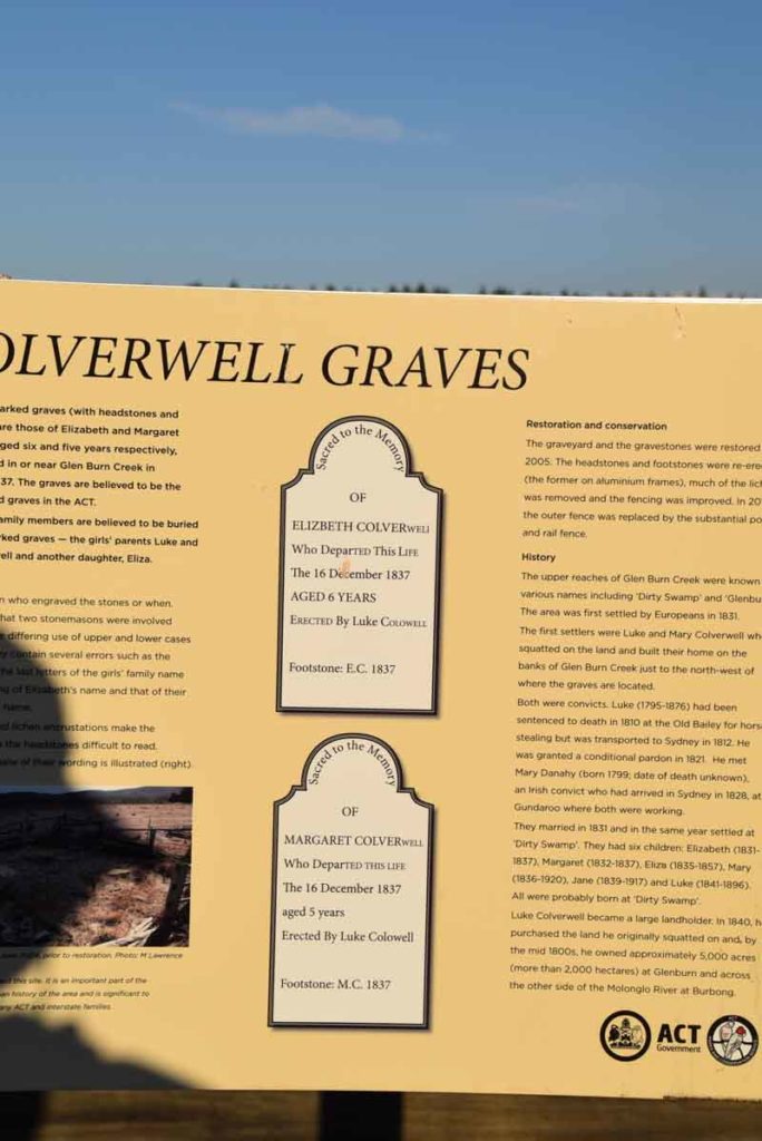
These graves are from 1837 and are some of the oldest graves in the Canberra Region predating St Johns Church
Remains of the hay shed
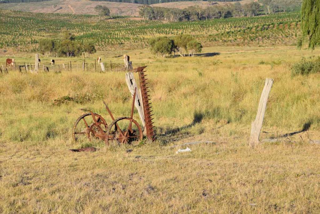
Old farm machinery dots the landscape
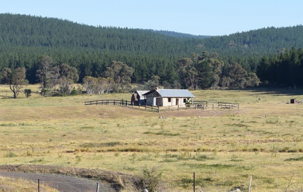
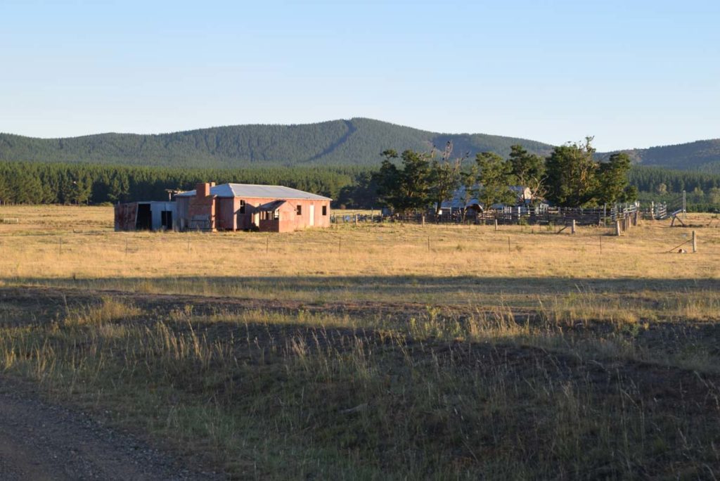
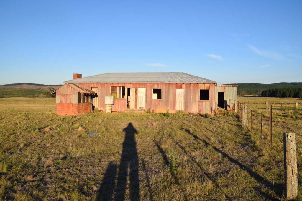
Glenburn Homestead from a distance
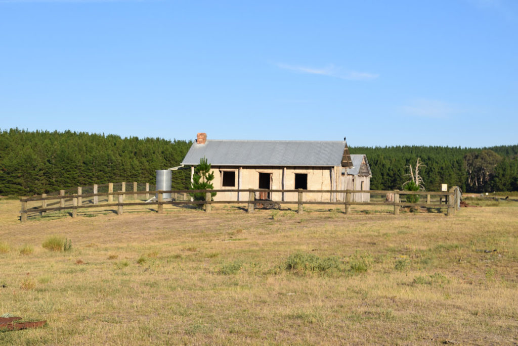
Glenburn Homestead
Rear of the Glenburn homestead
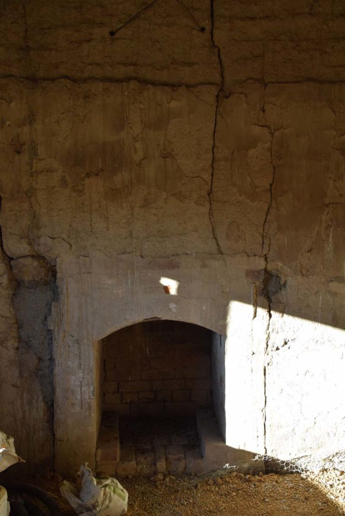
Fireplace inside Glenburn homestead
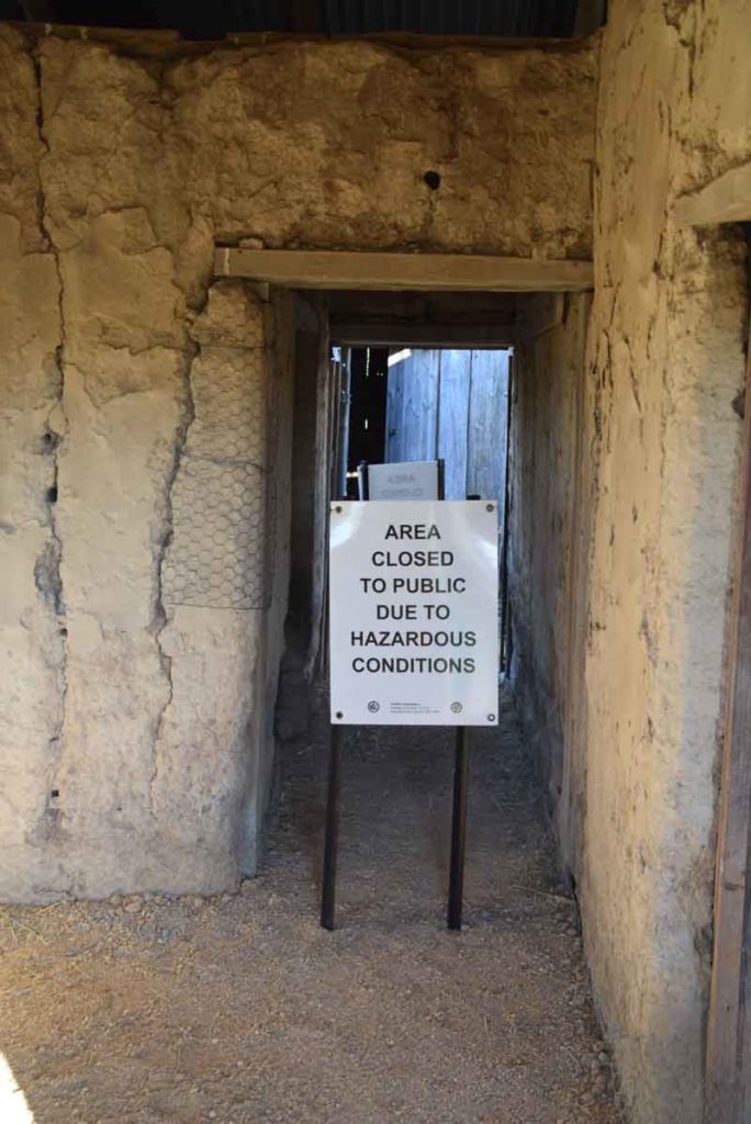
While you can enter the homestead there are areas you need to keep out of for safety reasons
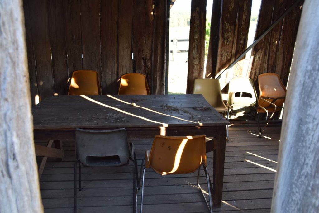
The small shed at the back of the homestead serves as a lunch stop or a respite from the heat or the rain
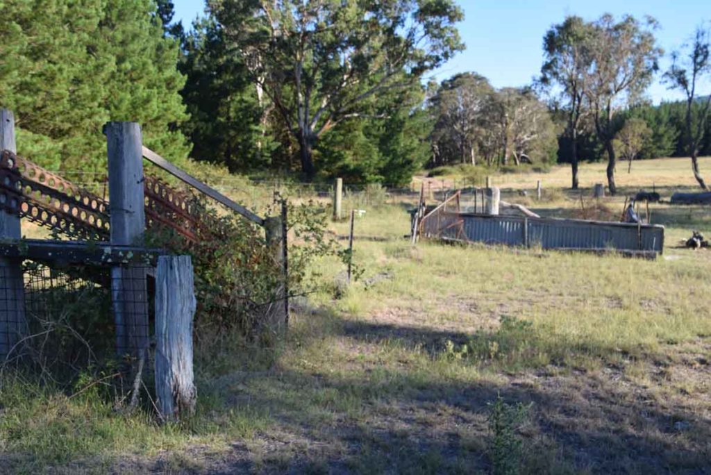
Sheep loading ramp and yards
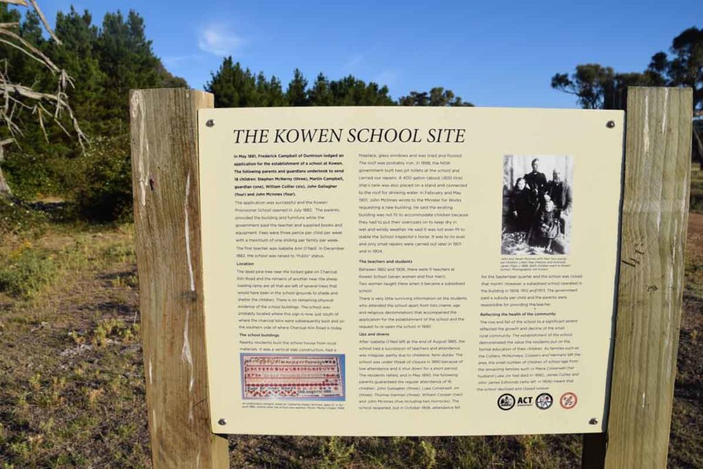
As you leave the Glenburn homestead head to the road and take a short walk upthe the heritage sites close by. This includes the school site
When you reach the fence near the old school site turn around and head back to the car park or continue on and complete the 12.6km Glenburn Precinct Loop Trail
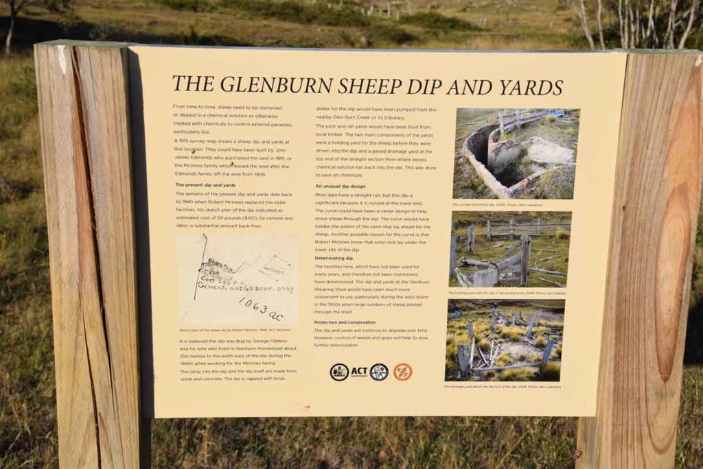
Sheep yards Signage. Walk up the hill towards the shooting club to skirt the creek line and you can easily access the sheep dip and yards
The old Sheep Dip. From here you walk back on the road past the Shearers quarters and woodshed towards the car park
Getting There
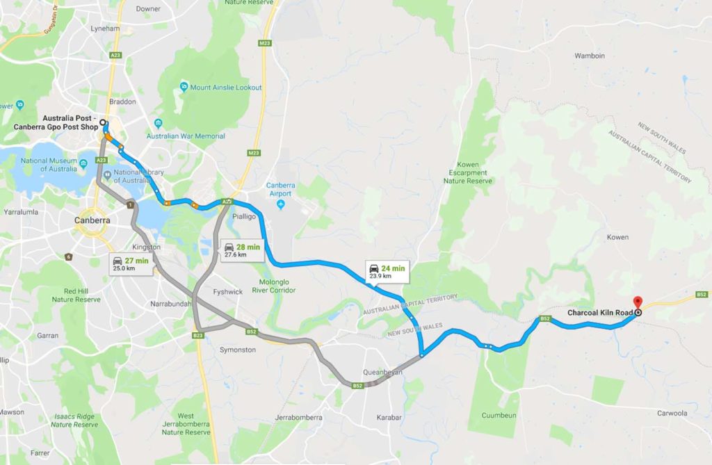
The hardest things about this walk is getting to the trail head. I have driven past this trail for the last 8 months without realising it’s there
- From Canberra drive through Queanbeyan and head towards the coast.
- Once you reach Burbong Bridge over the Molonglo River you only have about 1km to go
- You will see a large brown site indicating that this site is only 200 metres away and at about the same time you will notice a large timber farm shed just off the road so slow down
- There is an access road just past the shed on the left side of the road which has two driveways. Don’t go into the farm as its private property but look for the sign indicating the Canberra Clay Pigeon Shooting Club. The trail head is about 80 metres down the road
The whole trip from the the Canberra GPO is only about 24km which is one of the closet non urban walks to the centre of Canberra
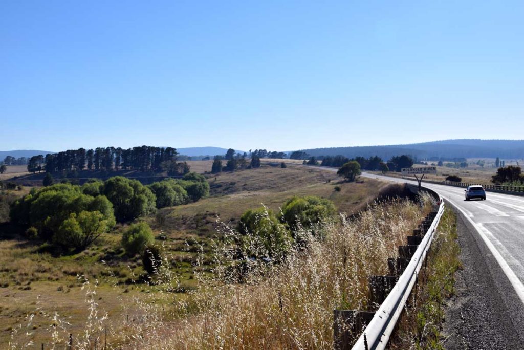
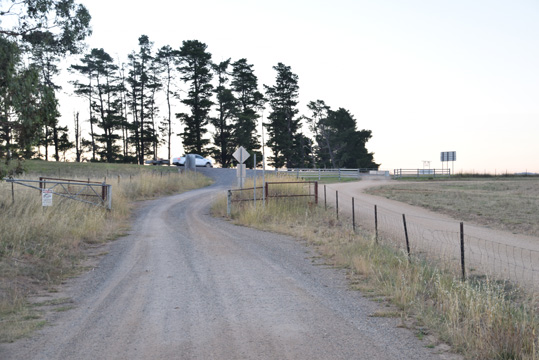
Burbong Bridge over Molonglo River. Notice the railway bridge to the left
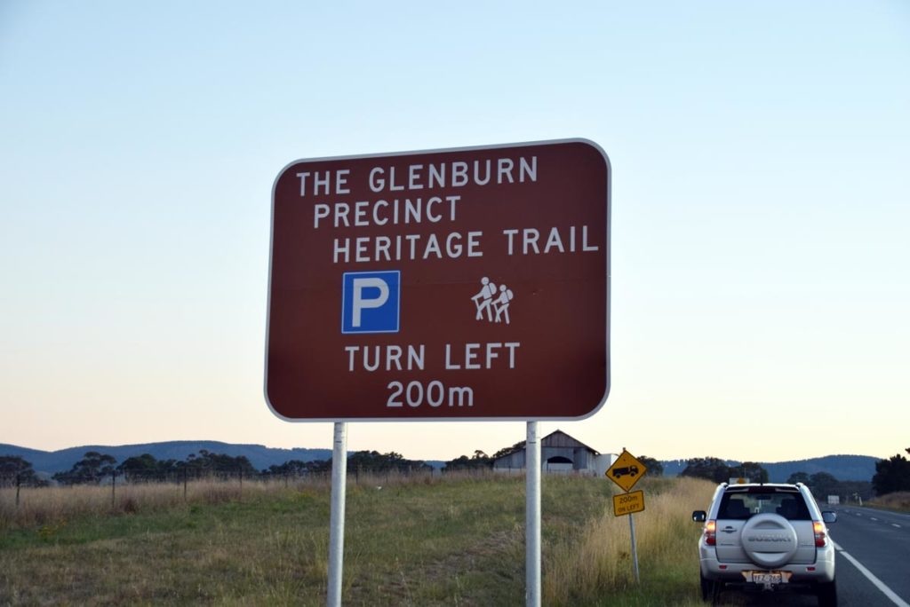
Sign and shed not far past the bridge
Entry road. The gate to the left is private property. The open gateway to the right with the shooting club sign is what you are looking for
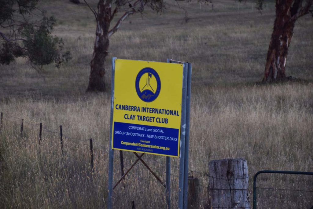
Shooting club sign
Looking back towards the highway
Things to Know
- Even hough you will drive through Queanbeyan to get there this trail is located in the ACT
- There is good phone signal on this trail which is a rarity on many Canberra trails
- You need to bring your own water as there is limited available on the trail
- There are no toilets available so bring a trowel
- This trail is a bit exposed during mid summer so walk early if the forecast is hot
Disclaimer
This walk was undertaken by the team from Australian Hiker