Bibbulmun Track WA (1005 km)
Albury to Kalamunda
Starting Location
North to south – Kalamunda on the edge of Perth
South to north – Albany
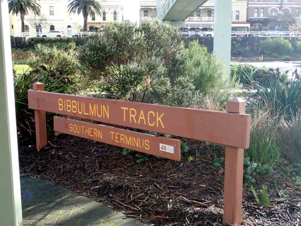
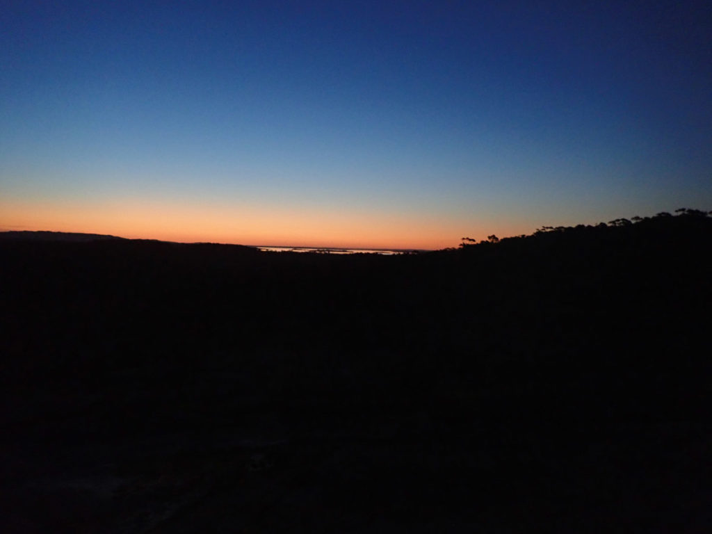
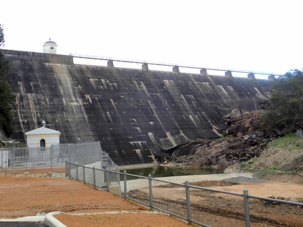
Bibbulmun Track Southern Terminus (this terminus has now been upgraded. In the right hand top photo of the image you can just make out the 6 Degrees Hotel which is about as close as you can get to the trail head if you need a place to stay.
Finish Location
North to south – Albany
South to north – Kalamunda on the edge of Perth
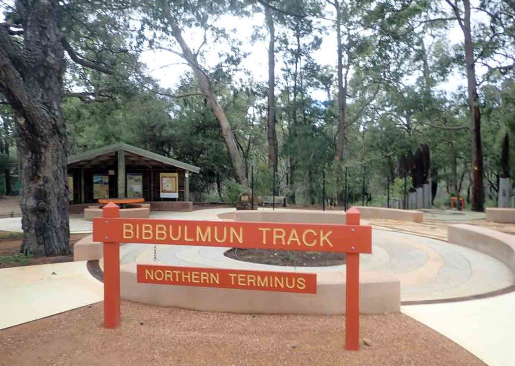
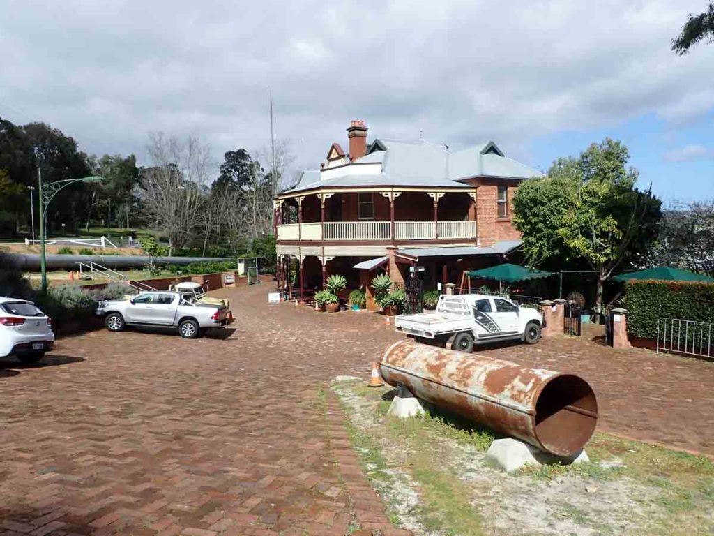
Northern Terminus of the Bibbulmun Track in Kalamunda in 2018
Best time to travel the Bibbulmun Track
May to October
Travelling over summer (late November-February/March) is not advised (due to bushfires and heat) but not prohibited. The impact of bushfires is weather dependent however shelters have been lost up to the end of late April due to fires so if you are starting a thru-hike earlier there is a risk you may not be able to complete the whole trail.
Aim to finish your hike by mid October at the latest to avoid the risk of fire and excessive heat at the start of the season. Water availability at the campsites may also be an issue over summer.
Just the Facts
Distance
- Distance: 1005 km (the actual distance will vary from year to year depending on diversions in place on the trail)
- Number of steps: 1,514,756
- Days taken: 36 days (32 hiking days and 4 rest days)
- Average daily hiking distance: 31.4km
- Wrong turns taken: 2
Calories
- Average daily calories burned: 5,793
- Average daily calories carried: 2,500
- Weight lost: 15kg (approximately)
Pack
- Pack weight range (including food and 3litres of water): 13.00kg-18.36kg
- Base weight (no food or water): 10kg
Encounters
- Number of days without rain: 8
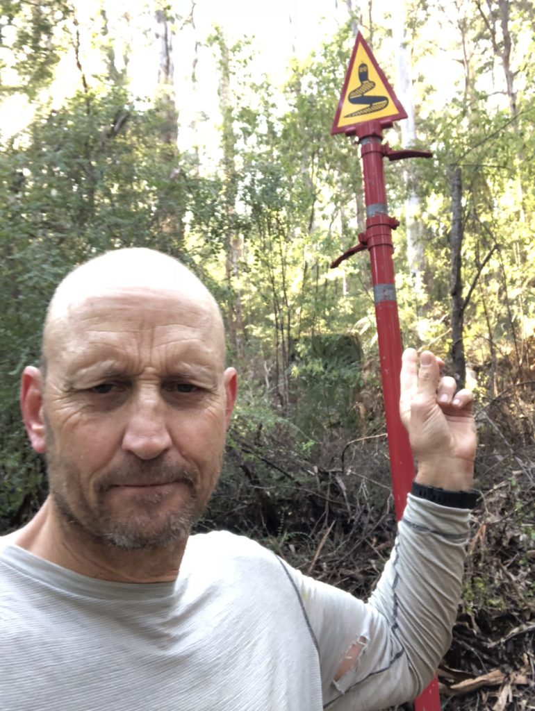
- Number of snakes seen: 0
- Number of snakes heard: 0
- Number of wild pigs I came across: 9
- Number of times I stumbled: Too many to count
- Number of times I fell over: Twice, both times can be attributed to my hiking poles
Favourite Huts
There are 49 campsites along this track and they are all three sided shelters with one exception, Mt Wells, which is an enclosed hut. That doesn’t stop people calling them all huts and the terms ‘double hutting’ or ‘triple hutting’ are common. Each and everyone has something on offer.
I didn’t stay at every campsite and skipped visiting one, opting not to go off track just for the sake of looking at it. The following list are my top eight campsites in order of preference. Each and every one had something special for one reason or another and in many cases I put it down to the ‘feel’ of the site rather than the physical quality:
- Waalegh campsite
- Great views
- Frankland River campsite
- Great raised campsite by the river
- Dog Pool campsite
- Great landscape, good feel about it
- Torbay campsite
- Great feel
- Murray campsite
- Great river views
- Giants campsite
- Nestled amount the Tingle trees
- Beraking campsite
- Perched at the top of a hill, nice open campsite
- Peaceful Bay campsite
- Tucked into the coastal bushland
Waalegh Campsite. This hut appears every old but in this case its all about the views. Stay here for some great sunsets if you have the opportunity
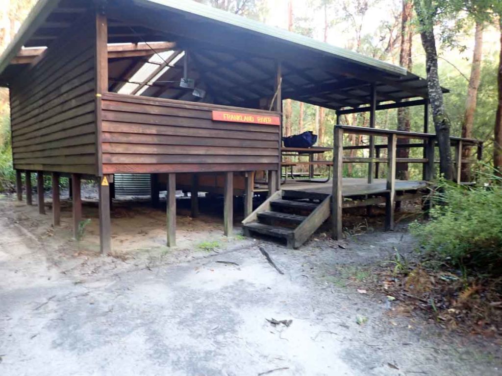
The view out from Franklin River campsite. This campsite is raised to cater for river flooding
View out of Dog Pool shelter. This campsite had a really nice feel about it
Torbay campsite. This shelter is just off the track nestled into the surrounding vegetation. It just felt ‘right’

The view out from Murray campsite. Spectacular views out on to the river
Beraking Shelter. I only stopped on the way past but it again had a good feel about it
The Peaceful Bay shelter nestled into the coastal vegetation.
Trip Podcasts
If you want some additional information have a listen to the series of podcasts on this trip:
After 2.5 years in the planning I announced I would do my first long distance Australian thru hike, and first thru hike, the Bibbulmun Track in Western Australia. This 1005 km (624 miles) track runs from Albany on the Southern Western Australian coast at one end and to Perth at the other end.
074-An interview with the Bibbulmun Track Foundation
In this episode we talk to Steve Sertis from the Bibbulmun Track Foundation about how the track came about, the role of the Bibbulmun Track Foundation, and some key takeaways on hiking this spectacular trail.
075-Bibbulmun Track here I come
In this episode we discuss my expectations, my apprehensions, and my hopes for my Bibbulmun Track thru hike which I started on 9 August 2018.
076-Week 1 Bibbulmun Track 2018
On 9 August 2018 I started my journey on one of Australia’s premiere long distance hiking trails, the Bibbulmun Track. Travelling 1000 km between Albany and Perth. This podcast provides an overview of a typical week on the trail completing 210 km and travelling between Albany, Andrew and Walpole. Listen to what I and other hikers go through in what has been some extremely taxing conditions.
077-Week 2 Bibbulmun Track 2018
At the end of the second week I reach Pemberton which means that 40% of the trail is done. I’m actually a day ahead of schedule but am not taking that for granted and now have seven days up my sleeve.
078-Week 3 Bibbulmun Track 2018
Week three of my Bibbulmun Track journey and our longest ever podcast due to 8 days worth of podcasting as I undertake the biggest week of the trip.
079-Week 4 Bibbulmun Track 2018
Week four is now over, just a short four day trip from Collie to Dwellingup. In this episode we also discuss people’s perceptions on the trail and how this will differ depending on the context.
080-Week 5 Bibbulmun Track 2018
This is the final episode of ontrail podcasts on Tim’s 2018 Bibbulmun Track hike. Listen to this podcast as Tim travels from Dwellingup to Kalamunda to complete his 36 day, 1000 km trip.
081-Bibbulmun Track Reality vs expectations
In this episode we review Tim’s recent Bibbulmun Track hike showcased in episodes 76-80 to discuss how the reality of the hike compared to the expectations prior to starting.
082-Bibbulmun Track gear wrap up
In this episode we briefly discuss the key pieces of equipment that I used on my recent Bibbulmun Track Journey and provide a broad overview of my reasons for choosing it.
My Trip
The Bibbulmun Track is widely recognised as one of Australia’s premier long distance trails and one of the best equipped in regard to shelters and town stops. Many people undertake this journey as a section hike, doing pieces of it over a period of months and even years. As a traveller from the eastern side of Australia doing this hike in pieces wasn’t an option. It would have taken way too long and once I start something I’m driven to finish it. The majority of hikers who do this trip in one go (Thru-hike) take around 50+ days but that time wasn’t available to me. I’m also the type of person who needs to be active. I just can’t sit in camp at the end of the day twiddling my thumbs; if it’s light I’ll be walking.
In August of 2018 after 2.5 years of planning I started my thru-hike of the 1005 km Bibbulmun Track in Western Australia. I had started doing physical training about 7 months before my trip and ramped this up to doing pack training (18kg pack) two months out. From a good knowledge of my own personal ability I decided to hike an average of 32km per day (20 miles) which is considered a good daily average in the US long distance trail scene. I have some of these US trails on my bucket list so wanted to use the Bibbulmun Track as my first long distance hike to see how I would go.
Having never done a hike of this length or duration before my main concern was overuse injuries and as it turned out I came across a number of hikers on my trip who were forced off trail for multiple weeks due to these issues. In preparation for this trip I did everything in my power to ensure that this type of injury wasn’t going to impact on me given the speed at which I was planning to travel. If you want to know more about this, read my article on the Impacts of Long Distance Hiking.
I started on 9 August 2018 and chose this time of the year for a number of reasons. Firstly I prefer my hikes on the cooler side. Coming from a Canberra winter where temperatures often get down to -7 degrees Celsius, a Western Australian Winter, while cold from a local perspective, wasn’t going to bother me. My timeframe was also in-between school holidays which made it easier to get leave from work. This timeframe was also a huge benefit as the trail wasn’t overcrowded. On the downside I only had eight days without rain over the entire trip. Many of these rain days consisted of short showers, the weather at the start of my hike could only be described as apocalyptic (read on).
I have written this trail review in five segments which is how I walked it. My shortest segment without a rest day was four days and my longest way eight days. For various reasons I decided to walk this trail from the Southern Terminus in Albany. This meant that I was going against the flow of most hikers who typically head south which I reasoned would allow me more opportunity for podcast interviews. And it just made sense to me to finish up in Perth as that’s where I was going to be flying out of to return home. Having now done the full trip I would recommend doing the trip in a northerly direction and I’ll explain why in the following article. Ultimately the direction you travel is a personal choice. So here goes.
The Lead Up
The week before the start of my trip I watched with trepidation as horrendous storms hit the southwest coast of Western Australia. A bit of rain wasn’t going to bother me but in addition gale force winds were lashing the south west of the state on a section of my trip which included inlet crossings and beach walks. From reading social media feeds there was some serious damage being done to the southern part of the track. I had pictures in my mind of lots of diversions at this stage.
After an early morning start from Canberra I arrived into Albany, after 14 hours of flights and airport lay overs, tired but raring to go. Albany as a town was impressive and the taxi driver who took me to my hotel was more than happy to provide the relevant details about why this town was so wonderful. I arrived in Albany in the evening and by the time I left the airport the local outdoor stores had closed. I had prepared for this and Trailblazers in Albany were kind enough to drop off to my hotel gas cylinder for my stove so I didn’t have to wait for them to open in the morning to start my trip.
Albany has no end to the number of great eateries for both breakfast and dinner and all close to my hotel. Six Degrees wasn’t the cheapest option as far as a hotels go but I chose it due to its location which was about as close as you could get to the trail head which meant an easy start in the morning. It was also located very close to the IGA supermarket which meant I didn’t have to walk too far for my last minute purchases. I spent an hour wandering around town and grabbing some takeaway before heading back to my room to set up my pack. The rain continued on and off during the evening, setting the pattern for much of the trip that lay ahead.
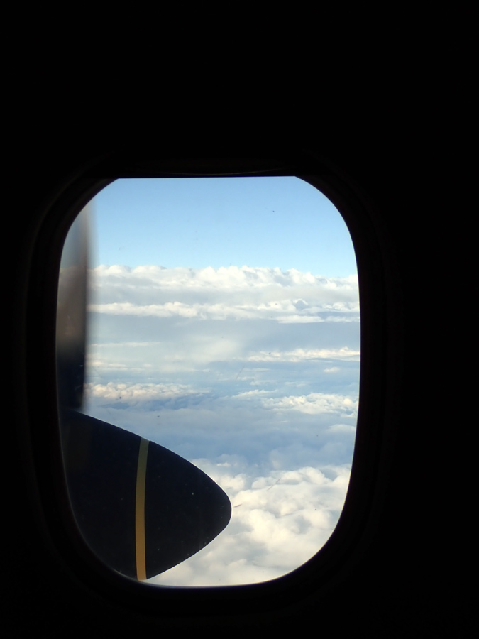
On my way. My flight from Perth to Albany
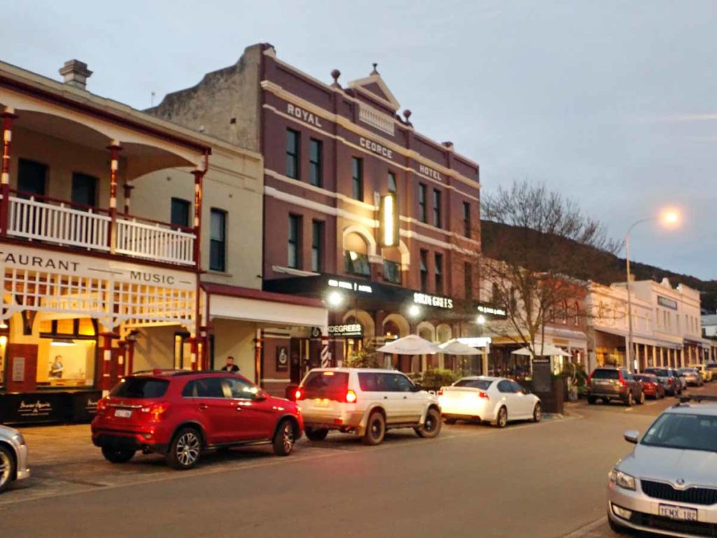
6 Degrees Hotel. The trail head is about 150 metres away and I wanted to be a close as possible to get an easy start in the morning
Albany to Denmark
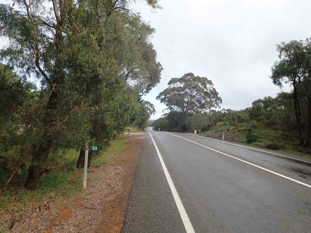
It’s the start of my trip and I’m up early as usual and this morning I head up to the post office and stuff my duffle bag into the post box to go back home before heading back down the main street to eat a full breakfast and heading off for the day. I check out early and head down to the Southern Terminus. After taking photos and doing blog posts I finally get started at around 9:00 am which was later than planned and by this time the rain and hail are bucketing down. They’ve forecast 100km wind gusts for today, oh joy. The first part of the trip is on a diversion due to the destruction of the first campsite, Sand Patch, which was destroyed earlier in 2018 by fire. The diversion signage is not that clear in the first 100 metres and at this stage I don’t have my eye in as yet. It doesn’t take long and I know what I’m looking for. I quickly start to look behind bushes as the trail markers are often hidden by regrowth.
Today was supposed to be a relatively short one, for me at least, with my planned trip being around 25 km to Mutton Bird campsite. After reaching that camp just after 2:00 pm I press on deciding to see if I could cross Torbay Inlet, the first of the water crossings, or worst case get a head start on the diversion if it’s too dangerous. One of the main reasons for this choice was that the tide was going to be at its lowest for the whole month on this day and if I leave it to tomorrow it will be an extra 50cm deeper making for a potentially difficult crossing.
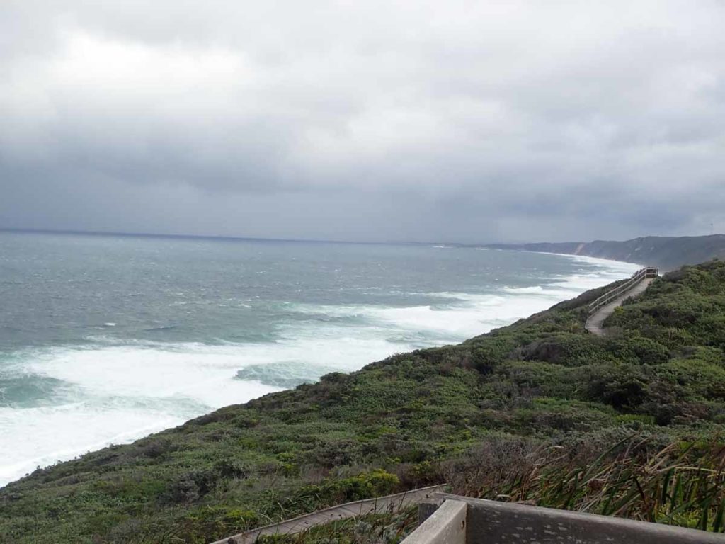
On reaching Torbay Inlet I drop off my pack and spend around 20 minutes working out where to cross and settle on a spot close to where the freshwater meets the ocean as this is where its the calmest and for that matter, the shallowest. The inlet crossing was good with water coming up to just below my knees so after reaching the other side and drying off the whole crossing has taken me just on 45 minutes. I press on heading towards Torbay campsite arriving in the dark after a 37 km day. Torbay remains one of my favourite campsites of the whole trip. It just felt right. The big issue on day one was the driving rain and 100 km wind gusts which hit as I came through the Albany wind farm and connected back onto the trail proper. If I hadn’t been holding onto the railing on the boardwalk at the time I would have been blown over – it was so strong so I braced myself as best as I could and waited for the front to hit me.
Day two arrives. As I’m sitting in Torbay campsite a native rodent bounds in. It looks at me then looks at the camping platform. It’s obviously aware that hikers mean food but just isn’t game to get up and have a look while I’m sitting there. I press on for what ends up being a relatively short 16.5 km day and by the end of it things haven’t gone as planned. On day one I averaged 4.5 km per hour and on day two this had dropped to 2.97 km per hour. This drop in pace was bought about by a number of factors with the main one being dehydration; who wants to drink water in the driving rain? I have found over the years that day two is always my worst day on of any multi day hike so at least I was prepared. I’ve also developed hot spot issues on the balls of my feet and a blister on my little left toe. The issue always affects me on days over around 20-25 km so it was expected. The blister issue is just the weird way I walk. Don’t ask me why but I grip with my toes, I always have done. This hotspot issue will go away after I develop a layer of callousing but that is a few weeks off. As such I need to strap my feet and after doing so my feet are fine (strapping lessons at the podiatrist was money well spent). I call it quits after reaching West Cape Howe campsite deciding I wasn’t going to make it to the next shelter, I’m still on track with my plan though. After setting up camp I eat dinner at 4:30 pm and go to bed for what turns about to be 11 hours of sleep. I must have needed it because I have never slept so long in my entire life before, it just doesn’t happen.
Day three and I reach Nullaki shelter around 1:00pm and have a relaxed lunch and let my feet air. I then walk to the designated pick up point to be picked up by Mark from Blue Wren Hostel in Denmark which is where I am staying tonight. The Bibbulmun Track actually runs through the lagoon at Denmark and the two preferred options to getting to the other side are either by boat (which is seasonal and not operating when I do my trip), or by vehicle pick up. If you are feeling masochistic you can also walk it but the Bibbulmun Track Foundation really rank this as a poor choice. It would have been a very soul destroying 26 km walk and not recommended. The other option is to cross the inlet but agin this option is not recommended by the Bibbulmun Track Foundation.
Denmark is a relatively small town but it bats above average as far as food goes. I had one of the best pizza’s I have eaten in my entire life and then headed to one of the local cafes for a spectacular breakfast the next morning. I came across the first of the south bounders in Denmark at the Hostel who provided some warnings of what laid ahead in regard to the conditions of the beach for the next few days and it sounds bad.
In my three days of walking to get to Denmark the main feature is the wind and driving rain. It stops and starts so its hard to get a good rhythm. This section of track has so much potential and would be spectacular in good weather but you play the hand you’re dealt. The vegetation is coastal heathland and there are very few trees along the coastal zone. The views out to the ocean even in this weather are amazing.
Bibbulmun Track Southern Terminus
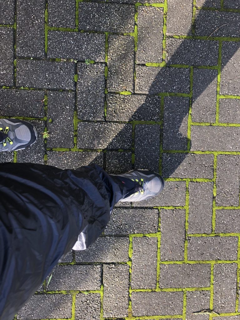
My first step. Only 1,514,755 to go!
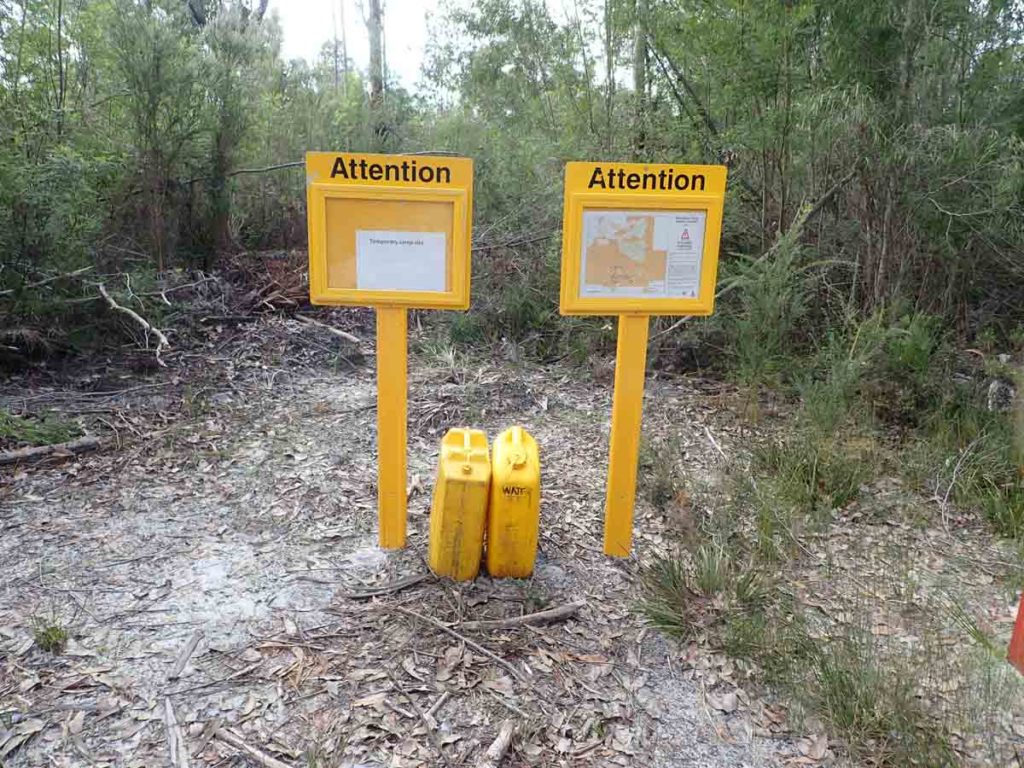
In 2018, prior to me starting this walk, Sandpatch shelter was burnt down when a controlled burn off got out of control. This meant a diversion around this area that required a bit of road walking
Back on track after the diversion. Just after this photo was taken I was hit by the forecast 100km wind gusts(see the approaching front in the background). If I hadn’t been holding on to the railing I would have been blown over.
Bibbulmun Track WA walking the Albany Wind farm. While it rained pretty constantly for the first three days every so often fine weather would come in. This was great spot for some lunch
The first inlet crossing on my 2018 Bibbulmun Track Hike, Torbay Inlet. The crossing only took about 3 minutes but the planning took about 30minutes to work out where was the best point cross. If I had of crossed the next day the water would have been 40-50cm deeper. As it was it was just below knee depth.
Torbay Shelter
Sitting in Torbay Hut on the Bibbulmun Track in August 2018 eating breakfast. This little native(?) rodent dropped in for a look. I could tell that it really wanted to get up on the camping platform because hikers mean food but it was a bit worried about what I’d do.
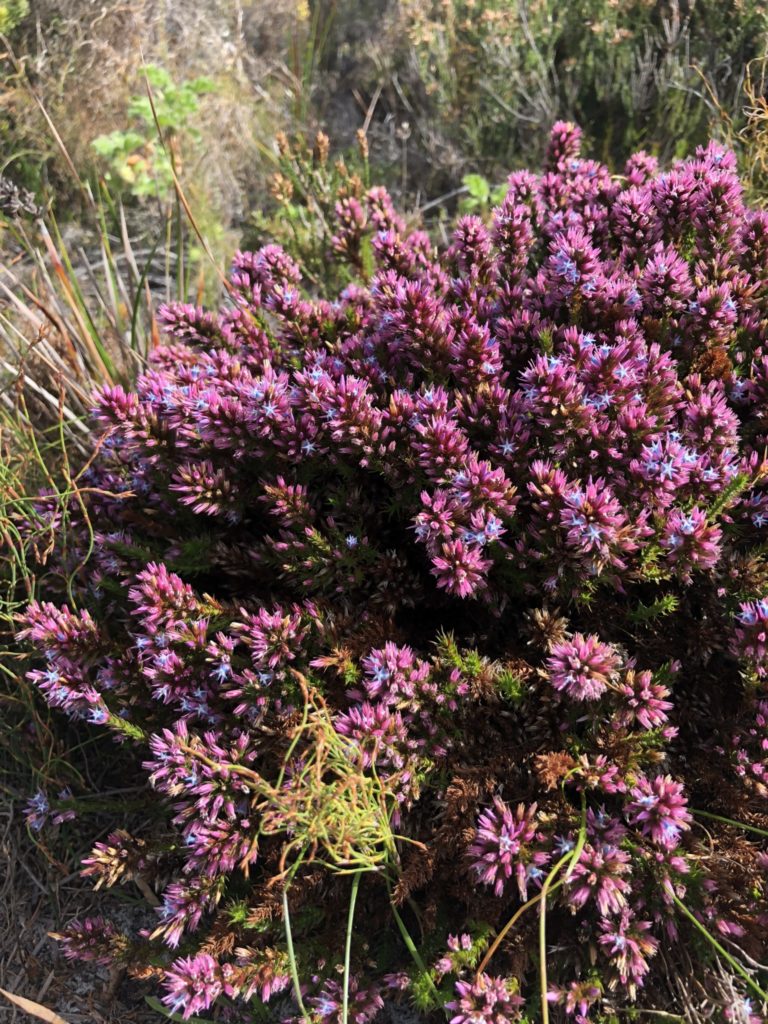
There was lots of colour even though I was early for the main wildflower season.
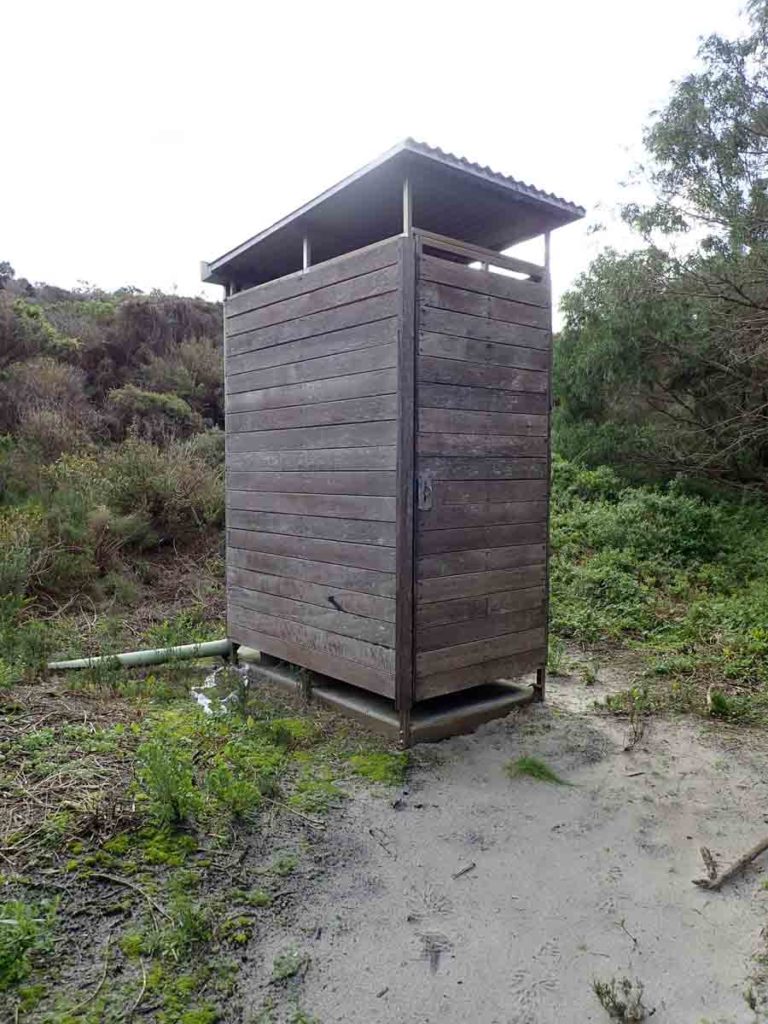
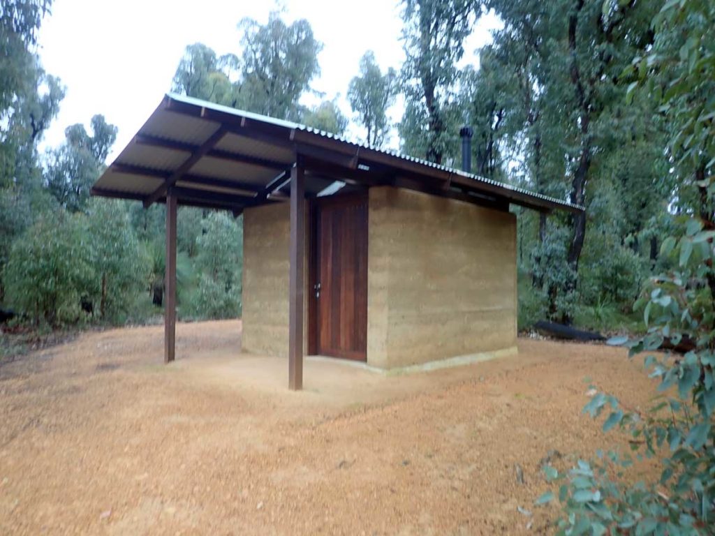
Typical toilet on the trail
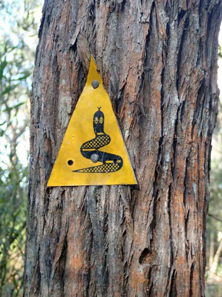
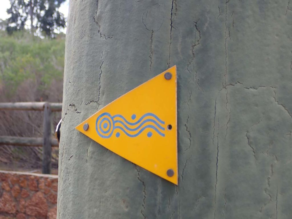
Trail markers. With a few exceptions these markers are extremely visible from long distance at nighttime with a good headlamp
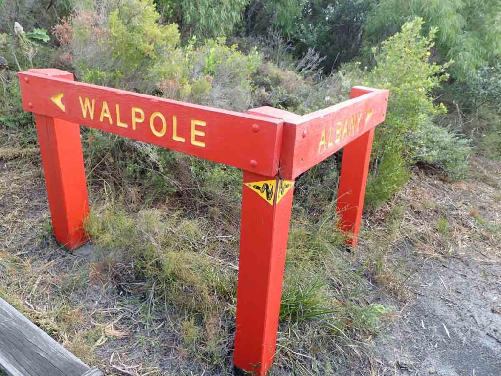
Directional signage
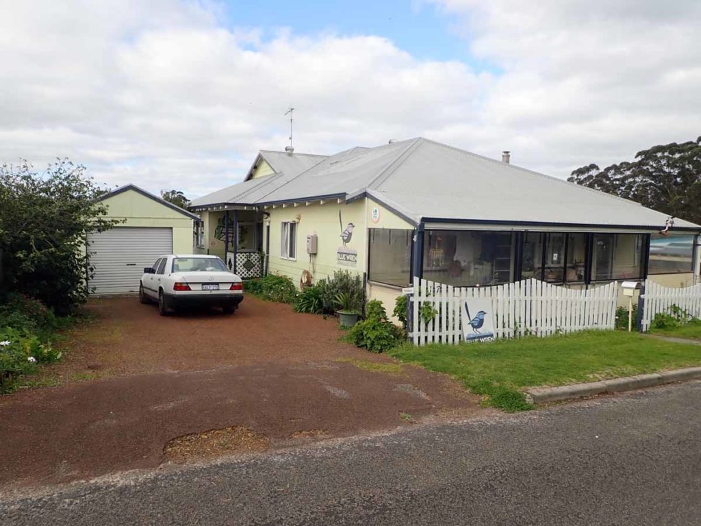
The Blue Wren accommodation in Denmark. They will pick you up on the other side of the inlet and cater very well for track hikers
Denmark to Walpole
I leave Denmark just after 8:00 am heading to the William Bay shelter which ended up being 22.9km away. I’m finding that there is definitely a discrepancy between the online tool for the track and my GPS. Today’s walk was excellent with 19 degree sunny weather and little or no wind so I actually appreciate the ocean views today. The first 8 km of the walk is spent leaving the suburbs of Denmark and from there the trip was upward as I approach the summit of Mount Hallowell. The views from the high points are excellent but I’m just not a peak bagger and find it irksome sometimes that trail designers always have to walk up the highest peaks they can find. I know many people like this but I’m not one of them.
On the journey to the William Bay shelter I pass through Lights Beach and as warned, the large sand dune that leads off the beach has been fully washed away by the recent storms. The damage done to the beaches along my walk so far is phenomenal. I work my way up through an adjacent area just glad it wasn’t snake season but there was no other option. The walk from here was uneventful but did involve sections of very soft sand going up hill which made for hard walking. I made it to William Bay shelter at around 2:30 pm and given my next stop was 20-30 km away, decide to call it quits. My feet have been fine today with the strapping and I seem to be settling into a regular pace and rhythm but I’ll see how I maintain this.
I settle in for the night, had dinner, and am asleep by around 6:30 pm. I’m not eating as much as I should but have always found that for me, exercising is an appetite suppressant so I need to force myself to eat to maintain fitness. I have already tightened my pants twice since the start of the walk so I know I’m steadily loosing weight.
It’s morning again and I’m sitting here in my sleeping bag having breakfast and writing for when I can get enough data signal to post. Today I’m heading towards the Boat Harbour campsite which should be around 21km away but I also have to cross the Parry’s Inlet. Given the high tide and the strong winds that started about an hour ago, I’ve decided to opt for the road diversion. Once I reach the diversion point there is a sign saying the beach was dangerous and to take the road so good planning on my part. I could also see down to the beach and even though it wasn’t high tide, the water was coming very close to the dunes and there would have been nowhere to go in case of a freak wave.
Long road walks and not so exciting. I keep passing lots of tempting food stores which luckily are closed as it is too early. I connect back with the main track just past Parry’s Inlet and head on to Boat Harbour campsite, all be it a bit slower due to the heavy soft sand.
So far I have only come across one southbound hiker and that was in Denmark. I know there are more people on the trail and I expect to see them in the next couple of weeks. I do however come across my first overnight hikers at Peaceful Bay today and they leave the Rame Head Hut in very good condition, thank you very much. I stop off at the general store at Peaceful Bay and have an ice cream (not a Weiss Bar unfortunately) and a chocolate milk (big mistake). I know that chocolate milk gives me an upset stomach when I exercise so I won’t do that again. The rain hit big time last night and was driven so hard by the wind it was coming through the timber walls. It didn’t last long but I was getting prepared to paddle if it kept up.
View from the summit of Mount Hallowell
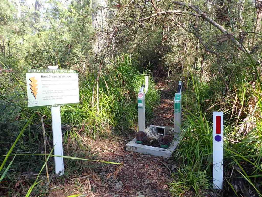
Foot cleaning station minimise the spread of dieback disease. Many of this type that I came across where broken or didn’t work
Peaceful Bay Shelter. You can see how protected this shelter is. Listen to the noise in the video below to see how heavy the rain came in later that night
This video was shot on the Bibbulmun Track at the Peaceful Bay Shelter during the night. The rain was so heavy that the water was coming through the walls of the shelter and given how protected this shelter was I was getting ready to paddle! Thankfully it eased of about 10 minutes later.
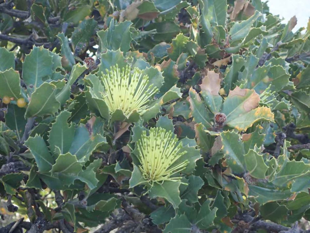
Parrot Bush – Banksis sessilis
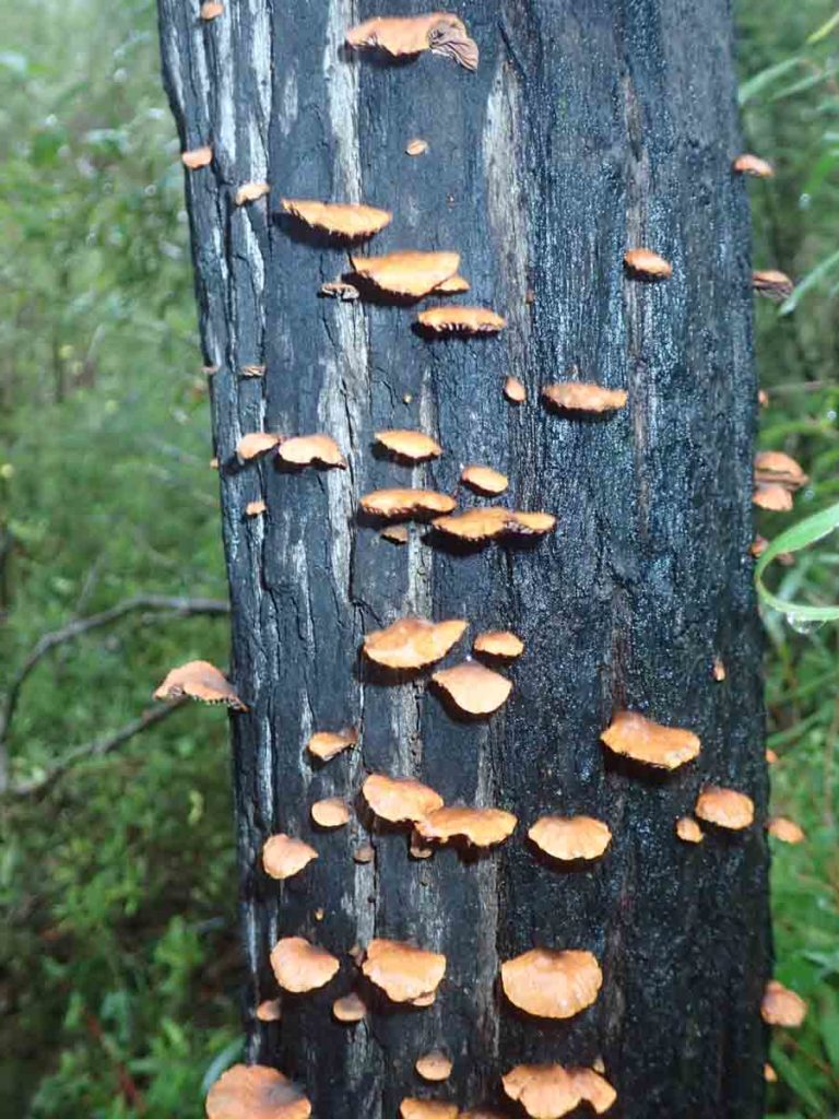
Fungus growing on a burnt tree
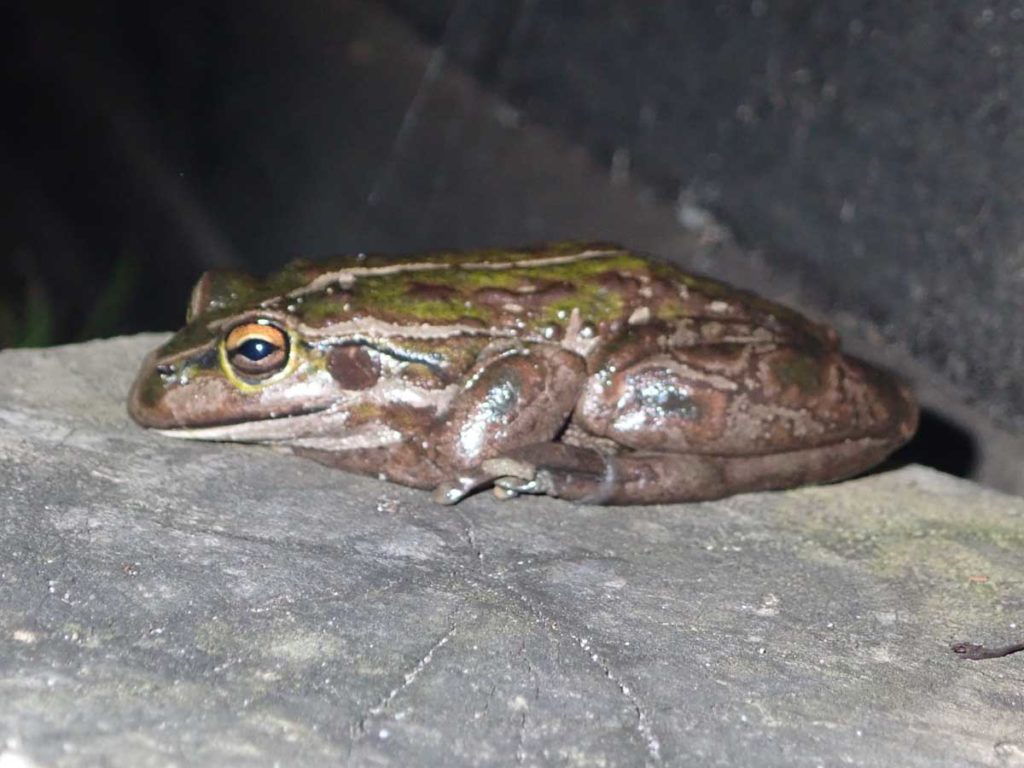
Frog at one of the water tanks. This one only appeared after I filled my water bottle
Irwin Inlet Canoe Crossing
Today was one of the better known inlet crossings and that was the canoe crossing at Irwin’s Inlet which is simpler than it looks. My trip over was a matter of paddle on the right, drift, repeat, and let the incoming tide and wind do the rest. The hardest part was getting the canoe into the shed on the top rack. A small person would struggle. I arrive at Rame Head shelter at just on 6:00 pm after a 10 hour and 40 minute day. This is the latest I will go to bed this trip while out on the trail as by the time I set up and have dinner it is around 9:00 pm. Tomorrow I plan on going to Franklin River shelter which is around 30 km and this will leave me around 20 km to get to Walpole the next next day.
Over the past week I have had some minor changes in vegetation and most notably was the introduction of grass trees to the landscape. Today however I went through some changes of vegetation picking up smaller eucalyptus, before moving through a large burnt out area and then started picking up the big trees and in particular the giant eucalyptus known as Tingles. These trees used to be much more widely spread but are now limited to a reasonably small area near Walpole in south western Australia. While they are tall trees, its the girth on the big remnant trees that can be as much as 400 years and and over 20 metres in circumference that is truely impressive.
I hit this part of the forest around the middle of the day when I have lunch at Giants campsite which for me was the most attractive shelter on the hike so far. I then press on to the Franklin River shelter for the night, another double hut day.
Earlier in the morning I come across a solo female hiker heading south and for the first time on this trip I have company for the night. Andrew, who is in his late 20s is heading south and you can tell he has been on the track for a while as his food intake was leaving me for dead. On the way to Franklin River I crossed over Sappers bridge and while this was closed to vehicles, was dry. I was advised by the female solo hiker I met earlier that when she crossed two days before she was walking through head high foam.
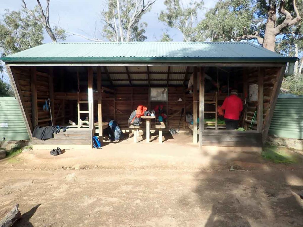
While Giants campsite was the prettiest site I had come across so far, I think Frankland River was close. Frankland River campsite is raised up off the ground due it’s closeness to the river as well as having a covered verandah and wooden floor, Frankland would be my favourite if I had to choose at this point. The toilet also requires a packed lunch as it a long walk which keeps it out of the flood zone.
The day into Walpole ended up being just on 17km. I head off around 7:30 am which is pretty good given I only got up around 6:00 am and my foot taping routine takes me about 20 minutes. Andrew who was sharing the shelter with me the night before, beat me out by about 10 minutes as he continued his journey south.
This was probably the best day I have had so far. While I pass the main area of Tingle trees yesterday it was raining on and off. Today I hit that magical spot with morning sunlight filtering through a light mist down through the tree canopy. It doesn’t last for too long but while it did it was just wonderful place to be.
I arrive at Walpole just on midday and I’m tossing up where to stay and decide to go the motel route. After settling in I do the grand tour of Walpole which is not a big town and more importantly went to the Post Office to see if my food ressuply has arrived. Sure enough it is there which is lucky because while there is a decent sized supermarket, I have worked out what I do and don’t like when I hike. While I would have coped, it would have been a struggle.
I also resupply on gas as I prefer to use the 100 gram size which means it fits inside my Jetboil stove making for a compact unit. I can get around 12 days comfortably out of the little canisters and while they aren’t as cost effective as the bigger ones, you don’t notice the weight.
After a quick lunch it is back to the hotel for a hot shower and unsurprisingly when I look in the mirror I have noticeably lost weight (mmmm another month to go). I spend the rest of the afternoon playing catch up on social media before starting on the week one podcast.
The day after is the first of my planned four rest days and I’m struggling. I feel like I need to be walking and given that the weather is good it makes it all that much harder. Mind you my feet are getting a chance to dry out and my body appreciates the day off. I know in the long term these rest days are worth it but it’s hard to not be walking. I am back on the trail tomorrow again but for the rest of the day I am revising my plans to see if they still work given the wet conditions I’m expecting between here and Pemeberton which is my next stopping point. I may push through faster than planned if it means one less day of walking through water.
Stile over the fence
One of the highlights of my 2018 Bibbulmun Track trip was the giant Tingle Forest. On this day the rain had only just stopped and the sun shone through the mist in amongst the trees creating an otherworldly effect; It was just amazing!
My motel in Walpole. I felt like a bit of luxury
Walpole to Pemberton
I plan on getting away by 7:00 am but as always things go a little slower than planned and I leave at around 7:20am. My plan for the day is to skip the first and second campsite and sleep in the tent at around the 30km mark. As I push on I deciding to make it to Wool Bales campsite for a 39km day which also includes a brain snap where I went off track for about 1.5 km before I realise what had happened. It was purely down to me not paying attention. I soon realised what the issue was but didn’t appreciate the extra kilometres on my biggest day so far. I end up getting to camp at around 7:30 pm which makes for a very long day. Today was my last view of the ocean for this trip and the sun finally comes out and from now on I’m into bushland. I’m interested to see what tomorrow brings as its supposed to be the start of the wetlands and walking through water!
Based on discussions with south bound hikers I wasn’t looking forward to crossing the Pingerup Plains. I had been hearing tales of doom and gloom, and more water than dry land. In fact a female hiker I met in Den=mark hit the Pingerup plain at its worst and said was was multiple kilometres walking through knee depth water. I hit the first of these water stretches just before Woolbales shelter but manage to get around them. Not so from Woolbales onwards. Within 10 minutes of leaving camp I hit the first of many stretches of water that can not be skirted. These water stretches continue throughout the day, some just 10 metres long and others 50-100 metres with most just below knee depth. While this is not my ideal hiking, it is very obvious that it had been a lot worse a week or two ago and the water stretches would have been about twice as prevalent. I think one advantage of all this water is that the snakes have all been washed away.
I had also planned on camping some nights on this section however the amount of water limits this option, hence the push to stay at the campsites. The saving grace is that Pingerup Plains are reasonably flat and it is easy to move quickly. Camping is generally frowned upon on this trail and in fact is prohibited in some areas. Having said that the majority of people I came across were carrying tents and were planning on camping.
The Pingerup Plains continue and I’m ahead of schedule as I push ahead. I overnight at Dog Pool campsite which for a northbounder is the first of the rammed earth constructions. I know there are a lot of social media posts indicating a dislike of these shelters but I think they are excellent. The toilet facilities are really good and weatherproof compared to the old timber outhouses. The shelters just have a nice feel about them. So far for me this is my favourite campsite and this is in rainy conditions. Having said that while I hang my food up to rodent proof it but I leave my silicone X-cup on the table and it is partially eaten by the local wildlife. I’m just lucky I have a spare cup on the bottom of my Jetboil stove.
This afternoon was a bit odd as I leave the Plains proper and am walking along management road. I keep an eagle eye out for a sign to head bush again and I keep on doubting myself thinking have I missed the turnoff? It turns out this road runs all the way to the campsite to avoid damaging fragile wetland. I arrived at Dog Pool just on 6:30pm to find another hiker, Wayne from New Zealand, who has just gone to bed. I am starting to see more hikers as I head north, most of whom are doing an end to end.
At this stage I’m still running ahead of schedule and after a few more wet stretches through the rest of the Pingerup Plains I arrive at Gardner’s campsite which is another rammed earth shelter. The journey here involved a detour around Lake Maringup and the campsite of the same name due to flooding. I had heard about this detour from Andrew whom I came across a few days before but the parks people in Walpole knew nothing. It appears that this diversion was arranged from the Pemberton parks office and word had failed to be sent out. The diversion actually shortened the track by 10 km so it made ‘double hutting’ easier.
I started out walking with Wayne for an hour or so before hitting my daily stride and spending the rest of my day walking by myself. Once I came off the diversion and ended up back on the track, I hit an area of soft sand. This wasn’t really an issue except that some trail bike riders, who decided they wanted to ride the Bibbulmun Track, had badly chewed up the track and made things hard going.
I arrive at Gardner’s campsite late afternoon to find three southbound hikers already there. Within the next few hours there are seven of us which is the biggest number of hikers I’ve shared a campsite with so far (and for that matter the rest of the trip).
I’m up and off the next morning and am aiming on reaching Pemberton tomorrow and rather than having a day just on 40km I plan on going past Schafer’s hut by around 5km. This means that for the first time I will be using my tent. I start earlish this morning and am walking by 7:20am. I stop at Northcliffe for lunch today at the Hollow Butt cafe; a pie, two hot chocolates and a coke. Mmmm the lunch of hikers. It was an opportunity to play catch up on social media but given the huge backlog I didn’t get very far, just scratching the surface.
I head off after a short stop for my night time stop. It’s been raining on or off for much of the day and while it’s now dry on the trail there are a lot of fallen trees and scrub which is slowing things down.
Walking through the Pingerup Plains is nice and flat but this area can come inundated after heavy rains. Heres just one example of what I walked through for around 3 day
Suspension bridge over one of the rivers
Nightime walk into Woobales shelter
Diversion around Lake Maringup which was flooded. Note the water can in case you are low on water
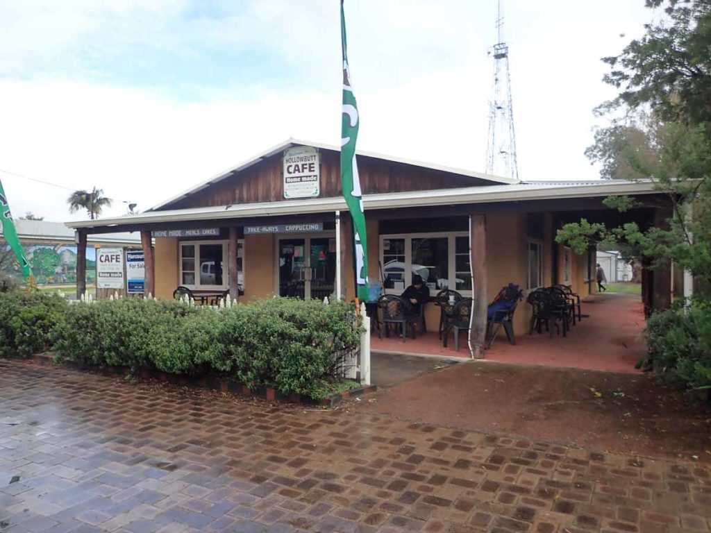
Lunch at the Hollowbutt cafe in Northcliffe. If you plan on relying on. this cafe check their Facebook page to when they are open
Pemberton to Collie
After a much appreciated break it was back on the trail again as I head out from Pemberton. So far in my journey this is the best maintained section of trail. The first section was on management trail that left Pemberton and wound its way through the local arboretum but this wide clear trail continued for a number of kilometres and only really narrowed about two hours out from Beedelup shelter.
While the amount of blown down trees would increase over the next few days, this section in the Pemberton area is definitely well looked after. In fact it looks like a machine had gone through at some stage in the past with much of the walking track wide enough for a vehicle. Today is also relatively easy and flat terrain to get through with large trees interspersed with smaller vegetation. Another camping night again tonight but it takes me a while to find a suitable site.

My motel in Pemberton. The accomodation was good but I would have liked something closer as I ended up walking 9km on my rest days due to three return trips into town
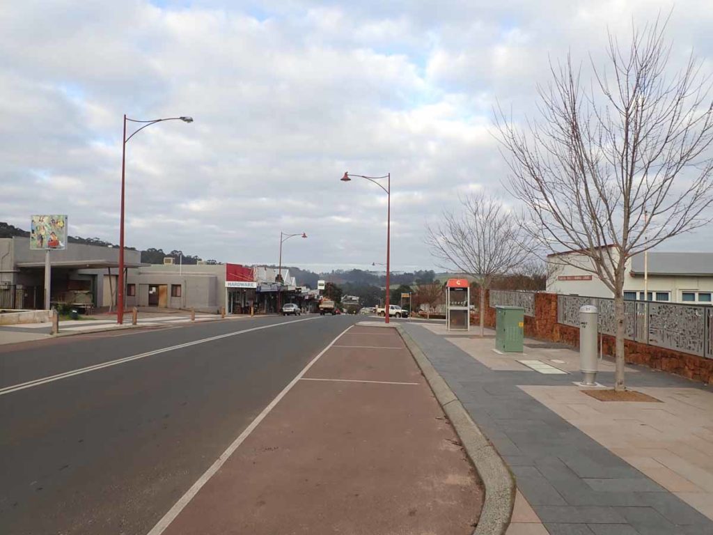
Pemberton main street. One of my favourite towns on the trail
Half way sign post. At the time I did this walk a tree branch had taken out the signage which have long since been replaced.
At the start of this morning I eagerly await the opportunity to take a photo of the half way marker. Purely a symbolic gesture I know but one that says ‘I’m now over the hump’ and have less of the track to walk than I’ve already done.
I am disappointed when I reach the sign only to find an orange post. At the time I wasn’t sure what was going on but I find out later that a branch had fallen down and taken both signs with it. I must admit my disappointment at this surprised me as I usually don’t care about the symbolic aspects of a walk but it is a way of marking how you’re going particularly on a walk of this length.
After another nights tenting I time my run into Donnelly River to ensure the general store is open and due to some bigger than planned days, I am running ahead of time. I am expecting to have decent internet signal so I can catch up on my posts but while I can get phone and text messages out, I have no luck with the internet. I was advised to stand outside of cottages 10-12 for my best chance of success.
I had heard Donnelly River was all about the pies and while I’ve already had breakfast, I can’t say no even though it is still fairly early in the morning. So after navigating my way around the tame emus and kangaroos, I make my way inside to what is a store from the past. It just has that old world charm and the wood stove was going. It would have been so easy to stay there.
The pies definitely live up to expectation and while not cheap I am tempted to have a second one. After charging some of my electronics I decide to head off because the rain has already settled in for the day and I don’t want to get too warm and cosy otherwise I’m not going to leave. Donnelly River is a key resupply point for many walkers and the store manager indicated a number of people who had previously dropped off food parcels had come and collected them again due to the wet weather, deciding to do their walks later in the year.
From Donnelly River I head off to Gregory Brook campsite and am startleted when I sit down for a break in the afternoon and another north bound hiker overtakes me. This was Kyle who I had been chasing for the past few weeks and knew I was likely to see him at some point. He was staying at every campsite while I was moving a bit faster on a daily basis. He had left Donnelly River after me and being less than half my age, was moving at a quicker pace even if he wasn’t doing the big distances each day.
Im up early again and it’s another rainy day which had started out so well but didn’t last and I’m plodding my way towards Ballingup. Over the past few days I have had the Donnelly River area described to me as the ‘roller coaster’ and today I find out why. After leaving Gregory Brook campsite I head off on a relatively easy terrain towards Millstream Dam. I’m in my own world and was startled by a wild pig, which is only 1.5 metres away, the only one I’ve seen so far – I quickly look around for piglets just in case she decides to get upset. Luckily she’s alone and after making a disgruntled squeal and shoots off into the bush. As I head down from the dam on management road the rain starts to settle back in and becomes quite heavy. I don’t mind the rain itself but given I’m walking through steep valleys, the low lying areas are becoming inundated from both today’s and yesterday’s weather. I thought I had left walking through water back in the Pingerup Plains but again I’m presented with two long wide puddles that I have no choice but to walk through.
I had been warned about ‘cardiac hill’ in this section as your make your way up to Blackwood campsite and given it is pouring with rain I just put my head down and keep on going. I’m glad I’m going up this hill as it would have been a knee killer on the way down and very slippery.
I get to Blackwood and while this campsite has the potential to be spectacular providing some awesome views to wake up to from your bed, it also has the potential to be a nightmare is the wind is blowing from the wrong direction. I arrive before midday and have a quick lunch as well as tending to my wet abused feet while the freezing wind and rain blows accross the front of the shelter. I’m getting cold just sitting there and it would only take a slight wind change to blow straight into the shelter, making for a miserable night.
I press on to Balingup and arrive just before 5 pm at the Post Office (which also does accomodation). I’m looking forward to a warm shower and a pub meal but am disappointed to discover that due to the medieval festival on the previous weekend, the pub is closed so I make do with another freeze dried meal. The Post Office is basic but good value even when a fuse blows late in the evening leaving us with power but no light.
There are other hikers staying here tonight including a solo male who is testing things out for a thru-hike next year. There’s also a family with two young boys who are doing this section and coping well with the 20 km plus days. This overnight stop was unplanned as I’m 1/2 day ahead of schedule on this section and had planned on having lunch here rather than overnighting.
I leave Balingup around 7:40 am and my mind is churning. I am hitting Collie on Friday for a rest day and my preference is to get in around lunchtime to maximise my town time but according to my plan I have a big day planned for Friday which would get me to town at the end of the day. I decide to ‘double hut’ it today and reach Noggerup campsite which will make for a 44 km day and the biggest day of the entire trip. I know from my training I can do this but if I’d planned this I would have left earlier. The day progresses well, raining on and off as usual (I’ve now been told that not only was July the wettest in over 50 years but that August is now the same). I get to Noggerup around 7:00 pm after night hiking for around 50 minutes.
One thing I discover is that the Wagual signs are actually easier to see at night time where as during the day they can blend in a bit with the surrounding environment. I surprise a hiker with my late arrival and I discover the next day that it’s ‘Pack Animal’ (a well known trail identity). He’s definitely a character and we get chatting about all things hiking. He has very strong opinions about the adverse effects of social media on the trail so I don’t tell him who I am or what I’m doing.
I’m not thrilled about Noggerup campsite, the shelter itself is OK but is very dusty and very easy to get dirt everywhere without even trying. Most of the shelters in this section are also near creeks, rivers and dams and as such the air is very damp and when I wake up all my gear feels damp.
After yesterday’s big day I have achieved what I wanted and now have two relatively short days. Today from Noggerup to Yabberup is around 21 km and I leave Noggerup around 9:00 am after catching up on social media. I dawdle for most of the day but even so I still get to the Mumbulla tavern well before its open and while I was originally going to have lunch there I decide to press on.
Just as I’m starting to look for a decent log to have lunch on, I come across another hiker, Nelson, who is southbounding from Kalamunda. I stop and share lunch and Nelson’s kind enough to do an interview with me for the podcast. It’s definitely a procsss I need to go through when I interview someone and I’ve learned to be careful about coming across as pushy.
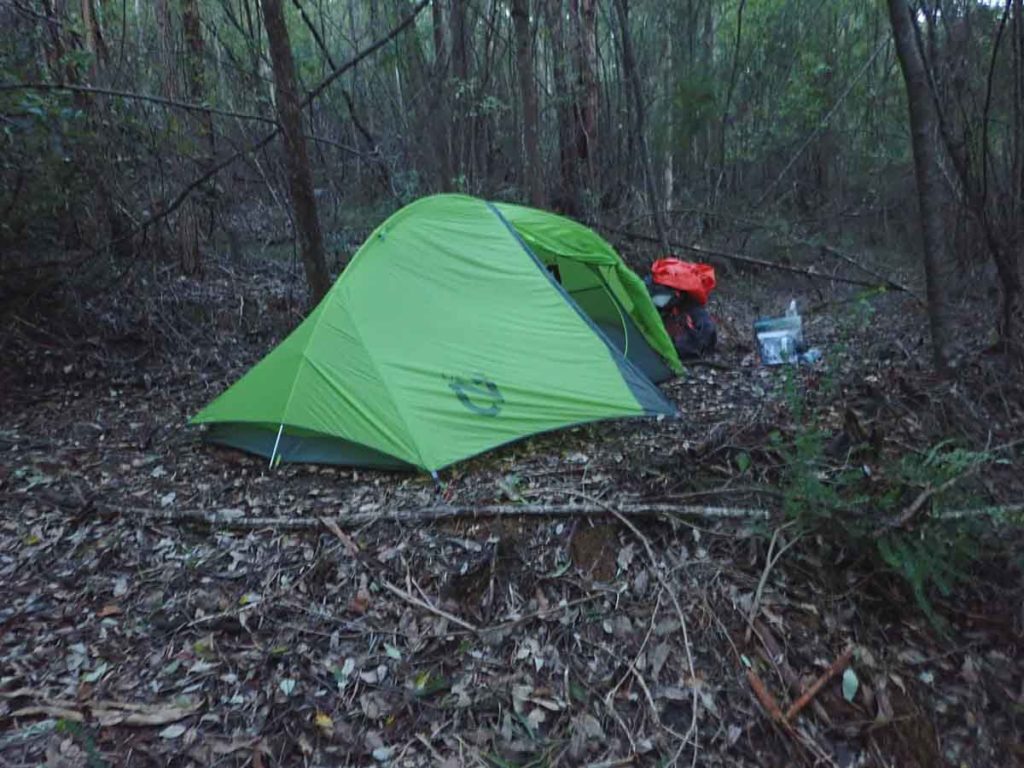
Using tents on this trail is limited. Check with the WA park service where and when you can camp
The view out from Yabberup campsite
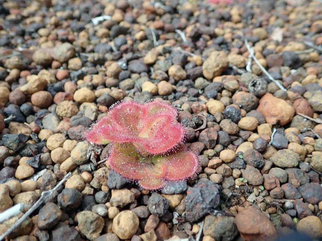
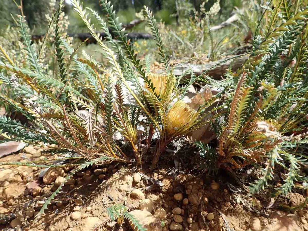
Sundew on the trail. Sundews were on most of the tail but with all the rain I struggled to find one to take a photo of that wasn’t covered in dirt
I press on to Yabberup campsite and come across another hiker who’s doing his last section on what will be his third/fourth end to end. Tom is 70 years old and I’m in awe of these people who are still out there doing big days – I hope I’ll still be doing the same when I get to that age.
While the landscape has changed over the past week, when its pouring with rain you tend not to focus on this. Today I really noticed the forest is now only around 15 metres in height which is a change from the big Jarrah and Kari trees that have been my companions for the past few weeks. I like Yabberup campsite, it just has a nice feel to it and is one of the few in this section that isn’t close by a creek.
My run into Collie throws me as I’d geared myself for a day that was only around 16 km in length and had planned to arrive in Collie just after midday. The day just never seemed to end and I discovered that the app I am using which usually works really well with trail distances, doesn’t work so well when you go off trail. Collie is one of those towns that isn’t on the trail so by the time I arrive at my motel at 1:00 pm I have done around 22 km. Not a problem but I just hadn’t mentally prepared myself for that distance.
After checking in I head into town for lunch to purchase town food and to purchase some gas for my stove. One thing I just don’t get is the love of the 230 gram /440 gram canisters in this part of the country. I am seeing hikers carrying multiple cylinders and only getting five days. I only have two hot drinks and a rehydrated meal each day so will get 12 days out of a 100 gram cylinder on my Jetboil stove. I’ve struggled to get 100 gram gas cylinders and while the Collie store usually carries them, they were out at the time I needed mine and had to opt for a 230gram cylinder instead. The rest of the afternoon is spent doing social media, washing and resting.
One of my biggest concerns for this trip was weight loss. I know from personal experience that for a typical two week trip I loose 7-8 kg. I was deeply worried about the impact of a 5-6 week trip. On my Bibbulmun trip the only gauge I had was the adjustment strap on my pants which indicated I’ve lost around 10 cm off my waist. The other indication is when I get to town and see myself in a mirror. I always loose upper body muscle on a long hike and this one is no different. While I don’t have a set of scales I estimate I’ve lost over 10 kg with two weeks still to go. The two issues I have are I’m burning around 5,800 calories a day and being physically unable to eat/carry that much food and also that exercise is an appetite suppressant for me so I don’t want to eat.
My town stops are different and I will gladly choose fat over sugar so stock up on mouldy cheese which is my pig out of choice.
This last section I’ve just completed see’s me loosing the giant trees and now I’m into forest that reminds me more of my local areas in NSW and the Canberra region. The vegetation has become drier and there’s now less scrubby undergrowth on the forest floor.
I decide to stop hiking around 5:30-6:00pm depending on when I find a suitable site. I find a good site but it’s in the bottom of the valley, surrounded by tall trees so even my satellite signal on my Garmin is not getting through. I manage to get my tent up and my gear inside just as the rain sets in. It’s an early night again.
Today my journey from my overnight campsite into Pemberton is not the longest of my trip at just over 31 km but it’s probably the hardest. I find a better campsite than the one I used about 500 metres away just below some powerlines. The next campsite is a further 5km away. The amount of downed trees is slowing things down and while some of them are easy to get around, others are so big or bushy that the easiest option is to head bush to create a new trail. Today is also full of hills, lots of hills. As I walk up the hill towards the Gloucester tree all I can think of is I have to go down this hill. Thankfully Pemberton is pretty well on a plateau so the walk into town is reasonably flat.
I get into Pemberton just before 6:00pm but manage to miss the local supermarket. After having a shower and getting changed I head into town for dinner and discover the Treehouse Wine Bar. This is a real discovery as the food is spectacular. I usually go for simple dinners in town and will do so tomorrow night but was very happy with my Marron and Whitebait for dinner, washed down with the local alcoholic ginger beer. Over the past few days I have been eating more and more of my food allotment although I have definitely lost weight. I’m guessing here but estimating around 7kg so far and still going. I am planning on playing catch up on my social media tonight but decide that sleeep is more important.
I spend my second scheduled rest day, this time in Pemberton. I have now completed 40% of the track and I’m a day ahead of schedule but realise this can change just as easily. Even though its a rest day I realise I picked the wrong hotel as my three trips into the shops ended up being just over 9km. Like my last rest day, this is a chance to catch up on social media and my podcast, eat some fruit and just relax before kicking off tomorrow for my biggest section of the trip.
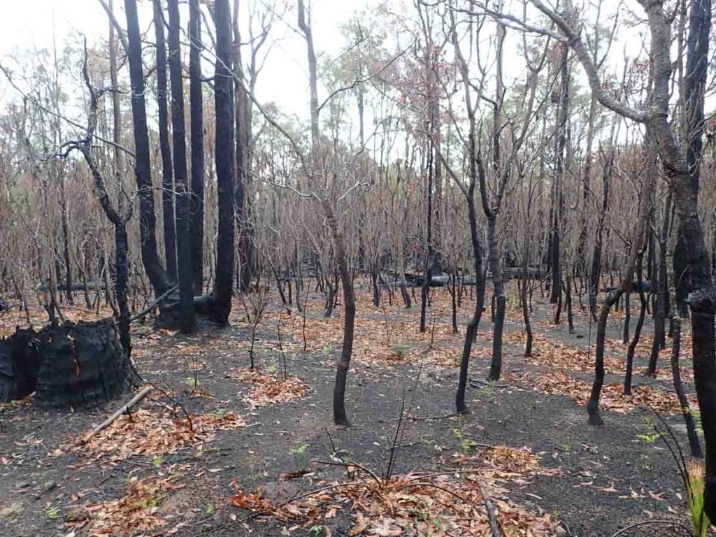
Burnt forest makes it hard to follow the trail. I soon realised that to find the trail I just needed to look at where the leaves were as they collected in the trail indentation
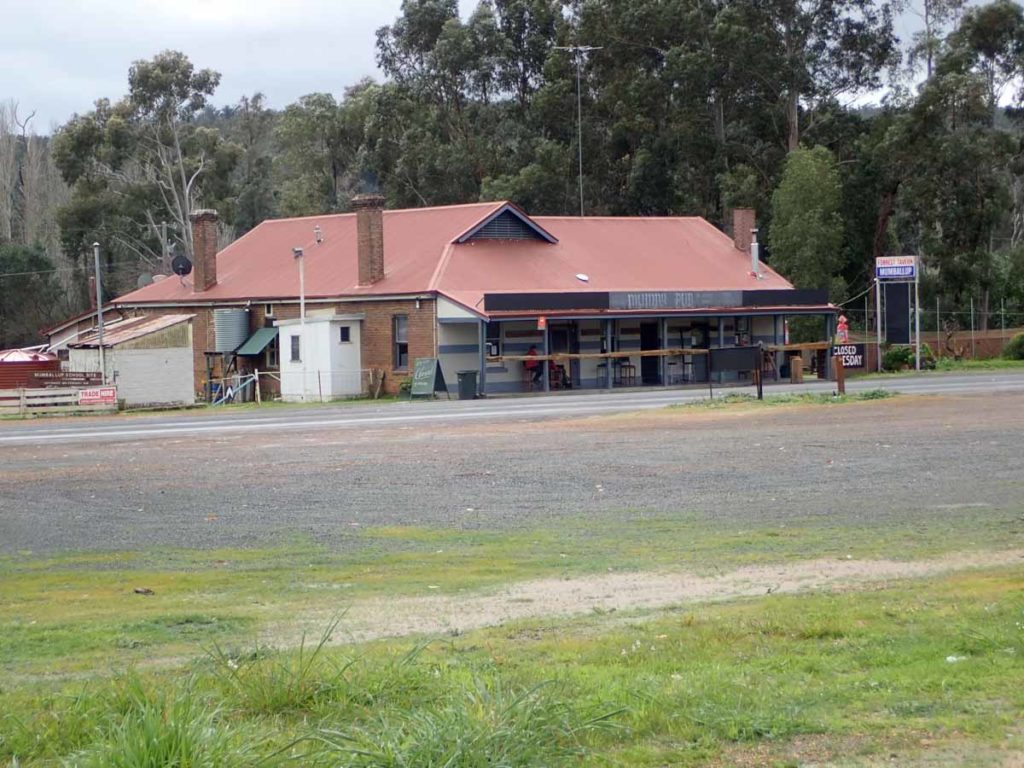
Mumbullup Tavern
The Donnelly river Village has the best meat pipes on the track as well as some very friendly wildlife
Collie to Dwellingup
I now have less than two weeks, 341km, left to go on this trip barring any accidents or injuries. My body is holding up well apart from the weight loss and this next section into Dwellingup is the shortest of the trip although the days are all big. I also have another rest day planned in Dwellingup before the final run into Kalamunda.
It’s another early start as I head on to Yourdamung campsite which gives me a 34km day. and one of the best day’ of the trip. The weather was sunny and warm without being hot, the vegetation was the drier type that I prefer and in addition it wasn’t too dense which means you could see the woods for the trees. The wattles were also flowering. Everything just felt right. The Tingle forest in the south still ranks as the highlight of the whole trip but this is a very, very close second.
The terrain today is pretty easy with very few hills so I arrive shortly before 4:00 pm. The days are getting noticeably longer now and it’s not getting dark so early. While I really like the atmosphere at Yourdamung campsite what I don’t like are the mosquitos. I noticed them buzzing around in the middle of the day at the Harris Dam campsite which was not a good sign and Yourdamung was even worse. I stop counting the mosquitoes I had killed when I got to 20 – I gave in and put my my tent inner over my face which solved the problem. There were more mozzies at this site than every other night put together.
During the night the temperature also dropped to the coldest on the trip (I was comfortable in my sleeping bag) but it did get rid of the mozzies. For once I wished to be sharing the campsite with someone so they could take their share of the mozzies! I leave Yourdamung after a good sleep which for me was 5:50am to head to Dookanelly campsite. My morning continues on pretty much the same as yesterday with very similar vegetation and the terrain is also similar but with a few more hills to keep me on my toes.
Throughout the day I cross a few open wetland areas but I don’t get wet feet although this may have been different after a period of big rains. Over the past couple of days I keep coming across these random little newly constructed bridges and while appreciated, they don’t seem to have a reason for being there. I discover later that these are gradually being put in to improve the track but at the moment they’re just random. While they skip areas that would be wet in the rains, they don’t cover all the wet areas.
Today was my biggest day of this section covering just over 40km. This wasn’t originally planned but I like having a short day into a rest stop to maximise town time. So all things being equal my day into Dwellingup will be around 15 km. I arrive at Dookanelly campsite around 5:40pm and find I am sharing the campsite with a family of three consisting of a son and dad (doing this trip for his 70th birthday) and mum who has come for a visit.
Dookanelly shelter is large for a timber shelter with full timber platform between the bunks and is situated in a forest of tallish trees. It has a good feel to it. Another early, and warm night.
As much as I try to get away at 7:00am it’s just not happening but I am taking my time to be quiet and not disrupt the other hikers who are stilll trying to sleep. I get away at 7:25am with full rain gear and it’s a good move as all the foliage is sopping wet from the previous nights rain. As much as I loved the last couple of days hiking, I loath this morning’s hike. Everything is wet, the path is overgrown and I’m not a fan of the riverside vegetation. It’s everything that the last two days weren’t.
I reach Murray’s campsite before midday – this is a nice campsite and I would be very happy to stay here as the early morning views of the river are spectacular. I’m joined by a crow and keep a very close eye on my gear as it’s inching it’s way towards my pack and food which is on the table. I head off at 12:30pm and things improve, the vegetation is back to what I like, drier and less dense. This afternoon sees me walking the crests of the hills although there is one huge hill on the trip to Swamp Oak campsite and if my fitness hadn’t improved I would have said that this was the hardest day of the trip. Its definitely the steepest part of the trip if doing it in a northbound direction but as it is, I’m at my peak fitness and I only stop to take a drink.
I get to Swamp Oak campsite around 5:00pm which is about the same time that it took me to do an additional 6km yesterday so it shows how much the hills have slowed me down. I’m sharing again tonight with two others including John who I came across near Denmark in the first week of the trip who was doing another section.
Ground cover Banksia
The hut is quite nice with two bunks and a table down the middle but it feels just right. I settle in for the evening to chat. Due to the weather it’s hard to get large maintenance vehicles to any of the huts and the toilet at Swamp Oak is full, just like Dookanelly so a portal has been installed temporarily.
Today I lingered at Swamp Oak as I only had around 12km to travel and couldn’t check in to my hotel until midday. I end up leaving at 8:30am which is a late start for me and as usual its raining again but this time it quickly disappears. I travel the distance slowly and arrive in Dwellingup just before noon so It’s my snack of choice a Coke Zero and a Weiss bar before I head a short distance down the road to check in. I have a shower and wash my hiking clothes before heading back up the short hill to the Blue Wren cafe for a very nice lunch. My food parcel has arrived including my new insoles which are now overdue. I head back to the Hotel and sort all my gear out before heading the the hotel proper for a great curry dinner. Tomorrow is a big day of eating to fuel up for my final run back to Kalamunda. Given the quality of the food it wont be hard to eat up big.
Picnic are at the base of Harris Dam just outside of Collie
My type of forest outside of Collie for about 1.5 days
Mumbullup Tavern.I was way to early for lunch so pressed on as the tavern opens at midday
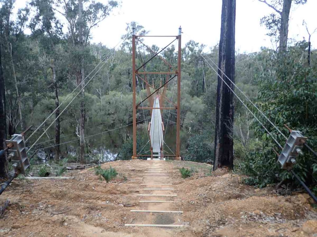
Suspension bridge over the Murray River
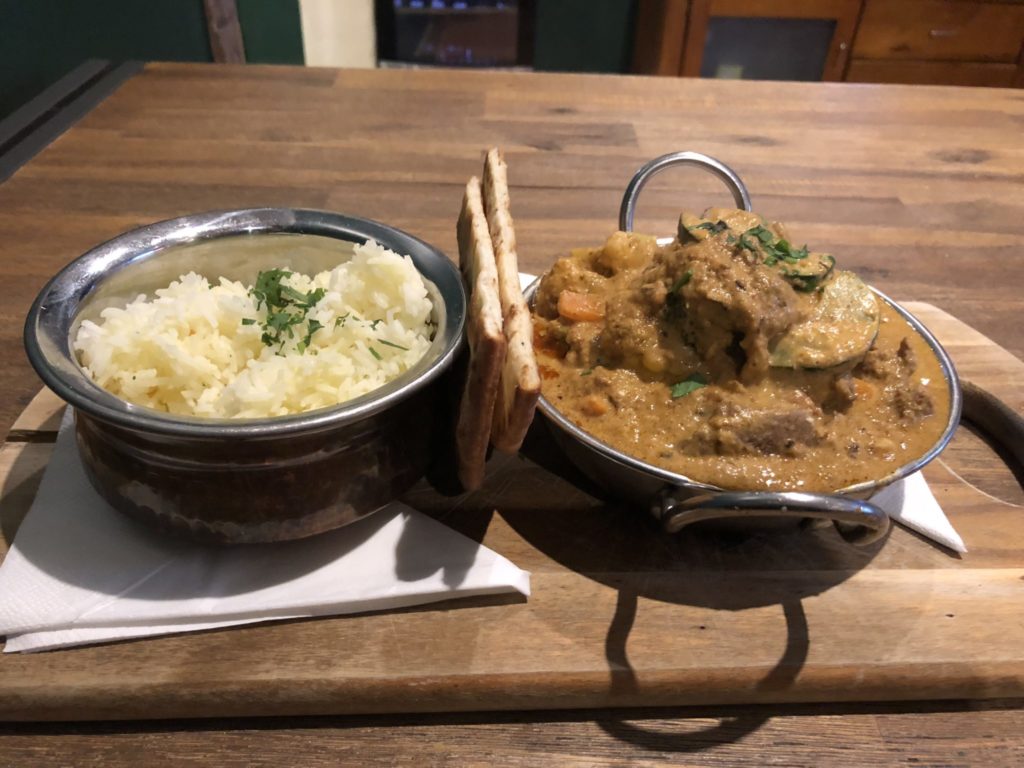
Curry at the Dwellingup Hotel
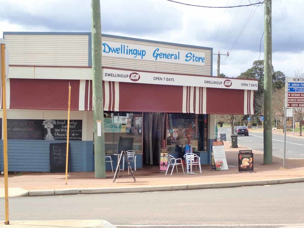
Dwellingup general store
The visitor centre stocks camping food
Dwellingup to Kalamunda
I spent this morning doing the podcast in between eating breakfast and lunch at the Blue Wren Cafe and then this afternoon starting to pack for the walk to Mount Wells tomorrow morning. Then it was back at the hotel for a takeaway pizza dinner. I was a bit stunned that they still have skimpy barmaids in WA which would explain the large number of males in the Hotel this evening.
I think over the duration of this rest day I have eaten the equivalent of three days worth of food on the trail which was sorely needed. My clothes which I washed yesterday have finally dried due to some creative use of the room heaters.
Tomorrow is my biggest remaining day of this section of the trip at just over 36km as well as a climb up to the old fire watching station which is the only enclosed hut on the trail. Given that it’s a hard day I’ll be starting at 7:00 am but this will provide for shorter days for the remainder of the week including a shortish day into Kalamunda on Thursday all things being equal.
First day back on the trail after my rest stop in Dwellingup. While the rest days have been good, allowing my body a chance to catch up on some much needed rest in particular my feet, I am finding that each time I stop it’s almost like starting a whole new trip. I find I need to get my head into the right frame of mind. But as soon as I start walking again everything falls into place. Today starts out strangely as it feels like I’m spiralling around Dwellingup and almost reaching the point I entered the town a few days before.
This is my last week of the hike with around 211 km left to reach Kalamunda. Today’s 34.5 km takes me down to under 180 km so each day over this remaining week I will average around 30 km with my last day into Kalamunda being the shortest. Today’s walk was relatively easy as the terrain on the most part was relatively flattish. While I expected the last section of today’s hike up to the campsite on the summit of Mount Wells to be difficult it was actually a pretty easy ascent. I came across a total of six hikers after I left Chadora campsite, including two who are staying at Mount Wells who all said that the walk up the other side of the mountain was much more difficult so I’m thankful I got the easy option for once.
Mount Wells is an old fire watching station so is the only enclosed hut on the Bibbulmun having been repurposed rather than built from scratch. There are two sleeping rooms as well as an indoor kitchen seating area and at best you could sleep may 10-12 people but that would be a real stretch; five would be comfortable. I sleep in the external room which can best be described as ‘Harry Potters cupboard under the stairs’. the advantage of this little room is that I have it all to myself and it’s small enough to keep warm at night.
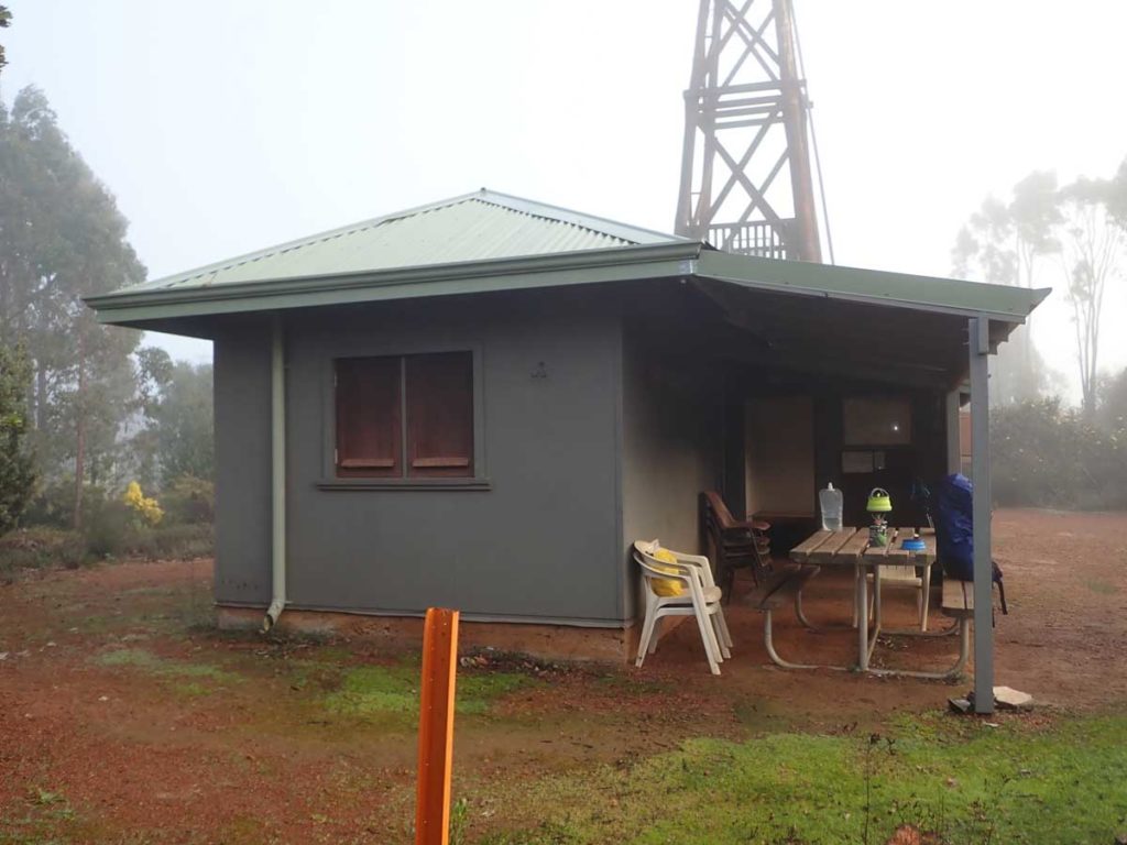
Mount Wells Hut. The only enclosed hut on the entire trail
In talking to one of the hikers I passed today they said there was a mist that rolled in at night and this also occurred tonight. This may also explain why it’s so cold up here compared to the rest of the track. Unfortunately the weather forecast is not great for the remaining week with rain, thankfully not much, being forecast for most of the days.
Its actually noisy up here as the Bauxite mine I passed a few days ago is still nearby and you can hear works happening even from this campsite. It won’t stop me sleeping but it’s still in the background.
It’s the start of day 32 and as of today I have just on 175 km left to go on my Bibbulmun Track adventure. I’m in no hurry to make a start today as I only (only!) have 31 km. But even after I dawdle a bit I get back on the trail at 7:30 am. Today is by no means a difficult day even with the hills but what does make it hard is the terrain which requires me to think about foot placement which is something that hasn’t really been an issue for the past five weeks so this slows me down.
I get to White Horse Hills campsite at 11:30am and there are already two hikers there just finishing a break as they journey from Gringer and head to Mount Wells. I feel like I’m slow today and I am. I past two other pairs of hikers on the way including one pair who knows who I am and has been listening to the podcast over the previous weeks. They introduce themselves and we chat about our respective trips. It sounds like Gringer was busy last night with six people staying there.
I reach Gringer campsite around 4:00pm and there are four scouts staying at Gringer for the night who have been out on a training hike for an upcoming Cape to Cape walk at the end of this month. One of them is happy to chat with me for the podcast and they have been doing some big distances including night hiking over the past couple of days. They finish up tomorrow morning at three Ways Roadhouse which is where I’ll be heading for breakfast.
I discovered last night that the Mundaring Weir Motel doesn’t do dinner on the night I’m going through so I may alter my schedule and put in a bigger day the day before so I get there around lunchtime instead but I’ll work that one out tomorrow.
Internet access has been good all day and I’m finally managing to catch up on my posting. As I sit here doing this post someone is hunting in the distance and every so often I hear gunfire. This is not surprising given I saw eight wild pigs this afternoon. Up until today, I had only seen one.
Today starts with a short journey off track to the Three Ways Tavern. I had planned to drop in for breakfast before continuing on to Mt Cooke Campsite. I arrive just on 7:00 am and I’m informed they can’t do a cooked breakfast until the cook arrives but they can’t tell me that will be. So after a short wait I have a hot chocolate and some toasted Banana Bread and leave the cafe just after 7:30 am. I had been looking forward to the cooked breakfast after hearing how good it was from other hikers but wasn’t willing to wait an unspecified amount of time.
I head back to Gringer and then off to Nerang Hut. The terrain to Nerrang is very flat and I get there in four hours as I’m moving pretty quickly this morning – the sun is out and there is 0% chance of rain; hooray!
Today is Sunday and it’s busy on the track. Over the last four weeks I’ve forgotten what a weekend means and that people actually do things on the weekend. All up I come across 18 people today, my busiest day yet. Of those hikers, 11 are doing a weekend hike, three are climbing Mount Cooke as a day walk, and the remainder are hiking the Bibbulmun end. o end.
One of the hikers I meet just before Nerang tells me that ‘Mt Cooke tore him a new one’ and up until he did that climb he had planned on doing an end to end but was now doing a section hike! I start to worry how difficult the climb will be and get diferent answers from the next two hikers I meet. Mount Cooke finally comes into view and I feel a sense of relief as it’s half the height of my local mountain I walk four times a week and spent the last two months pack training with a full pack. It’s by no means the hardest climb I’ve had on this trip and I only stop once for a drink of water. I realise the comments about this climb had come from someone only a week into his trip. After four weeks on this hike my fitness is the best it’s been in years and my perspective on what’s difficult is very different to those just starting out. However I wouldn’t want to do this climb in the rain and walk over the large rock shelf near the summit as it would be very slippery. The views from the summit aren’t great, in fact they are better from the lower peak. The only real indication you are at the summit is a rock cairn otherwise its pretty uninspiring.
The journey down the hill is slow as I test my footing as I go just to be on the safe side; my knees don’t like downhills. I arrive into the Mount Cooke campsite around 4:15 pm and there is one other hiker there for the night which is now a rarity as I’m expecting reasonably packed huts on the remainder of my nights. I spend a few hours talking to Rick before heading to bed for a sleep around 9:15 pm which is a late night for me. I’m still working on how to pick up half a day over the next three days but will play it by ear. Tomorrow is an option but given its 100% chance of rain I may leave it until the next day with the forecast looking better.
I manage to get away from Mount Cooke just after 7:00 am. My original plan was to stay at Canning campsite tonight but in an attempt to reach the Mundaring Weir Hotel for lunch on Wednesday I decide to make up some time either today or tomorrow and given that Hellena campsite is out of action today, canning seems the best choice. Instead of staying at Canning as planned I pushed through for a 38 km day doing the extra 10.7 km to reach Brookton. This means that tomorrow instead of staying at Bearking, I will instead reach Waalegh campsite which will make for a quicker day into Mundaring Weir on Wednesday.
Today was a harder day than yesterday with the trip to Monadnocks campsite requiring me to summit Mt Vincent and Mt Cuthburt in quick succession. Neither mountain was difficult but the tracks down required careful foot placement which slowed me down although I did reach Monadnocks in under four hours which wasn’t bad considering the terrain and the weather which is again wet on and off.
After filling in the hut book and taking photos, I pressed on to Canning. I only passed two other hikers, both southbounders, who knew who I was and after a quick chat pressed on. A bit different from the 18 hikers I saw yesterday. I’d given myself until 3:30 pm to reach Canning if I was going to press on to Brookton and managed to reach there at 3:00 pm.
Brooketon campsite. This is one of the newer rammed earth constructions which they are planning on amending as they can be a bit exposed in extreme weather. Many people dislike the newer huts but I loved them
Brookton Campsite toilet facilities
The trip to Brookton was reasonably easy with no major hills so I reached the camp shortly before 6:00 pm. I’m definitely noticing the days getting longer. What surprised me was that I’m alone tonight. I didn’t think I’d have a hut to myself for the rest of the trip. Brookton is a rammed earth hut so I feel like I’m rattling around such a large area. I managed to get sopping wet feet today so may break out the dry socks tomorrow if it’s not raining. In the meantime I have everything hanging on hooks at the moment in an attempt to dry things out.
I have a fitful sleep last night due in part to the noise of the nearby highway which was quite busy. I get up at around 5:30 am, have breakfast and pack. I have just on 28 km to do today out of the remaining 66 km. The terrain is not too difficult today but it won’t be a fast day given I have under 30 km to do. And my body is definitely feeling the trip and will appreciate some shorter days.
I leave Brookton at 7:20 am to what is forecast to be a rain free day. I hope so as I’ve put the dry socks on. I think if I did just two more weeks I’d be able to walk on water; anything to keep my feet dry. I’m only 30 minutes out of camp and just cresting a small hill and find I have excellent signal so spend 30 minutes on the side of the trail doing social media and talking to my wife.
The next camp along, Mount Dale, is only around 9 km away and I pass four hikers on the way. Two doing a section hike and two doing an end to end heading south. I realise I have a conflict between hiking and podcasting as there is at least one hiker who would be happy to chat for an interview but all I can think of is getting to my campsite. This is a new conflict for me.
I drop into Mount Dale campsite to sign the book and take some photos and while the camp is OK it’s a weedy environment, not my favourite. I press on and after having lunch on the side of the trail I reach Beraking campsite. It’s a good little site and the views not bad. I had planned to stay here but the extra time I picked up yesterday means I’m pressing on to Waalegh.
Again I realise that the hikers I’m coming across have just started so when I ask about the terrain ahead I have to temper their answers with my experience of the track. My concept of hills and mountains is very different to that of WA locals and after nearly five weeks on the trail I’m supremely fit and power up these inclines. I also find that the new southbounders often ask me ‘how many kilometres did you walk?’ and can’t quite grasp the kilometres I have been doing when i tell them I’m averaging over 30km a day.
The vegetation has changed and there is a lot more in flower than in recent days. Still no snakes yet and I only have two more days to go. The hard thing about this section is the downhill parts – not the slope but the rocky surface – that slows me down. I arrive at Waalegh at around 4:15 pm after a 28 km walk and am very surprised. The image I’d seen of the hut doesn’t do it justice. While the hut is old, small and lacking in features when compared to the newer timber huts, it has breathtaking views of the sunset. This campsite ended up being my favourite of the whole trip.
There are three other people at the hut tonight including a section hiker who was just ahead of me today as well as two southbound end to enders who started a few days ago. We’re all in bed by 7:30pm and I’m gearing myself up for a 6:30 am start so I can reach Mundaring Weir Hotel for lunch. If I succeed this will be the earliest start of the trip so far.
It was the coldest night of the entire trip last night and for the first time I can see the lights of Perth on the horizon so I know the end is near. The sunset last night was a parting gift from the trail and the sunrise this morning was also pretty special so I’m going to have to vote Waalegh campsite as my favourite of the trip. I wasn’t originally planning on staying there but I’m glad I did. The views from the toilet if you leave the door open are also pretty inspiring (the views out at least).
First stop on today’s walk is the Helena campsite which burnt down earlier this year. I can see down to the campsite and it looks like they’ve cleared all the rubble away but it was hard to be sure. Helena is in the middle of a large burnt out area and the hiker who was evacuated just before the hut went up was very lucky as there would’ve been nowhere to go. I don’t mind the burnt areas as it is all part of the natural cycle and I love seeing the new growth come to life. For those orchid lovers it also makes them easier to spot when they don’t have to compete with other growth but this will change soon enough with a bit more warm weather.
I press on to Ball Creek campsite and it is not a bad little campsite very open and spacious which is a good as it’s the main stopping point with Helena gone. Two other hikers turn up a few minutes after me and after a quick chat I head off. In total I pass six other hikers today and including one of my camp mates from last night, there will be seven at Balls tonight.
Mundaring Weir Hotel
I reach Mundairing Weir Hotel at around 12:45 pm and eat up big. The food is excellent but I feel a bit bloated eating greasy food after a relatively healthy diet over the past five weeks. For some reason I’ve discovered mandarins over the past few months and while I’ve always liked them, I’m now craving them so I am looking forward to some fresh fruit and vegetables tomorrow. I’m staying with friends for the next two nights and have been promised a curry tomorrow night which will be very well welcome.
After having lunch with a fellow hiker who I meet at the hotel, and who is starting his journey, I leave the hotel just before 2:00 pm and head on to Hewetts campsite for the night. I arrive at around 3:40pm and potentially could reach Kalamunda at around 6:15 pm but I prefer to finish during the day. Besides there’s rain forecast for tomorrow and why not finish the same way I started; I’ll see how that works out.
The terrain today is uppy and downy (technical terms) but nothing strenuous. It’s still the loose rocks and those damp giant gum nuts that make for treacherous footing so I take my time. I come across four trailrunners this morning and do a double take when I see one of the runners twice. He has gone around the mountains while I have gone over but he still makes me feel like I’m standing still.
I’m still not sure how I feel about finishing and I don’t really think I will know until it happens. For me there was never a doubt that I was going to finish and this trip is about the personal achievement factor, and just being in the moment (for five weeks) it will be interesting to see how I feel tomorrow. As I’ve said previously, my body has had enough and my energy reserves are depleted. This may have been different if I still had another week or two to go but I think physiologically it’s time. Today I taped both my heels as the spot on my feet where the callous meets soft skin hurts and the taping helps immensely. Learning how to tape my feet was the best thing I did prior to the start of my trip.
Two other overnight hikers turn up around 5:00 pm and they are loaded down with all the luxuries including a portable DVD player. They don’t quite last the distance and are asleep well before me. I head to bed at 7:30pm.Last night on the trail!
I have around 10 km to go in the morning and expect to arrive in Kalamunda around mid morning. It’s the 36th day since I started my journey on 9 August 2018 on the Bibbulmun Track. I wake up after a sleep in and today for the first time the realisation I will finish the track today hits me. I have spent the last five weeks living the Bibbulmun Track and this adventure is far longer than the two week stints I have done previously in various locations and even the length and timeframe makes a difference. I have always found on a two week trip that I spend the first week unwinding and then the second week thinking about work the following week. With five weeks there is only the track; I have pretty much lived and breather the Bibbulmun for this period.
I get up and go through a familiar routine I have used for many years. I start the day the same way, and it’s one foot in front of the other; left right, repeat. In fact since I’ve started this journey I’ve taken 1,514,756 steps with my biggest day being just a smidge over 44 km. For the last few days my body has told me that it’s time to stop, but not today. Today my body is quiet, it knows I won’t believe it given that it’s the shortest day on the track; it’s now a mental game. I only have just on 10 km to do but I’m slow to get away from camp leaving at around 8:20 am after chatting to the couple who were there last night.
This is my latest start since the first day and the realisation this is my last day is slowing me down. I want to spend more time on the track, this familiar thing in my life and this 10 km will turn out to be the slowest of the whole trip.
Apart from the late getaway I stop after 10 minutes to record a video. This is something I have been doing every day but today it’s a delaying tactic. The emotion hits me and after 12 attempts to record what I want to say the emotion is getting to me each time so I give up and move on and try again. I eventually manage to record my video, upload it and press on. Just on 2.5 km later I reach the Camel Farm and ‘oh look they sell ice creams’ so I have another excuse to stop.
I finally press on deciding that the trail designers have a sadistic bent as I approach the final steep descent then another final steep ascent to reach the northern terminus that signifies the end of the trail. The ascent poses no problem but again it’s careful steps going down as the last thing I want is to roll an ankle in the final few kilometres as it’s wet (it’s been raining) and rocky.
And finally at 11:30 am I reach the northern terminus; my journey is finished. There’s elation but also a sense of sadness that this trail which has been my life for the past five weeks is now done. At this stage I feel at a bit of a loss. Is this it? Journey over, I’ve completed my first long distance (1,000km+) thru-hike. This track has left an indelible imprint on me, one that I’m not likely to forget ever.
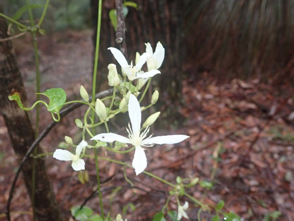
Native Clematis in flower
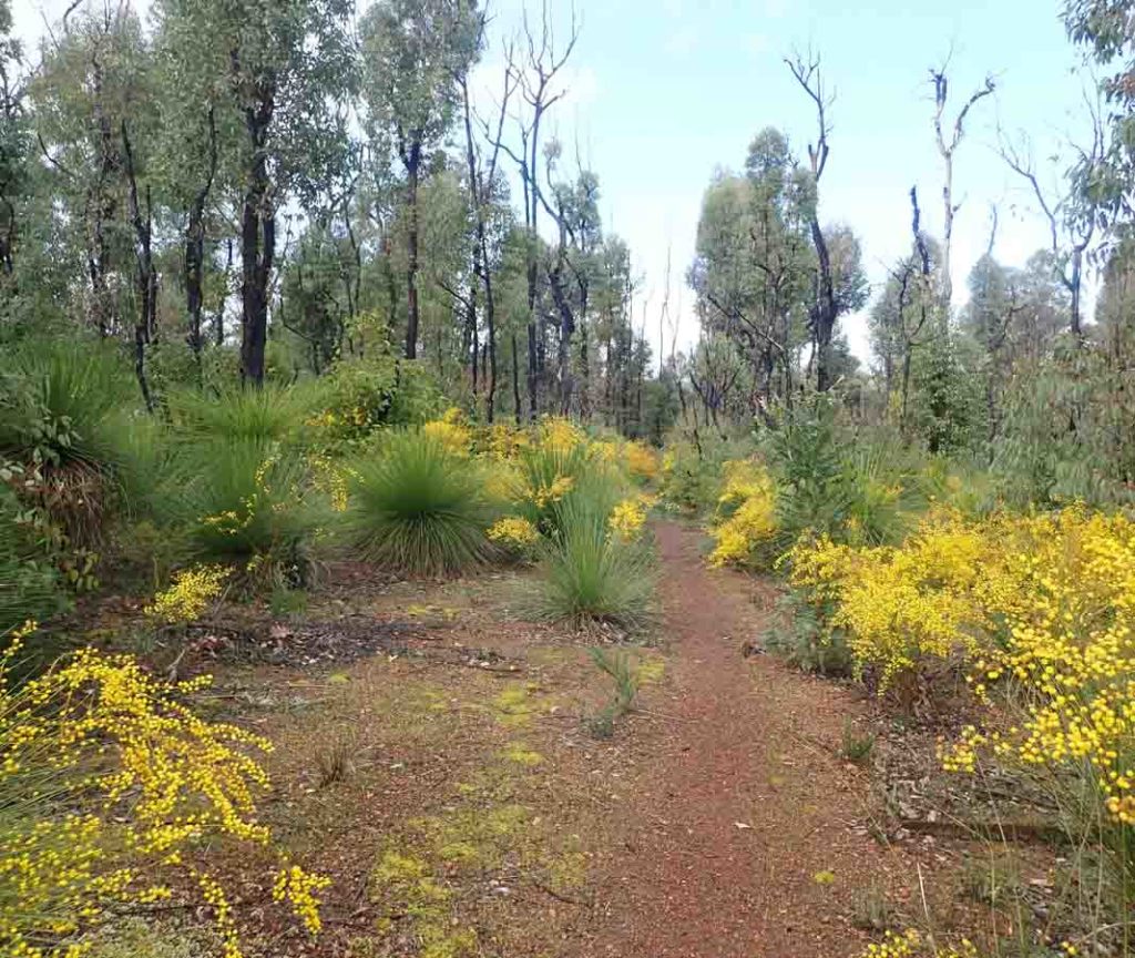
Wattle in flower
Munda Biddi Trail marker which is used by cyclists. This trail parallels the Bibbulmun Track but there are some common sections shared by both trails

Grevillea in Flower
While this shelter may not be the best the spectacular views at Waalegh made this the my favourite overnight spot on the whole trip
Mundaring Weir
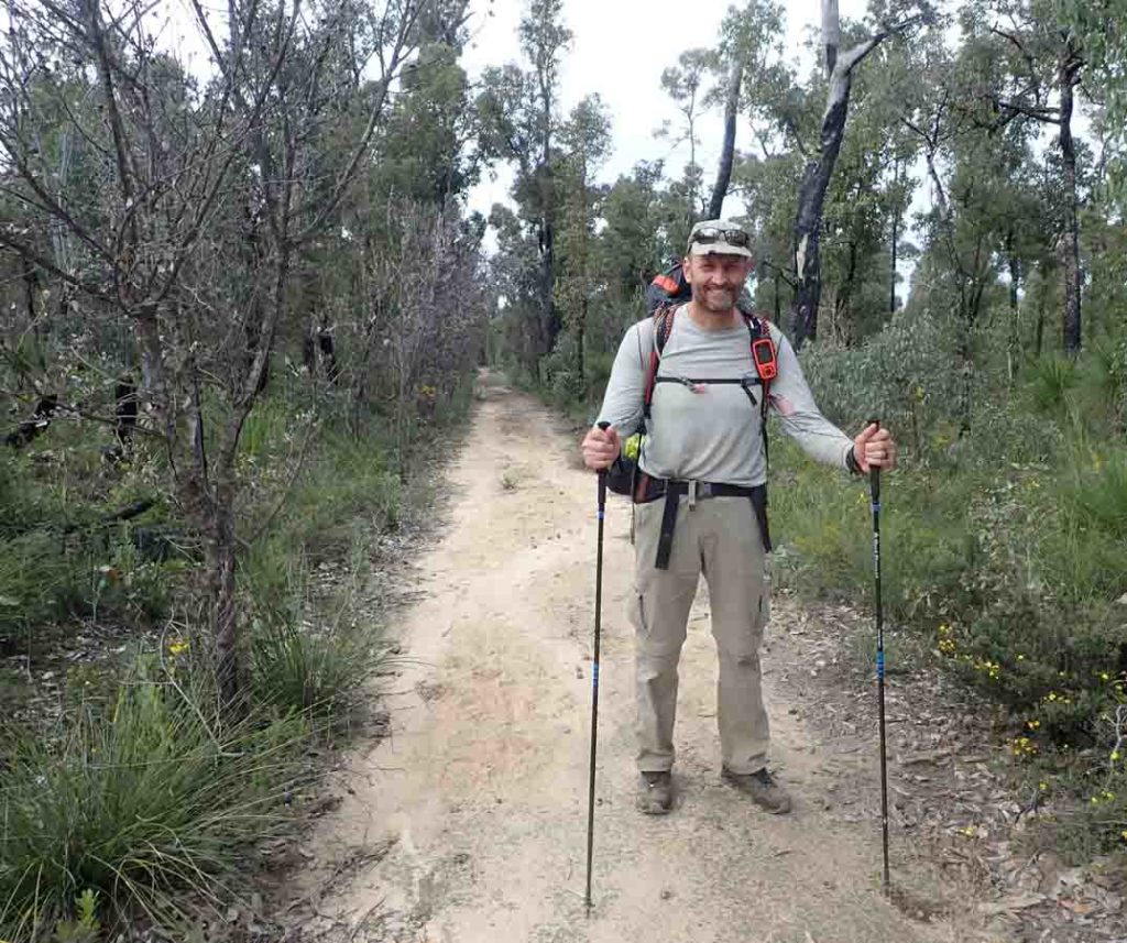
This is the only picture of me take by another hiker on my entire five week trip
Northern Terminus of the Bibbulmun Track in Kalamunda
The Final Word
I have only walked this hike northbound but in doing so I compared every up and down and came to the conclusion that were I to do this walk again I would still choose the same direction. People often argue that starting in the south is harder physically but if you have trained and have the fitness I don’t think this matters. Every southbound hiker I came across complained about the difficulty of the hills leading out of Perth and I think this is just a function of starting a long hike; the hardest bit is going to be the first week or two regardless of the direction you travel.
Everyone’s experience on a trail like this one is going to be different and this will be based on factors such as weather conditions, personal fitness, and personal preferences. For me the scenery on the Bibbulmun Track was good but I have a personal preference for the Australian desert landscapes, such as the Larapinta Trail. Having said that I enjoyed the landscape that went to making up this track, in particular the giant Tingle trees in the south. For me the big takeaway of this trip was mainly in the mental realm. Being able to go allocate a small part of my consciousness to keep me on track and to keep an eye out for any dangers but at the same time to devote much of my mind to just thinking about anything and everything, and to solve the problems of the world as I saw fit. This is what I like about these long hikes.
So overall what did I think of this track? It’s a cracker, and one well worth doing. You just need to decide the logistics and allow yourself enough time to undertake this hike in a manner that suits you. When I interviewed hikers that I came across and asked them what advice they would offer without fail it was ‘just do it’.
Tim's evolution over 35 days
35 days without a shave and around 15kg weight loss. This video record it all.
Things the Guide Books don't tell you about the Bibbulmun Track
- This southwestern corner of Western Australia has an annual rainfall of around 1100 mm a year, most of it during the winter and early spring months. I knew it was going o be wet, but not that wet. Come prepared for wet weather if that’s when you are hiking
- Choose the time of the year for the type of hike you want. I saw no snakes on my trip but a matter of 2-3 weeks later they were everywhere. It was also drier later in the season. Your hike, your choice
- “Wild camping” is frowned upon on this trail and even prohibited in some areas. Having said that this information is not easy to find so it is unsurprising that people aren’t aware of this. Nearly every hiker I came across indicated that they intended on camping in between shelters at least occasionally.
- Phone coverage varies on this trail but if you are on Telstra network you will have coverage regularly through the trail; just dont count on it as an emergency option because it can’t be guaranteed. If you’re regularly hiking in remote areas of Australia use the Telstra network.
- You don’t have to use heavy duty hiking boots to do the trail. Trail runners worked well for me but its your choice. Listen to Episode 5 of the podcast for an interview that on an epic and expensive boot failure story on the Larapinta Trail.
- This trail doesn’t really get that cold. Sure the temperatures can drop below zero degrees Celsius in mid winter but if you have come from a really cold climate then as long as you are prepared its actually quite comfortable
- You don’t need a compass to walk the trail. HOWEVER, you do need the tools and ability to be able to navigate off the trail in an emergency, preferably without relying on electronics
- The trail markers are pretty good on this trail and so long as you pay attention you won’t get lost.
- While there is toilet paper at some of the shelters this is not a given. Bring your own!
Getting there
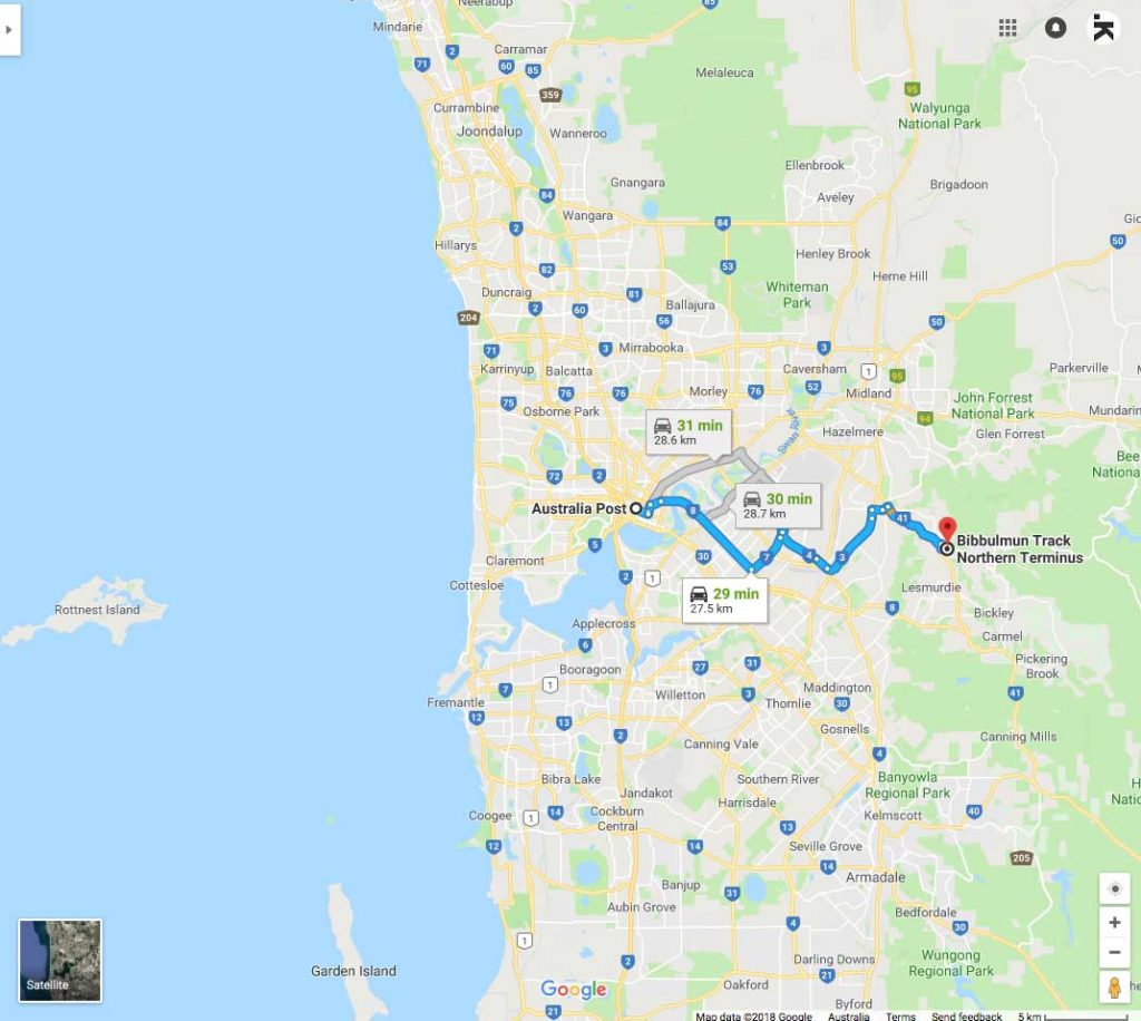
Bibbulmun Track Northern Terminus shown on Google maps. The Northern Terminus is located on the outskirts of Perth in Kalamunda, Western Australia
Bibbulmun Track Southern Terminus located in the Albany, Western Australia
Disclaimer
This track was walked by Tim from Australian Hiker
Last updated
28 June 2026