2022 Great Ocean Walk
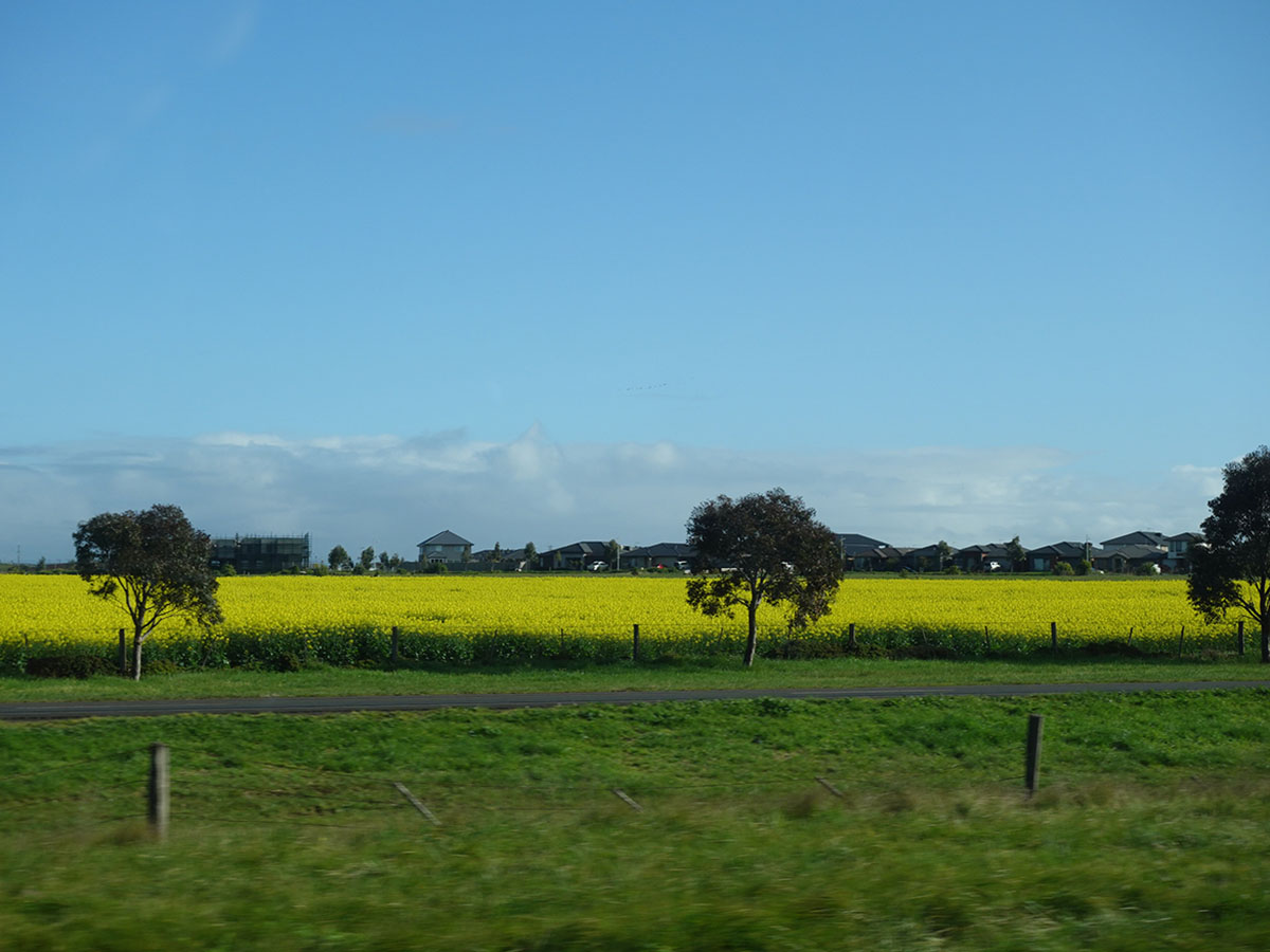 Canola Field in flower
Up early today and we are on the road by 6:45am. It would have been earlier but I wanted some photos of the Twelve Apostles Visitor Centre when the car park wasn’t full of cars but we needed to wait until the sun was up to get some reasonable shots. From there we have a steady drive all the way back to Canberra again visiting McDonalds for our meal requirements – gotta love the drive thru! I also had a small list of photos to take on the way back including the giant wind turbines near Princetown and the myriad of Canola fields along the way that provide a vast sea of bright yellow as far as the eye can see.
The trip home was uneventful and even after having decent showers at the motel we were definitely looking forward to soaking in a nice hot bath. Tomorrow is a day catch up, clothes and gear cleaning and podcast preparation. Over the next week we will release the write up of this trail with recommendations on how to get the best from your experience.
Camping done and dusted on our Great Ocean Walk and all that remains is to pack up our gear and start walking. We had most of our gear packed and we were just eating our breakfast when our dry tent was hit by sudden rain. While I managed to unpeg the tent as one unit and carry it into the kitchen shelter, the fly was again damp. The rain didn’t last long and just in case we donned our rain jackets and headed off. Today’s walk was billed as being ‘easy’ and compared to the past few days it was just that. A day without big elevation changes as we made our way along mainly headland with just the few smallish ups and downs.
Again we had a few muddy areas but on the whole the trail tread was fairly dry and easy to walk along. The first real sign that we were reaching the end of our trip was when we started the downhill approach towards Princetown. The main reason for this town approach was more about using an old bridge to cross the Gellibrand River. Just prior to heading across the river we sat in the sun for a short period and had a snack break before we headed back along the headland making our way to the destination. Eventually we came around a corner and had our first clear view of the well known Twelve Apostles rock formations located along the Victorian coast.
The views came and went and each time the Apostles came back into view they increased in size and the distanced shorted. One of the biggest surprises for us was coming across what was essentially the end trailhead and some great views of the Twelve Apostles but we still has around 2.5km to go to the visitor centre. From a previous visit I had a vague memory of crossing under the road via a short tunnel and we came across that tunnel at the end of the Gibson Steps carpark and with that around another 1-1.5km and 30 minutes later we arrived at the visitor centre. The visitor centre isn’t huge containing a small coffee shop/kiosk but the food is hearty and filling.
From here we had a 3km walk up the road to our motel – this was the very reason we picked it being the closest to our trail finish point. Trail done and dusted, long showers, change of clothing and we headed into Port Campbell for another great pizza. All that is left now is a good night sleep before driving home tomorrow.
According to the guidebook today was classified as hard which meant this was potentially the hardest day of the trip. As it turned out, physically this was very similar to yesterday’s hike but with much less mud and that was a welcome difference. The condition of the trail due to rain has a big impact on your speed and you find yourself slowing down so that you don’t lose your footing.
One thing that’s rare about Ryans Den as a campsite on this trip is that you walk into the campsite and then walk back out again. Apart from the section 1 Elliot Ridge Campsite every other site you walk through including Devils Kitchen. This morning we went uphill for the much of the morning past farmland and in all honesty this was the steepest part of the whole trip. Once we reached one of many high points at the back of rural areas we continued along but this time into the Otway National Park. Just prior to this we passed one of the biggest rural properties in the area that hugged the cliff top.
Another thing we noticed was the change in vegetation types; coastal, rural and forest all in one day. On other days we tended to be walking in the same type of vegetation for much of the day. As the guidebook promised, this section of the trail is well known for its fungi and while the main season is over, there was still lots of photos to take.
The mud continued but nowhere near as bad as yesterday and once we moved past the midpoint, the ups and downs became less noticeable with the gradient changing to more gradual.
We arrived at Devils Kitchen at around 12:20pm having walked just under five hours and averaging around 3km per hour. While rain was forecast for mid morning, the sun stayed with us until mid afternoon until the clouds and rain set in.
I managed to stuff up our gas estimate for the first time in a long time. We started the hike with our preferred 100 gram canister that had been used once before. This should have lasted us the full six day trip but due to extra hot drinks on day three, we ran short by essentially one full meal. Thankfully another hiker on the trail had plenty and we were able to snaffle some hot water for dinner and a hot chocolate.
This day for us is the best day so far with the changing landscapes, as tough as it was.
Day 3 was another rainy day with a number of muddy steep sections including one we crossed that was so bad we all ended up with muddy shoes and socks. I’m so glad we dried our socks out from yesterday! This walk was again undulating, although not as bad as it has been over the past few days. We moved along the base of a cliff face, close to the ocean, before we finally came out onto Johanna Beach and our second inlet crossing.
Knowing we had an inlet crossing today we were out of camp early and while we wouldn’t make low tide, we needed to avoid high tide to make the crossing as easy as possible. Gill and I have spent much of our lives in and around the ocean so have always been comfortable crossing inlets, knowing when, and when not, to cross. The Belgium hiker we met at the Aire River Campsite last night wasn’t familiar with inlet crossing so she joined us today. We realised the knowledge and skills in regard to the ocean and inlet crossings generated over many years that we take for granted isn’t something every hiker has. In fact unless you do coastal hiking this may well be something you have never had to deal with (cue new article and podcast for later in the year).
So after the longest beach walk of the trip we started paralleling the inlet and approaching the crossing point just as the heavy rain returned. After watching the wave patterns and water movement we realised the water wasn’t overly deep (less than knee level) but when a wave came through, it did so with force. This required us to pay attention and brace when needed. After completing our crossing it was a short walk off the beach to a nice seating area with views down the beach and the opportunity to remove half of the beach from our shoes that we picked up in the crossing. One thing of note here is that this was the first time I have ever felt the wind blow through my shoes!
We soon headed towards the car park and day area, and after what seemed like a long way away we eventually came to the Johanna Beach Campsite which was perched at the top of the cliff top looking out towards open ocean. There is one particular tent site that in the right conditions, would be the perfect site allowing you to watch the ocean from the tent but it would require little wind and warm weather so it’s more of a summer site. In our case we wanted a protected area out of the wind and picked one of the two sites close to the kitchen shelter which was under the Casuarinas with lots of pine needles which provided soft under-tent cushioning.
We spent much of the afternoon watching the tide rise and fall on the beach and trying to dry out our gear by hanging it all over the shelter. We did get some rain later in the night at around 12:30am but it was light, lasting only for a few minutes so we didn’t have to worry about packing wet gear in the morning. As far as the campsites go, this would probably rate as our overall favourite of the trip, complete with the obligatory family of Fairy Wrens.
Day 2 and another two camp day of roughly 21km starting off at the Blanket Bay walk-in campsite which is where we finished off yesterday, hitting Cape Otway at lunchtime and then finishing off at Aire River in the afternoon.
Today’s walk focused on hitting Parker Inlet at the right time. Parker is one of the two inlets on the walk that could potentially derail our plans but we didn’t do ourselves any favours and just managed to luck it, more on that in a minute.
We left the Blanket Bay Campsite at just after 8:00am in the morning and ideally we should have been at Parker Inlet at low tide but opted for the later start expecting to get to the inlet while the tide was still reasonably low. Within about 100 metres of leaving Blanket Bay we were given a ‘Decision Point’. We’ll talk more about these decision points in the write up; the name implies there is an option but in reality this wasn’t the case. We ended up turning back to the start after 30 minutes when we were presented with a rock outcrop that would require a degree of confidence in bouldering with no surety of what to expect after that.
Once back on the main trail we made quick time and ended up reaching Parker Inlet at 10:30am, 2.5 hours after low tide but given our loss of time at the start of the day, we were happy at how fast we moved. One thing that was going to be reinforced the next day was that this trail does rely on hikers being familiar with, and confident with, crossing inlets. We hit the Parker Inlet crossing, chose our crossing spot and after I stripped off my pants and being the taller hiker, went first and determined that the chosen crossing point was around 70cm deep, mind you if I’d picked the wrong spot this wouldn’t have been the case. Gill followed straight after and we took a 30 minute break for morning tea, allowing our legs to dry off before heading on. While we sat drying off and snacking, we watched as the tide rose about another 30cm from when we crossed and this made us think about the school group that was following.
We continued on past Cape Otway Lightstation and Campground, heading to the Aire River Campground crossing over cliff tops, sand dunes and through bushland, still with the occasional muddy areas but nowhere near as much as yesterday. We spotted the occasional wallaby and multiple birds along the way. Today we came across a large healthy Echidna who as soon as it saw us, shot into the bush which was a bit of a surprise for us as on the Three Capes Track in Tasmania, Echidnas really don’t care about hikers one little bit.
Speaking of wildlife, Gill was walking in front of me and thought she’d seen a Goanna shoot off into the bush. She indicated where it had gone and instead I was greeted by a diamond shaped head, grey eyes and an open mouth which I was pretty sure was a Death Adder of some variety. Sure enough when I checked a few days latter when I had internet access it turned out to be a Common Death Adder which just reinforced that it always pays to look from a distance, with a trekking pole in the lead and not go into an area where you can’t see where you’re putting your feet. Another surprise for us was this day ended up being the warmest of the whole trip and also the sunniest so we were glad we had good sun protection.
The rest of the afternoon was uneventful taking the odd break as we went. Even though this day just seemed to go on forever given our mistake at the start of the day, we ended up walking around 24km rather than the expected 21km. We finally arrived at the Aire River Campground at 4:50pm and were greeted by another thru hiker. We learned our new friend was from Belgium, had been going campsite by campsite and started two days before us. Given our remaining days would be done campsite by campsite, we would finish the trip together.
The Aire River Campground was another of those sites that shared resources with car campers. As much as I loved the hiker’s area, there is a very steep walk down to the toilet and then back up the hill which really made you think twice about the need to go or not. A great day overall!
Today we start our adventure on the Great Ocean Walk in Victoria and rather than doing this walk over eight days as designed we’re doing it in six. Many walks can be done in more than one direction but this walk is a rarity because it’s designed to start at Apollo Bay in the east and finish at the Twelve Apostles in the west. In addition to the reward of this well known set of rocks, the distances at the Apollo Bay end are closer together so the trail is easier in the east and therefore it makes sense to start there and head west. So we have chosen to do this walk over six days by merging sections 1 and 2, and sections 3 and 4.
Having travelled from interstate logistically it made sense to stay at a motel near the trail end and get transport back to the trail start in Apollo Bay. We chose the taxi option which wasn’t the cheapest but given the buses don’t run on the weekend it was our only option. We arranged a pick up from our motel which allowed us to leave the car there for the week. After an 80 minute trip we were ready to go starting at around 9:30 am.
This walk start was a bit of a rarity as we had an Australian Hiker follower, Rob, who was in the area and who joined us for the trip to the first campsite at Elliot Ridge before he returned back to the start of the walk. This section of the walk to the first campsite is approximately 10km long and took us from the trailhead at the Apollo Bay visitor centre, through the caravan park just outside of town, then onto the trail tread. This first half of the trail provided views to the ocean as well as introducing us to the local bushland before reaching the Elliot Ridge campsite. This campsite, we learned over the coming days, was typical of the infrastructure on this trail with the main difference being the vegetation and scenery. The tent pads in this case were bare earth and while this probably wasn’t an issue for much of the time after a period of rain it could get a bit muddy.
After a lunch break we said goodbye to Rob as he headed back while we continued on to our next destination of Blanket Bay. The trip there was a challenge due to the very muddy management road and regardless of what footwear you were wearing, it was super slippery. Tim had a spectacular fall managing to become airborne. Apart from his bruised dignity and some dirty clothing, all was well.
The highlight of this day was hearing two Koalas grunting in the forest even though we couldn’t see them. We arrived at Blanket Bay at around 5:20pm after a total trip of 22km and for this night, we had the company of a school group of about 14 in size as well as another group of 6. The walk-in hiker area of this campsite was attached to a drive-in site and this meant we had approximately a 100 metre walk to the toilet.
As mentioned the infrastructure was almost identical with all the campsites but Blanket Bay just had a special feel about it. The sunrise viewed from the grassy area at the front of the campsite, the small waterfall at the rear of the campsite and the small beach means this campsite had a lot to offer for those not in a hurry.
Today was pre-trip travel day leaving Canberra at just after 6:00am and arriving at our accomodation at the Twelve Apostles Motel just after 3:30pm. The weather gods were with us with a warm sunny day and relatively traffic free roads until we hit Melbourne.
We always take the easy option when we do long drives taking a cup of of tea with us which in my case lasted nine hours (I love my thermos cup) and the day’s snacks but as far as breakfast and lunch goes we make good use of McDonalds.
While I’ve seen it many times before I still don’t get tired of the flowering Canola crops along the way, to me they look like a yellow ocean.
Once we arrived at our motel we offloaded our gear and then headed the 10km drive into Port Campbell for an early dinner, and when I say early I mean 4:30pm. After doing the walk around Port Campbell we headed back to the motel to get our clothes ready for our first day of hiking. All we have left to do in the morning is have a shower, eat breakfast and wait for our lift.
Last night was the final pack (sort of) as tomorrow we head to Victoria for the start of our adventure on the Great Ocean Walk. It is ‘sort of’ because there are still some adjustments to do. Our tent which is the red bundle in the back of Tim’s blue pack needs to have the poles stripped out and put into one of the side pockets which will allow the rest of the tent to packet down to a much smaller size. We also have to set up the podcast on Tim’s iPad Mini as it saves a huge amount of time doing this at home so that will be done this afternoon.
The other logistical thing as part of this pack was to check the amount of gas in our stove canister. It was lucky that Tim did because the one that was sitting with the stove from a previous trip would have lasted at best 2.5 days. It was an easy fix to swap it out for one that was almost full, problem sorted.
All up the fully loaded packs with 2.5 litres of water and food for six days for the two of us comes to:
- Tim 14.80kg
- Gill 12.88kg
The final weeks leading into a hike can be a bit frantic. In addition to getting everything sorted at work and around the house, there’s the getting sorted on the hiking front and for us this falls into two main categories. First there’s the social media and blog related preparations to put in place including preparing for podcasting and posting along the trail.
Then there’s the gear. Last night we collected all our gear into one place. While the majority is very easy to locate, a few things need to be collected from the various hiding holes around the house. They do have a home but in some instances a few of the little knick-knacks I carry may only get used for a few days a year so I have to remember where they live. The image in this post is Tim’s gear all laid out across the couch, inlacing what I’ll be wearing. Mind you, this includes my share of the food and all the shared gear including tent, stove and first aid kit.
I know from experience that while this might look like a lot of gear, it will comfortably fit into my pack. Pulling all our gear together a few days before allows us to identify any shortfalls and means we have time to visit a local store if needed. In this case we pretty much have everything we need so once we do a final pack, we’re right to head off.
The final weeks leading into a hike can be a bit frantic. In addition to getting everything sorted at work and around the house, there’s the getting sorted on the hiking front and for us this falls into two main categories. First there’s the social media and blog related preparations to put in place including preparing […]