Finding water on a hike
Hiking Practice
At home we tend to take the availability of water for granted, we walk to the tap, the fridge, or if we are out and about the store, and drink as we need. When we are hiking, particularly in remote areas the availability of water becomes a more complex issue. For short hikes we may just carry a water bottle or we may wait until we get back to the car or trailhead to rehydrate. For overnight hikes we can often carry what we need.
The problem arises when we start to do multi-day hikes and it becomes impossible to carry all the water we need for multiple days because of the weight and the bulk. It’s at this stage we need to top up on water as we walk. This requires us to know how to find water which may not always be easy.
In this article we discuss options for locating water while on a hike, ranging from the simple to the more complex.
All water is not created equal
The first thing you need two know about using water you find while hiking is that no matter how clean it looks, you are best to work on the assumption that it contains germs or parasites and as such you need to filter, filter, filter!
In walking a section of the Australian Alps Walking Track from Kiandra to Tharwa in April 2019 I counted over 200 horses that were trashing many of the natural water supplies in the area. In addition, if you are hiking in coastal areas many of the water supplies close to the coastline may be brackish (salty) and therefore not drinkable. So while maps or apps may show water it may be a water source you can’t use.
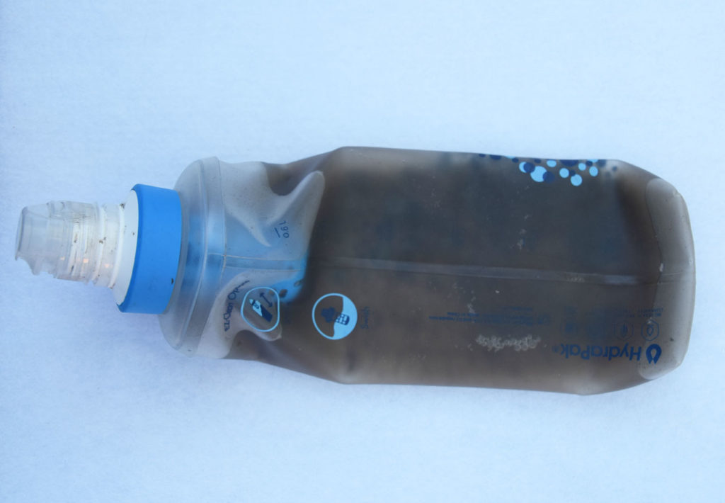
Katadyn BeFree Water filter containing dirty dam water. Apart from being very dirty, this water was also gelatinous and given this was sourced from a rural dam the best way to describe the consistency of the water was ‘cow saliva’
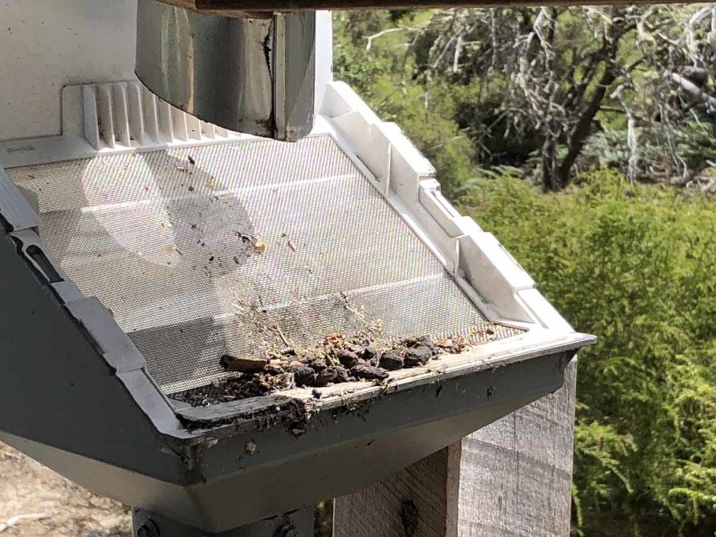
This image shows part of the roof of a camp shelter on Kangaroo Island which feeds into the water supply tank. Please note the Possum poo on the filter mesh. While the large solids are filtered out, germs in this poo end up in your drinking water so again you need to filter
Built infrastructure
There are literally thousands of hiking trails spread throughout Australia ranging from just a few hundred metres to 100+km. Many urban hikes and shorter walks located in National Parks often, but not always, have a high degree of infrastructure including water bubblers or taps which provide water on a regular basis. Some longer trails are also well catered for – the Larapinta Trail has both natural water sources as well as regularly maintained water tanks along the trail. You still need to know where these tanks are and ensure you carry enough water with you to get to the next water source.
We always recommend carrying your own water just in case. On day hikes we will always have two 750ml water bottles in the car to drink at the end of the hike in addition water in our pack bladders particularly on hot days even for the shorter walks.

Water bubbler on trail near the summit of Mount Jerrabomberra. This walk is fairly short and in all honesty carrying a water bottle would get you through this hike however I had if I known about this water bubbler prior to the walk, I wouldn’t have bothered carrying water with me
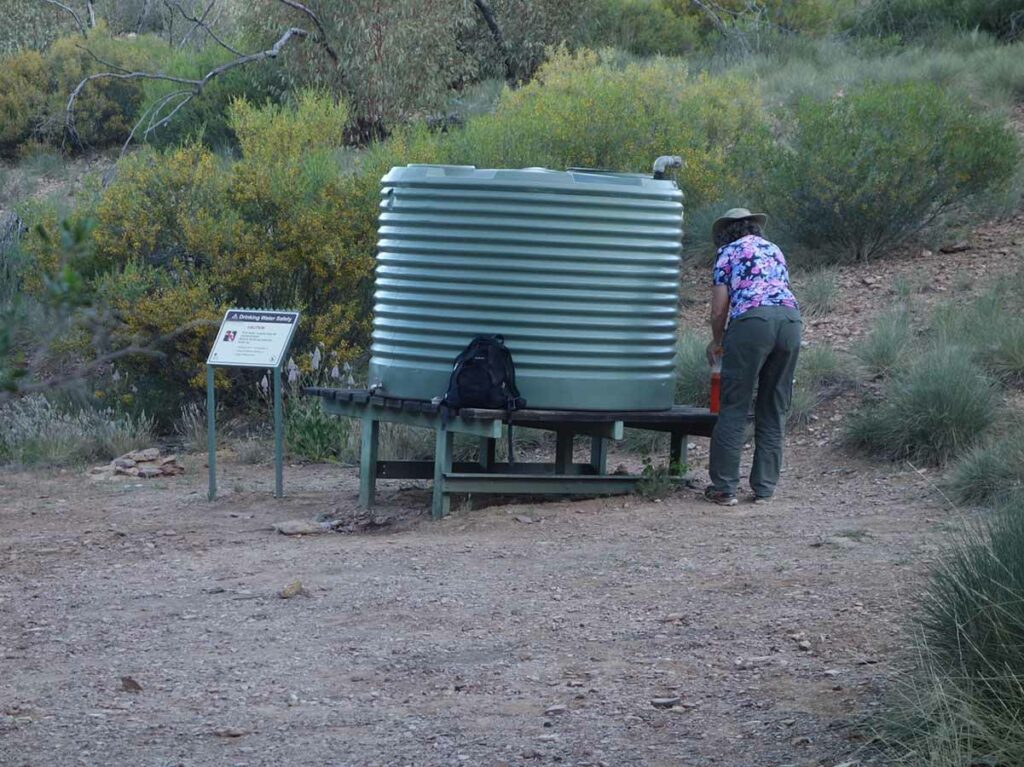
Water tank on the Larapinta Trail. These tanks are spaced at regular intervals and are topped up on a regular basis. Provided you know their location, you can be sure carrying enough water to last you through to the next tank
Natural water sources
On longer hikes you are likely to rely on natural water sources such as dams, creeks and rivers to resupply your water. Some trails have numerous natural and reliable water sources which you don’t have to put much thought into while other trails have a mixture of water sources that may only be reliable at certain times of the year. When planning a longer distance hike do lots of research prior to starting your walk. The internet, trail apps, trail write ups, guide books and topographic maps provide a range of resources to identify water sources. Use multiple resources where possible to ensure you have all the facts.
Topographic maps are becoming less common as electronic mapping systems take their place. Having said that knowing how to use topographic maps is a big bonus in remote areas. Looking for water at the top of a hill is usually not going to be helpful. However looking for water at the bottom of gullies is likely to be more reliable. Learn how to recognise rivers, creeks, lakes and dams to work out when you are likely to locate a water source.
Natural water sources can be seasonal. In the Australian Alpine areas water supplies are usually plentiful in early spring and summer as the snow melt makes its way through the landscape. Once you get to autumn however, much of this water has dried off and often only the permanent lakes and rivers are reliable water sources because many small streams have disappeared. I learnt this the hard way in an area I had been hiking numerous times over a five year period that had reliable water from spring right through summer but many of my usual water sources had dried up – I was left with using poor quality water. Thankfully I always carry a filter which was lucky because purification tablets wouldn’t have helped me on this occasion.
The key points to note about natural water sources are:
- Work out how fast and how far you travel in a day and how much water you consume as you go
- Where possible drink from moving water sources such as creeks and rivers or larger lakes
- Always filter water no matter how clean it looks
- If the water is dirty use a ‘pre-filter’ to remove solid particles. A buff or other piece of cloth is a useful option here if you have no choice
- Check water in any creeks and rivers that is close to the ocean before filling up your water storage container just in case its salty/brackish
- Where possible, avoid drinking water from water sources that run through farms as they may contain animal or chemical contamination
- Know what your plan is if you run low or run out of water. This may mean a detour off trail or even stopping/delaying your hike
If you are relying on natural water sources and there is some doubt on the reliability of a water source, then be conservative. Get to your next water source with enough water in your storage container to get you most of the way to the next refill location.
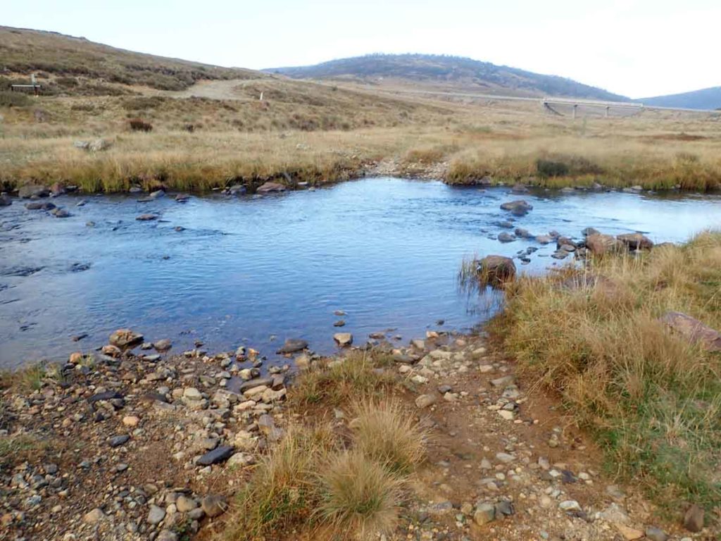
Eucumbene River Crossing near Kiandra on the Australian Alps Walking Track. This river is a reliable water source year round
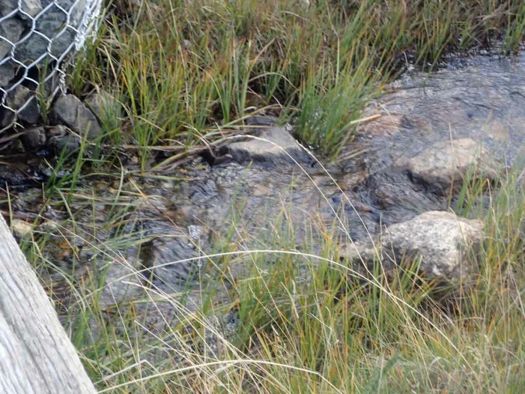
Small creek on the Australian Alps Walking Track. While this water looked really clear, I filtered it prior to it going into my water bladder
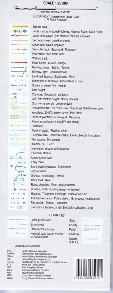
Topographic map key from Namadgi National Park in the Canberra region. This key indicates graphically whether water sources are ‘perennial’ (Permanent) or ‘intermittent with waterfall’ (its been raining). Also present on this map are water tanks. Learning how to read the features on topographic maps will help provide a huge amount of useful information information
Water caching
When doing long distance hiking in very dry areas you may need to cache water. Caching is the practice or storing food or water for future use. This will require you to travel out, usually by vehicle, and conceal an animal proof water/food container that you can relocate when you hike ti that point. While caching food is a common practice on some trails, caching water is less common
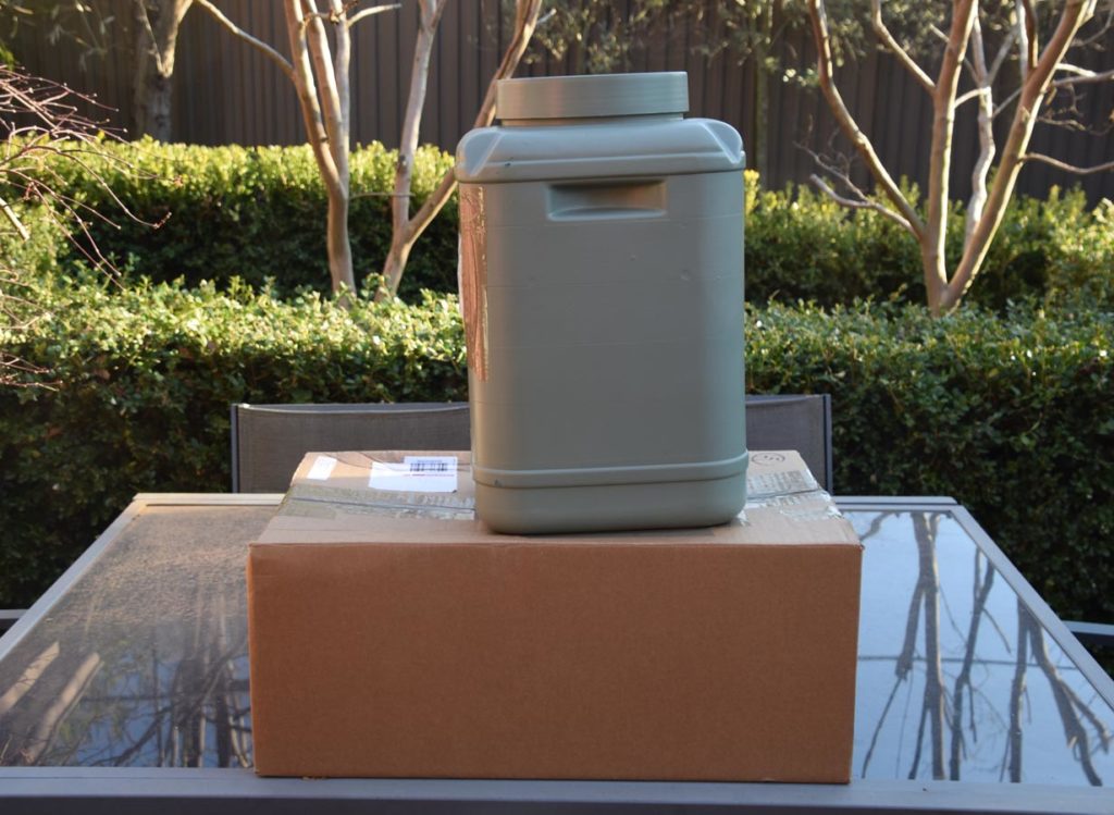
A caching container. This one was used for food however it could have also been used for water if nessesary
Final thoughts
In identifying water sources, particularly on longer hikes, the key take away is to do your research, particularly on those trails where water availability can be an issue. This may require you to time your hike for a certain time of the year to ensure that reliable water is available. Ultimately ‘if in doubt’ be conservative. You may end up carrying more weight than you need to but that’s a better choice than running out of water with a days hiking ahead of you.
Last Updated
19 July 2026