Yankee Hat Track ACT (6.2 km)
Namadgi National Park
Closest Town
Tharwa, ACT
Starting Location
Yankee Hat trail head carpark
Finish Location
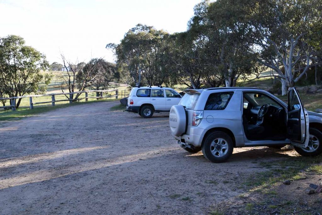
Yankee Hat trailhead carpark. This carpark will fit around 15 cars. There are toilet and picnic facilities at this car park.
Best time of the year to travel
Year round although in Spring you get the wildflowers on the grassy plains
Yankee Hat Track Review
The Yankee Hat trail is a good opportunity to see Aboriginal rock art within an hours drive of the centre of Canberra city. This is an easy walk with only some minor steepness and the walking surface is either flattened grass, constructed metal mesh boardwalks, or natural formed trail so is suitable for all levels of able bodied walkers. The carpark is well laid out and the trailhead contains toilet facilities as well as a a picnic table and a new small covered shelter.
Once you turn off the bitumen main road you will now be travelling on dirt road and its at the this point you want to ensure that you have a car with good ground clearance. In fact in late 2025 there was signage up advising to use a 4WD due to 2 small water sections that need to be crossed. the first section crosses a concrete culvert but the section is on natural road which has flood signs. As such is best to travel to this site in and AWD or a 4WD with good ground clearance.
The open grassed area immediately at the start of the walk is home to large mob of Kangaroos and since the 2020 fires this population has dramatically increased being spread along the sides of the dirt road that takes you too the trail head. We have done this walk a number of times over the past 20 years and in spring of late 2025 I ahem never see some many kangaroos and so many joeys hopping around., As such you need too slow down to cater for any kangaroos that decide to hop in front of your car.
You can do this walk at any time of the year and any time of the day but we would suggest starting earlier in the day to avoid the crowds and the heat. Having said that on our most recent visit we cam across around 20 people in total but they were spread out meaning that it never felt crowded.
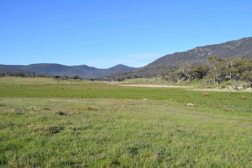
While a popular walk in the Canberra region it is also one of the best kept secrets with most locals being unaware of its existence. As a result the start of the trail is in very good condition. The trail is well laid out and seems to meander until you realise that you are circumnavigating a swamp at the bottom of the valley.
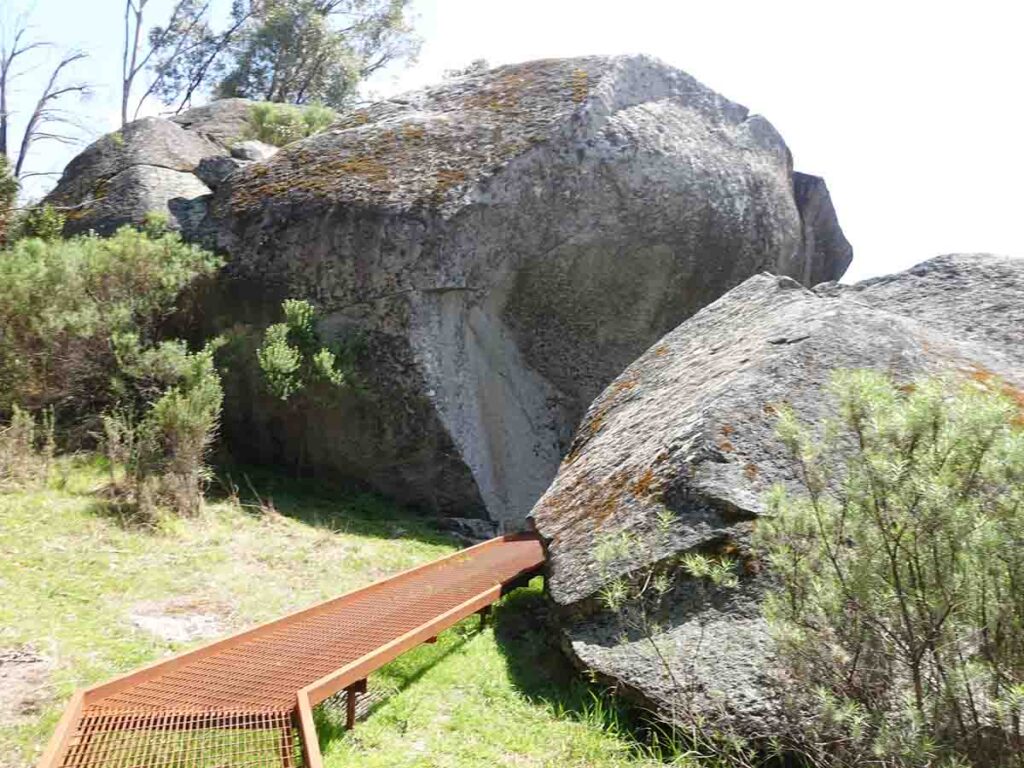
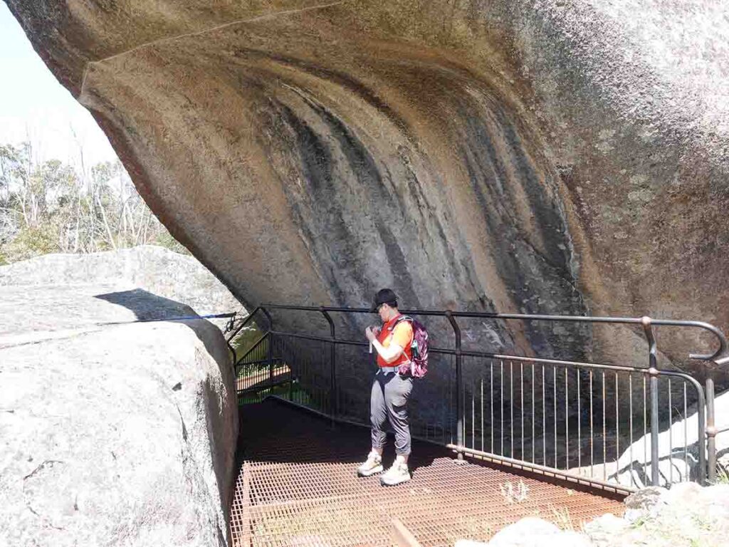
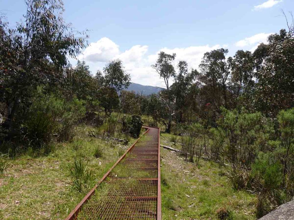
The rock art site is contained within the tree line of the Bimberi Wilderness and has good interpretive signage around a constructed metal mesh gallery which is also a good area to take a break. Once confusing thing about this revamped walk is that the trail mesh continues on from the rock art gallery but its not obvious that thats the way you should head and given that few ere sure we turned around and may our way back the way we came. Either option is fine remember to sign back out of the trail register on the way back.
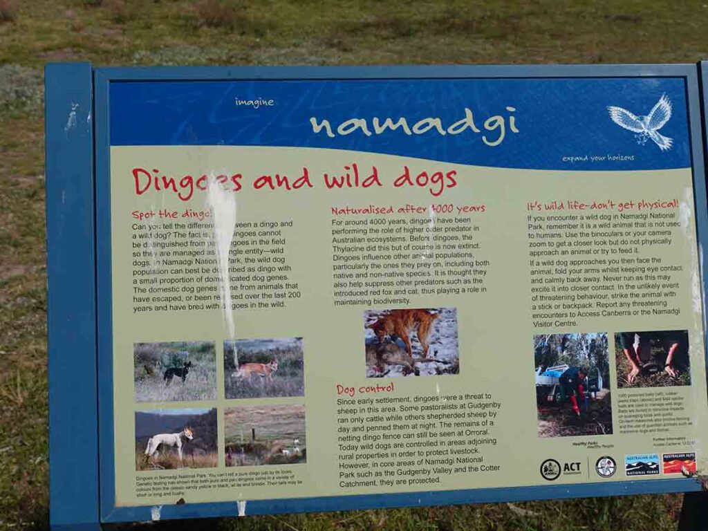
Animal life varies but you will be guaranteed of seeing Kangaroos and the occasional wallaby and if you are lucky some oil our larger Goannas (see image below).
Since the 202o fires the infrastructure including the interpretive signage has been upgraded so if its been a while since you last visits its definitely time to god back for another look.
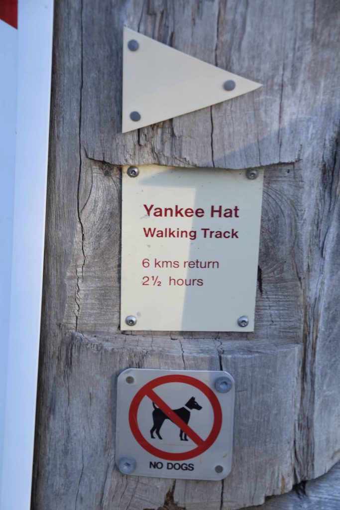
The trail itself is approximately 6.2km long and although the recommended trip time is 2.5 hours, fit regular walkers should be able to complete this trail in about 90-120 minutes. This is a good option for those looking for an easier mid distance walk as well as being a good place to take visiting tourists to see Aboriginal rock art.
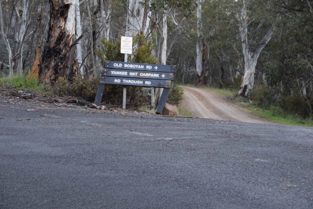
Signage at the turnoff to Yankee Hat. From this point on the road is unsealed
Yankee Hat car park
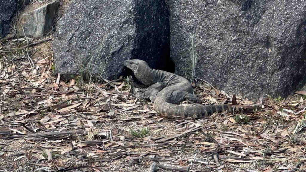
Goanna sun baking in the car park
Trail marker
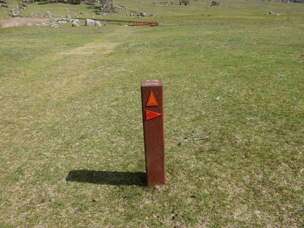
Another type of trail marker. This type of newer trail marker is more common than the older style above but you will still see both
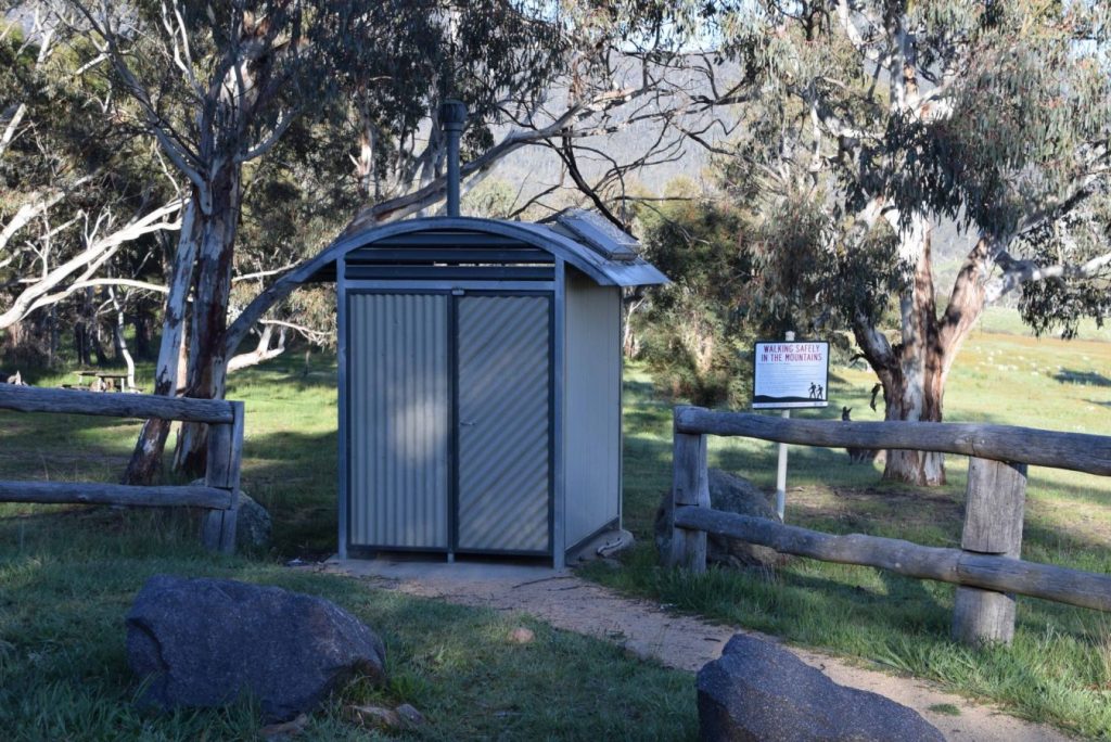
Toilet at Yankee Hat car park
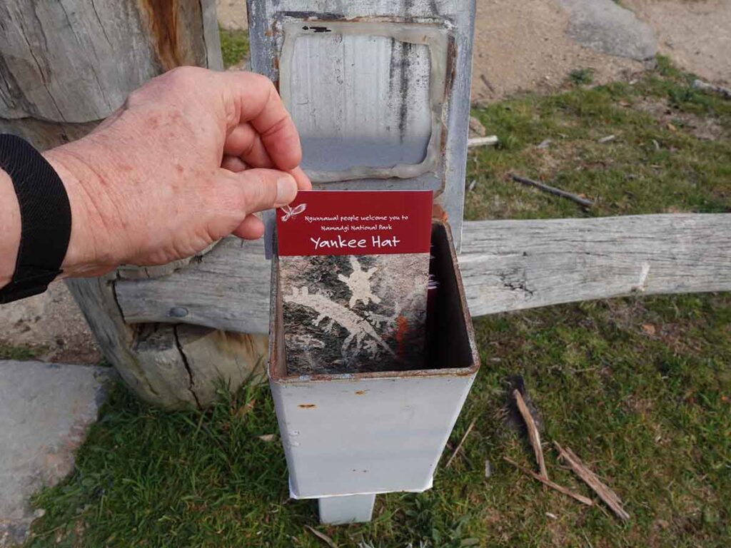
Yankee Hat trail brochure
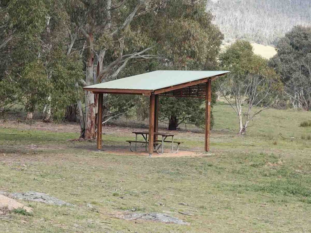
Covered picnic area
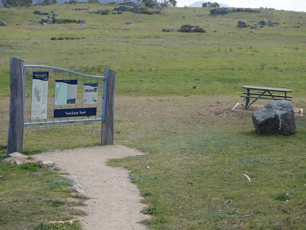
Yankee Hat trail head information Kiosk and picnic table
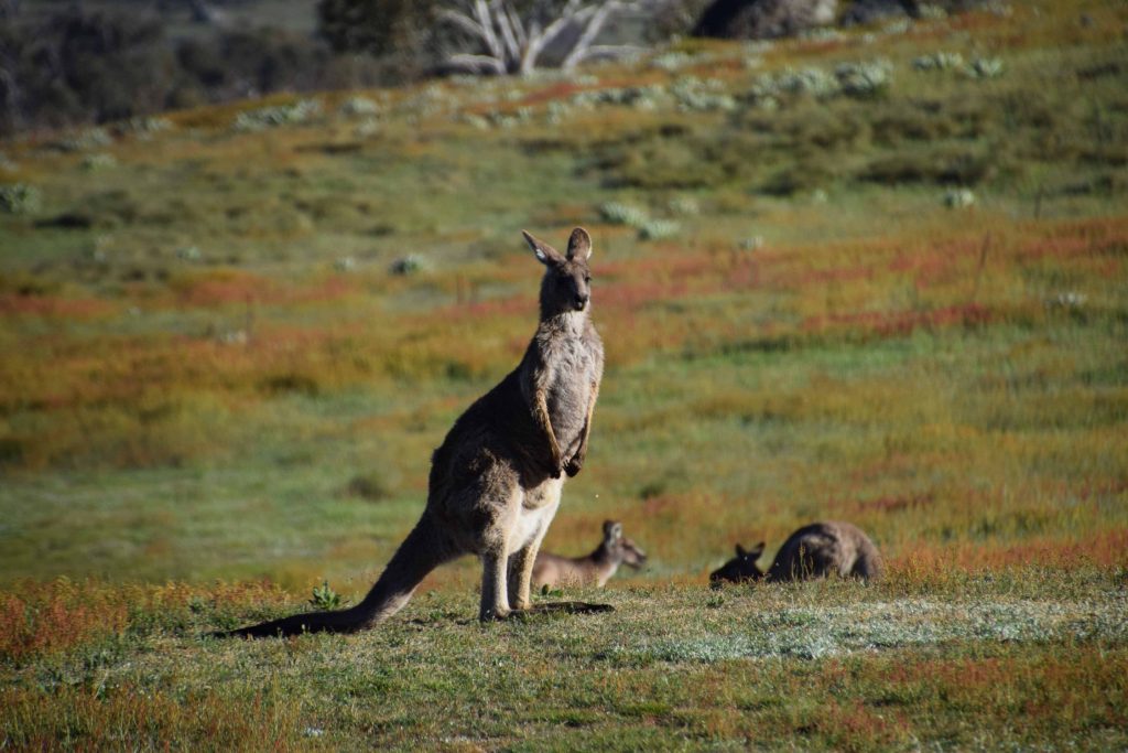
Kangaroos are usually present near the start of the trail as well as the road into this site
The first time you do this walk you could be forgiven an assumption that you cut across the Vally but this is actually a swamp so you b=need to skirt around it
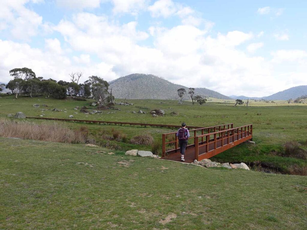
Creek crossing at Yankee Hat 0n a metal mesh bridge and boardwalk
Information signage on trail
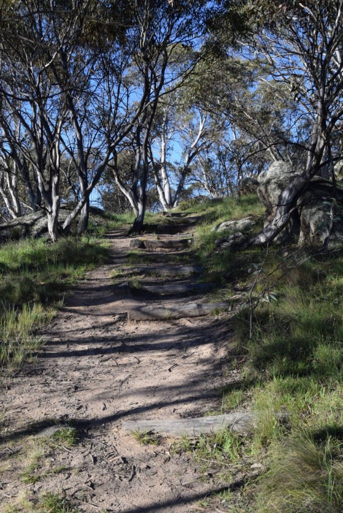
The trail varies between being out under the tree line with the majority in the open.
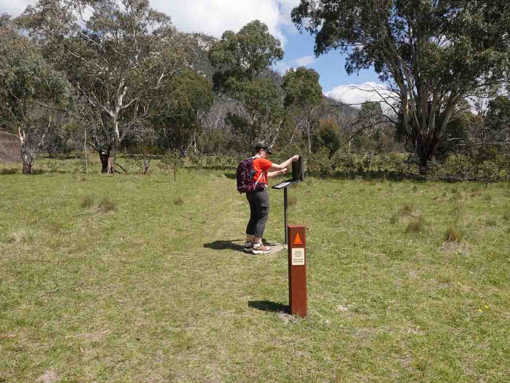
Gill signing in. The trail register is close to the rock art sign about 2.8km into the walk
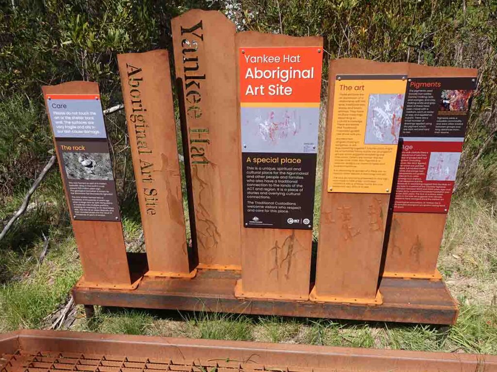
Yankee Hat Rock art information kiosk
Reaching the Yankee Hat rock art gallery
Rock art gallery
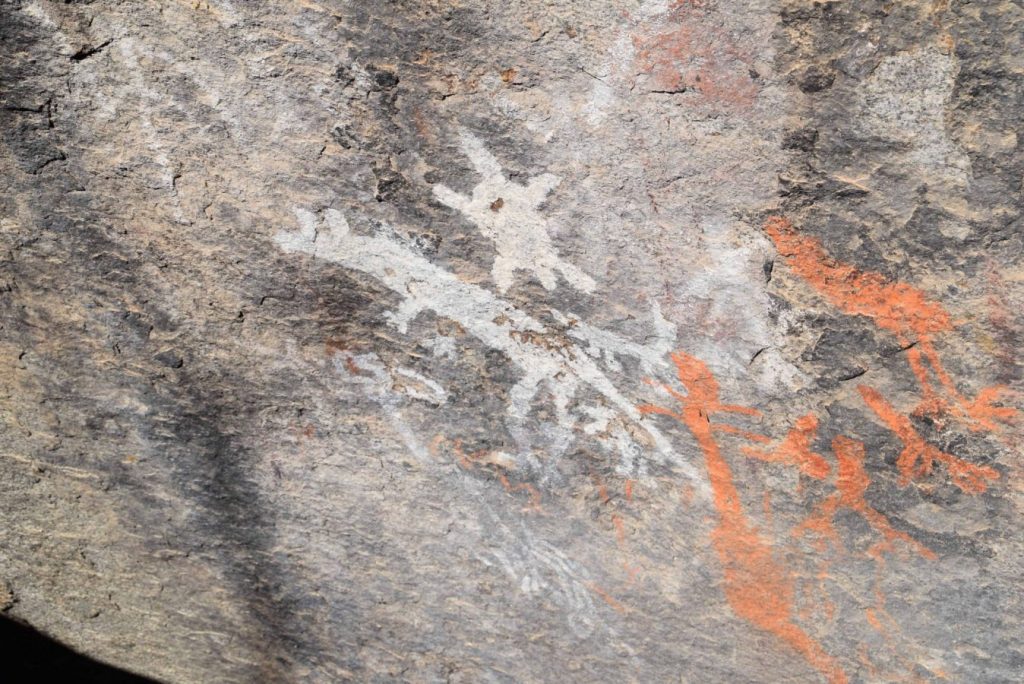
Aboriginal rock art. This site contains a viewing platform and explanatory signage
Silicon drip line. This drip line prevents water from running down onto the rock art helping to extend its life.
To head back down you can either turn around and go back the way you came or keep heading straight on and loop back around to the trail register (Don’t forget to sign out)
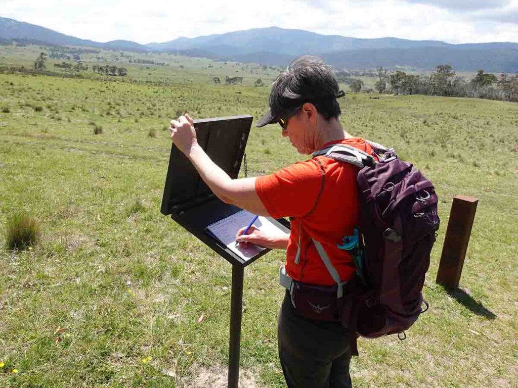
Gill signing out on our return trip
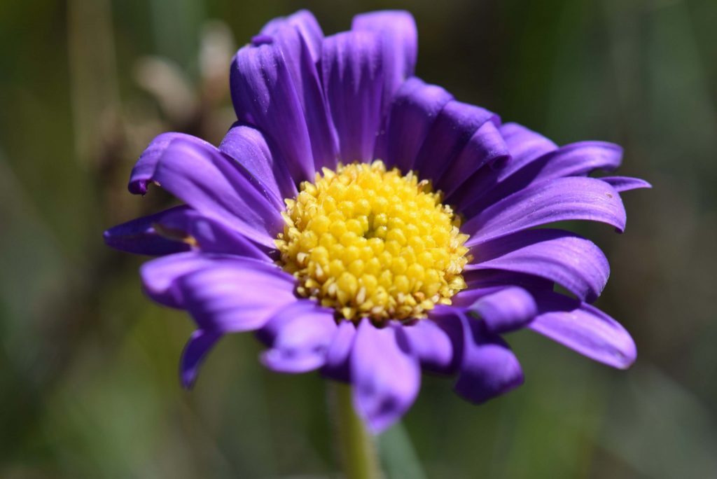
There is usually plenty of wildflowers around during the spring time.
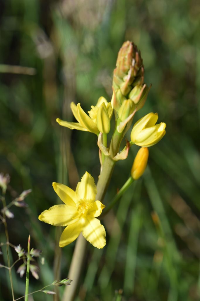
At different times of the year various wildflowers out out along the edge of the trail
When starting the trail it seems strange that you don’t head in a straight line however you soon realise that you are traveling around a swamp
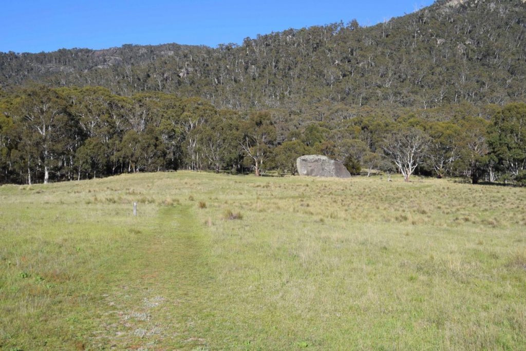
The start of the Bimberi Wilderness. The rock art site is just on the edge of the wilderness area and the terrain changes quite dramatically from open plains with some tress to dense vegetation.
Trail video
This video slide show provides a visual overview of our experience on the day of our walk
Getting There
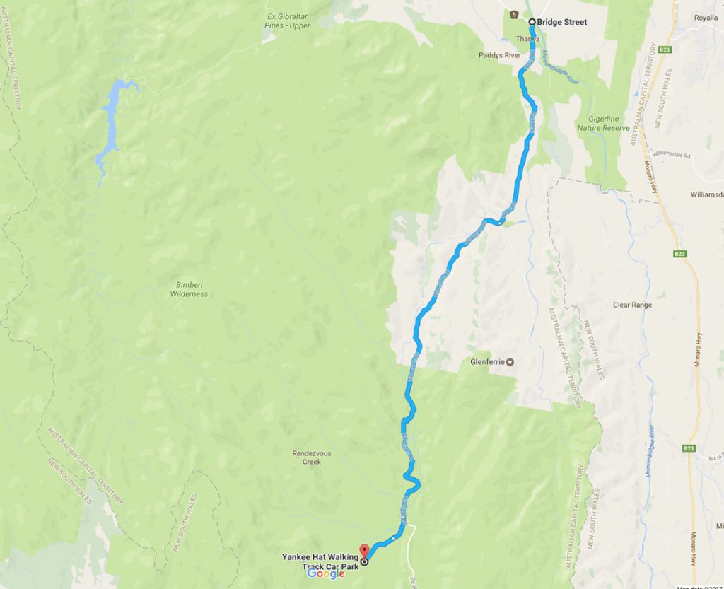
Map from Google maps showing directions to the Yankee Hat carpark from the Tharwa Bridge
This site is approximately 1 hours driving from the centre of Canberra. Head south along the Tuggeranong Parkway, past the Lanyon Homestead and though the village of Tharwa. The site itself is in the Namadgi National Park towards the end of Old Boboyan Road with the last section of the road as you turn off to the trail head being unsealed. Access to this site is relatively easy however be aware that after heavy rains you may need a, AWD / 4WD for access.
Things to know
- Phone: The phone signal on this trail (Telstra), is sporadic
- Water: Bring your own water
- Toilets: There are toilet facilities at the trail head
- Trail: This walk is on formed trail with small sections of stepssteps
- Dogs: Dogs NOT allowed on leash
- Camping: Camping is allowed in Namadgi National Park
- Other:
- Don’t take a car that has low ground clearance particularly after it has rained as you may need to cross 30-40cm+ of water on the turnoff road to the trail head in one section
- Pay attention to the trail when off the sealed roads as the potholes can be hard to spot
- Travel slowly past the large mobs of Kangaroos on the sides of th road once you turn past the bitumen
- in warmer wether take an insect net or bug spray as the flys can be merciless
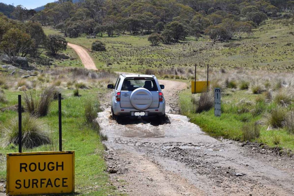
Water crossing to and from the trail head. If there has been heavy rains you may not get over this section and on occasions the road may be closed however this is very rare. Avoid using cars with low ground clearance and if possible use an AWD or 4WD.
Disclaimer
This walk was undertaken by the team from Australian Hiker
Last updated
9 November 2025