Uriarra Loop/Shepherds Lookout ACT (9.1km)
Canberra Nature Reserve
Nearest Town
Holt, ACT
Starting Location
Stockdill Drive car park Holt, ACT
Finish Location
Stockdill Drive car park Holt, ACT
Best time of the year to walk
Spring and Autumn
Uriarra Loop/Shepherds Lookout Walk Review
Canberra is still a relatively young city so new trails are being developed on a regular basis and old ones that have on the whole been forgotten, are becoming popular again. Recently I was trawling the internet looking for hikes that were away from bushfire zones and I came across two walks I hadn’t seen before; the Uriarra Loop Walk and the Shepherds Lookout Walk. These walks are located on the edge of Canberra city near the suburb of Holt and have been there for a while but as the city continues to grow and the suburbs move closer, they are becoming more popular again. While both of these walks can be done as standalone walks if you don’t feel like exerting yourself they are easy to join up into a single trail of 9.1 km in distance. These walks take in the Molonglo and Murrumbidgee Rivers where they connect so during the warmer months there is opportunity to combine the walks with swimming and/or fishing.
There are two options for starting this walk. The first, and the one we recommend, is located at a small car park along Stockdill Drive which is the road that takes you to Canberra’s main sewerage treatment works (more on this later) about 1 km past where the houses stop. The housing in this area is relatively new and will increase users on this trail as more and more people move into the area. The second option is to start this walk at the Urriarra East Recreation area which is where the toilet and babecue facilities are located. By starting at the Stockdill end you can access these facilities and/or use the recreation ground for a lunch/tea break part way through the walk.
We started this walk by heading straight down to Shepherds Lookout which is around 300 metres from the carpark on a trail that is bitumen for the first 150 metres before turning into compacted earth. The lookout itself is a metal trail platform on the edge of a steep section of hillside and gives you views straight ahead to the Murrumbidgee River over the surrounding landscape. To the left of the platform you can see both the Murrumbidgee and Molonglo Rivers at their meeting point.
Once you leave the viewing platform keep to the right on the loop and about 80 metres away from the platform there is a right turn which takes on a downhill journey to the Molonglo River past the Murrumbidgee sewerage treatment works. This is not as bad as it sounds and it is rare to smell anything unpleasant. The walk down to the river is steep at times and will give you a work out with some steep stair sections. Once you each the river itself, you will cross by means of a narrow timber crossing. This is a great place for a swim providing shade on the starting side of the walk and full sun on the other.
Once you cross over the river, follow the the trail for a short distance ignoring the turn to the right that will take you up hill – this is where you will reconnect to the trail on the way back. Shortly after the trail that goes straight ahead and takes you away from the river up hill where you cross a road and you then follow the branch road down to the Uriarra East Recreation Area. Take the opportunity to use the toilet facilities at this point and have a break. From here follow the river down stream where you will cross another road before looping back around. Continue on and you’ll eventually meet up with the Molonglo River back at the small bridge you crossed on the way out before taking the trail back up the hill the way you came.
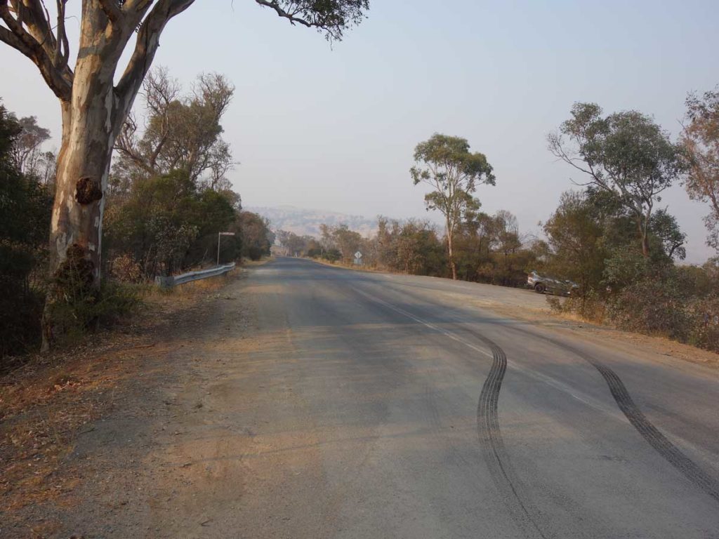
Once you reach the top of the hill instead of turning left at the T junction, turn right and this will provide a shorter route back to your car. The trail is reasonably obvious and there is the occasional directional arrow to follow but you do have to pay attention as sometimes the signage has fallen over and the the world’s smallest arrows have been used at other points to mark the direction. Much of this trail particularly on the ‘lower loop’ is sandy and it makes it hard going at times. On the day we did this walk the temperature was forecast to be close to 40° Celcius so we started early but even so it was getting very warm by mid morning when we finished.
The walk takes you through wooded areas but much of the trail is open and exposed. If given the choice I wouldn’t do the walk in the mid summer period. Wildlife was reasonably limited on this walk and due to the dry conditions we only came across the occasional kangaroo.
This walk is never going to make my top 10 list of hikes but it is definitely worth doing once. We both enjoyed our time on this trail and it gave me in particular the opportunity to visit an area of Canberra I had’t been to for about ten years.
Turn off onto Stockdill Drive
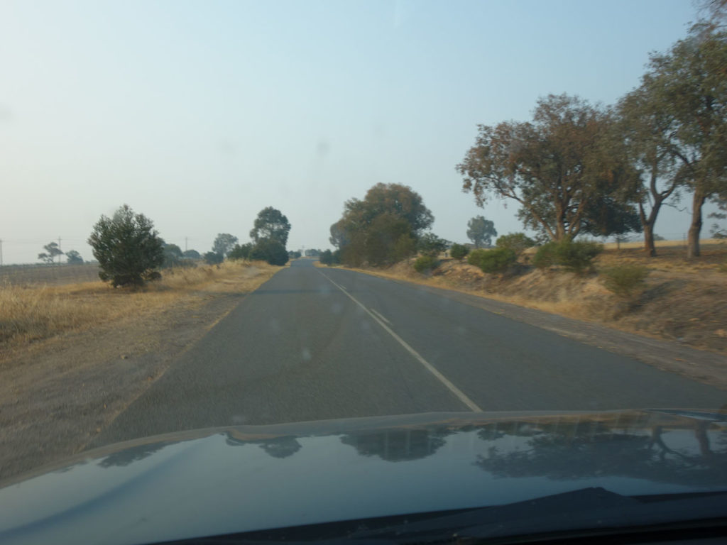
Stockdill Drive
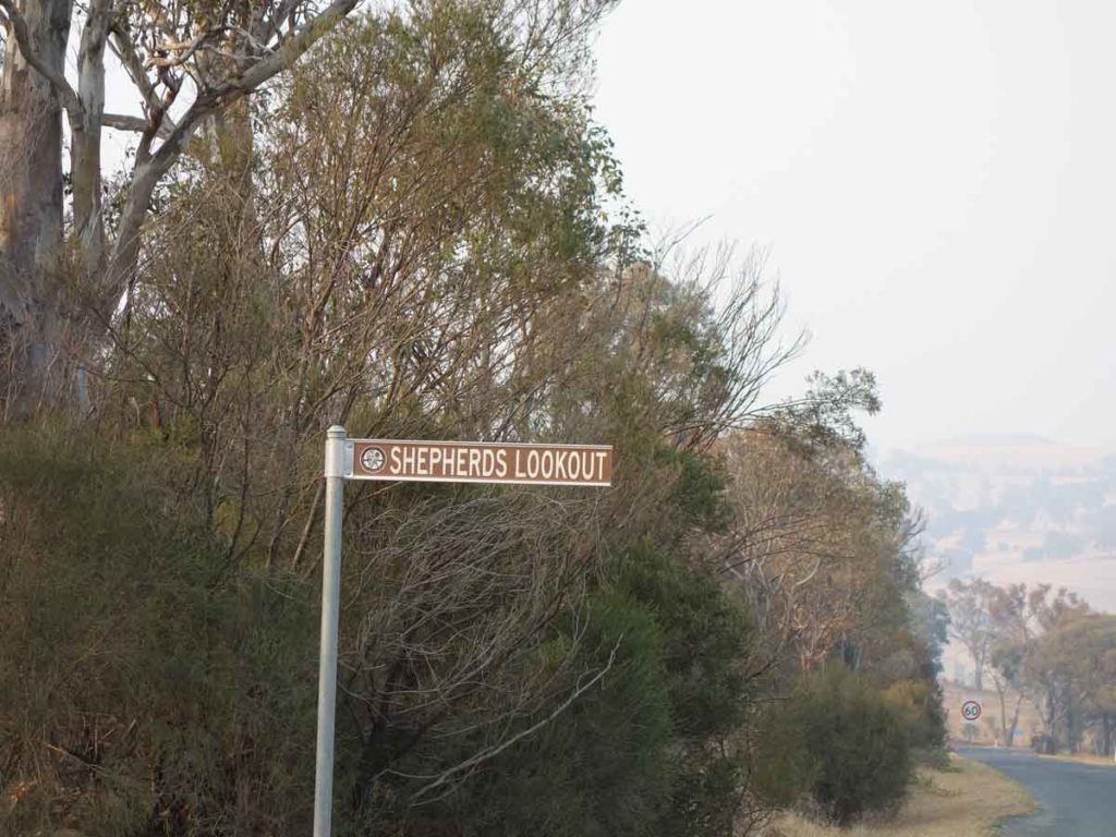
Shepherds Lookout sign. Keep an eye out for this sign as that’s where you’ll park the car
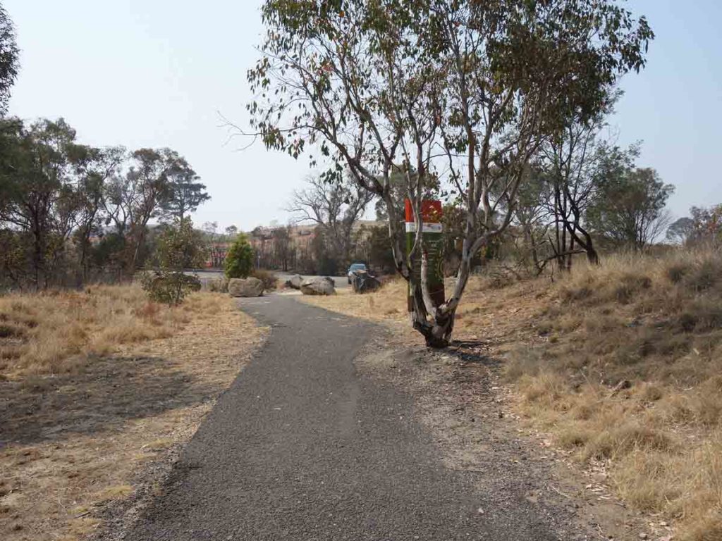
Stockdill Drive car park
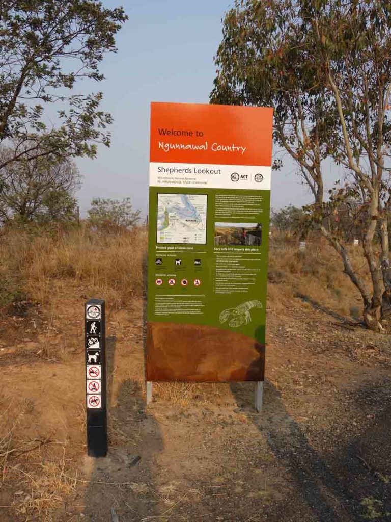
Trail head signage
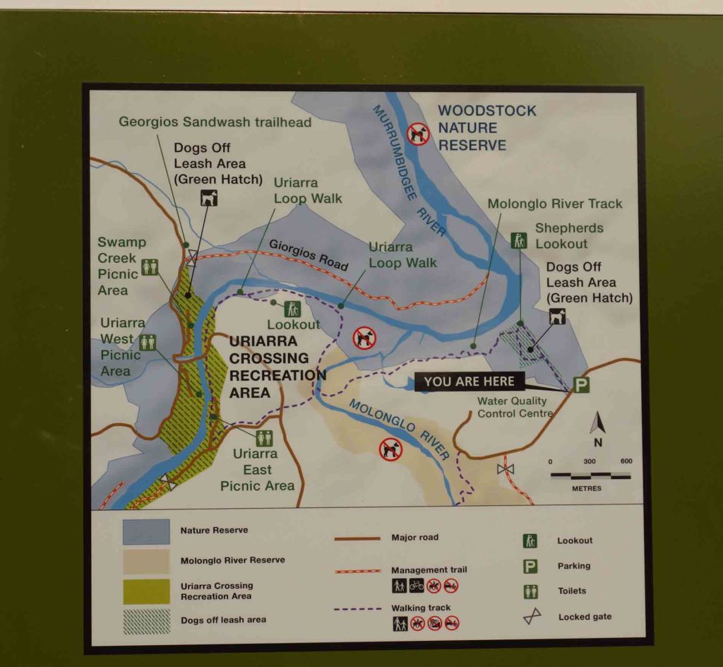
Trail map at the trail head. It’s a good idea to take a photo and use as a guide on the trail just in case

Trail example
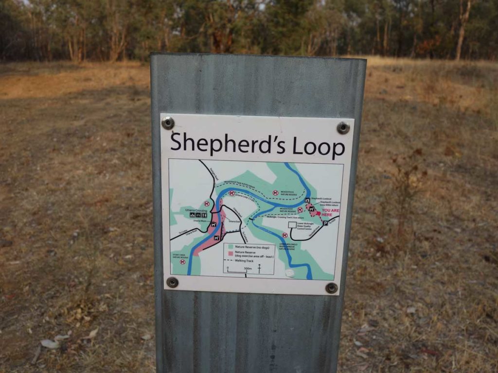
Trail signage example

Shepherds Lookout

Murrumbidgee River from Shepherds Lookout
This trail has been all but forgotten by many of Canberra’s bushwalkers but is deserving of a visit. This walk takes in both the Molonglo and Murrumbidgee Rivers
Take the loop track about 80 metres and follow the signage to the Uriarra Recreational Area

Through the fence we go

Trail example heading down the hill to the Molonglo River

Trail marker – this arrow is a decent size but some are very small

This track skirts the edge of the Molonglo Sewerage Treatment Works

Potential stop point below the treatment works. If there has been a period of big rains then the track may be impassable at this point

The track is pretty obvious although some of the signage has fallen over

Crossing the Molonglo River
This river crossing is a great place for a swim or just to take a break

World’s smallest marker arrows. Go straight ahead as opposed to the right at this point. The right hand branch is where you will return

Up the hill …

…and over the fence

Cross over to the access road at the left of the photo

Short walk down the road

Uriarra East Recreation Area entry sign. Turn right just behind the sign

Toilet facilities at Uriarra East Recreation Area

Picnic area at the Uriarra East Recreation Area

Kookoaburra

Across the river to another picnic area

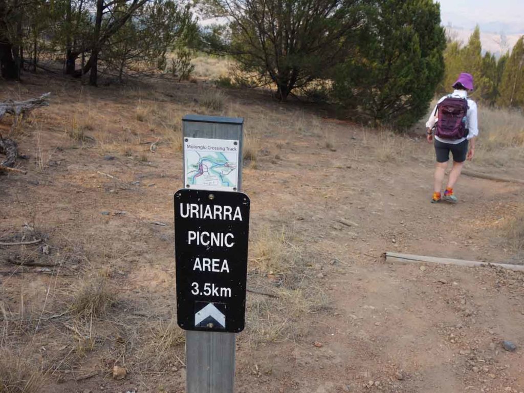
Go to the end of the car park, find this sign with trail information and continue to follow the river

Cross the second road

Sandy track section. This makes for a bit of hard work particularly in hot weather

As you follow this trail you will look over the little wooden bridge you crossed on the way out. The trail will take you back down to the river crossing

River crossing

Back up the hill

Turn right at the top of the hill

Head back to the car park by turning right
Approaching the car park
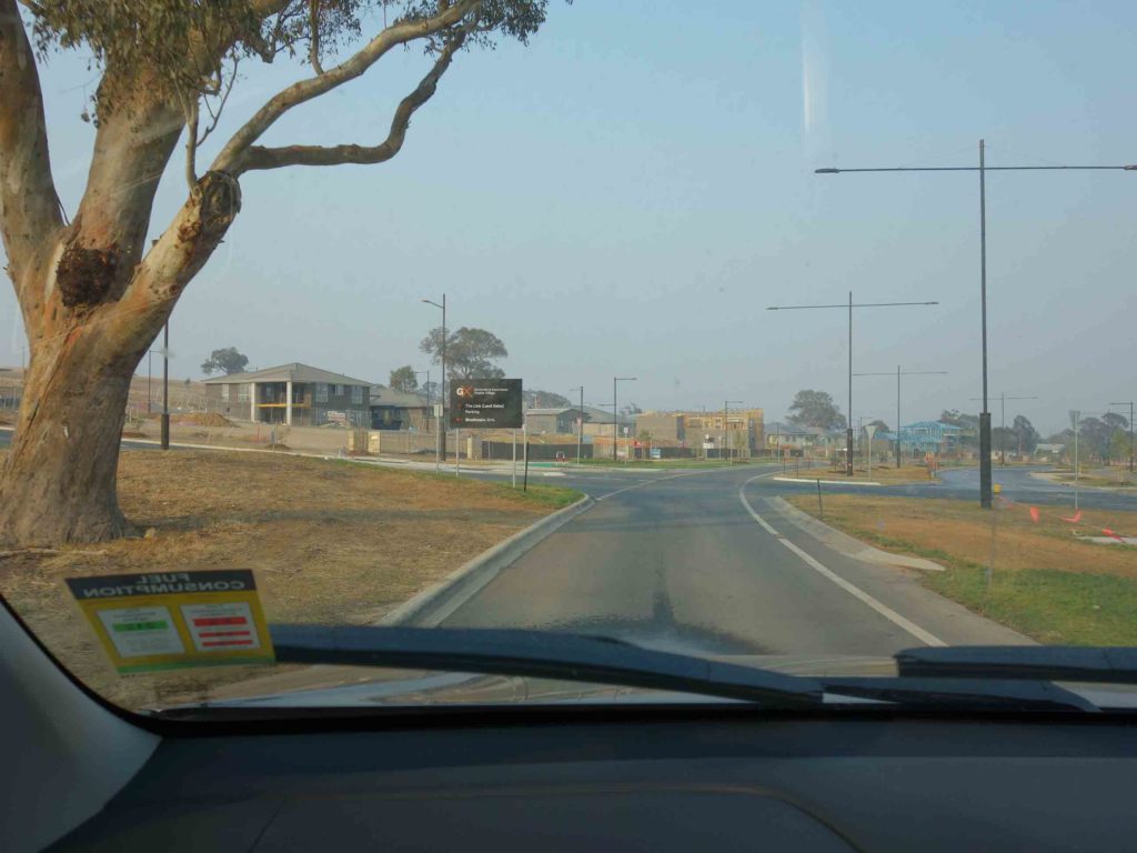
Getting There
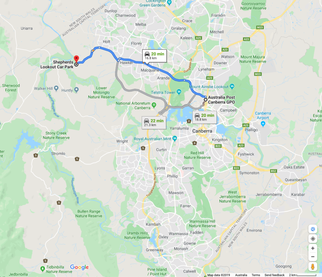
Google map showing the distance from the Canberra GPO to the trail head. This walk is 17 km from the Canberra GPO and will take around 20 minutes to reach from the city centre
Turn off onto Stockdill Drive
Shepherds Lookout sign. This small car park will fit about 6-8 cars
Stockdill Drive car park
Things to Know
- Phone: There is excellent phone coverage on this trail (Telstra)
- Water: You need to bring your own water or a filter to use the river water
- Toilets: There are toilets facilities at Uriarra East Recreation Area
- Trail: This trail consists of formed track
- Dogs: No dogs allowed on the main trail
- Other:
- Bring insect repellent particularly in the hotter months
- This walk is an out and walk back experience
- Start early if walking in the hotter months
- If there has been a period of heavy rain, sections of the trail may be inaccessible/closed due to flooding
Disclaimer
This walk was undertaken by the team from Australian Hiker