Hume and Hovell Track NSW (426 km)
NSW
Starting location
North to south – Cooma Cottage, Yass NSW
South to north – Hovell Tree, Albury, NSW
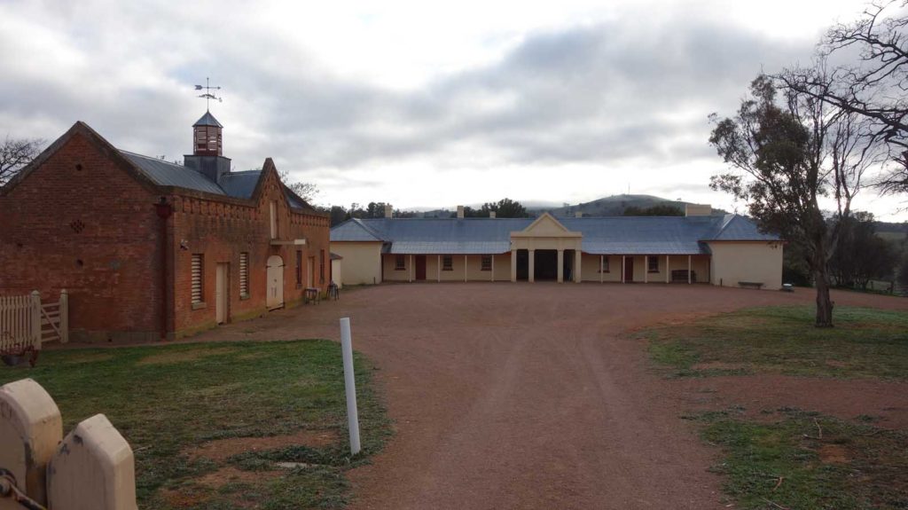
Cooma Cottage track head
Finish location
South to north – Cooma Cottage, Yass NSW
North to south – Hovell Tree, Albury, NSW
Best time to travel the Hume and Hovell Track
The best times to do this hike are mid September to early November or mid March to mid-May.
Travelling over summer (late November to late February) is not advised due to bushfires and heat but not prohibited. If you are starting a thru-hike during the summer months there is a risk you may not be able to complete the whole trail. Water availability at the campsites may also be an issue over the summertime.
Travelling over winter also has its own inherent risks. From around mid-may to mid/late-September there is a high likelihood of snowfalls and in particular during mid winter these may be reasonably heavy. If you are experienced in hiking in the snow conditions and are prepared then it’s not impossible.
Favourite campsites
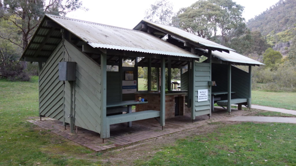
The three sites that are identified as ‘track heads’ on this trail and are aimed at walkers, caravans and car campers. They have excellent facilities and are well maintained.
- Fitzpatrick Trackhead
- Thomas Boyd Trackhead
- Henry Angel Trackhead
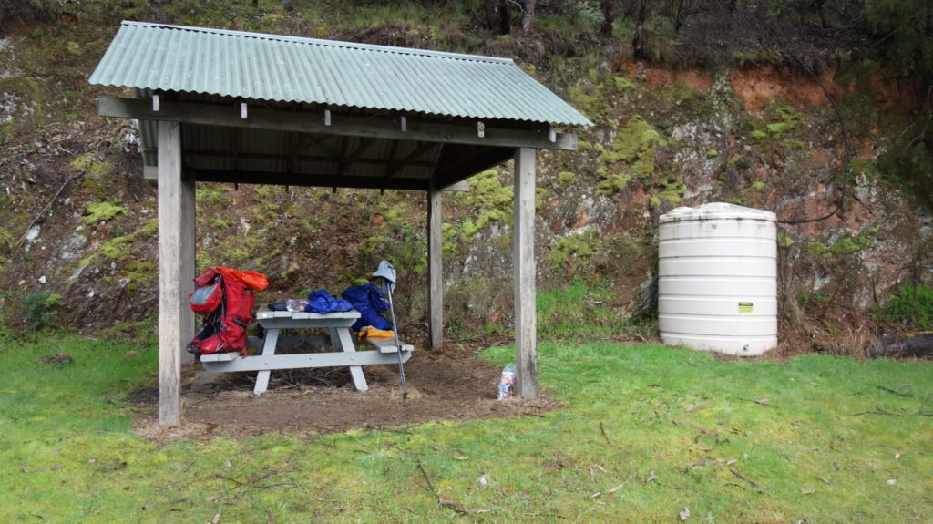
The majority of the overnight stopping points are labelled as ‘campsites’ and these vary in their upkeep. They generally have a pit toilet (usually just one), a single shelter with a table, additional tables and fire pits. Some of these sites also have water tanks.
Trip Podcasts
If you want some additional information have a listen to our series of podcasts on this trip:
117-Hume and Hovell Track: in the footsteps of explorers
Over the next month Gill and Tim from Australian Hiker will commence their end to end on the Hume and Hovell Track. This track, in the state of New South Wales (NSW), travels between the towns of Yass to the north and Albury to the south, for a distance of 426 km. In this episode we provide some background to one of Australia’s lesser known long distance trails, talk about some of the logistics involved, as well as our expectations for this trip.
121-Hume and Hovell Track Week 1
In this week’s episode we listen to our on-trail recordings of our first three days on the 426 km Hume and Hovell Track.
122-Hume and Hovell Track Week 2
In this week’s episode we continue with our Hume and Hovell on-trail recordings and in this episode we bring you days 4-11.
123-Hume and Hovell Track-a premature end to a thruhike
What started out as a 19 day thru-hike has now been turned into a section hike due to injury after completing 310 km of this 426 km trip. In this episode we discuss our last few days on the Hume and Hovell Track, our reasons for cutting the hike short, and where we go to from here. Rest assured there are plans in place to finish this trip off!
Additional episodes will be post in Autumn (Fall) of 2020 when we finish of this trip.
1824 Hume and Hovell expedition
In 1824, explorers Hamilton Hume and William Hovell were tasked by Governor Brisbane to mount an expedition in search of new grazing land for the colony. The journey, in the main funded by the two explorers, commenced on 17 October 1824 at Lake George and finished at Corio Bay (instead of the planned destination of Westernport) on the Victorian coast before they returned to their starting point on 18 January 1825.
While this journey was considered a major success and one that greatly contributed to the founding of the city of Melbourne, the relationship between Hume and Hovell was a strained one and remained that way until their deaths approximately 5o years later.
Our Trip
The Hume and Hovell Track in New South Wales is one of Australia’s lesser known long distance trails, fully contained within NSW and running between the towns of Yass and Albury on the Victorian border. Originally this track was created as part of the 1988 Bicentenary and when opened ran a length of 316 km rather than it’s current length of 426km.
The track has two trailheads in the towns of Yass to the north, and Albury to the south as well as passing around the edge of Wee Jasper, and close by Tumut, Talbingo and Tumbarumba.
Every long distance track/trail in Australia has its own unique character. By no means is this a wilderness trail passing through National Parks, Nature Reserves, State Forests, and rural land. The trail also takes in management trail, public roads and purpose built hiking track. For me this walk provided an opportunity to see parts of NSW I had only ever driven past or had never visited.
One thing you are never likely to say about this track is that it is easy. There are some very hard sections and if you are pushing through on this track to get it done under 20 days then you will feel it with large steps sections of track.
We started the Hume and Hovell Track track as a 19 day thru-hike but ended up calling it quits after 13 days and approximately 310 km; spending day 14 walking off track due to Tim’s knee injury. The following write up takes us through the walk we undertook – we will complete the rest of this track in the first four months of 2020 once the summertime heat dissipates.
Day 1
Day one is finally here and we start our Hume and Hovell trip just before 8.00am after getting an Uber from Canberra. A strange choice for starting a hike but there is no public transport early on Saturday morning. We didn’t want to fork out for a hotel room by travelling the day before and I wasn’t cruel enough to make our relatives and friends spend 90 minutes driving there and back on a day off.
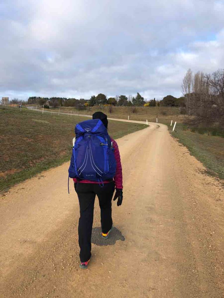
The day we started, Cooma Cottage, Hamilton Hume’s residence was closed, and in fact opened the next day but even then it was around 10.00am. Being true to form we wanted the full experience so walked the 200 metres down the gates of the cottage , took in all the the interpretive material and did the photo opportunity.
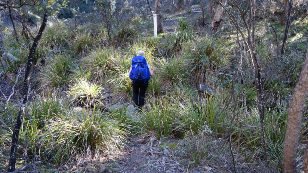
The entire day was spent road walking with the first 10 km walking into Yass then to the turn off on Black Range Road. Plenty of opportunities for coffee and McDonalds along the way but walking along a highway is not my favourite thing to do. Having said that I have driven through Yass many times but this walk allowed me to get a better idea of what the town was like.
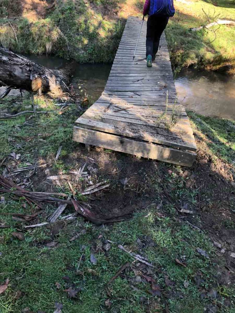
Once we turned off onto Black Range Road the walk became much more interesting and we were amazed at some of the enormous mansions on show as well as the number of houses out this way. We were expecting to walk just on 22 km today but missed the camping area (we didn’t actually but were expecting some sort of identification signage). We end up walking a total of 26 km and stopped on the road verge when we found a decent camp site. Plenty of water in the creeks and streams along the way except for the high point as we went over the top of the hills which was pretty dry.
Being a road walk, the day was pretty hard and by the end of it we set up camp, ate dinner and were in bed, by 6.00pm.
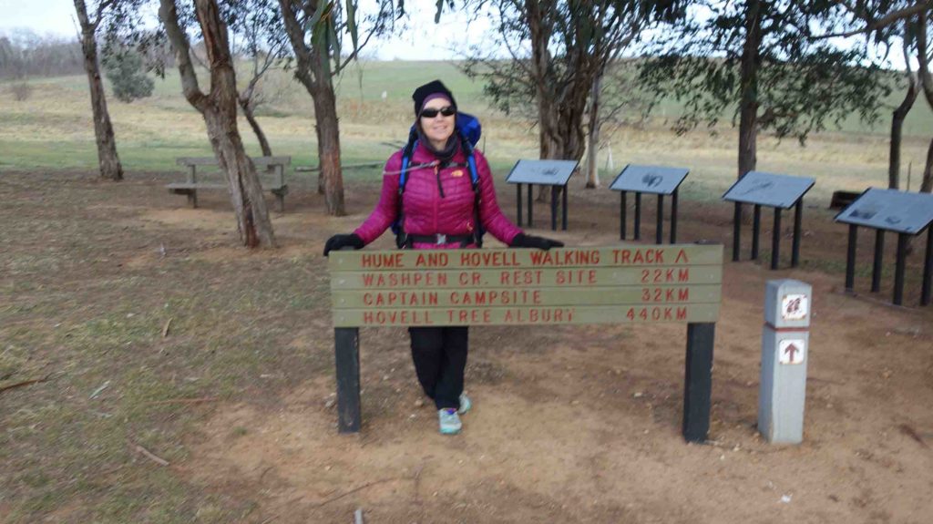
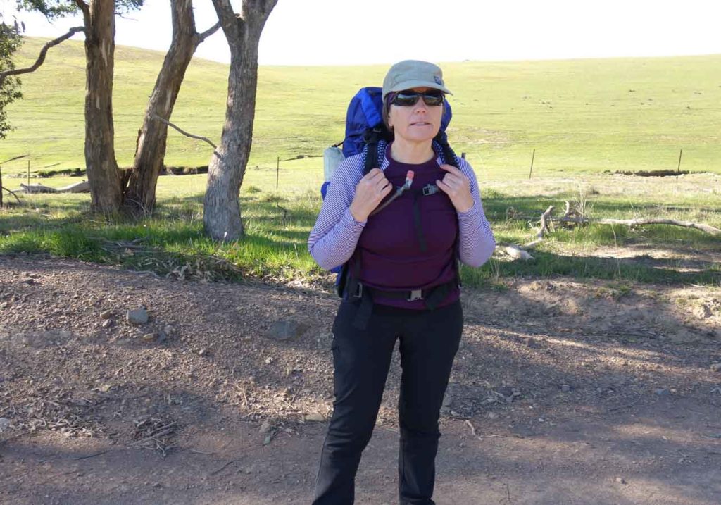
Gill at the Cooma Cottage Track Head in Yass, NSW
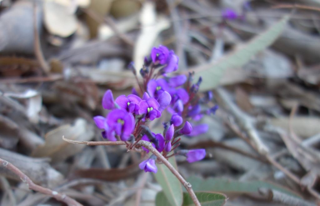
Hardenbergia in flower
Morning tea day 1 on sitting by the side of the road

Campsite day 1, having dinner
Day 2
It’s day 2 and we both had a very good sleep in blocks of around five hours and are now just lazing around before heading off on the shortest day of our trip. The temperature last night was cool but not overly uncomfortable.
Today we leave our overnight stop on the side of the road with the intent of stopping at the Captain Campsite. I imaged this site was named after the explorer Hovell as he was a naval officer but no it was named after the lead Bullock of their team. How on earth they managed to get a bullock through the bush when roads were non existent at the time – it is bad enough just walking. As it has only taken an hour to get to this campsite we decide to press on and average out the next two days. We go to what we thought was going to be an area with water views but when we get there we discover it’s the name of the property and the road we are hiking.
We press on and find a nice spot off the road after walking around 15.2 km for the day which leaves us a shorter day for tomorrow – this comes in handy when you’re trying to produce and edit a podcast.
After setting up tent at around 2.30pm-ish we have a snooze and decide we don’t feel like eating so after a hot chocolate and a Sustagen we are in bed by 6.00pm and asleep not long after. The scenery is starting to become more natural and feels more like a hike now.
We are slowly working out the maps and what all the little symbols mean – only using them to check what’s ahead.
Gill raring to go on day 2
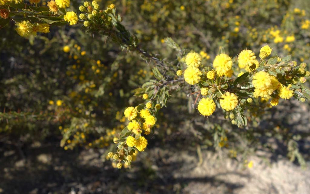
Wattle in flower
Accessing the Captain Campsite. We were only camped 4km from this site on day 1
The Captain Campsite
Day 3
It’s day 3 and we both had a restless night last night. The tent site which was wonderful for an afternoon nap all of a sudden became ‘slidey’ during the night. It was also a long night as well being in the tent for around 12 hours. I was already awake but a car drove through, from God knows from where, at 5.00am and after that we we are awake just waiting for a bit of light so we could get up.
The appetite is still not there so we only had part of breakfast and were fine with that. The other problem we had was that while we topped up on water yesterday afternoon it wasn’t enough; it did however last us through until we reached Burrinjuck Dam.
We started walking just before 7.30am and the trip today was much nicer as we walked though more natural bushland and the road really became more of a track. At around mid morning the road became a hiking track for the first time and it was amusing to see the sign saying no horses or motorbikes. The track is narrow enough for hikers when it’s dry with some sections requiring you to watch your footing due to greasy track and downed trees. In wet conditions it would become very slippery and downright dangerous for horses or motorcycles. It seemed to take forever to get around the dam and it really throws you when you can see your destination about 1 km across the water but you need to walk 4 km around the edges.
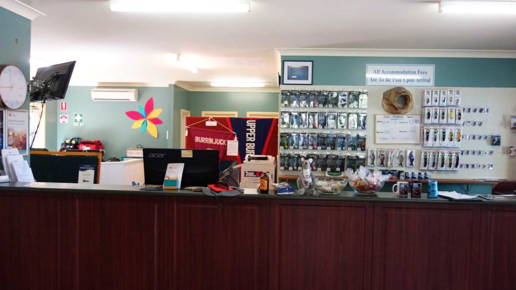
We arrived at Reflections Holiday Park at Burrinjuck at around 10:30am and did what for the day was the hardest part, the walk from the dam up to the Park office. If you do this walk, find out in advance where your accommodation is and drop your packs.
We eat lunch on our cabin porch and we’re almost mobbed by the parrots and cockatoos which were obviously wanting a feed. If you listen to podcast episode 121 you will hear them squawking away in the background.
The other thing we did today was pick up our food drop which we left here eight days ago. We will end up doing a cull as I’ve made some poor brand choices. I don’t know why I chose peanut butter without sugar or salt; I think cardboard would taste better.
The rest of today I’m in social media and podcast mode and that will take a while. Since there is no phone signal the access to the internet is limited and the best place to pick up good signal is on the porch of the office as the cell tower is close by.
I’m looking forward to a sleep in a bed tonight and the chance of a shower. Tomorrow we are on the boat and crossing the dam at 8:00am.
Our first off road section
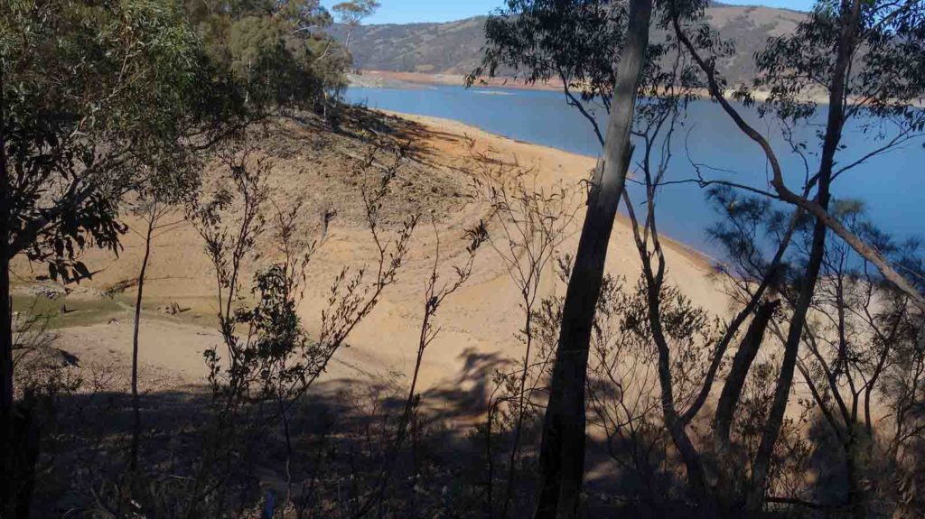
Approaching Burrinjuck dam, the water level is very low
Crossing Carrolls Creek before reaching the caravan park
Caravan park Office Burrinjuck
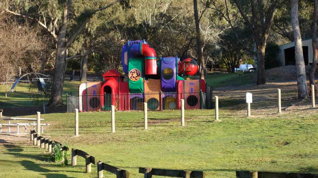
Play area at Burrinjuck

Shop at Burrinjuck
Drying off gear at our cabin

Birds wanting food
Day 4
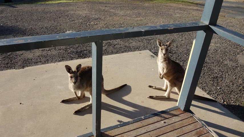
It’s the start of day 4 and we both had a good nights sleep in our cabin at Reflections Holiday Park on Burrinjuck Dam; it’s amazing the difference a mattress and a hot shower makes. This morning I need to get up early and head to the office to post on social media only to discover I have good signal in the cabin so I am very pleased about that given it’s a cool morning. This morning the birds have been replaced on our porch by kangaroos wanting to be fed. The kangaroos are fat and lazy, and I even saw one eating laying down with about as minimal effort as possible. It is no wonder they’re so plump.
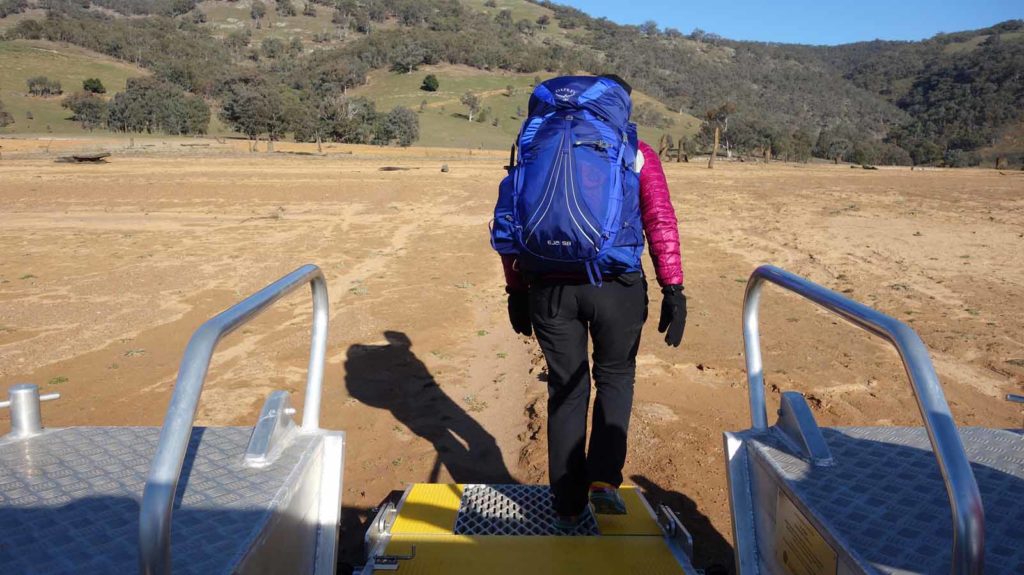
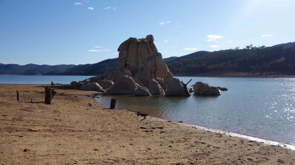
This morning we meet Dean the park manager at 8.00am for an interview for the podcast and then he will drive his boat and us across the Dam to the start of our walk for the day. The boat ride is nice and smooth and takes us around 10 minutes to our drop off point at Cathedral Rocks. Dean tells us that the Dam level is around 32% and that at full water the Cathedral Rock is under water by about 5 metres. He also tells us there is another group of hikers following behind us which must be the group I was aware of prior to starting.
The start of the walk sets the scene for the day as we gradually make our way uphill away from the Dam and at this stage its through rural properties. We only see about five cars for the entire day and most of those are on the outskirts of Wee Jasper which we skirt around and it’s very pleasant walking at this stage. We also pass through our first private property and there are trail markers everywhere to make sure we stay on track.
We stop for lunch on the crest of the hill and enjoy spectacular views over the rural valley. After lunch we press on to the Fitzpatrick Track Head. We arrive there just before 2.00pm and while this is an exceptional campground that has showers as well as a potable water tap, we decide to press on after topping up our water. The army has a training course on and at the time we get there they are all out bush doing rock climbing and abseiling but we talk to the designated chef who is minding the camp and is kind enough to give a piece of fresh fruit each. Even with this large group, the campground is big enough to hold everyone comfortably.
We top up our water bladders as well as one of our 2 litre spares just in case we don’t find water. This section is 11.3 km until the next campsite and water source, and is rated hard which is an understatement. To start with the trail is a bit confused just as you leave the campground but we follow what we think is the obvious route and find the trail proper not that far away. After a very short period of flatfish ground the track is almost all uphill with a gradient of about of 1:10 or worse for much of it. I’m carry just on 21-22 kg of pack weight which includes my split of eight days of food for two people and 5 litres of water and given how unfit I am at the moment I’m feeling it.
In addition to being a steep section, the track is narrow with steep drop offs in some areas. In heavy rains this section of the trail would be treacherous and would require slow and deliberate foot placement. At around 4.15pm we reach a flat area below the saddle having done just over 5 km of very, very hard track and decide to call it quits as we are both well and truly stuffed. We camp on an area that has very obviously been used before as it’s been cleared of sticks and rocks. There may be other sites but I doubt that they would be better. We set up camp, have dinner and are asleep just before 7.00pm which is a late night for us.
Feed us
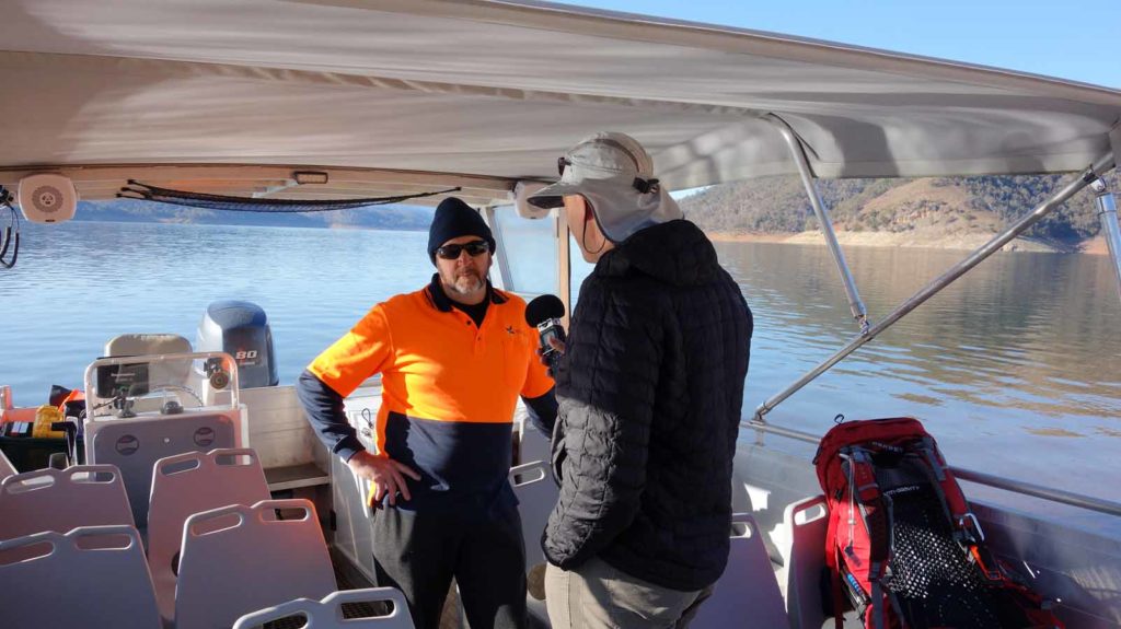
Interviewing Dean on the boat
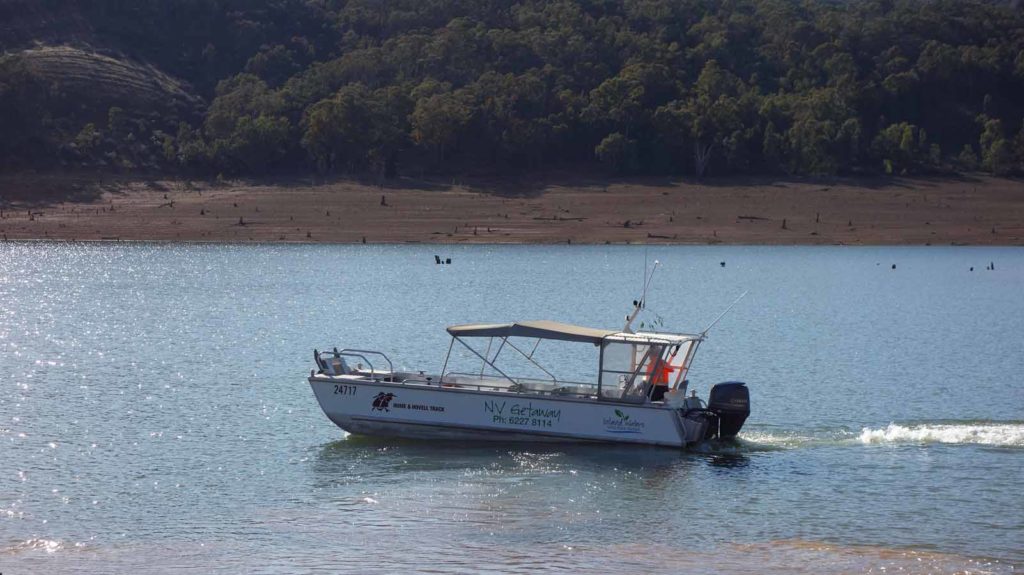
Boat on the Dam
The boat crossing across Burrinjuck Dam takes around 11minutes once you get going
Exiting the boat which is well set up for hikers with packs
Cathedral Rocks
Looking back towards Burrinjuck Dam on day 4

Cootamundra Wattle
Walking through private property day 4
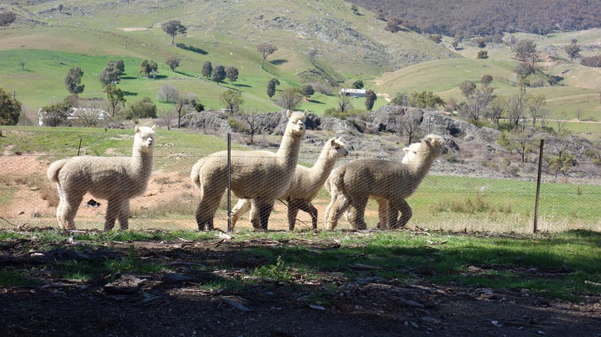
Lots of lamas/alpacas
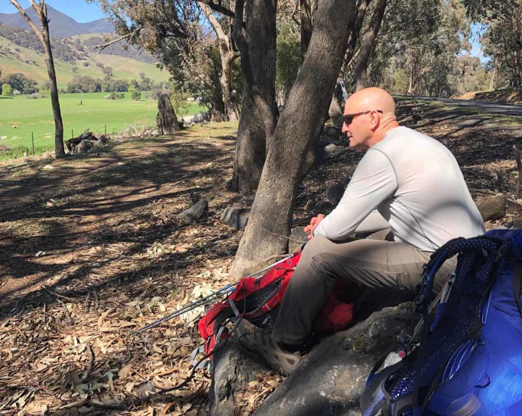
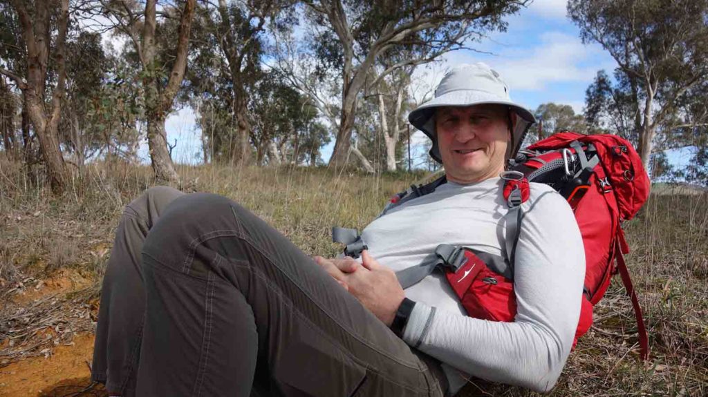
Tim on the Hume and Hovell at our lunch stop day 4
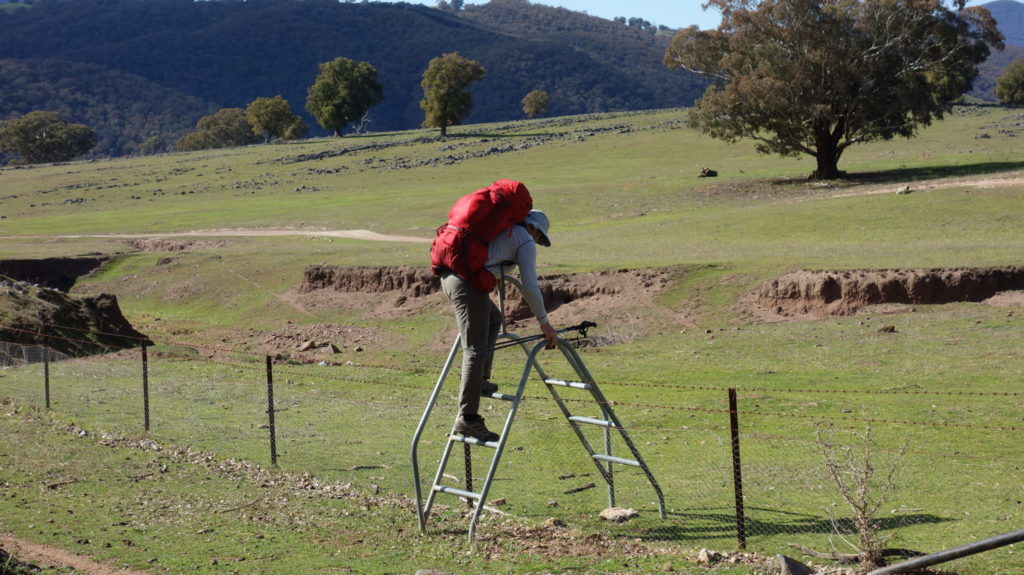
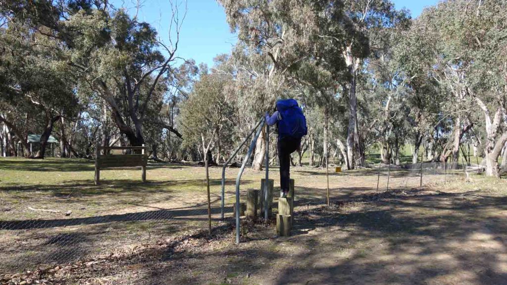
One of the many Stiles on this track
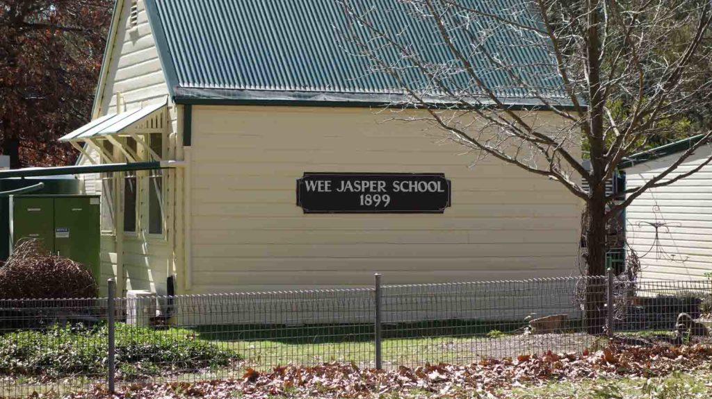
Wee Jasper School

Fitzpatrick Track Head

Grevillea in flower
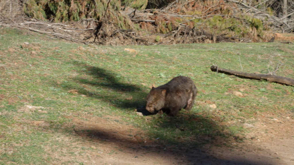
Wombat just off the track
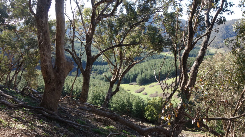
The view down into the valley below
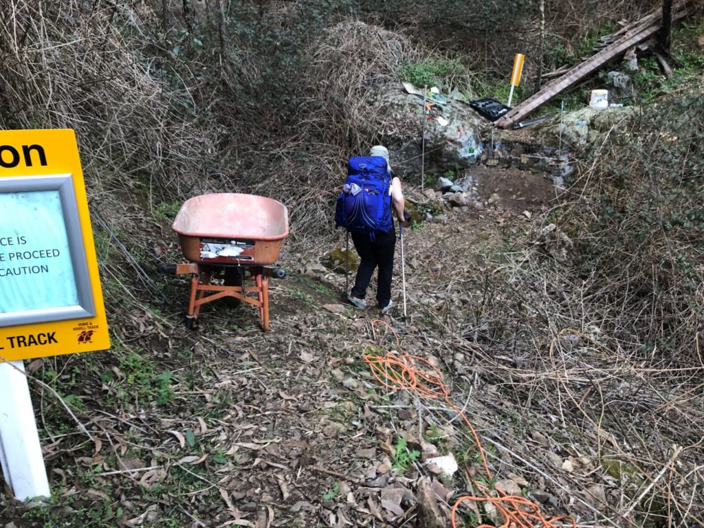
Track repair
Day 5
We start the morning the same way as yesterday; going ever up. For some reason I thought we weren’t going to Summit Mount Wee Jasper but we did for a morning gain of about 500 metres in altitude and a chance to catch up on social media. The view was fantastic.
During this walk we go through a couple of changes in landscape into a more open forest which is the type of environment we like. While the government is progressively killing off the blackberries dead or alive, they still manage to snag us. We are heading downhill now and come off Mount Wee Jasper onto a forestry road.
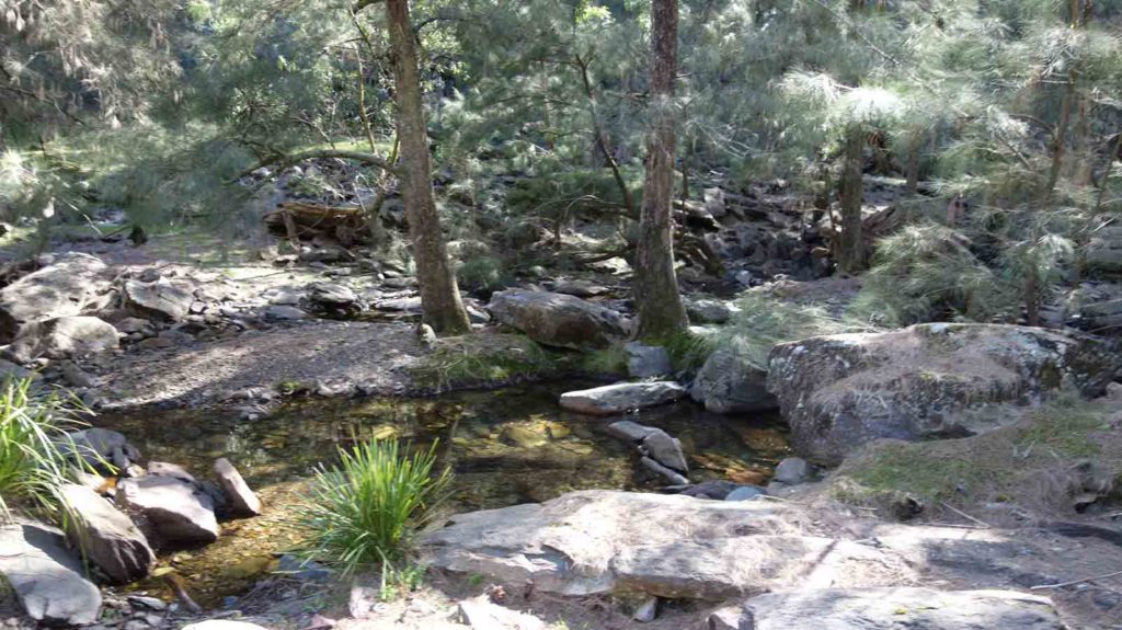
We road walk for a few kilometres before heading back into bush again following a creek (the only chance for water on this section) before we reach Log Bridge Camp. Log Bridge is the typical set up with a shelter and toilet nestled in a valley on a creek. The roof and one wall are missing from the shelter but it’s still a pleasant little site all the same. We have our lunch and then press on to Micalong Campsite and get there just in dark at around 6.00pm. We are greeted by another hiker, Sarah and her dog Bella. By the time we are set up for the night and have dinner they have already gone to bead for the night and we also head to bed around 8.00pm.
This campsite is right on the river as is our tent, in fact the edge of the camp is only 20 metres away from the water. This is an indication of when it was built as that wouldn’t happen these days. We have the flattest campsite possible so are looking forward to a great sleep.
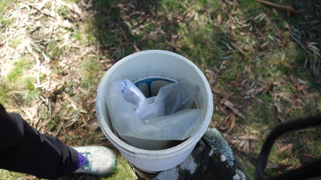
The pit toilet has been used for someone’s garbage (mostly empty beer bottles and cans!) but at least they had the decency to put it in a rubbish bag. It always amazes me that people won’t pack their rubbish out.
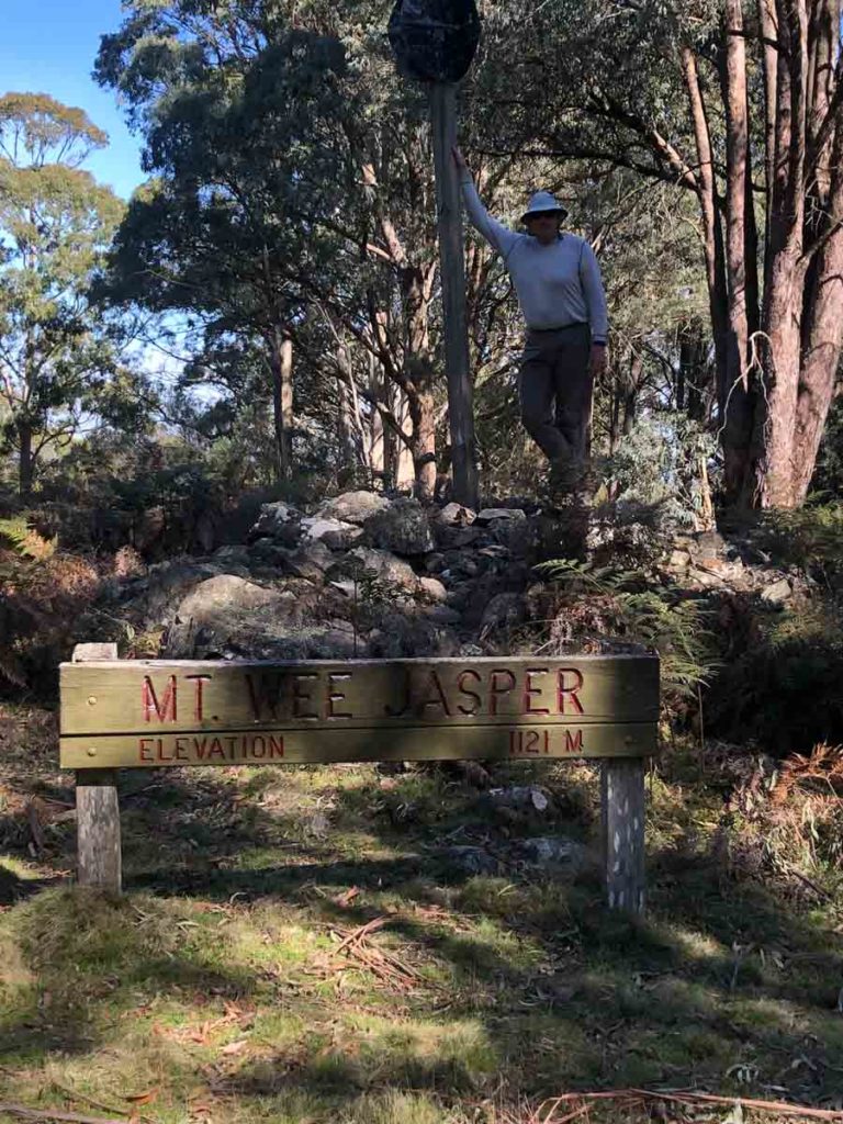
On the Summit of Mount Wee Jasper
Log book on top of Mount Wee Jasper
Deep Gully Heading towards Micalong
Native Orchid
Day 6
We both get a good nights sleep less than 10 metres from the Micalong Creek. This creek is bigger than many rivers I’ve seen and I try to search the dim dark recesses of my mind for my geography lessons about what defines a river but fail. It appears it’s gone the way of calculus and trigonometry.
As we pack, our fellow camper Sarah and her dog Bella are up and about so after we have eaten we go and say hello. Sarah is kind enough to talk with us for the podcast and tells us this trail is the only one in Australia that allows dogs (but not in all sections). So Sarah is hiking with Bella where she can and a family member will pick her up for sections where dogs aren’t allowed. It’s interesting to hear Sarah talk as she is a vet and lets Bella set the pace. They are carrying two first aid kits, one for her and one for Bella. We finish packing and press on.
The plan is to reach the Thomas Boyd Track Head but we know that doing so will depend on the terrain. If need be we will stop early. We reach the first campsite in good time before lunch despite a diversion due to a destroyed bridge which requires us to get wet feet so we stopped for an early morning tea. The middle of the day gives us a false sense of hope that the ups and downs have finished. After making good time we hit the hills again, and again the terrain changes but it’s feels for both of us very familiar and provides a feeling of being home.
We foolishly think that our current pace we will get us to the Thomas Boyd Track Head at around 5.30-6.00pm but then the hills continue. And by hills I mean serious hills. Mainly downhill to start with, which my knees hate, but also with some steep treacherous sections, many of which require negotiating around blackberries, wombat holes and tree falls. Lots of trees falls. And then it’s up again on a gradient approaching 1:3. There aren’t any options for stopping early due to private land so our only choice is to press on. I must admit this wasn’t a consideration in the planning process as we had intended on staying at designated campsites all the way but realise that stopping early is not an option in many sections and that pressing on is the only choice. We arrive at the campsite at 8.00pm for our hardest day of the trip so far.
We are both stuffed. I’ll never start a hike this unfit ever again! Having said that this trail continues to be the most physically demanding we have ever done.We eat dinner and set up camp and by the time we get to bed it’s 10.00pm which is the latest finish to a hike I’ve ever had. I’m definitely looking forward to a good night sleep.
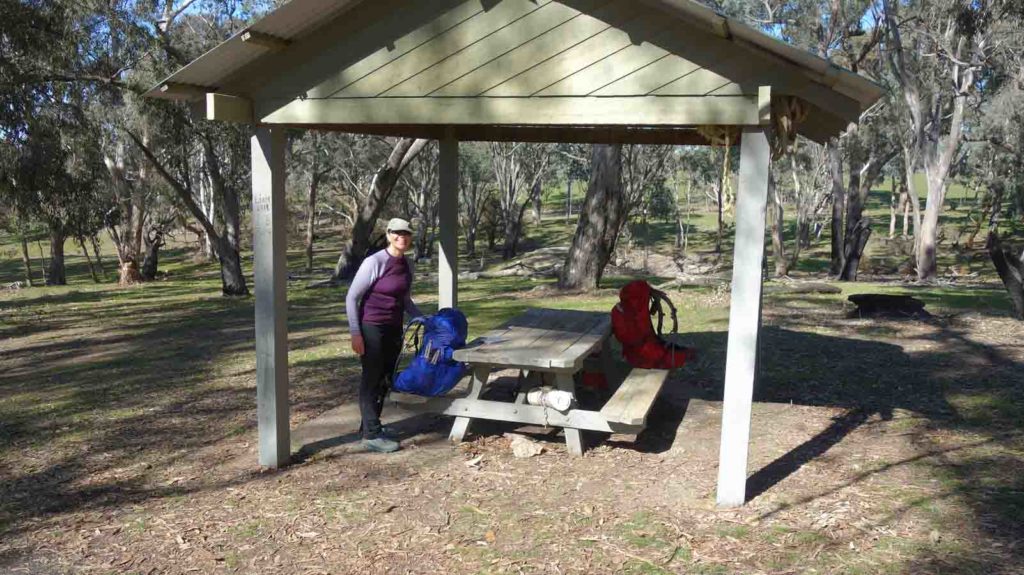
Thomas Boyd Track Head is a brilliant site and well set up – given its the middle of the week we have it all to ourselves.

Creek crossing at detour
Broken Bridge
Day 7
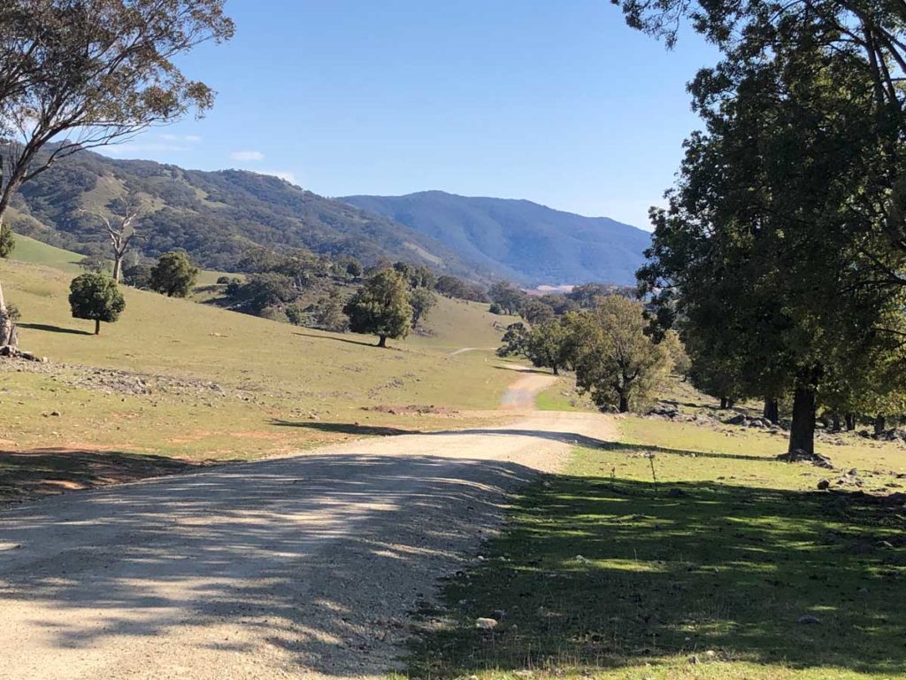
We wake earylish at 5:00am and one thing that comes to mind is the mild weather. We are forecast for some cool nights but nothing below zero degrees which surprises me. Just a few weeks ago there was ice on the trail. We are slow to get moving after yesterday’s epic day and leave the Thomas Boyd Track Head around 8.30am. The day starts out pleasantly enough travelling through rural NSW weaving our way through farms as we go; sometimes through, sometimes around.
We cross three suspension bridges during the day, the first at the campsite which is solid and pretty stable as is the third. The second is a very unstable bridge without wooden slats and as a result it’s a bit scary. If you have a fear of heights, don’t look down! We press on continuing to walk through some lovely rural landscapes and then it’s back to both bushland and farms. Again we are swooped by magpies who think that 100 metres is too close to their nest and continue to do so all the way up the hill.
By this time it’s raining. Hard. I have the opportunity to do social media posts standing in the middle of a paddock but pouring rain and strong headwinds are not conducive to getting out the electronics.
We keep on going expecting we won’t reach the Blowering Dam campsite as the going has been slow but we hit the Snowy Mountains Highway and move a lot quicker. In addition there really is no other camp option so we press on. We reach Blowering Dam and get excited because we can see a large park and think we have reached our destination. We were a bit confused because we were convinced we would be camping on the Dam itself. It turns out that this area is a just a ‘day’ park and camping is prohibited.
We have one more climb to the top of the Dam wall and then it’s down again for about 500 metres on a gradual descent and we finally reach our campsite, still in the rain, just before 6.00pm for a 10 hour day. We pitch the tent as close to the shelter as we can so we can at least get out of one door without getting saturated.
After a bite to eat it’s just on 8.00pm and it’s time for bed and by now the rain has really set in.
Part of the infrastructure at the Thomas Boyd Track Head
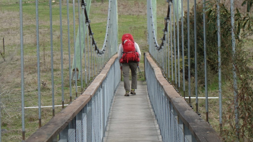
Crossing the suspenion bridge at the Thomas Boyd Track Head
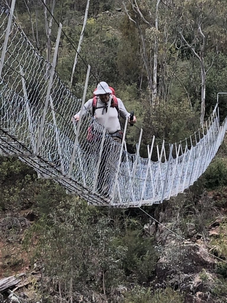
See through suspension bridge
Campsite at Blowering Dam
Day 8
As promised by the weather forecast another day of rain. The morning wasn’t too bad with just the occasional shower but as the day wore on it got heavier and more frequent. Today we walked 21.5 km around Blowering Dam and didn’t quite reach our designated stopping point of Yellowin Campsite, falling short by about 9 km. The rain, and on my part a lack of energy, have set in. I usually find that I struggle as I start dropping weight and my body fights me on my need for energy … at the moment my body is winning. That will change over the coming days but it just makes things harder. Gill is powering on and helping me get through this malaise.
We had some great views over Blowering Dam today and for some reason I know most of the other big dams but this one just slipped my mind. Days later one of our tribe on social media reminds us that this is where Ken Warby set speed records on water, I remember the name now. About mid morning we stop for a rest and I check my phone signal and hooray it’s strong enough to post. We spend about 40 minutes on the side of the track playing catch up on social media before heading off.
We press on to Browns Campsite which is typical of the camps on this track and have an early lunch under shelter. On we trudge through the mud and the rain and while the Dam level is very low, a few good days of rain in this large basin will help raise the Dam level quite quickly. There’s an image on the Hume and Hovell website that I’m pretty sure shows the Dam at full height and boy is it different.
A highlight for today was when I saw an Emu dad and his chicks – very pleased, although Gill missed out. We decide to stop at Windy Point as there is an area to camp as well as a toilet. Pretty basic as far as campsites go and it’s a 500 metre walk to the water. We set up the tent in one of the rare moments of sunshine we manage to dry off the tent given we didn’t have a chance this morning. We have an early dinner and are in bed by 6.00pm. We hear a car enter the camping area as it gets dark and it seems to be driving around in circles before it pulls up outside our tent and then turns off its lights and drives away. We hear a gunshot shortly after and realise that the hunters are out even though it’s not allowed in this area.
The rain has finally stopped but we aren’t sure for how long. The rain I don’t mind but it makes the track very muddy. Tomorrow is planned as a 14 km day so we should be able to make up some distance and time but that will depend on difficulty of the upcoming section.
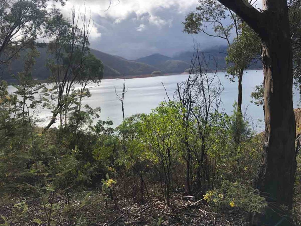
Blowering Dam
Brown’s campsite, a typical campsite on the Hume and Hovell Track
Day 9
It’s day nine and I’m feeling much better after yesterday’s bad day. Everyone has bad days in long distance hiking and usually for me it’s on day two. Today I felt much more myself as we covered just on 26 km and at least for the moment we are back on track; when the maps describe a section as hard, they mean hard and with it the average speed drops. The one downside of last nights sleep was I had the weirdest dreams I have ever had (dinner related perhaps?) which Gill thought was quite funny when I told her. It’s so good when you can make your wife laugh!
Another day being swooped by birds but this time it was a pair of Welcome Swallows who had built a nest in the toilet. Don’t know why they didn’t care yesterday but they did today and aren’t happy that I’m there. The magpies on this section of the track don’t seem to care about hikers so at least from that perspective we were safe.
We spent until lunchtime walking a forest road along the shores of Blowering Dam and reached our planned destination for yesterday, Yellowin about 2.5 hours into the morning. There are so many possible campsites along the Dam shore that we could have easily walked on yesterday but I was just so exhausted our chosen stopping destination was the right one.
The forecast rain for today only amounts to some very quick showers and that’s a blessing but the red clay soils on the road stick to your footwear which can be annoying. The forecast for rain is easing from now. One thing we notice is the warmer than expected temperatures with sub zero temperatures being the norm just two weeks ago. Can’t not like that.
Immediately after lunch we started a 300 metre ascent up a hill but on a road with a good gradient so it wasn’t as bad as some of those we previously walked on this track. By now we are approaching Talbingo Dam and the only time I have been here before is to do diving work on the Dam wall; but that’s another story. The scenery is ever changing with different vegetation types being present. A lot of the park-like areas that make up the camp sites along Blowering Dam look like they were planted in the 1960’s-1970’s based on the plant selection. There are groupings of plants I just haven’t seen together for that long.
After a slight climb up we finally reach the Ben Smith Campsite just before 4:00pm and that’s us for the day, back on schedule although that may change depending on the terrain over the next few days. As we walk down the valley to the campsite I see one Deer and hear another, the first for this trip. While cute they are becoming a major pest in Victoria and progressively moving into NSW in bigger numbers.
We set up camp, filter water, eat and are in bed for an early night and to catch up on social media. I go to sleep early and wake up due to the brightness thinking that it’s morning so I crank the Ipad only to discover it’s 11:00pm and the moon is creating all the light. It back to sleep I go.
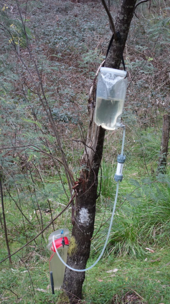
Filtering Water at the Ben Smith Camp Site
Tree damage at Campsite
Day 10
We were a bit more organised this morning and after another rainy, but mild night, we are up early, packed and away by 7.30am. Our plan today is to get to Paddys River Campsite but we will see how we go as that’s just on 29 km including a morning of hard terrain.
We head down the hill in bushland before walking on management road for a short period and then it’s back into walking through rural properties. All the weaned calves are in a couple of paddocks and they expect to be fed but aren’t quite sure if we are the ones who do that. A young bull calf mock charges a few steps before running away and we are followed by about 40 of them until we move on to the next paddock and it’s another walk straight up the hill to bushland. There is some snow on the southern side of one adjacent mountain which shows we are nearly into the high country.
To start with we are walking around the hill’s following the gully’s on a steady but mild incline so we make good time. The terrain starts to get steeper and we can hear the sound of water which turns out to be the Lower Buddong Falls. We cross the falls at this point and now it starts to get hard; and I mean really hard. The gradient is less than 1:10 at this point and as bad as 1:3 in some areas. The track is very narrow and has been washed out in a couple of points so care and attention is needed with our footing. We pass the upper Buddong Falls and skip the side trip for the better photo opportunities. From any angle the falls are impressive!
We stop for lunch at the Buddong Picnic Area at just on 4.5 hours after we start which is not bad going since the recommended time is 5 hours.
The going gets easier at least from a perspective of the slope but now we are back on management road and the week of 4WD use has left its mark turning sections of the road muddy. We reach Buddong Hut not long after which tends to be a typical high country hut. We stop for a quick visit before pressing on.
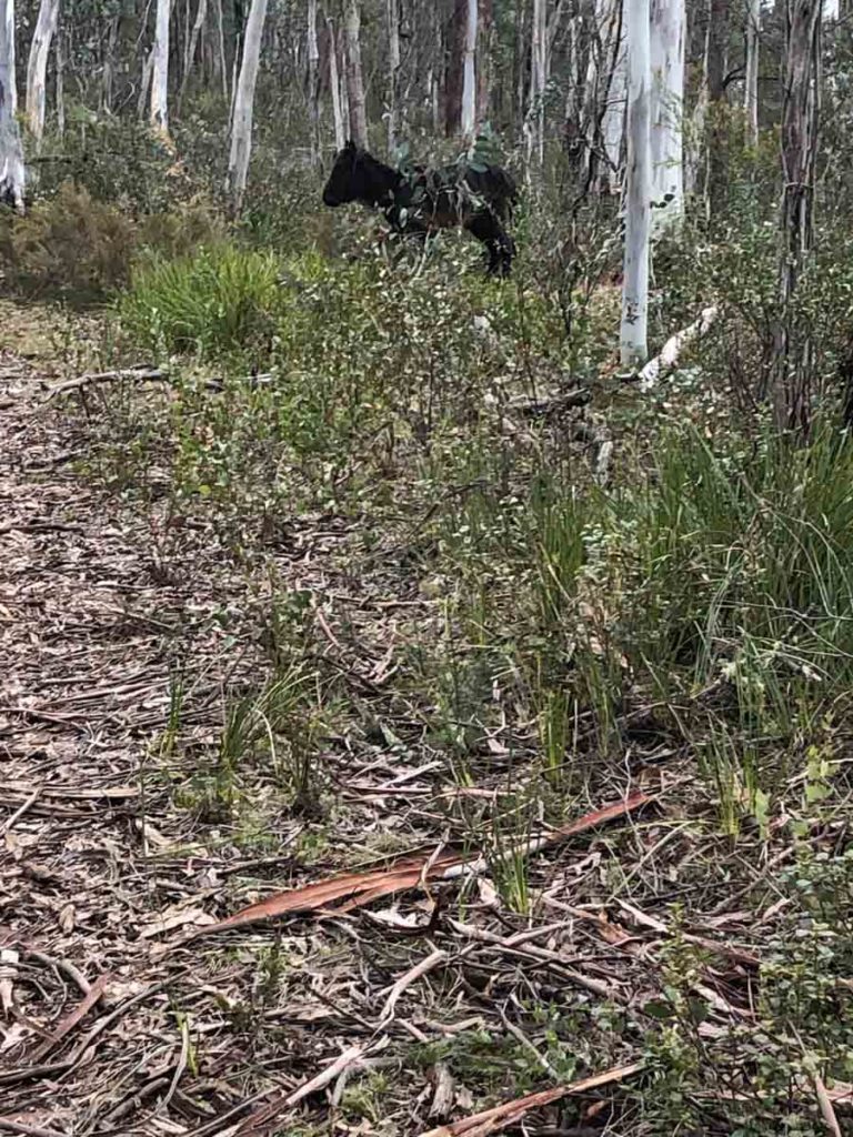
We are starting to ascend again and the landscape is charging and we come across our first Brumby. It’s small and doesn’t look well and the fact that we get as close as we do is an indication it’s not well. It finally decides to move and in the process falls over before getting up and quickly moving off.
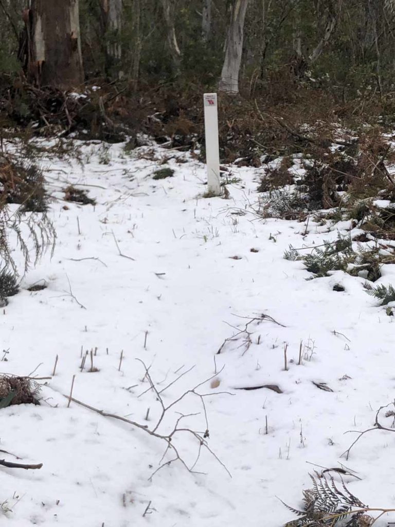
The other thing that starts to appear is snow, gradual at first but by the time we reach the high point we are walking through solid snow and the trail becomes hard to follow. We expected snow on this trip given the time of year and this year’s falls have been light overall.
The choice of white trail markers becomes questionable at this point and at one stage we had to take stock of our location before committing to a direction. There is really no opportunity to stop early with no water (apart from melting snow) and no flat ground so we press on making good time. We exit the bushland and while the snow is still around we are back on management road heading straight to Paddys River Campsite.
We arrive around 5.00pm, tired but pleased we have reached our destination. There is a 4WD vehicle across the small dam so we pick a site away from everyone else under some low trees. Two fisherpeople pass by and while they haven’t had any luck they have seen a Platypus so we are hopeful as we continue on in the morning.
Back to our evening routine of setting up camp and cooking and by this time the cold has set in so we eat inside our tent. We record for the podcast and we can see our breath so know that it’s going to be a cold night. We discuss our plans for tomorrow which is a day of around 22 km to Junction Campsite – we may add another 6 km to get us to the Henry Angel Track Head but that’s a decision for tomorrow.
Wild Horse
Snow on the Trail. it got heavier by the end of the day
Day 11
Last night was a very cold one and while I don’t have a thermometer with me I estimate from experience we reached about -5 degrees Celcius. The water in my pack bladder has frozen and the condensation on our tent fly was also ice. Gill had almost every bit of clothing on she was carrying and I had put on my thicker layers to sleep in. We decided on waking just to have a quick bite and have a cup of tea later in the morning which is a rarity for us.
We are of two minds this morning whether to stop at our planned stopping point of Junction Campsite at around 22 km or press on to the Henry Angle Track Head which is a further 6.5 km but will see how we go. The walk today isn’t difficult but it’s long and involves winding our way in and out of the gullies and hills although moving downwards out of the snow zone very, very gradually. The vegetation changes as we go lower and also on the sunny and shady sides of the hills. We start to see tree ferns and ground ferns and the undergrowth increases as we descend. We also see seven horses today and while they are wary of us they don’t race off like they do in the high country.
While it’s not difficult walking it’s long and and there is the occasional treefall, one of which we take about 10 minutes to get around because of its location. We realise that if we want to reach the Henry Angel Track Head we are likely to be walking in the dark so opt against that.
We enter the private forest area where Junction Campsite is located. There is a sign telling us that logging activities are in progress and to contact the operators (text only as there isn’t enough signal for phone) on the number provided. This seems to be an old sign but we do it just in case. We hear back from them and they confirm they aren’t logging in that area at present.
We press on and reach Junction Campsite around 4.00pm. So far this is the best camping site (with the exception of the track heads) as there is no 4wd access being a private property. There are plenty of good flat areas next to a creek as well as the usual picnic tables and toilet. Also lots of wombat holes.
We are in bed by 6.00pm having set up and eaten in the sun today. I was hoping for enough signal to do the podcast but no joy so it will be late this week (which I hate) but outside of my control. With luck I am hoping for tomorrow night. Only eight days to go if things go to plan.
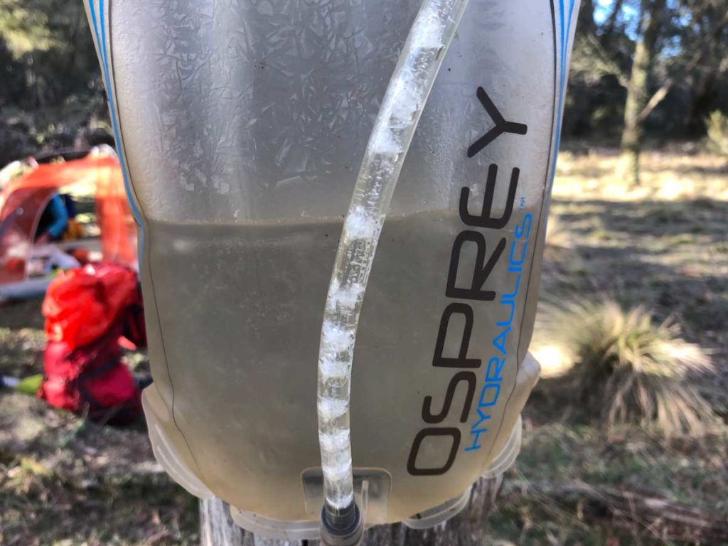
Frozen water Bladder at Paddys River Camp Site

Interpretation centre at the Henry Angel Track Head
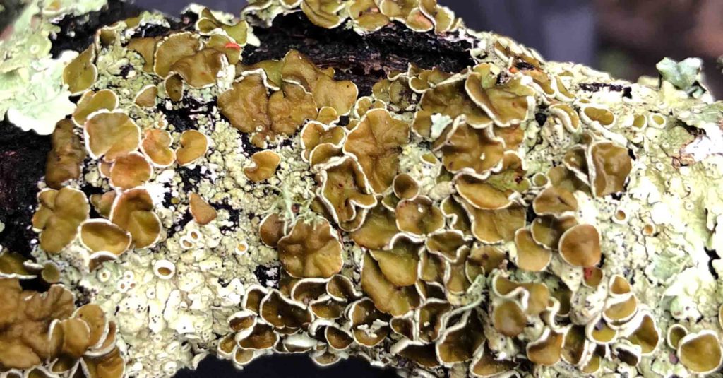
Lichen
Day 12
It’s day 12 and we’ve had another frosty night this time at Junction Campsite. We woke to find ice on the outside and inside of the tent. As lovely as it is to sleep beside a babbling creek, the combination of moisture and cold temperatures has its consequences. This morning was in no way as cool as yesterday so there is some good news. The Big Agnes Copper Spur UL2 Platinum three season tent is surviving it all!
We have a usual morning routine but it was easier today to swap tasks. I packed up the inside of the tent and Gill collected the (icy) water to filter for the water bladders and our morning cuppa. Junction Campsite is a really nice spot and we were sad to walk away around 7.30am. We head off to Henry Angel Track Head only 6.5 km away and arrive in time for an early morning tea in the sunshine. We are impressed with the campsites but especially the track heads on the Hume and Hovell Track. Henry Angel is no exception. The facilities are great and there is also some really interesting interpretive signage too.
We now head on towards Mannus Lake Campsite and fingers crossed, our food cache! The hike to Mannus Lake takes us through farmland and past the remnants of late 1800 gold mining operations. We’re also now very much walking in the footsteps of Hume and Hovell. The sad thing is that any visibility of this old infrastructure is hidden by blackberries.
We follow the creek which rages beside us and Gill stumbles upon one of our favourite things – an echidna. It takes a bit of time for it to notice us and then it tries to hide when it sees me with that ‘oh crap I’ve been spotted look’. By hiding I mean moving six inches to the right and burying its face in soft soil … a case of ‘if I can’t see you, you can’t see me’ as well as ‘l’m sharp and pointy’.
We soon encounter the steep and long ascent through the Bugandyera Nature Reserve. The ascent was flagged as hard but given what we’ve encountered in previous days, it wasn’t too bad. The temperature today was 18 degrees Celcius and we were in full sun which did make it tough.
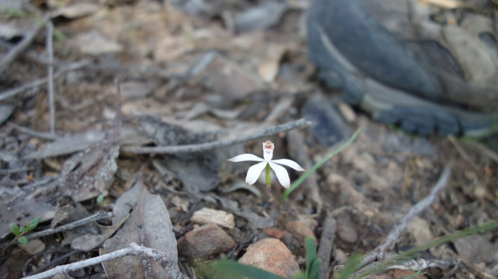
Once the ascent was out of the way, we meandered along to discover more of our favourite things. Gill notices a native hooded ground orchid and then another. I then see a different species and once we have our ‘eye in’ we see dozens and dozens. So many so that we stop taking photos. What a great day this is!
We see Mannus Lake from the distance and continue the long descent through rural properties. We get to the campsite and notice a couple who have set up their caravan on the other side of the camping area. We have two priorities now 1. dry out and set up our still sopping tent (a byproduct of the ice from the morning) and 2. recover our food cache. Gill handles the tent and I recover the food. Both tasks are completed with minimal fuss.
Camp setup and dinner done and it’s time to do our podcast editing and publishing given I have good 4G connectivity being so close to town but which makes for a late night.

Echidna
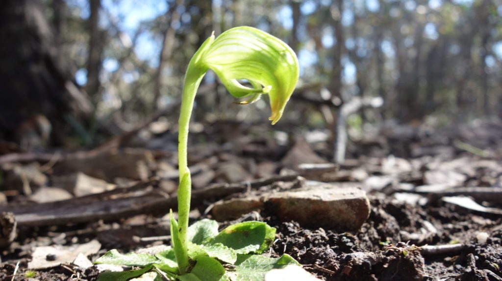
Pterostsylus Orchid
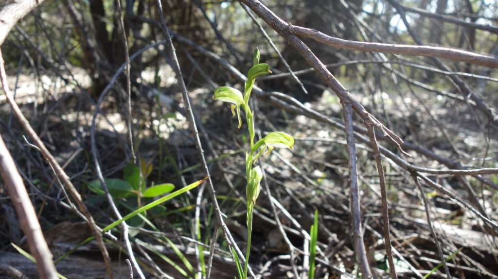
And another species
Day 13
After another cold start to the morning at Mannus Lake due to all the moisture we pack up and head off towards Mundaroo Campsite. Again we spend much of the day walking on management road and for much of the morning we are walking through forest. This time there is active harvesting going on with a number of side roads closed due to the work. We have to stop around mid morning for about 15 minutes as a logging vehicle brings a load of logs down the hill and stacks them on the side of the road.
The pain in my knee has been an ongoing issue for a few days now. I’m not enjoying myself and while we have been monitoring the issue for a few days the conversation turns serious. Do we keep on going and try to complete the remaining 116 km or do we pull the pin on the hike. This is a difficult decision and a hard one to make but I don’t want to do permanent damage to my knee so we decide that it’s time to call it quits.
Those who have known me for a number of years will know I have an obsessive personality and am one of those people that puts in 110% effort, finding that extra bit of something, seemingly from nowhere, to get through just about any situation. My right knee has been failing and while I can spend the first few hours of the day averaging around 4.5 km per hour walking speed (depending on the terrain), at around the 2-3 hour mark, my knee is swollen considerably. The pain gets to the point that my walking speed is around 2 km per hour on flat easy ground. While I was managing to walk anywhere up to 26 km per day I was doing so on regular applications of Voltaren and doses of ibuprofen. Masking the pain is also leaving me with a hot sweaty nauseated feeling that is impacting my focus – not good from a safety perspective or enjoying the walk.
We reach Mundaroo Campsite around 3.00pm and set up camp. This campsite is probably the most unloved of all the ones that we have come across so far. The regrowth is starting to encroach on the grassy area and in one part is only about a metre away from one of the fire pits. There are also a lot of dead branches across the site which seems to indicate that the camp hasn’t been maintained for a while. Another issue here is that getting to the water source at the bock of the campground is a bit of a bush bash and the water is reasonably silty.
After reaching camp we contact a family member who is happy to come and collect us. We get and even offer to do it that day but that would mean us walking an additional 10 km and her driving at night so we arrange for a pick up tomorrow.
Morning view of Mannus Lake
Mannus Lake in the morning
Day 14
We wake up early after a good night’s sleep and after breakfast and packing up we start walking out to the pick up point. It’s only a 10 km walk today with half of it on the track before we head towards the main road and our designated pick up point. We take our time and reach the road around 11.30am. Our lift arrives about 20 minutes later so we have timed this well.
For me this is a let down and one I struggle to understand in some respects given I managed just over 1000 km on last years hike with no health issues at all. I do have a series of injuries going pretty well up my entire body and the cumulative impact has conspired to create this problem that turns out to be Bursitis. I know what I need to do to resolve the issue and know that it will take a number of months to fully resolve but I’m not a good patient.
Last words
So now the Hume and Hovell Track thru-hike that Gill and I commenced on Saturday 31 August has come to a premature end and what started as a thru-hike has now become a section hike. The decision to call it quits took much soul searching and was a hard decision to make. Only recently we released a post on Calling it Quits on a Hike and in all honesty, I never thought this would be a consideration I would ever need to make with my body always managing to respond to whatever I have asked of it previously.
In terms of the trail we completed so far, this is the hardest walk I have ever done. In part this view was a result of my poor fitness but even with that my view wouldn’t change due to the steep sections of trail, the walking on management track and the narrow (and at times treacherous footing) that you need to pay attention to in some sections.
We have now completed around 310 km of this 426 km walk and are planning on finishing the remaining 116 km in Autumn 2020 and at that time we will update this review and release one last podcast on this track.
To be continued ………….
Things that you need to know before hiking the Hume and Hovell Track
- Depending on the time you have available, this walk this is an extremely demanding track. It is essential that you have planned and are physically prepared for the daily distances that you intend to do
- Work out in advance how you are going to get to the trailhead in Yass. We got an Uber for $98 but we didn’t want to drag our relatives out of bed early on Saturday morning or stay in Yass the night before which would have been more expensive. Buses are available during the week
- Water availability and quality on this trail is variable
- Carry enough water to last you for your planned distances for each day
- Study the maps and know were your water resupply points are
- Carry water purification tablets/drops, as well as a filter, sometimes it’s just easier to chemically dose the water
- Carry a water pre-filter. Some of our water sources were very silty
- Be prepared for snow conditions between May to September
- Be prepared for cold conditions. We had -5 degrees Celcius temperatures in mid September
- You will be walking sections of road throughout this track
- Pay close attention to where the private property is. There is no camping allowed on private land and if you just look at the distances you may find that your planned campsite isn’t an option
- Check the availability of the boat across Burrinjuck Dam as this will impact on when you walk. The boat availability is a good reason to do this walk in a southerly direction
- You can do the alternate route that bypasses the water crossing
- Check when Cooma Cottage (the starting point in Yass) is open if you want to look around the site
- Depending on the weather you will need footwear that has good grip as the trail can be a bit treacherous
- Wear long sleeves and long pants to protect yourself from the blackberries
- Phone signal on much of the trail (on the Telstra network) is pretty good. Internet signal is intermittent.
- Bring your own toilet paper as the majority of campsites don’t have any.
To be continued.....
Our remaining section of this track was due for completion in early 2020 but due to COVID this has become a project for 2021, and then 2022. We will update this write up at that point in time
Resources
- Hume and Hovell Track Website
- Hume and Hovell Track Facebook Page
- Hume and Hovell Track Instagram Page
- Purchase the Hume and Hovell Track Map Set
Disclaimer
This track was walked by Gill and Tim Savage from Australian Hiker. We still have 116 km on the southern end of the trail to complete and will update this article in Autumn 2020 on completion