The Big Hole Walking Track NSW (3.7km)
NSW
Nearest Town
Braidwood / Captains Flat, NSW
Best Time of the Year to Travel
Year round
Starting Location

Trail head at the Berlang Camp Ground, Deua National Park. There is plenty of parking and camping at this site
Finish Location
Trail head at the Berlang Camp Ground
The Big Hole Walking Track Review
This is a walk I have had on my ‘to do’ list for a couple of years and for one reason or another it took me a while to get around to doing it. After taking a short break from hiking due to an injury, I decided this short walk fit the bill so on a cool mid Spring morning we headed off to Deua National Park.
The first decision you need to make for this walk is deciding which of the two routes you will take to get to the trail head. Do you travel the shorter, but narrower road through Captains Flat or take the longer sealed road through Braidwood? The Braidwood option is the one we recommend as the road to the trail head is sealed with the exception of the last 700 metres into the trail head. The road via Captains Flat has a large section of winding dirt road and only ends up being 10 minutes faster.
The trail head is located at the Berlang Camp Ground which is around 700 metres off the Cooma Road on a dirt road. While the turnoff is well signposted, I managed to ‘break’ Google Maps which tried to tell me the real turnoff was another 500 metres down the road. When I turned around after finding there was no road further down, Google Maps went into a loop and got very unhappy because I was supposedly going the wrong way!
The Camp Ground has nice flat grassy camping areas along with a single composting toilet, picnic tables and fire pits. There is also information signage as well as a box to pay camping fees if you decide to stay overnight. The information sign identifies the two walks that start from this camp ground which includes The Big Hole Walk as well as the longer Marble Arch Walk.
Cross the short grassy area to the starting signage and follow the well formed path all the way to the lookout platform at The Big Hole. Something I skipped over when researching this walk is that you need to cross the Shoalhaven River very shortly after starting the walk. On the day we did the walk, we managed to rock hop and keep our feet dry but if you have poor balance or if there has been recent rain then you are likely to get wet feet as you cross.
This trail is uphill almost the entire way to the halfway point but the gradient increase is slight and steady so you don’t tend to notice. The surrounding vegetation is a mixture of low heathland interspersed with medium sized Eucalyptus forest and is very pleasant to walk through. Wildlife was non existent on the day we did this walk but that’s not what you are here for – your goal is The Big Hole which is a large sinkhole at around the 1.9 km into the walk and it just appears out of nowhere. Most people will take around 30 minutes t0 reach the lookout. In fact without the warning sign and fence that appears shortly before reaching the destination, you wouldn’t even know the hole was there. This is a walk you want to keep a very close eye on your kids, as while the fencing is excellent, if they decide to wander off the trail the sinkhole (which is around 100 metres deep and 50 metres across) is easily accessible.
The viewing platform has some nice timber seating on which to take a break. The fencing is right on the edge of the hole and while I don’t have a fear of heights, it does feel like it would be oh-so-easy to fall in, even though the platform is nice and robust.
We spent around 20 minutes taking in the view before turning around and heading back to the trail head. One thing to note here is that the trail continues on to the Marble Arch which is a 13.5 km return trip so if you are fit and have the time, do the longer walk so you can take in both sites.
The views on the way back to the trail head are panoramic and are an added bonus to viewing the sinkhole.

Turn off to Berlang Camp Ground which is around 25 minutes from Braidwood, NSW

Side road to Berlang Camp Ground. The camp ground is about 700 metres down this road
Car park and information sign

Camping fees

Toilet at Berlang Camp Ground

Fire pit at Berlang Camp Ground

Big Hole information

Picnic and camping area

Starting sign

Shoalhaven River
Rock hopping to get across the Shoalhaven River

Spent Banksia flower

Trail example on The Big Hole walking track

Scenic view on The Big Hole walking track

Grevillea in flower

The Big Hole walking track ‘stairs’

Native pea flower

Final approach to The Big Hole. Keep a close eye on the kids from here

The Big Hole viewing platform

Seating at The Big Hole viewing platform

The Big Hoe – 100 metres down and 50 metres across
Video taken at The Big Hole viewing platform

Interpretive signage at The Big Hole
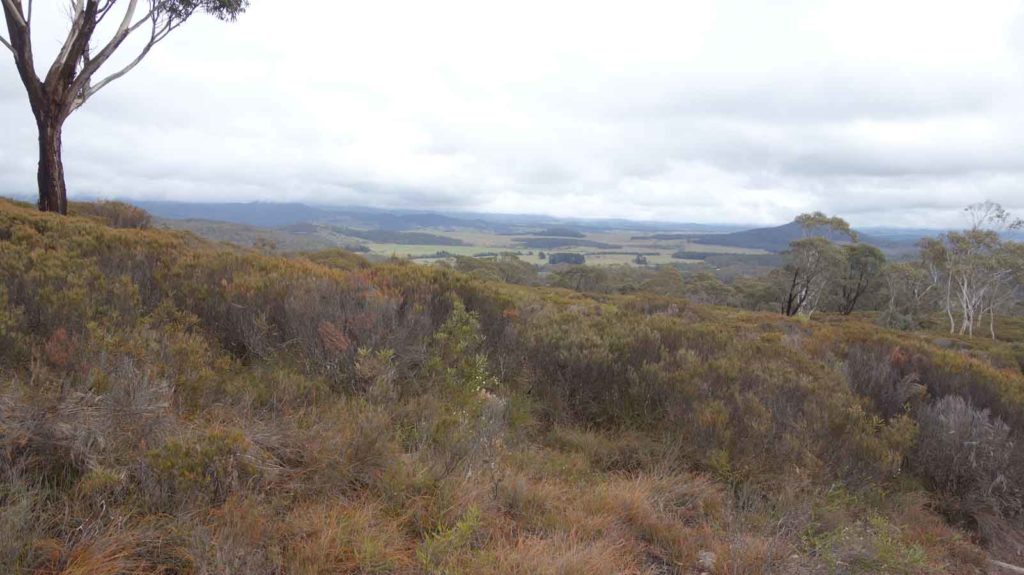
Stunning view on the return journey

Panorma on the return trip

Back to the Berlang Camp Ground
Getting There

The trail head is just 100-130km form the centre of Canberra and will take about 90minutes to get to. The route through Braidwood is longer than the one through Captains Flat but is almost as quick. Once you get to Braidwood head along the Cooma Road for about 30 minutes and the turn to the Berlang Camp ground is on the left
Turn off on North Head Road about 2 km off the Cooma Road
Trail head car park
Things to Know
- This trail has reopened again after the 2019-20 bushfires so will look a little different than the photos in these images.
- You can access the trail head via Captains Flat or Braidwood. Braidwood is slightly longer but much easier driving
- Phone signal is variable but reasonably good on the Telstra network
- There is a toilet at the trail head
- The trail head is also a camping ground
- You should bring your own water
- Keep an eye on children as you approach the viewing platform as The Big Hole is just that, a big hole in the ground
Disclaimer
This walk was undertaken by the team from Australian Hiker