Hanging Rock Trail ACT (0.6 km)
Tidbinbilla Nature Reserve
Nearest Town
Canberra
Starting Location
Hanging Rock car park

Entry to the Hanging Rock car park is well signposted. While there is good parking and a couple of picnic tables at the car park, there are no toilet or water facilities

The car park will comfortably take about 15 cars and is well maintained even though it is unsealed
Finish Location
Hanging Rock car park
Best Time to Travel
Year round
Hanging Rock Trail Review
This is another of those tiny little walks, just on 600 metres, that most people would say why bother but I’m glad that we did this one. The Hanging Rock walk starts at the Hanging Rock car park, go figure, which is also the same starting location for the longer Ashbrook Fire Trail walk. I would recommend this walk as an add-on for those who have just completed the longer walk or for the family members in the group who either aren’t up for a longer walk or just feel like something to do while waiting for the more enthusiastic walkers to return.
There is good interpretation signage at the start of the walk as well as at the approach to the rock shelter about 150 meters after you start which explains what you are seeing in this area. This trail is a loop and when given the choice take the left hand loop up towards the rock shelter so you approach it via the explanatory signage. The trail itself consists of metal mesh boardwalk as well as natural trail and is very easy even given the small uphill section that takes you to the top. Once you reach the summit you are presented with what would have to be one of the largest boulders in the territory that creates a natural rock shelter. You can see why this was used for that purpose, in addition this shelter is close to the nearby Ashbrook stream which provided access to water as well as abundant food. Being just on and below the crest of the hill combined with bushland and other rocks, this area is well protected from the natural elements.
This walk will take the average person about 15 minutes and is pretty easy but I would allow extra time just to have a good look around.

Picnic tables in the car park. Apart from these tables there are no other facilities. Its only a short trip back to the bigger car parks where there are toilets and water

The trail head to the Hanging Rock Trail is located to the right hand side of the car park

Bridge at walk start

While there is no sign here, take the loop to the left so that you approach the shelter by going past the interpretive signage

Mesh track at the start of the walk

Signage and seat about 150 metres into the walk

Interpretive signage on the trail

Typical trail example

Hanging rock. This boulder is huge and appears to be self supporting, hence its name. It would definitely provide good shelter in bad weather

Shelter from the weather on a number of sides

A number of other boulders surround the main shelter adding to the protection from the elements

Surrounding bushland

Heading down towards the carpark
Getting There

The trip from the centre of Canberra is approximately 51 minutes and 50 km. Once you enter the Tidbinbilla Nature Reserve travel to the Hanging Rock car park to start your walk. The car park is approximately 9 km from the visitor centre and is on the right hand side of the loop – it is clearly signposted. Don’t worry too much if you go the wrong way as the road loops around and you will eventually come to this trailhead which ever way you go.
The Tidbinbilla Nature Reserve contains a series of walks that are closer to Canberra than those at the nearby Namadgi National Park. Many of the Namadgi walks, particularly those that go into the Bimberi Wilderness Zone, are more remote requiring a higher level of skill but with it a higher degree of seclusion whereas the Tibinbilla walks are easier to access but you are unlikely to be alone on the trail.
- Entry fees are not being collected until further notice (25 February 2024)
- Gates open as 7:30 am and you will need to be out by 6:00pm at the latest (8:00pm in summer).
- Visitor centre is currently closed
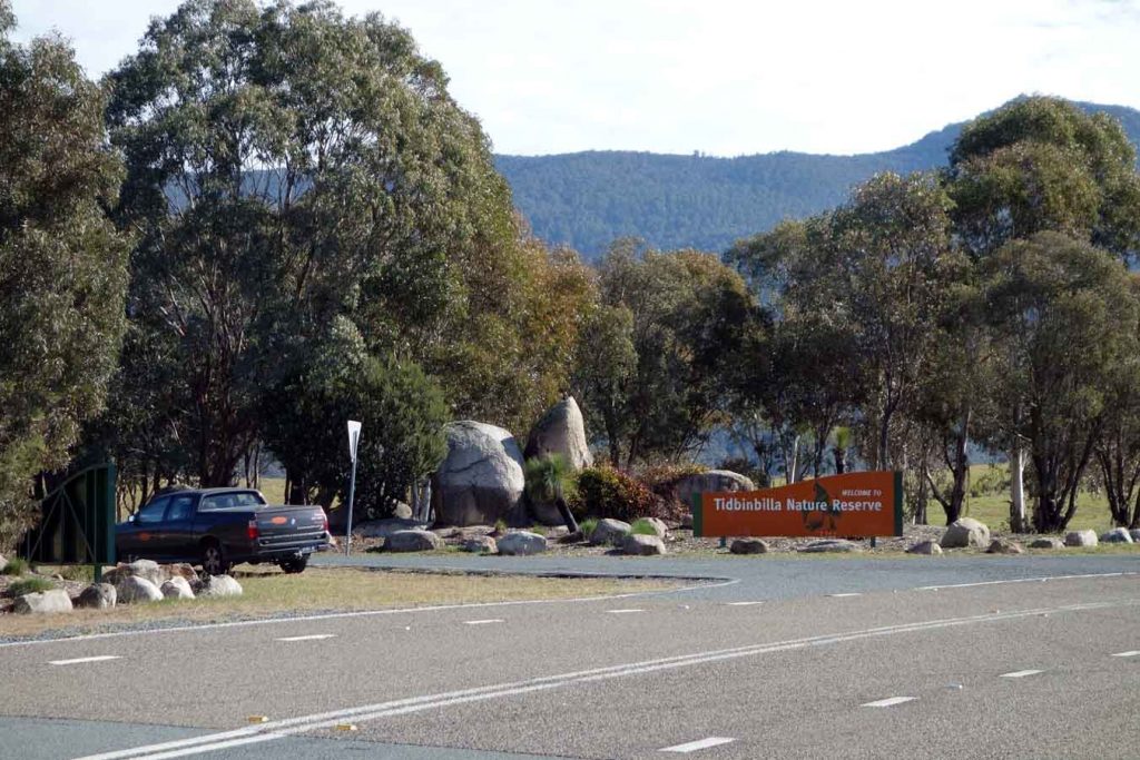
Tidbinbilla Nature Reserve entry
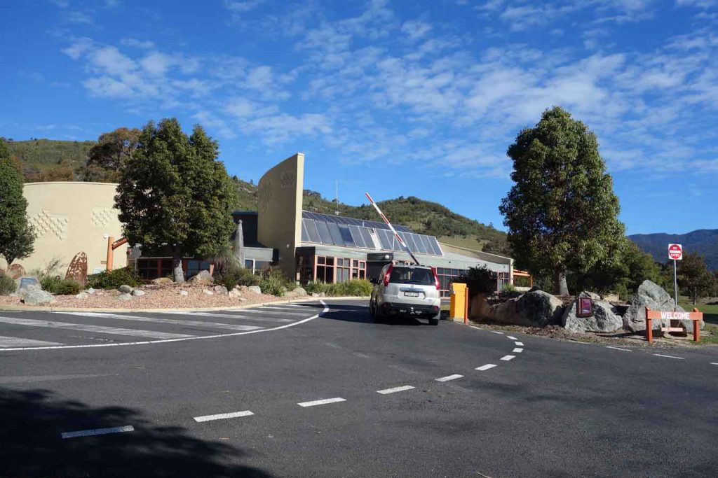
Tidbinbilla Visitor Centre and boom gate. If you have an annual pass you can just swipe your card for access without having to enter the visitor centre
Things to Know
- Phone: There is variable phone signal on this trail (Telstra). You can however access free wifi just after you start the walk
- Water: Bring your own water
- Toilets: There are no toilets on this trail but they are only a short drive away
- Trail: This trail is on faormed track
- Dogs: Dogs are NOT allowed
- Camping: No camping is allowed on this trail
- Other:
- The carpark will fit about 8-10 cars
- Entry fees are not being collected until further notice (25 February 2024)
- Gates open as 7:30 am and you will need to be out by 6:00pm at the latest (8:00pm in summer).
- Visitor centre is currently closed
Disclaimer
This walk was undertaken by the team from Australian Hiker