The Overland Track TAS (65 -125 km)
Tasmania
Starting Location
Ronny Creek in Cradle Valley is the usual starting location for the overland track. However if you arrive early, have the time and the fitness level, I suggest starting with the Cradle Valley Boardwalk at the Cradle Mountain Interpretation Centre. This adds 5 km to trip but is well worth the effort.

The trailhead at Ronny Creek carpark
Finish Location
Narcissus Hut is the usual finishing point of most walkers. However, if you have the time and the fitness, I suggest you look at doing the walk around Lake St Claire via Echo Point Hut. This additional section will add 17.5 km to the trip but is an undulating walk without any steep sections and allows you to hike along Lake St Claire for some great views that are different to what you have seen during previous sections.

All done and dusted! The trailhead at Cynthia Bay
Best Time to Travel
January-March. While you can walk this trail the whole year if you have the experience, most hikers prefer drier conditions with minimal chance of snow so February is the pick. However, be aware that you can get snow at anytime of the year. The days are also longer during summer so you also have more available walking time.
Lessons Learnt
- Protect your food from the possums present at a number of the huts. At the camping platforms at Lake Windermere we were visited three times during the night by one persistent possum trying to get to our food which was inside our tent
- Carry three pairs of socks. The weather is not always warm enough to dry off your socks from the day before and if you want dry feet then two pairs is not enough
- Carry more toilet paper than you think you will need – enough said
- If you want to sleep on the tent platforms leave early in the day to avoid any large groups. This is only an issue at some of the smaller tent sites
- You only need to carry about one litre of water. Its almost impossible not to see water on the trail however I also recommend a water filter
Things the Guide Books don't tell you about the Overland Track
- Some of the huts are small and only contain a single room so they can be noisy. I recommend using the tent platforms wherever possible
- If you do plan on using the tent platforms then freestanding tents are your best option. Non freestanding tents are also fine but bring extra guy lines for setting up if you plan on using the platforms
- Take a mixture of tent pegs including a few sand pegs to assist with the tent set up process. I use a tent which has a two sided entry and found that a sand peg was ideal to hold the fly/door in the right position by wedging the sand peg between the boards of the tent platform
- Avoid using open tarps unless you like mosquitos and leaches
- Avoid hiking the Overland Track at night, especially those areas that have natural trails as you often need to make your way through slippery tree roots which require good vision
- Phone coverage is almost non-existent which is expected (and desirable) considering the remoteness. If you absolutely must use your phone then your best option of getting a signal (without a satellite phone) is with the Telstra network. You will have phone signal until you get past Cradle Mountain, then again on Barn Bluff. From there its intermittent and high mountains don’t always guarantee a good signal
- You don’t have to use heavy duty hiking boots to do the trail. However whatever type of footwear you use, it should be waterproof and have good traction as you will be making your way through mud and puddles in a number of sections
- There are no recharging facilities for electronics on the trail
- You don’t need a compass to walk the Track. HOWEVER you do need the tools and ability to be able to navigate if you get lost
- Be prepared to not to ascend the high peaks. Excessive winds, fog and cloud cover can make these peaks unachievable, and even quite dangerous in bad conditions
- Start and finish the trip in Launceston (Lonnie) if you aren’t planning to do any other site seeing in Tasmania. It’s easier logistically

Tent on a platform. Notice the sand peg on the lower right hand side off the image wedged in a gap in the platform to hold the tent firmly in place

Cradle Mountain white out. We turned around half way up because there was zero visibility in the cloud zone
Permit System
- A permit system is in operation between 1 October and 31 May which is designed to limit the damage to this fragile ecosystem. There is a maximum limit of 60 departures each day which consist of:
- 34 independent walkers
- 13 group members e.g. schools, community groups and commercial operators that are booked to use the group tent platforms
- 13 walkers departing with the commercial tour company ‘Cradle Mountain Huts’ using private hut accommodation
- As at November 2023 the permit fees are:
- $285 for adults
- $245 for children under 17 and for concession card holders
- As of July 2023 the required pass is included in the track fee
- Please note that while a track permit isn’t required in the off season (1 June-30 September)a parks pass is still required
- During the permit season you must start the walk at the Cradle Mountain end
- A permit only sets the starting day and not the trip duration. If you can carry enough food and equipment you can be there as long as you like. A permit also doesn’t guarantee a sleeping space in the hut
- Book early if you want to travel at a particular time of the year as the available start dates book up quickly
- During the rest of the year – 1 June to 30 September – there is no permit required although you still need a Parks Pass. You also have the option of starting at the Cynthia Bay end of the Track if you wish

Overland Track Pass in the preferred position
The Overland Track - Review
Tasmania has a reputation for being Australia’s hiking mecca and without a doubt the Overland Track is Australia’s best known walking trail. It is on just about every hikers’ bucket list and for many non hikers its the walking trail they most aspire to do with the possible exception of the Kokoda Track in Papua New Guinea. We finally decided it was time to do this track so set about planning in mid 2016 to do the hike in February 2017. For me this was the shortest lead time for a trip I had ever done; I am currently planning multiple trips up to five years ahead.
The Overland Track is not a particularly long trail, at its shortest it is 65 km long. If you have limited time or just want to be able to say you’ve ‘done’ the Track then do the bare bones option. Potentially if you are a fit fast walker you could easily do this trip in as little as three days. You will still have a great time but you will miss out on some spectacular scenery and side treks. One group of hikers raced through only to spend several days at Lake St Claire waiting for a bus – we didn’t understand that!
One of the struggles with this track is right at the beginning at the planing stage, there are so many options. If you’re travelling from interstate or overseas where to do fly into? Where do you fly out of? What side trips should you do? Do you really need all the gear that the website says? There are so many choices it is hard to know where to begin.
For me Tasmania was the only Australian state I had never been to so I didn’t just want to fly in and fly out, I wanted to have a (short) look around Launceston and Hobart as well. This meant that with our leave arrangements we had seven days of walking available to us. Step two was to book our Track permits through the online booking system. This system is relatively easy to use but a bit clunky requiring a number of page changes to get everything done.
The Overland Track like many of the world’s top tracks was becoming overcrowded so a booking system was implemented. This system allows a maximum of 60 hikers including 34 independent hikers, to commence their track each day. Bookings only apply from 1 October to 31 May and during this season you must start the trip at Cradle Mountain. As of July 2023 you are no longer required to purchase a seperate parks pass to do this trail with that fee included in the trail pass. As at 2 November 2023 the fee for adults was $285 AUD for the Track pass which includes the Park entry permit. This permit are picked up at the visitor information centre either the day before or on the day of your trip. Pick up the day before if you want an early start. For the rest of the year (winter) you can travel either direction and while there is no Track fee, you still need to purchase the Parks Pass at around AUD $45 AUD (as at November 2023).
So dates set and passes purchased, my next step was to determine what side trips we wanted to do. It is rare that hikers just do the minimum distance undertaking at least one of the many optional side trips. As mentioned the problem is that there is too much choice. If you are a peak bagger then you might target all the mountains on the trail. Most of the side trips add additional days to the trip. If you are a history buff then you might want to spend time in all the old huts scattered along the trail. If you are a keen macro photographer then you definitely must do the Pine Valley side trip which will add a day to your trip and this is what we decided to do. In total we did the following side trips which added up to just over 122 km in seven days:
- The Cradle Valley boardwalk (5 km one way) is the official start of the track prior to the Ronny Creek carpark
- The side trip to Lake Will (3 km return)
- A visit to the Old Pellion Hut located just a short distance (2 km return) from the New Pellion Hut and camping platforms
- A visit to D’Alton and Ferguson waterfalls (1 km return)
- The side walk to Pine Valley (17.8 km return) plus the Labyrinth (4.8 km return) and the Acropolis (6.4 km return)
- And the walk from Narcissus Hut to Cynthia Bay which added 17.5 km (one way)
Next was gear. The paperwork for this trail is a bit daunting and in fact you need to sign a form that indicates you have the appropriate gear for this trip. The issue with the Overland Track is the wide variety of weather conditions. This is Tasmania and you are in the mountains so even in mid summer you are not going to be sunbathing unless you don’t feel the cold. Now I’m not saying that it is freezing but the temperature over our summer trip didn’t get past low 20’s (Celcius); comfortable but not hot.
There is also potential for snow in any month of the year and you should expect rain on a regular basis. I was pleasantly surprised when we only had one day of heavy rain and one day of light drizzle for the whole trip. So you need to come prepared and this includes a tent. While you can potentially stay in the huts each night, this is not a guarantee and in all honesty I prefer to stay outside the huts as its less noisy (otherwise bring ear plugs).
If you are familiar with our website and podcast you will know I am progressively lightening my load and trying to become an ultralight hiker. It won’t surprise you when I say I am always amazed at the size of people’s packs. It is horses for courses so if you are willing to carry your gear then good on you. For us our packs weigh just on 16.5 kg (37 pounds) which included three litres of water (only for the first day), seven days of food and enough layering to keep us warm, and dry, down to minus 7° Celcius.
Transport from Launceston to Cradle Mountain is something you will need to organise. There are plenty of transport companies that will take you from Launceston or Hobart to Cradle Mountain and back. We booked late and were potentially going to be the only one on the bus which could have meant an expensive trip. Because others joined us, transport costs were about $80 each from Launceston and $90 each to Hobart at the end of the trip. In addition the transport company also held our bags for us and transferred them to our accomodation at Cynthia Bay ready for us to get cleaned up.
Water is also another consideration on the trail but is usually so plentiful you just need to carry enough to get you through the day, about two litres should be enough or you can collect water and filter as you go.
The Track surface consists of essentially a few types. The first is a series of varying sized boardwalks and these are usually placed in areas where the environment is at its most fragile. Most of the boardwalks are in very good condition but there are some that are rotted and broken so pay close attention when you come across those bad sections. The second type is natural trail and what this looks like varies widely. Expect clean compacted granite in some areas, mud and trees roots, and more tree roots, and just when you think you’ve had enough even more tree roots.
I found the roots particularly annoying as my feet where too big for the spaces in between so I found myself walking on the roots rather than between them. Oh did I mention that the tree roots are slippery. The worst section at least from my perspective was from Windemere Hut to New Pellion Hut. I can’t stress enough you should carry trekking poles.
The third and last surface is mud. Having talked to walkers who have done this trail before I was expecting more mud than we got but due to the minimal rain I was happy with the limited amount of mud. I did walk this trail in leather hiking boots and managed to keep my feet dry and warm the whole trip but a number of hikers used trail runners unsuccessfully. I almost forgot there is some rock in one particular section on the way up to the Labyrinth in Pine Valley that was actually a creek bed and while on rock we found ourselves walking through a waterfall as well, charming.
The signage on the trail is well marked. It took me a little while to work out why some trail markers were on two metre tall poles and very close together and then I remembered the snow. Wintertime must be a fun time to hike.
With up to 60 people a day starting the Track you will never be lonely. We found that while we started the trip at the same time as other groups, we often saw different people every day due to different itineraries as well as different walking paces.
Now to the reason that people hike this trail…it has to be the scenery. The Tasmanian wilderness areas can only be described at spectacular. Mountains, towering forests, some dark and forbidding, some light and open, waterfalls, historic huts, moore lands, creepy crawlies, wildlife and lots of mosses and lichens.
We had planned to summit Cradle Mountain but only got part way up before the cloud bank caused a solid white out. I don’t feel the need to climb tall mountains and it would have been dangerous so we aborted that attempt. Listen to Episode 022 of the Australian Hiker Podcast where we discuss issues associated with this whiteout and where one hiker found themselves in a dangerous situation. My favourite part of the whole trip and something that Gill agrees with, was our side trip to Pine Valley. I love macro photography and I would have been very happy just to spend two solid days with an SLR camera and a macro lens.
What’s a hiking trip without things to watch out for and the Overland Track is no different. As cold a climate it is the most common snake on the trail is the Tiger snake. From talking to other hikers we appeared to be the only ones who didn’t see snakes. Going to the macro scale this is a wet climate and with it comes the leaches. It was not unusual to see hikers with blood running down their legs because a leach or two had latched on. One pair of hikers set up their tent on grass and even before they got inside had leaches crawling up the tent walls. Not on the animal side but probably the main thing to keep an eye on is your footing. With the mud, water and tree roots tripping and slipping can be a big issue so make sure you stay focused on the trail.
Now as mentioned we chose to walk from Narcissus Hut to Cynthia Bay but we could have taken the ferry across the lake. This option is one that many people take and usually costs a minimum of $40 per person. The boat cost per trip is $240 and if you happen to be the only person on the boat then that is what it will cost you so be prepared to either wait for other hikers or start walking.
So would I recommend hiking the the Overland Track? Yes I would. I think this is a very worthwhile trip that everyone should do at leat once. Would I do it again? Simply put no. While I will return to Pine Valley at some stage with my heavy SLR and macro lens to go nuts taking photos of mosses, lichens and fungus, I currently don’t have a desire to walk the entire Overland Track again. I still think back fondly to my Larapinta Trail trip in 2016 and I am already planning a return trip. For me that’s a good indication of what makes a great trip.

Crater Lake

This is actually a bit of vandalism with the ‘L’ removed from the sign. but funny all the same
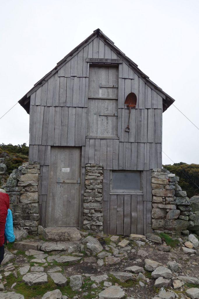
Hut at the base of Cradle Mountain

The Currawongs can open your pack and steal food. The main reason for using a pack cover
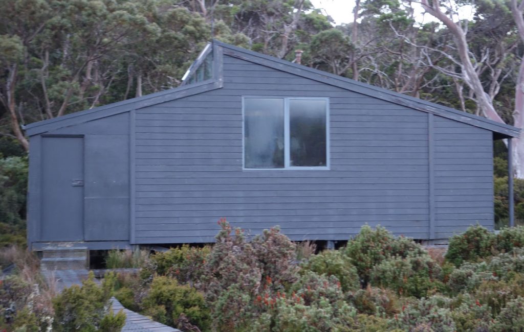
Waterfall Hut

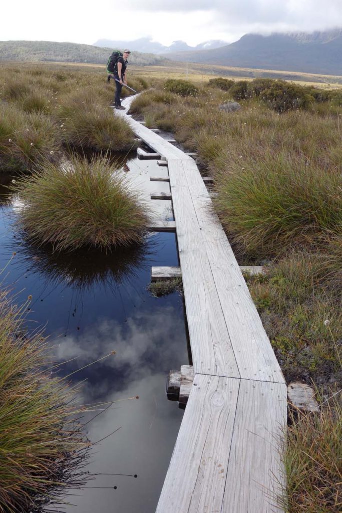
Boardwalk example

Wildlife on the trail

Wallaby totally ignoring us

Skinny boardwalk, big feet

Composting toilet

Tim and Gill at Lake Will
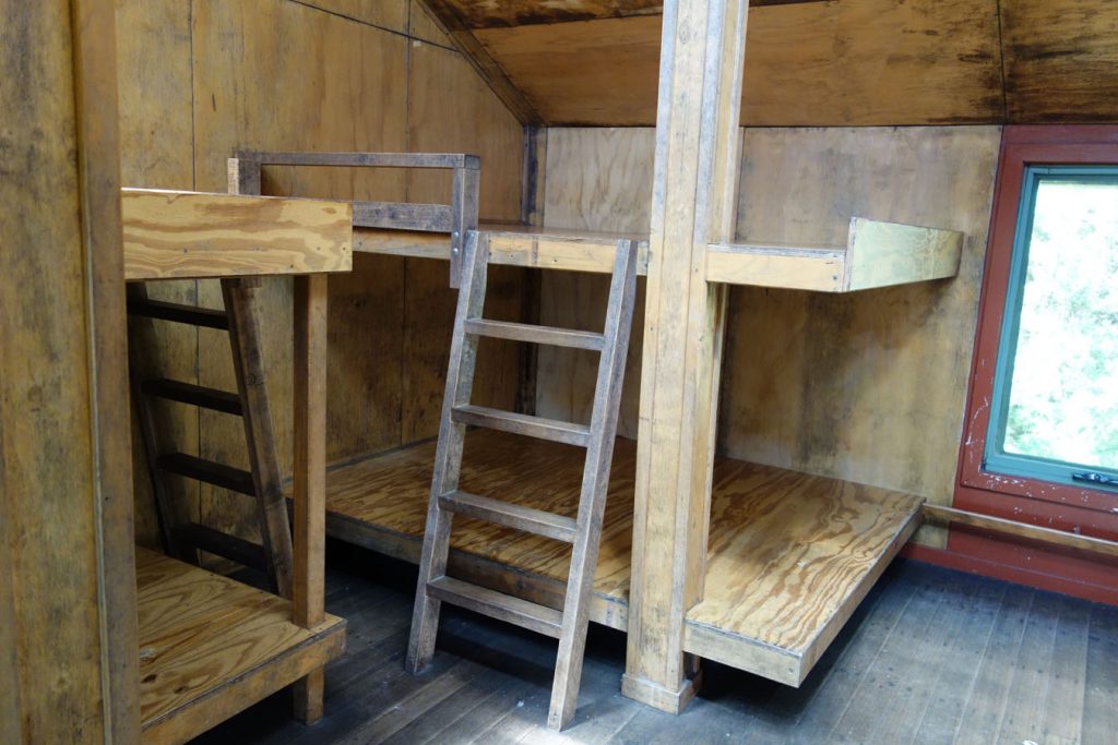
An example of sleeping platforms inside one of the huts

Young Echidna

Bad boardwalk example. This is a rare site on the trail with the majority of it being very well maintained

Colourful bark

Snooze on the jetty at Narcissus Hut

Suspension bridge in Pine Valley

New sleeping platform being built at Pine Valley

Sometimes it’s easier to go though the tree

Mud on the trail
Boardwalk through water

D’Alton Waterfall

Lichen and moss growing on the trees

The ferry from Narcissus Hut to Cynthia Bay
Resources
Overland Track website from Parks Tasmania
If you would like to listen to the associated podcasts on this trip they can be found at the following links:
Episode 018 The Overland Track-Expectations vs Reality
Episode 020 The Overland Track-A day on the Trail
Episode 022 The Overland Track-Interviews on the Trail
Things to Know
- Phone: Don’t expect phone signal on this trail
- Water: Water is available at various points along the trail both at the huts and from natural sources but with either option we suggest you bring a water filter is you plan on drinking from the river
- Toilets: There are toilets at various intervals along the trail at the respective huts
- Trail: This trail consists of formed natural track and boardwalk
- Dogs: NOT allowed
- Other:
- This walk is done in an end to end fashion and during the main walking season you are only allowed to walk in Ione direction
- Keep an eye out for cyclists on the central section of the trail
- Bring adequate shade (hat, long sleeves etc) in the hotter months
- Expect it to rain on this trip and come prepared
Disclaimer
This walk was undertaken by the team from Australian Hiker