“Kokoda Track” – Mt Ainslie ACT (4.5 km)
Urban hike
Nearest Town
Campbell, ACT
Starting Location
This walk commences immediately behind the Australian War Memorial in the suburb of Campbell with the trail head in Remembrance Park
Finish Location
This walk commences immediately behind the Australian War Memorial in the suburb of Campbell in Remembrance Park
Best time of the year to walk
Year round
'Kokoda Track' - Mt Ainslie Summit Walk review
Canberra is euphemistically known as the bush capital with the hills, ridges and buffer zones throughout the city deliberately left as natural bush making this one of the world’s unique planned cities. Being in such close proximity to the memorial has meant that this trail is unique and named for the Kokoda Trail in Papua New Guinea in memory of one of Australia’s most well known wartime engagements. This is without a doubt the most popular walking track in the Australian Capital Territory with hundreds of people, both tourists and locals, completing this walk on most days .
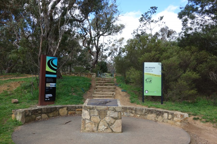
The trail head is located in Remembrance Park at the rear of the Australian War Memorial and contains excellent interpretation material on its New Guinea name sake including a 3D bronze relief providing background. In addition a series of plaques line the trail up to the summit providing information on key sites. With a couple of small exceptions this trail has a hard constructed surface which for most of the first half of the trail consists of a series of switch backs. As you approach the summit these switch backs give way to a meandering route with the hardest part of this walk being a long series of stone steps approximately 100meters from the summit that ends with an informal lookout that in some ways provides better views to the central part of the city than the main summit lookout. Once you reach the summit there are a small number of picnic tables, a water bubbler for both people and dogs, and views across not just the central city area but also to the northern suburbs and off the the airport side of the city.
Throughout the year the bushland through which the trail winds showcases the local flora and at times fauna with the odd kangaroo or wallaby being seen. Due to its location and the views to the central part of the city a large number of tourists, and locals, undertake this walk and without out a doubt this is the heaviest used trail in Canberra City. If you want a bit of solitude you will need to start very early. This trail also forms part of the 145km (90 mile) Canberra Centenary Trail that takes in much of the city. In addition to this trail there are also a number of other access points including fire trails that provide access to the summit.
Park at trail head which is located in Remembrance Park at the rear of the Australian War Memorial
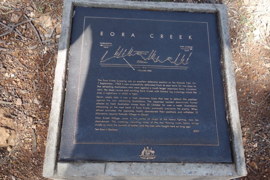
Trail head with bronze relief map of the Kokoda Track in Papua New Guinea
Interpretive signage explaining key points on the Kokoda Track
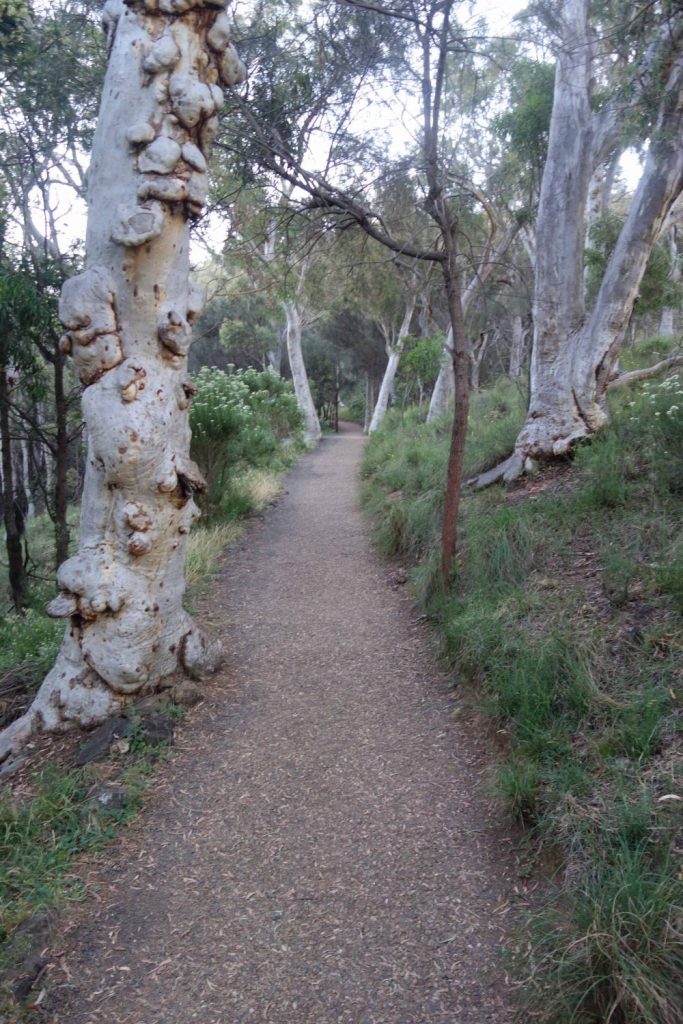
Trail example of the way up to the Mount Ainslie summit
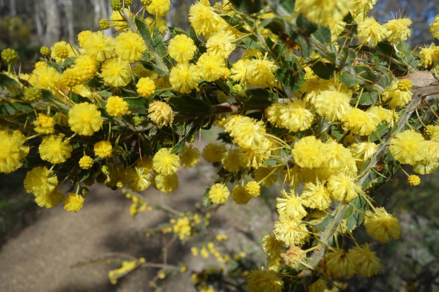
Flowering Wattle in September
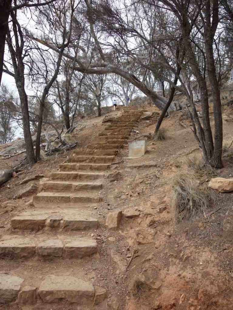
Stairs near the summit. This is the hardest part of the walk and many people will use this as fitness training
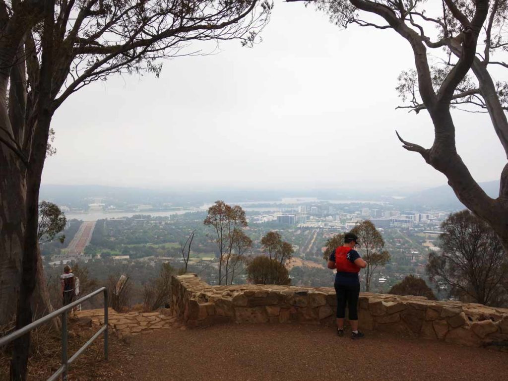
Lower Lookout on Mt Ainslie. this lookout is about 90 meters from the summit and because of it’s open nature will provide a slightly better panorama of central Canberra
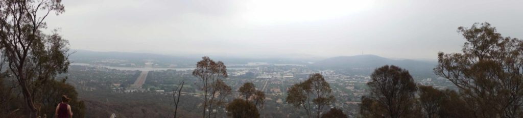
Panorama view from lower lookout
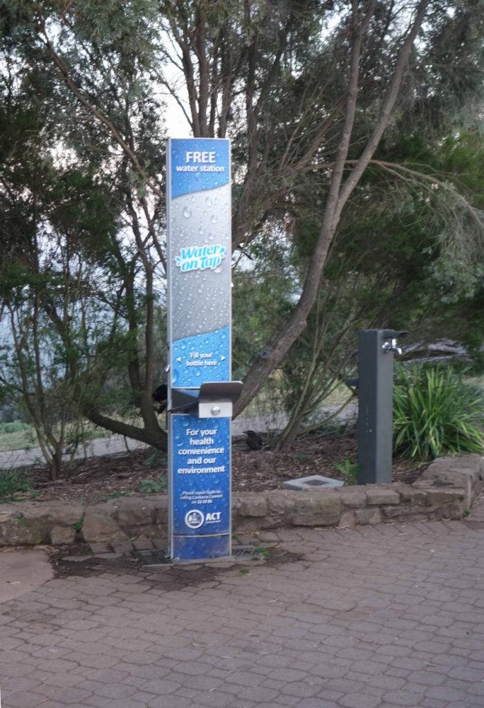
Drinking fountain at the summit of Mount Ainslie. There is a water bowl at the base for dogs. Keep an eye for bees in the hotter months as this is also their water source
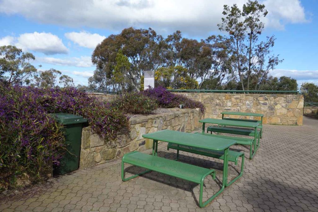
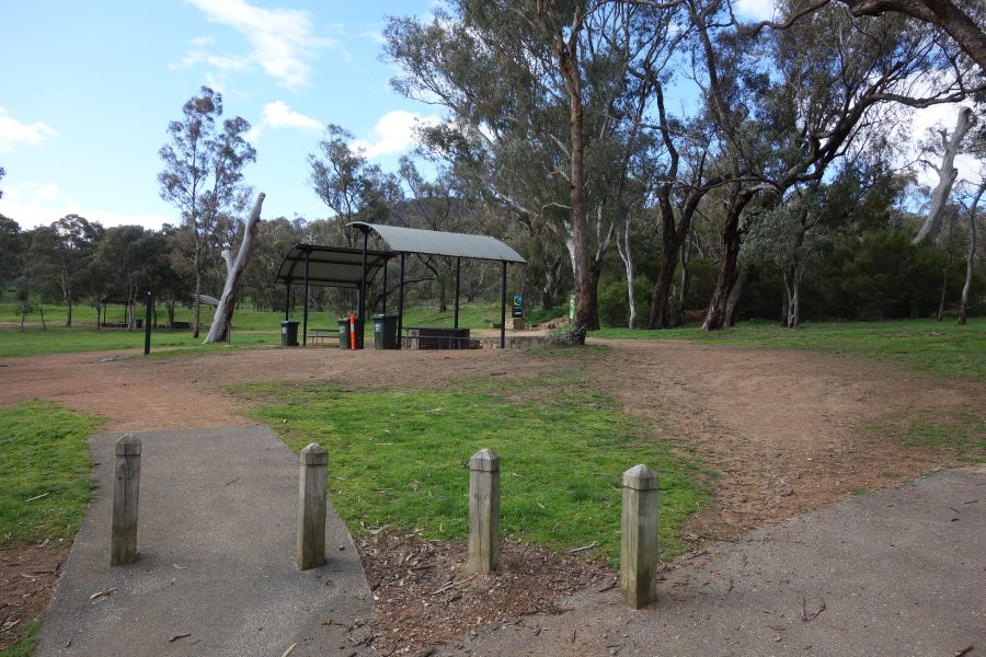
Picnic tables at the summit of Mount Ainslie
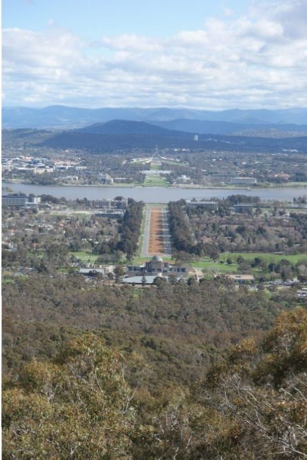
View from the summit
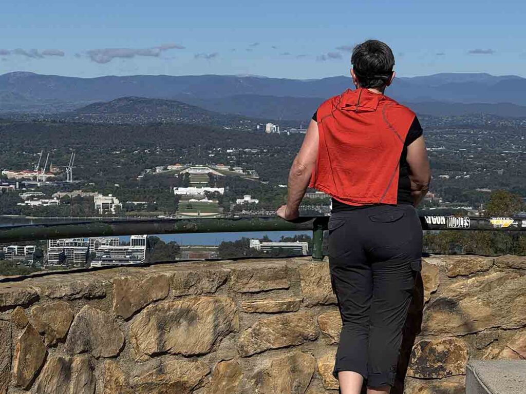
View from the upper lookout at Mount Ainslie
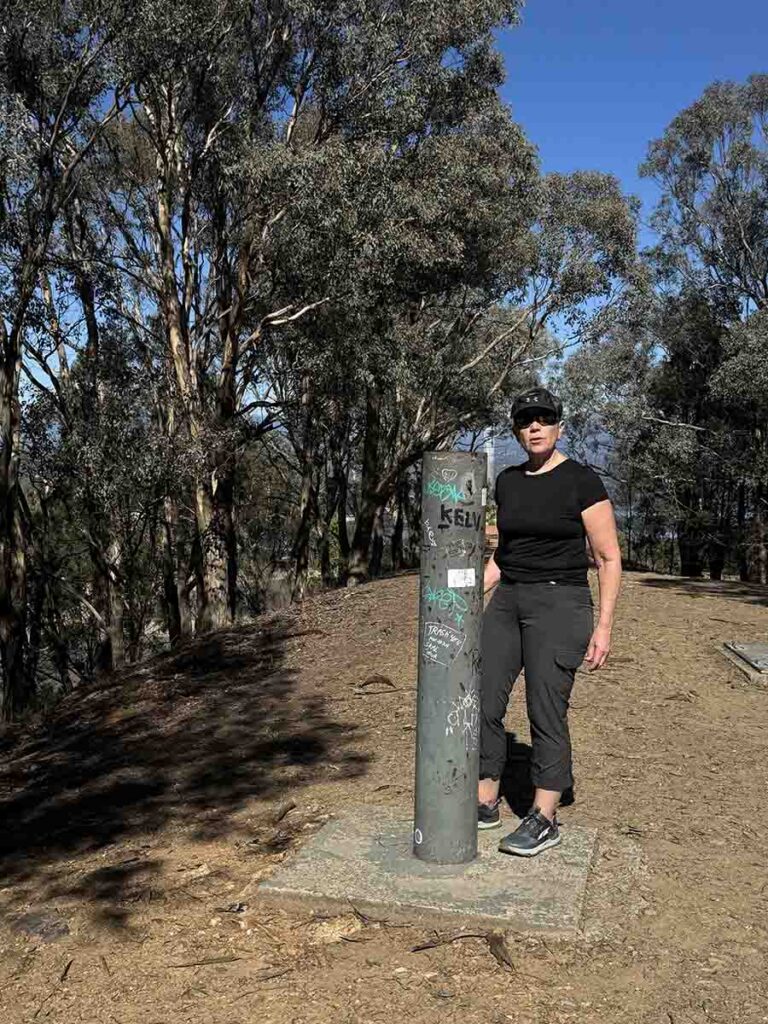
Summit marker on Mount Ainslie
Trail video
This short video provides a start to finish overview of this walk
Getting There
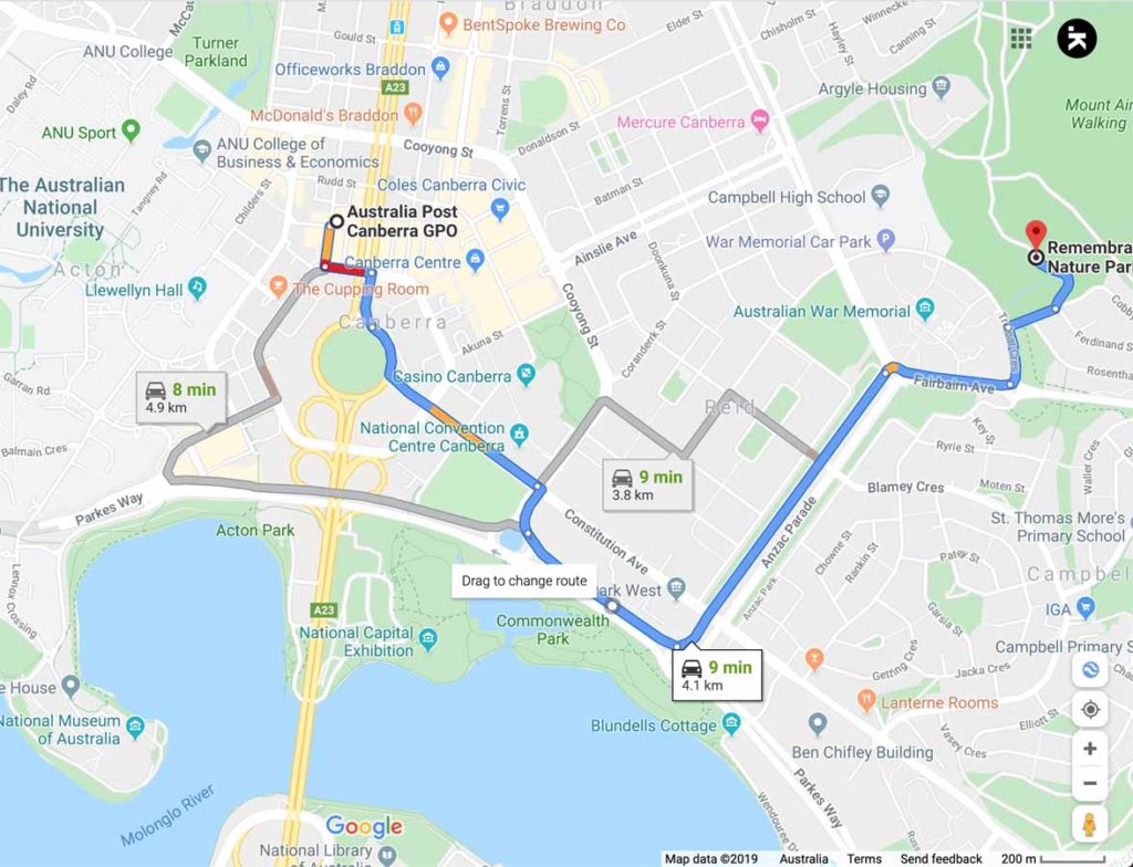
Google map to trail head for Mount Ainslie Walk. This walk is less than 5km from the city centre and very easy to access
Things to know
- Phone: There is very good phone signal on this track (all Networks)
- Water: There is a water source at the summit
- The water bubbler at the summit is also the water source for the bees in the hotter months during the warmer parts of the day
- Toilets: There are no toilets on this trail
- Trail: This trail consists of formed track
- Camping: No camping Allowed
- Dogs: Dogs allowed on leash
- Other:
- This walk is done as an out and back trail
- This is one of Canberra’s busiest walks so expect lots of people
Disclaimer
This walk was undertaken by the team from Australian Hiker
Last updated
29 March 2026