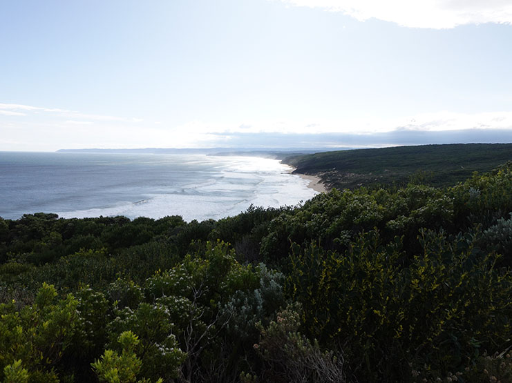
Great Ocean Walk VIC (105km)
Coastal Walking
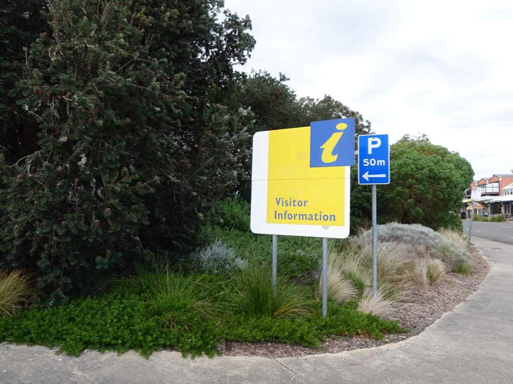
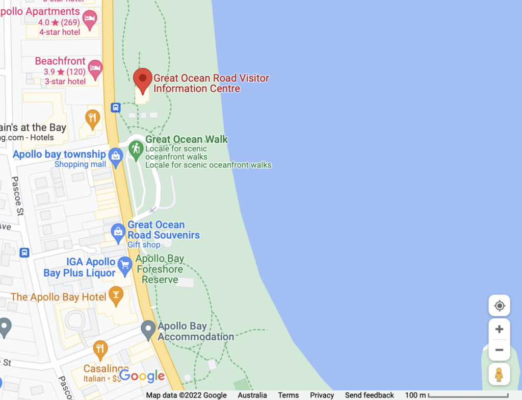
Starting location
Visitor Centre, Apollo Bay, Victoria
Apollo Bay Visitor Centre
Finishing location
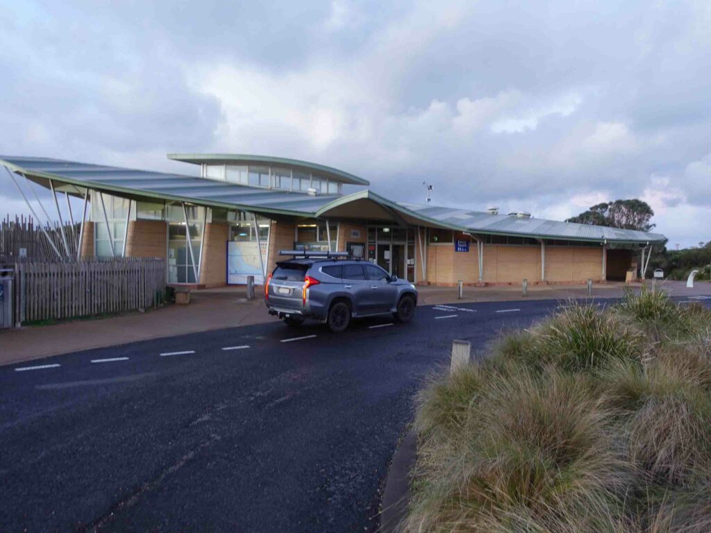
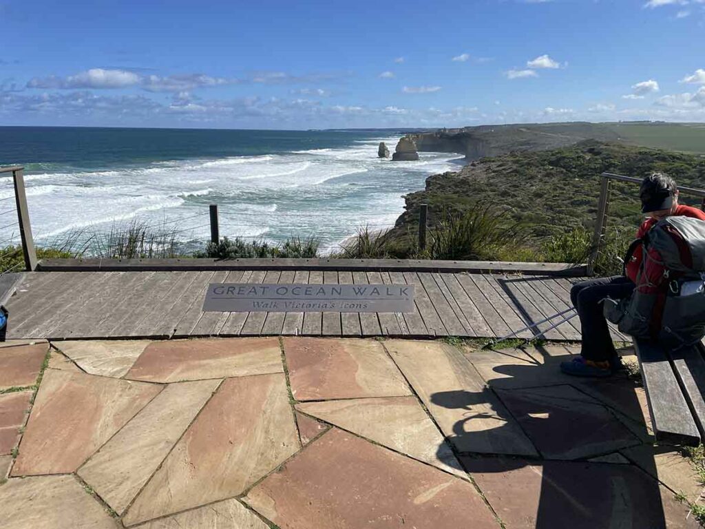
Visitor Centre, Twelve Apostles, Victoria
Best time to travel the Great Ocean Walk
Year round
- Being a coastal walk this trail is very different to inland trails. The environment on the Great Ocean Walk is impacted by the Southern Ocean which brings lots of rain and winds. This part of the Victorian coastline can receive well over 1200mm rain annually and the trail can be quite muddy in some sections at certain times of the year.
Summertime daytime averages (January)
- Maximum 22°C
- Minimum 15°C
- Rain days average 4 days
Wintertime daytime averages (July)
- Maximum 13°C
- Minimum 9°C
- Rain days average 16 days
The time of your hike will impact your reasons for doing this trail. Here are some things to consider:
- If you want a bit of solitude avoid school,Christmas, and Easter holidays
- If you want to see whales look at hiking late August to late October
- If you want wildflowers look at late September to mid October
- If you don’t like the heat avoid November to February as the temperatures can get quite hot compared to the seasonal averages
- If you don’t like the rain skip May to November (August is the wettest month of the year)
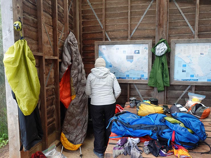
Map
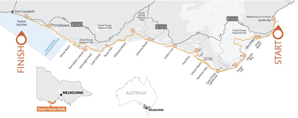
Trail image for the Great Ocean Walk, Victoria – 105km in total
- Image from Parks Victoria
Nearest Town
- Apollo Bay in the east
- Port Campbell in the west
Trip Podcasts
If you want some additional information have a listen to the series of podcasts on this trip:
- Australian Hiker Podcast Episode 227 Expectations
- Australian Hiker Podcast Episode 228 Part 1 On trail episode
- Australian Hiker Podcast Episode 229 Part 2 On trail episode
- Australian Hiker Podcast Episode 230 Expectations versus Reality
Our Trip
We prefer to avoid the heat wherever we can so for us doing a hike sometime between late May to mid September works really well. In the case of the Great Ocean Walk, starting this walk at the end of August was also the only time we could both get away at the same time.
The following write up will take you through this trip day by day. Based on our experience, we offer some suggestions on how to get the best from this adventure. In addition, we have released a series of four (4) related podcast episodes (see links above/below) that provide an alternative way of finding out more about this trail.
In additions there is a slide show of this walk containing many more images and videos that we could possibly include in this write up.
Our Itinerary
Measured distances for each day
- Day 1 (24.49km)
- Transport from the Twelve Apostles to the Apollo Bay Visitor Centre
- Apollo Bay Visitor Centre to Elliot Ridge Campground
- Elliot Ridge Campground to Blanket Bay Campground
- Day 2 (20.84km)
- Blanket Bay Campground to Cape Otway Campground
- Cape Otway Campground to Aire River Campground
- Day 3 (14.38km)
- Aire River Campground to Johanna Beach Campground
- Day 4 (13.85km)
- Johanna Beach Campground to Ryans Den Campground
- Day 5 (13.85km)
- Ryans Den Campground to Devils Kitchen Campground
- Day 6 (16.60km)
- Devils Kitchen Campground to The Twelve Apostles Visitor Centre
Total distance walked 104.01km
The Lead Up
For me this was the second longer format hiking trip of the year in Victoria and also the second trip where we have driven to the trail and home again rather than taking some form of public transport or air travel. In the lead up to this walk I had been keeping a close eye on the weather and in the process discovered that the period between late July through to September is some of the wettest in this region. The forecast and actual weather occurring in the region confirmed this. As such we expected a rainy trip which usually doesn’t bother us too much with the plus side being that water supply wasn’t going to be an issue.
This walk is one of those rare ones that while there is nothing stopping you from starting at either end of the trail both the transport options and the approach to the Twelve Apostles means that it doesn’t make sense to travel westwards. So we drove to our accomodations at the Twelve Apostles Motel (the closet to the ending trailhead – 3km) and spent the night. The next morning we took transport (See below) to Apollo Bay to start our walk. We had also booked our return accomodation six nights later so no matter what time we finished, the walk to our car and room (and a hot shower) would be a short one.
In the case of this trip this was one of the options I considered doing in May when I walked the East Gippsland Rail Trail in eastern Victoria but Gill vetoed that because she also wanted to do this trail. Usually when I start looking at my walking plans for the following year my calendar is firmly set and I know exactly what my plans are. So while I don’t necessarily do a lot of planning there are thought processes going on in my mind and I’m thinking about the trips even if I’m not doing the fine detail stuff. In the case of the Great Ocean Walk this was a snap decision with only three months planning put into this trip.
We both managed to get COVID in June and while we got over it fairly well this did knock our fitness level around. While we are happy with the 11-23km days, we weren’t as fit as we would have liked, at least in my case. Instead of doing this walk as an eight day option which for many people is the common format, we opted to combine days 1-2 and days 3-4 and then do single campground days there after for a six day itinerary. This format worked out well for us. Having said that we always keep a day up our sleeves just in case there was a delay on-trail for any reason. Once we had determined our trip itinerary we booked our campsites which is essential if you are doing trips in Victoria as wild camping isn’t allowed in most areas of Victoria.
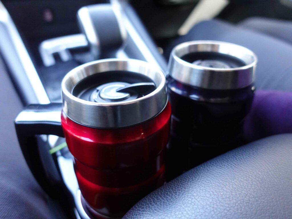
Thermos Travel Mugs to keep us fuelled for the day of car travel
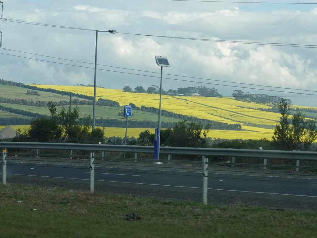
Canola fields in full flower on our trip down, and back
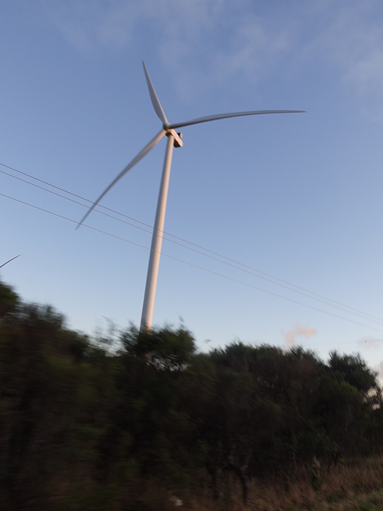
Wind Turbine approaching the Great Ocean road. this photo doesn’t do the size of this turbine justice
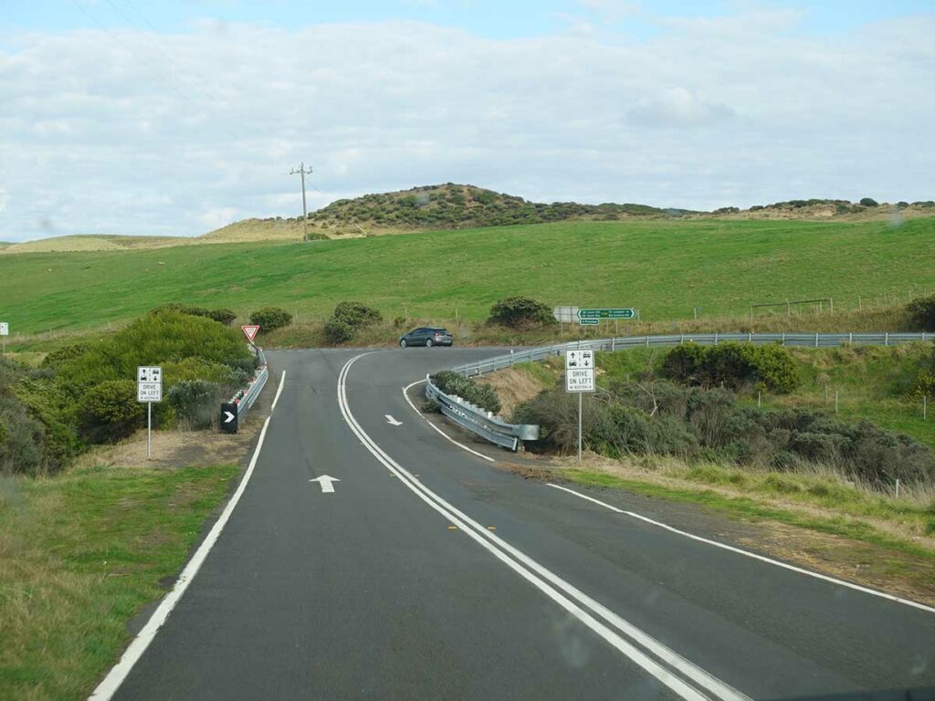
On the road for a 10 hour drive and just about to turn onto the Great Ocean Road
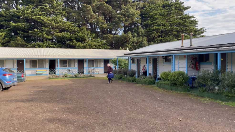
Twelve Apostles Motel
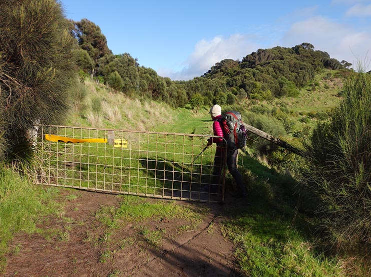
Day 1 Apollo Bay Visitor Centre to Elliot Ridge Campground and Blanket Bay Campground (23.84km)
Today we start our adventure on the Great Ocean Walk and rather than doing this walk over eight days as designed we’re doing it in six. Many walks can be done in more than one direction but this walk is a rarity because it’s designed to start at Apollo Bay in the east and finish at the Twelve Apostles in the west. In addition to the reward of this well known set of rocks, the distances at the Apollo Bay end are closer together so the trail is easier in the east and it therefore makes sense to start there and head west. So we have chosen to do this walk over six days by merging sections 1 and 2, and sections 3 and 4.
Having travelled from interstate logistically it made sense to stay at a motel near the trail end and get transport back to the trail start in Apollo Bay. We chose the taxi option which wasn’t the cheapest but given the buses don’t run on the weekend it was our only option. We arranged a pick up from our motel which allowed us to leave the car there for the week. After an 80 minute trip we were ready to go starting at around 9:30 am.
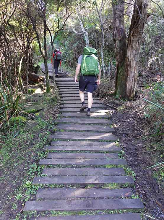
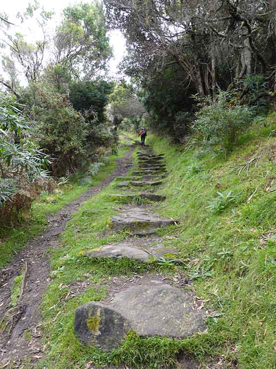
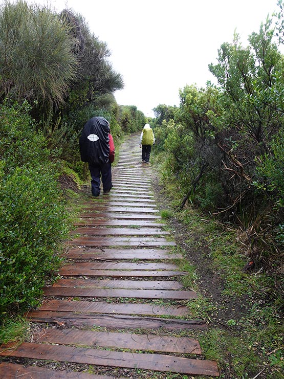
This walk start was a bit of a rarity as we had an Australian Hiker follower, Rob, who was in the area and who joined us for the trip to the first campsite at Elliot Ridge before he returned back to the start of the walk. This section of the walk to the first campsite is approximately 10km long and took us from the trailhead at the Apollo Bay Visitor Centre, through the caravan park just outside of town, then onto the trail tread. This first half of the trail provided views to the ocean as well as introducing us to the local bushland before reaching the Elliot Ridge Campsite. This campsite, we learned over the coming days, was typical of the infrastructure on this trail with the main difference being the vegetation and scenery along with how many steps to the toilet there were. The tent pads in this case were bare earth and while this probably wasn’t an issue for much of the time after a period of rain it could get a bit muddy.. this is one of the few sits that you all into and then back out again to continue along the trail with most campsite you walk in and then continue on in the same direction.
After a lunch break we said goodbye to Rob as he headed back while we continued on to our next destination of Blanket Bay. While the mornings walk was on mainly good condition trail the trip in the afternoon to Blanket Bay was a challenge due to the very muddy management road and regardless of what footwear you were wearing, it was super slippery. Tim had a spectacular fall managing to become airborne with the term of ‘A over T’ being very descriptive. Apart from his bruised dignity and some dirty clothing, all was well.
The highlight of this day was hearing two Koalas grunting in the forest even though we couldn’t see them. I seem to have a very special power in regard to animals and birds because as soon as I bring out my phone or recorder they will, without fail, stop making a noise, even when I’m inside a tent and they can’t see me. We arrived at Blanket Bay at around 5:20pm after a total trip of 22km and for this night which was later than we expected due to the muddy conditions which slowed the pace right down. When planning the this walk the recommended pace to use is 3km per hour which is slow by most people standards but that how much the mud impacts your travel. We had the company of a school group of about 14 in size as well as another group of six and this first night as it turned out was the busiest of the whole walk.
The walk-in hiker area of this campsite was attached to a drive-in site and this meant we had approximately a 100 metre walk to the toilet and hill this was the prettiest campsite of the whole trip you really think about if you need to go to the toilet or not, particularly if its raining. Each campsite has a ‘Kitchen Shelter’ which isn’t designed for sleeping but rather for preparing meals out of the rain. We had a platform adjacent to our tent site and the weather was good so we opted to cook near our tent instead.
One thing to note here is that the walk-in campsite area (for hikers) has a small waterfall as the end of the area and when I walked about 20 metres to have a look I turned around and found two Currawongs going through my food bags back on the bench near the tent so be careful of your food at this site.
As mentioned the infrastructure was almost identical at all the campsites but Blanket Bay just had a special feel about it. The sunrise viewed from the grassy area at the front of the campsite, the small waterfall at the rear of the campsite and the small beach means this campsite had a lot to offer for those not in a hurry. If you are dawdling then this is a great opportunity to drag out the swimmers if its warm enough.
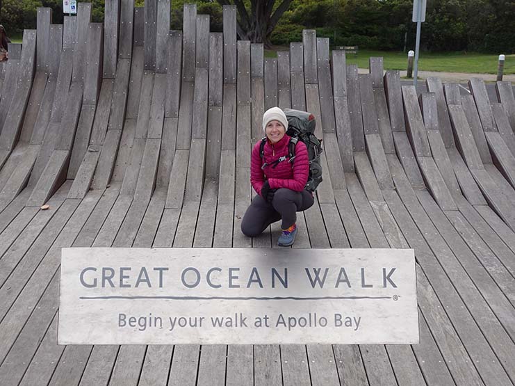
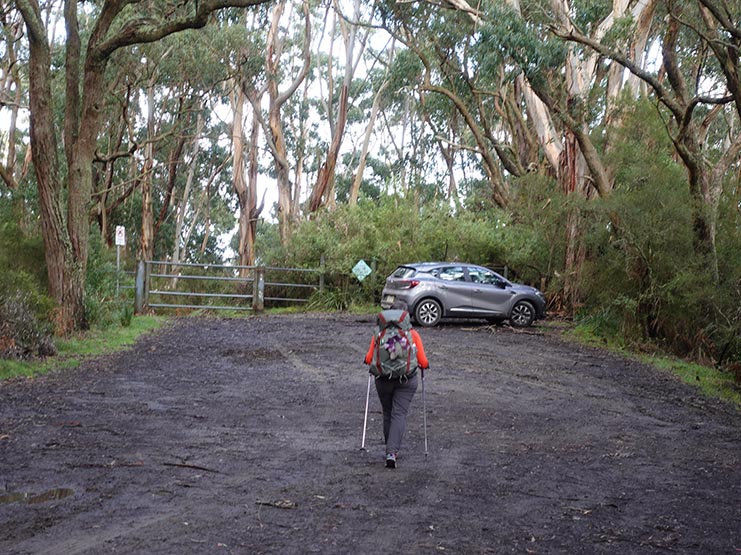
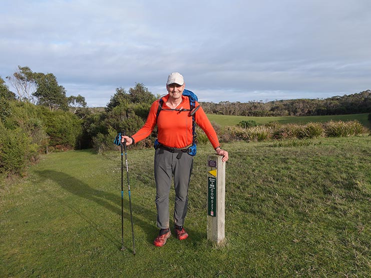
Gill at the Apollo Bay trailhead
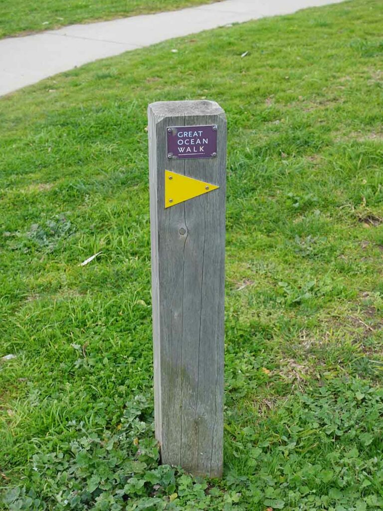
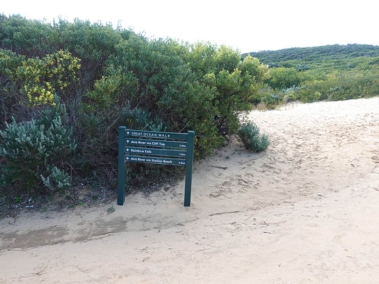
Trail signage pointing the direction. These little markers are at key points along the trail
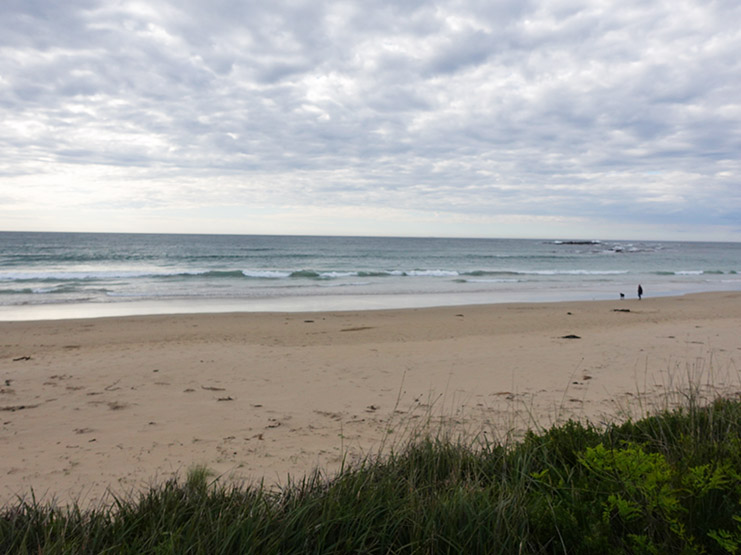
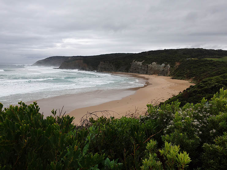
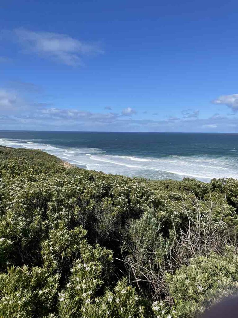
Beach view
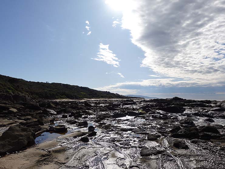
Rock platform
Gill and Rob heading up timber track section
Gill and Tim at morning tea on day 1

Trail signage is provided at key points and is clear and easy to follow providing direction as distances
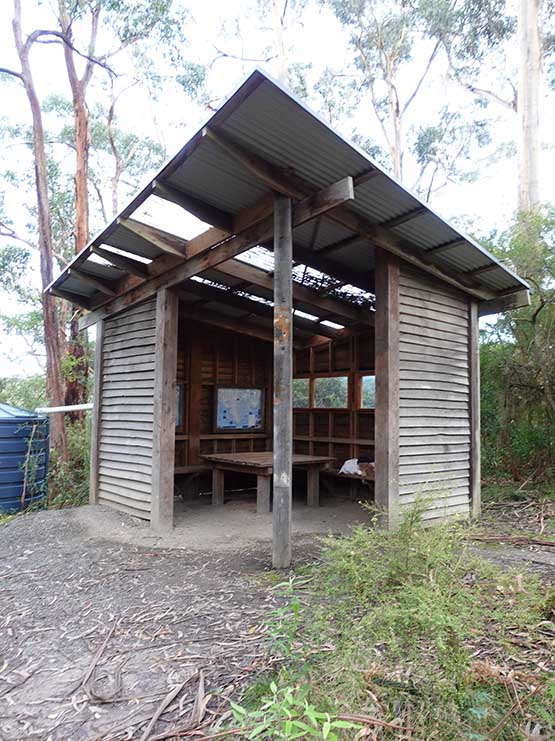
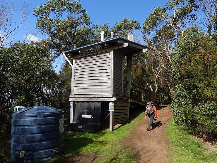
Elliot Ridge Campsite kitchen hut. There is one of these at each campsite and apart from a variation in the floor composition (Mainly sand/earth) they are pretty much identical continuing two long benches on the side and a table in the centre
Muddy trail on the way to Blanket Bay Campsite – this mud slowed us down as it was very slippery underfoot
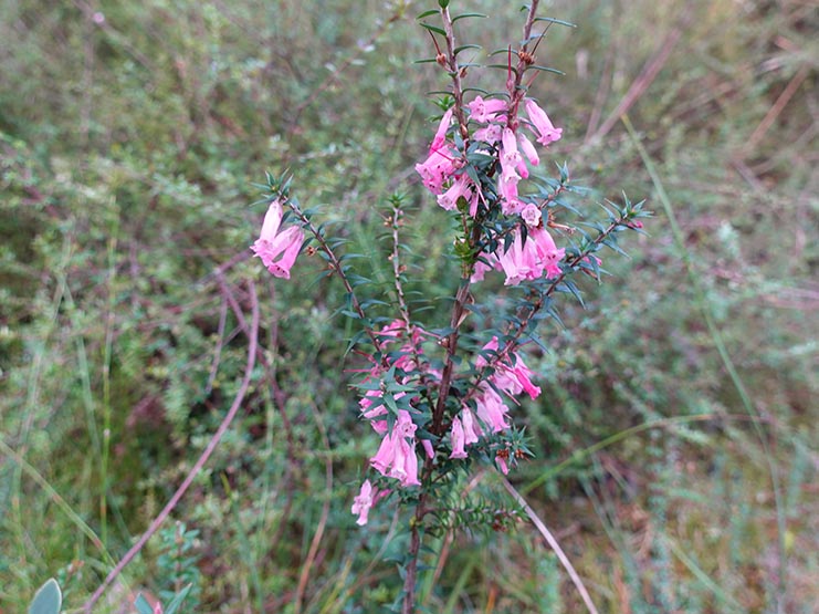
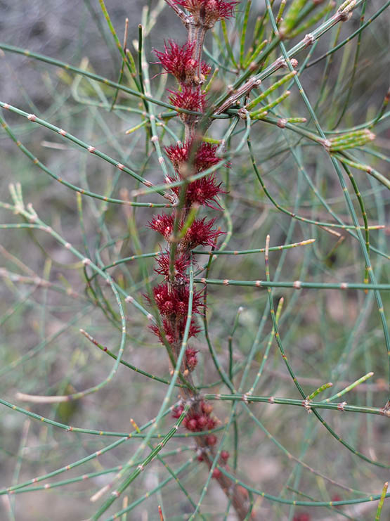
Epacris in flower
Up the steps to the Blanket Bay Campground
Blanket Bay Beach
Tim and Gill’s tent at the Blanket Bay Campsite
Toilets at the Blanket Bay Campground. This set of toilets and the ones at the Aire River Campsite are shared with car campers and are much larger than at other walk-in sites
Day 2 Blanket Bay Campground to Cape Otway Campground and Aire River Campground (20.84km)
Day two and another two campsite day of roughly 21km starting off at the Blanket Bay walk-in campsite which is where we finished off yesterday, hitting Cape Otway at lunchtime and then finishing off at Aire River in the afternoon.
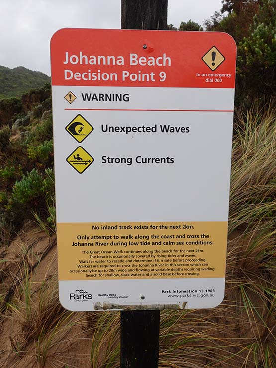
Today’s walk focused on hitting Parker Inlet at the right time. Parker is one of the two inlets on the walk that could potentially derail our plans. We left the Blanket Bay Campsite at just after 8:00am which was low tide and ideally we should have been at Parker Inlet at that time but that would have meant starting to walk by 6:30am. Within about 100 metres of leaving Blanket Bay we were given a ‘Decision Point’. We’ll talk more about these decision points in the ‘Last words’ section below. The name implies there is an option but in reality this wasn’t the case. We ended up turning back to the start after 30 minutes when we were presented with a rock outcrop that would require a degree of confidence in bouldering with no surety of what to expect after that.
Once back on the main trail we made quick time reaching Parker Inlet at 10:30am, 2.5 hours after low tide but given our loss of time at the start of the day, we were happy at how fast we moved. One thing that was going to be reinforced the next day was that this trail does rely on hikers being familiar, and confident, with crossing inlets. In fact the guidebook states that this crossing can be as high as neck deep but I have also talked to hikers who have done this trip and had around ankle depth as well. The neck deep level would realistically require a ‘King Tide’, storm conditions blowing straight into the inlet, and heavy rains pouring water down stream but if you have no experience in crossing inlets, deciding what’s safe is hard sometimes.
We hit the Parker Inlet crossing and my first thought was that this is really easy before I realised this was the first very small water crossing and that the inlet was about 50 metres across the beach. Both Gill and I have spent a lot of time around the ocean from a work perspective so are used to crossing inlets so after choosing our crossing spot and after I stripped off my pants and being the taller hiker, went first and determined that the chosen crossing point was around 70cm deep. Mind you if I’d picked the wrong spot this wouldn’t have been the case. Gill followed straight after and we took a 30 minute break for morning tea, allowing our legs to dry off before heading on. While we sat drying off and snacking, we watched as the tide rose about another 30cm from when we crossed and this made us think about the school group that was following.
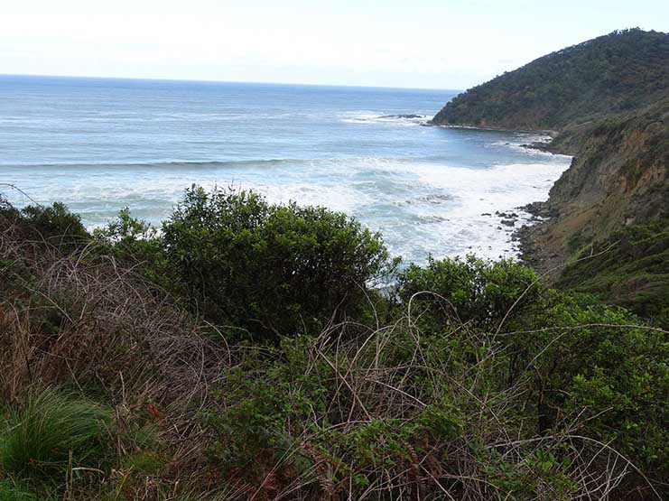
We continued on past Cape Otway Lightstation and Campground and while we had intended to visit the lighthouse, there was a change in management so access to the sight was not an option. We continued on up the hill and managed to view the lighthouse from a distance before heading to the Aire River Campground crossing over cliff tops, sand dunes and through bushland, still with the occasional muddy areas but nowhere near as much as yesterday.
We spotted the occasional wallaby and multiple birds along the way. Today we came across a large healthy Echidna who as soon as it saw us, ambled off into the bush which was a bit of a surprise for us as on the Three Capes Track in Tasmania, Echidnas really don’t care about hikers one little bit. Speaking of wildlife, Gill was walking in front of me and thought she’d seen a Goanna shoot off into the bush. She indicated where it had gone so I moved closer to per into th foliage and instead I was greeted by a diamond shaped head, grey eyes and an open mouth which I was pretty sure was a Death Adder of some variety. Sure enough when I checked a few days latter when I had internet access it turned out to be a Common Death Adder which just reinforced that it always pays to look from a distance, with a trekking pole in the lead and not go into an area where you can’t see where you’re putting your feet.
Another surprise for us was this day ended up being the warmest of the whole trip and also the sunniest so we were glad we had good sun protection.
The rest of the afternoon was uneventful taking the odd break as we went. Even though this day just seemed to go on forever given our mistake at the start of the day, we ended up walking around 24km rather than the expected 21km ( I removed that additional walking from the distance above). We finally arrived at the Aire River Campground at 4:50pm and were greeted by another thru hiker. We learned our new friend was from Belgium, and had been going from campsite to campsite and started two days before us. Given our remaining days would be done campsite by campsite, we would finish the trip together.
The Aire River Campground was another of those sites that shared resources with car campers. As much as I loved the hiker’s area, there is a very steep walk down to the toilet and then back up the hill which really made you think twice about the need to go or not. A great day overall!
Sunrise at Blanket Bay
Leaving the Blanket Bay Campground
Follow the sign and stairs just a short way across Blanket Bay Beach
A coastal view along the way
Foot cleaning station along the trail. These are designed to prevent the spread of disease that can impact the environment so please use them
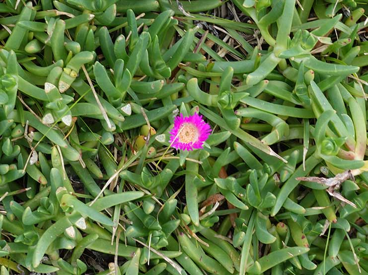
Pigface in flower
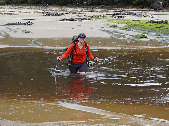
Gill crossing Parker Inlet
Steps after Parker Inlet. they just seemed to go up and up
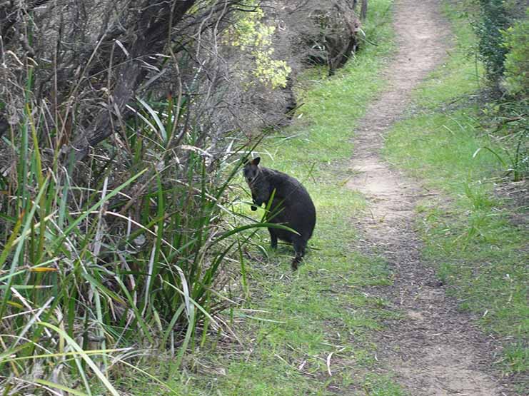
Wallaby on trail

Kennedia ground cover also commonly known as ‘Running Postman’ in flower
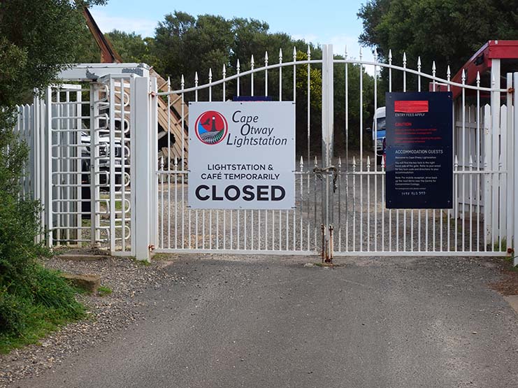
Cape Otway Lighthouse was closed due to a change in management but this was only expected to be short term. Apparently hikers can enter free so if you are doing this walk its worth asking
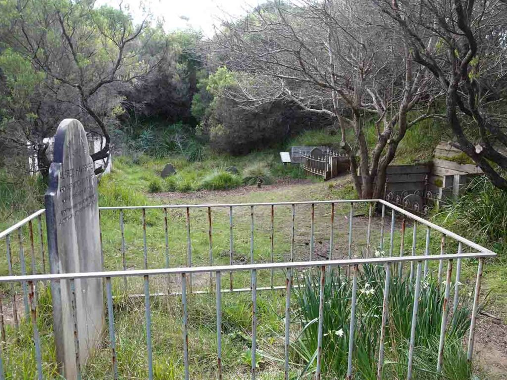
Old cemetery at the Capet Otway Lighthouse

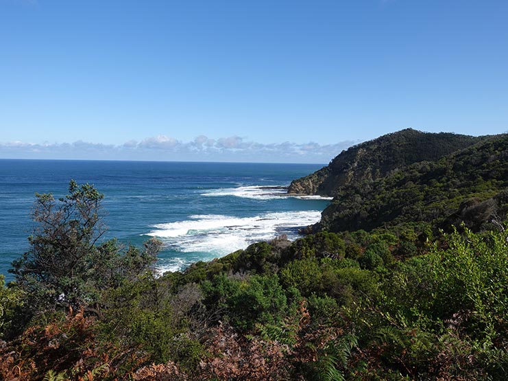
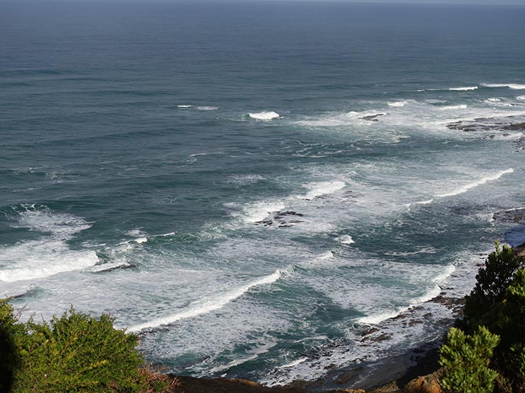
Ocean image afternoon day two
Signage on day two
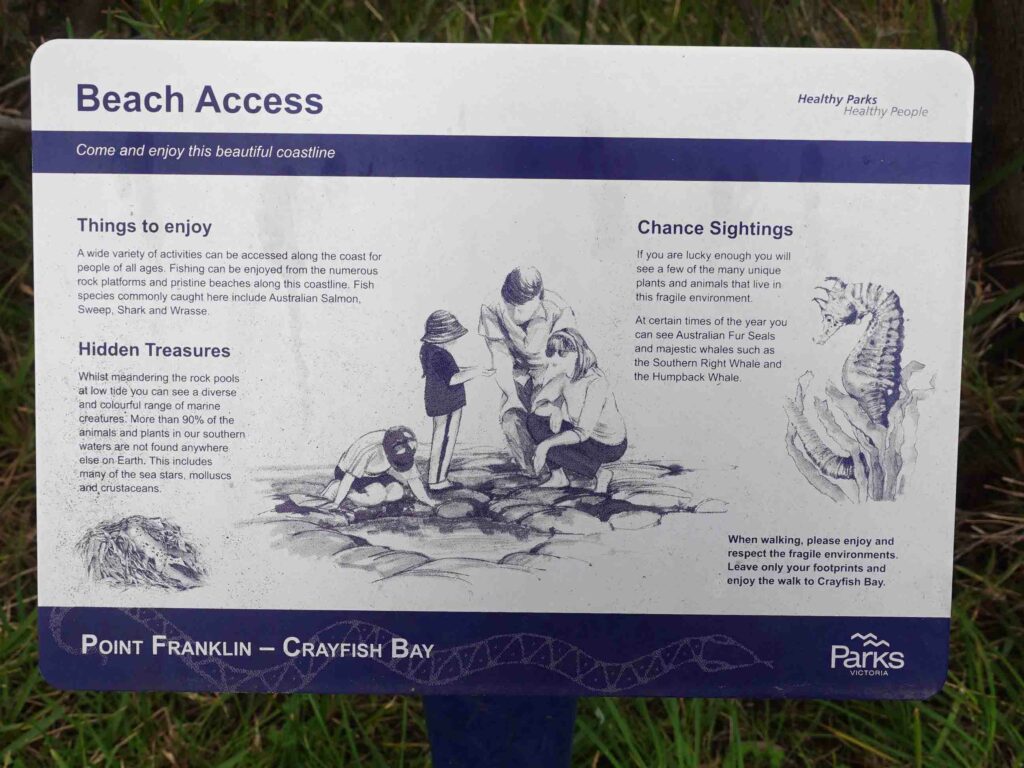
Interpretation signage is scattered along the trail at key locations
Approaching Aire River Campground
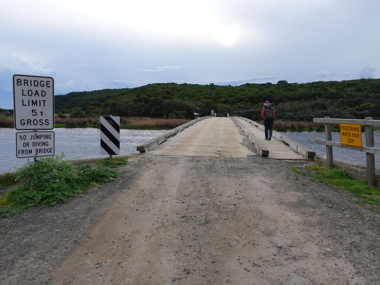
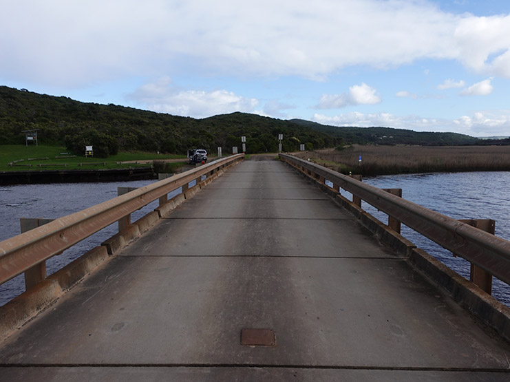
Bridge to the Aire River Campground
Day 3 Aire River campground to Johanna Beach (14.38km)
After talking to our new companion we discovered she had opted not to do the Parker Inlet crossing as a solo hiker but instead had backtracked by road and gotten a lift around the crossing before coming to the Air River Campground. Knowing we had an inlet crossing today we were out of camp early and while we wouldn’t make low tide, we needed to avoid high tide to make the crossing as easy as possible. As mentioned Gill and I have spent much of our lives in and around the ocean so have always been comfortable crossing inlets, knowing when, and when not, to cross. The Belgium hiker we met at the Aire River Campground last night wasn’t familiar with inlet crossings so she joined us today. We realised the knowledge and skills in regard to the ocean and inlet crossings generated over many years that we take for granted isn’t something every hiker has. In fact unless you do coastal hiking this may well be something you have never had to deal with (cue new article and podcast for later in the year).
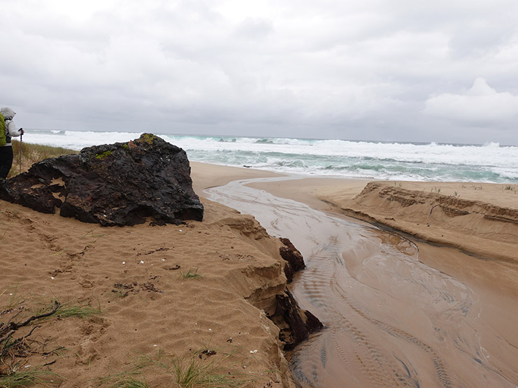
Today was another rainy and windy day with a number of muddy steep sections including one we crossed that was so bad we all ended up with muddy shoes and socks. I’m so glad we dried our socks out from yesterday! This walk was again undulating, although not as bad as it has been over the past few days. We moved along the base of a cliff face, close to the ocean, before we finally came out onto Johanna Beach and our second inlet crossing.
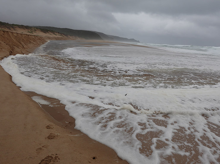
So after the longest beach walk of the trip we started paralleling the inlet and approaching the crossing point just as the heavy rain returned. After watching the wave patterns and water movement we realised the water wasn’t overly deep (less than knee level) but when a wave came through, it did so with force. This required us to pay attention and brace when needed. After completing our crossing it was a short walk off the beach to a nice seating area with views down the beach and the opportunity to remove half of the beach from our shoes that we picked up in the crossing. One thing of note here is that this was the first time I have ever felt the wind blow through my shoes!
We soon headed towards the car park and day area, and after what seemed like a long way away we eventually came to the Johanna Beach Campground which was perched at the top of the cliff top looking out towards open ocean. There is one particular tent site that in the right conditions, would be the perfect site allowing you to watch the ocean from the tent but it would require little wind and warm weather so it’s more of a summer site. In our case we wanted a protected area out of the wind and picked one of the two sites close to the kitchen shelter which was under the Casuarinas with lots of pine needles which provided soft under-tent cushioning.
We spent much of the afternoon watching the tide rise and fall on the beach and trying to dry out our gear by hanging it all over the shelter. We did get some rain later in the night at around 12:30am but it was light, lasting only for a few minutes so we didn’t have to worry about packing wet gear in the morning. As far as the campsites go, this would probably rate as our overall favourite of the trip, complete with the obligatory family of Fairy Wrens.
Trail example on day three. This shortish sections of timber are used particularly when the slope is steep
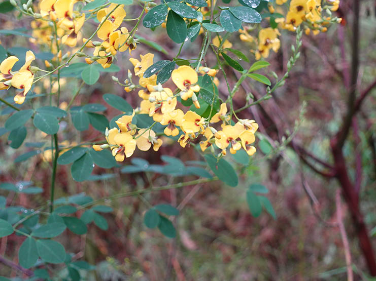
Native Pea flower

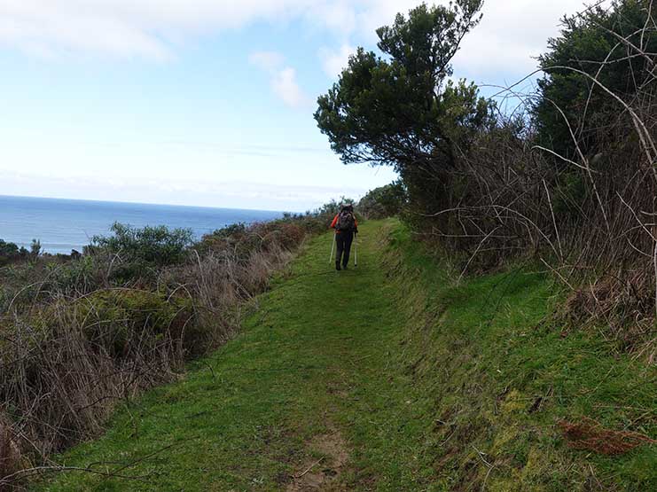
Walking along the upper cliffline
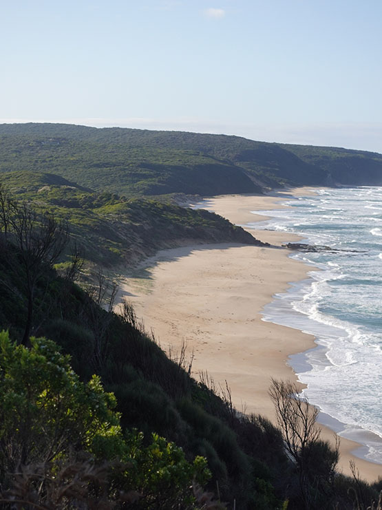
Beach view on the way the Johanna Beach
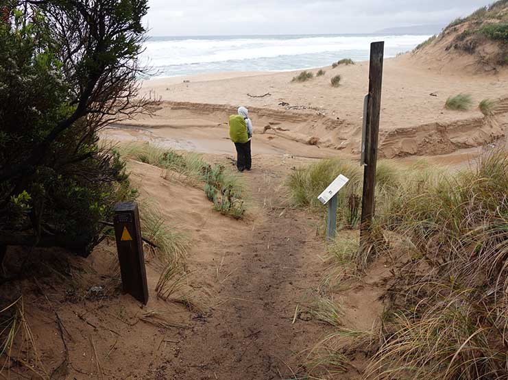
Down onto Johanna Beach
Pay close attention to the weather and the tides
Stream crossing at the start of Johanna Beach
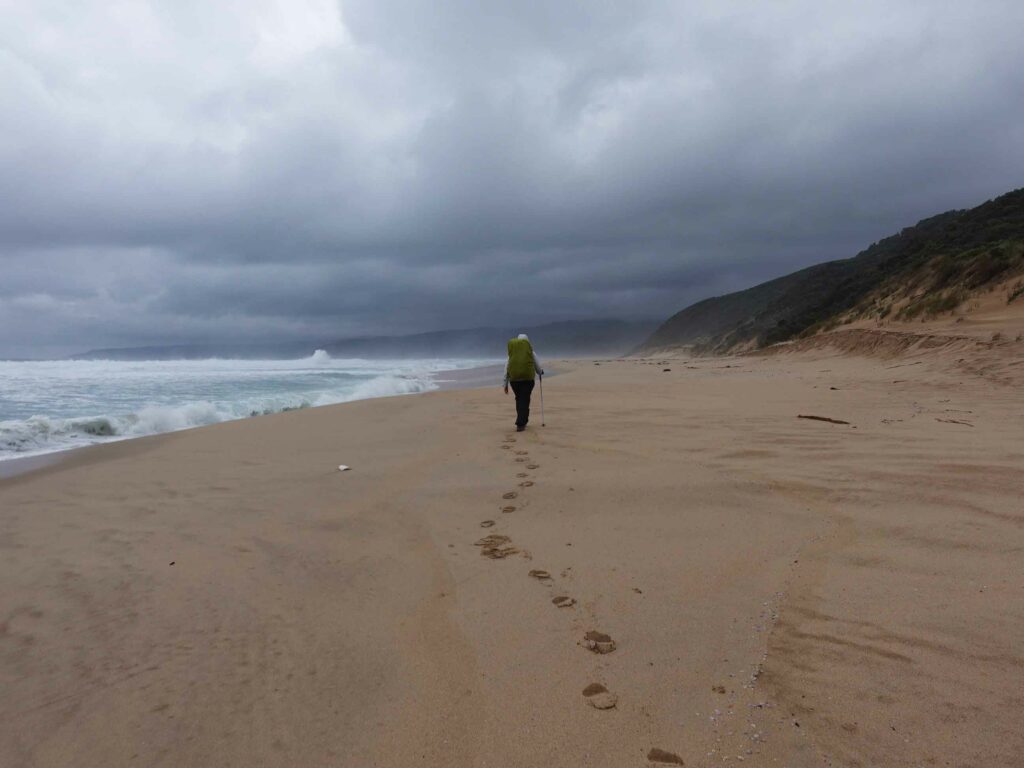
Walking along Johanna Beach
There is an inlet in there somewhere at Johanna Beach and this is what we just crossed. It wasn’t deep but but there was good force behind the waves
Drying our gear at the Johanna Beach Campground
View from the toilet at Johanna Beach Campground
Day 4 Johanna Beach Campground to Ryans Den Campground (13.85km)
The guidebook advised this would be a day of ups and downs. Compared to previous days much of today was spent ascending or descending slopes, and navigating wooden stairs or rock steps. The day was classed as medium difficultly day and it certainly was. This day is also known for being muddy and it certainly made the hills really challenging no matter how good the traction on the bottom of your shoes. The day started with a steady climb up from the campground and this became the pattern for the day and so far our most difficult day of travel of the whole trip due to the mud.
Wildlife continues to be almost non existent it hasn’t been totally absent with the exception of lots of bird life being our companions. In fact we’ve found that each of our campsites has a small group of Superb Fairy Wrens that do the rounds of the campsite in the morning including the kitchen shelter to see if there is any food. I’ve learnt more about Fairy Wrens in the past week as a result of this trip than I’ve ever know before being keen to find out what I’m seeing, or in the case of the Wrens, what I thought I was seeing. Almost every beach we’ve come across has had Hooded Plovers which are endangered mainly because of where they nest. They are such a cute little bird to watch.
Today was also our best day for whales as we followed what we originally thought was a group of Southern Right Whales making their way along the coast but after doing our research it turned out they were Humpback Whales. We got to watch them breach, blow, and hunt food with bubble nets as they slowly made their way along the coastline.
We expected a day without inlet crossings but I suppose it’s a fine line between what an inlet is as opposed to a creek crossing; there were two of them today that required us to strip our shoes off to cross at Milanesia Beach. It would have been tempting to try to leave the shoes on and rock hop but the rocks were slippery and slimy so removing the shoes was the best option. One thing we noticed was that each day has something unique about it and today apart from the terrain and the whales, there was a big variety of vegetation types noticeable as we moved from one type to another.
We arrived at Ryans Den Campground at around 2:20pm and spent the afternoon deciding which of the flat but bare earth campsites to use, having a late lunch and setting up our tent. Tomorrow is supposed to be the hardest day of the trip but as it turned out it was no worse than today’s trip. According to the trail map in each of the shelter kitchens we are moving inland for the remaining few days of our trip.
View from Johanna Beach kitchen shelter on the day we arrived
Johanna Beach the day after we crossed the inlet – totally different weather today

On the trail day four not long after leaving the campsite as we made our way uphill
Shortly after leaving Johanna Campground
Ocean view day four
No mud, yay!
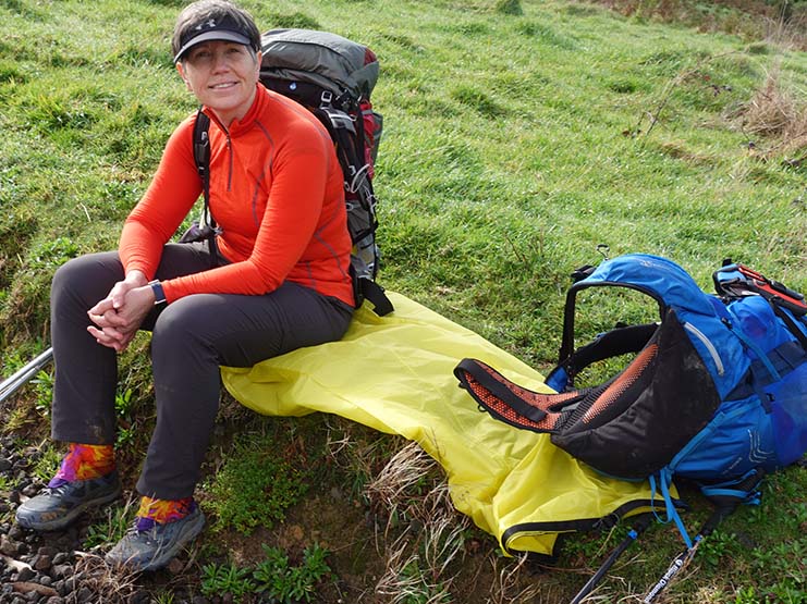
Taking a break on the side of the trail

Jonquils just off the trail. This large random batch of flowers is an indication that at some stage in the past there was a house on this site

Socks drying as we walk

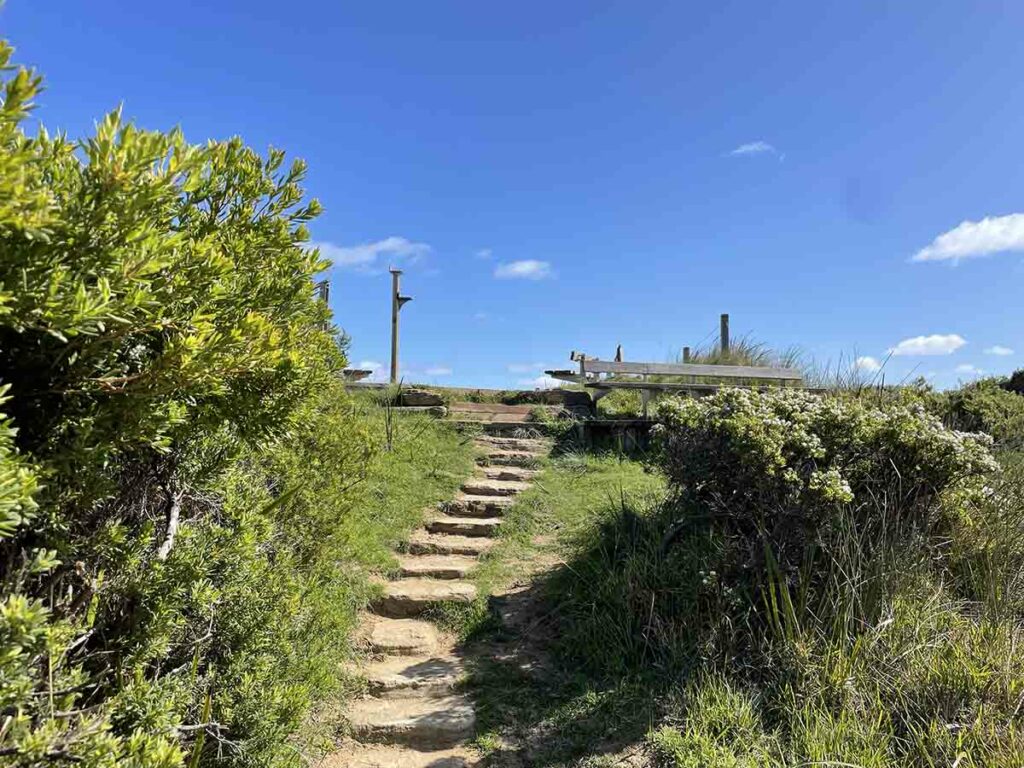
Down the steps
Heading back into the national park

I picked up a passenger (Leach)
Ocean day four
Toilets at Ryans Den Campground. This is the main style of toilet on this trail and the variation tends to be the view and the stair/ramp access
Day 5 Ryans Den Campground to Devils Kitchen Campground (13.85km)
One thing that’s rare about Ryans Den as a campsite on this trip is that you walk into the campsite and then walk back out again. Apart from the section 1, Elliot Ridge Campground every other site you walk through including Devils Kitchen.
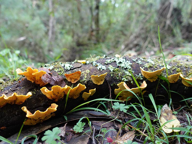
This morning we went uphill for the much of the morning past farmland and in all honesty this was the steepest part of the whole trip. Once we reached one of the many high points at the back of rural areas we continued along but this time into the Otway National Park. Just prior to this we passed one of the biggest rural properties in the area that hugged the cliff top. Another thing we noticed was the change in vegetation types; coastal, rural and forest all in one day. On other days we tended to be walking in the same type of vegetation for much of the day. As the guidebook promised, this section of the trail is well known for its fungi and while the main season is over, there was still lots of photos to take.
The mud continued but nowhere near as bad as yesterday and once we moved past the midpoint, the ups and downs became less noticeable with the gradient changing to more gradual. We arrived at Devils Kitchen at around 12:20pm having walked just under five hours and averaging around 3km per hour. While rain was forecast for mid morning, the sun stayed with us until mid afternoon when the clouds and rain set in.
I managed to stuff up our gas estimate for the first time in a long time. We started the hike with our preferred 100 gram canister that had been used once (one day) before. Our canister should have lasted us the full six day trip but due to extra hot drinks on day three, and the previous use, we ran short by essentially one full meal. Thankfully another hiker on the trail had plenty and we were able to snaffle some hot water for dinner and a hot chocolate.
Another early night for us again tonight. This day for us is the best day so far with the changing landscapes, as tough as it was.
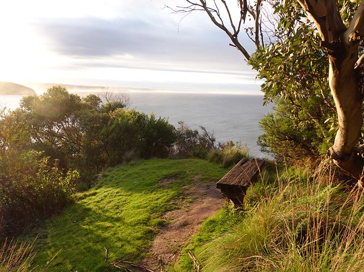
Morning view from the clifftop at Ryans Den
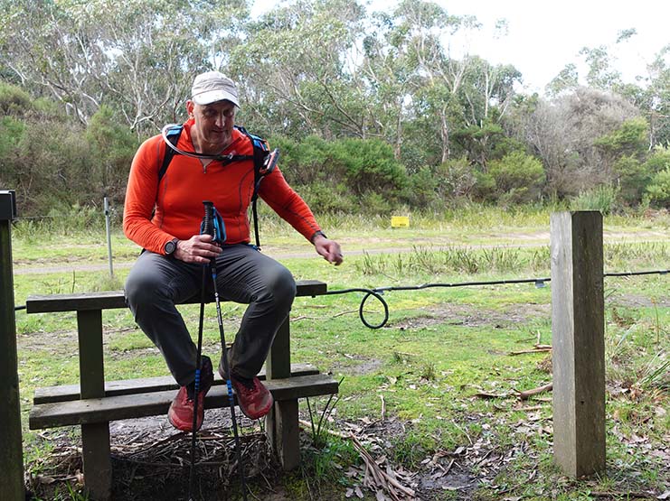
Tim on the trail day five
Fungi on the trail
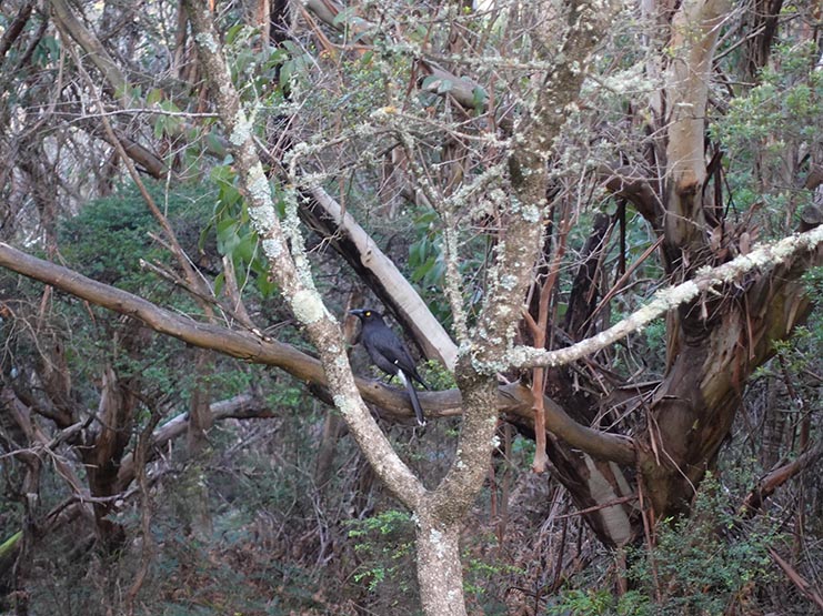
Currawong on the trail
Watch the electric fence. At this crossing stile the wire was protected but where I am pint is a section of exposed wire
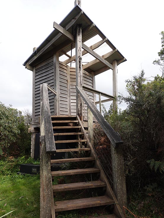
Devils Kitchen Toilet day five
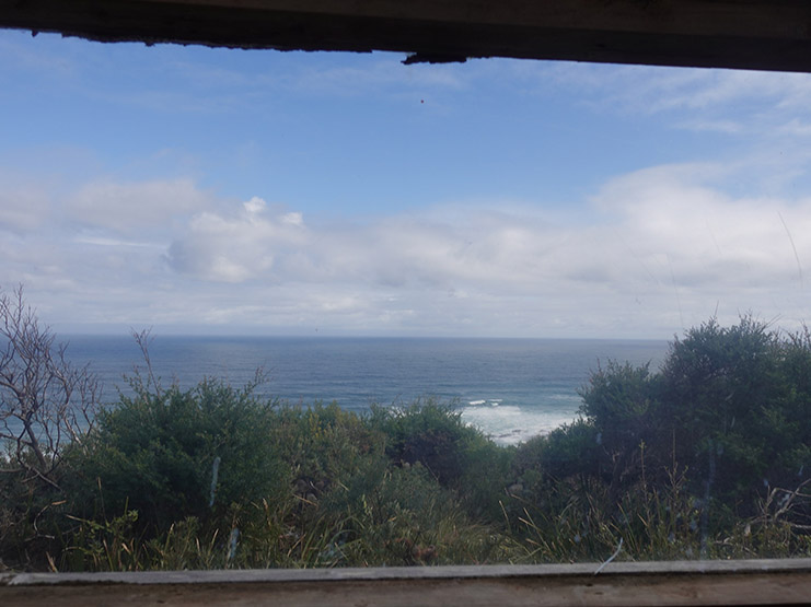
The toilet view from the Devils Kitchen toilet. This is what you when sitting on the toilet
Fantastic view to the ocean from the toilet at Devils Kitchen
Day 6 Devils Kitchen Campground to the Twelve Apostles Visitor Centre (16.6km)
Camping done and dusted on our Great Ocean Walk and all that remains is to pack up our gear and start walking. We had most of our gear packed and we were just eating our breakfast when our dry tent was hit by sudden rain. While I managed to unpeg the tent as one unit and carry it into the kitchen shelter, the fly was again damp. The rain didn’t last long but just in case we donned our rain jackets and headed off. Today’s walk was billed as being ‘easy’ and compared to the past few days it was just that. A day without big elevation changes as we made our way along mainly headland with just the few smallish ups and downs.
Again we had a few muddy areas but on the whole the trail tread was fairly dry and easy to walk along. The first real sign that we were reaching the end of our trip was when we started the downhill approach towards Princetown. The main reason for this town approach was more about using an old bridge to cross the Gellibrand River. Just prior to heading across the river we sat in the sun for a short period and had a snack break before we headed back along the headland making our way to the destination. Eventually we came around a corner and had our first clear view of the well known Twelve Apostles rock formations located along the Victorian coast.
The views came and went and each time the Apostles came back into view they increased in size and the distance shortened. One of the biggest surprises for us was coming across what was essentially the end trailhead and some great views of the Twelve Apostles but we still has around 2.5km to go to the visitor centre. From a previous visit I had a vague memory of crossing under the road via a short tunnel and we came across that tunnel at the end of the Gibson Steps car park and with that around another 1-1.5km and 30 minutes later we arrived at the visitor centre. The visitor centre isn’t huge containing a small coffee shop/kiosk but the food is hearty and filling.
From here we had a 3km walk up the road to our motel – this was the very reason we picked it being the closest to our trail finish point. Trail done and dusted, long showers, change of clothing and we headed into Port Campbell for another great pizza. All that is left now is a good night sleep before driving home tomorrow.

On the trail day six
On the trail day 6
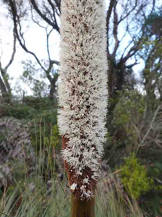
Grass Tree in flower
Crossing the Gellibrand River near Princetown
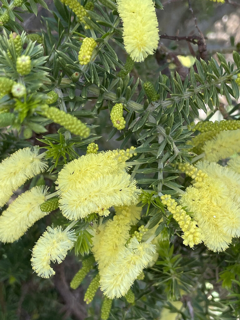
Wattle in flower
Ocean day 6
Casuarina in flower
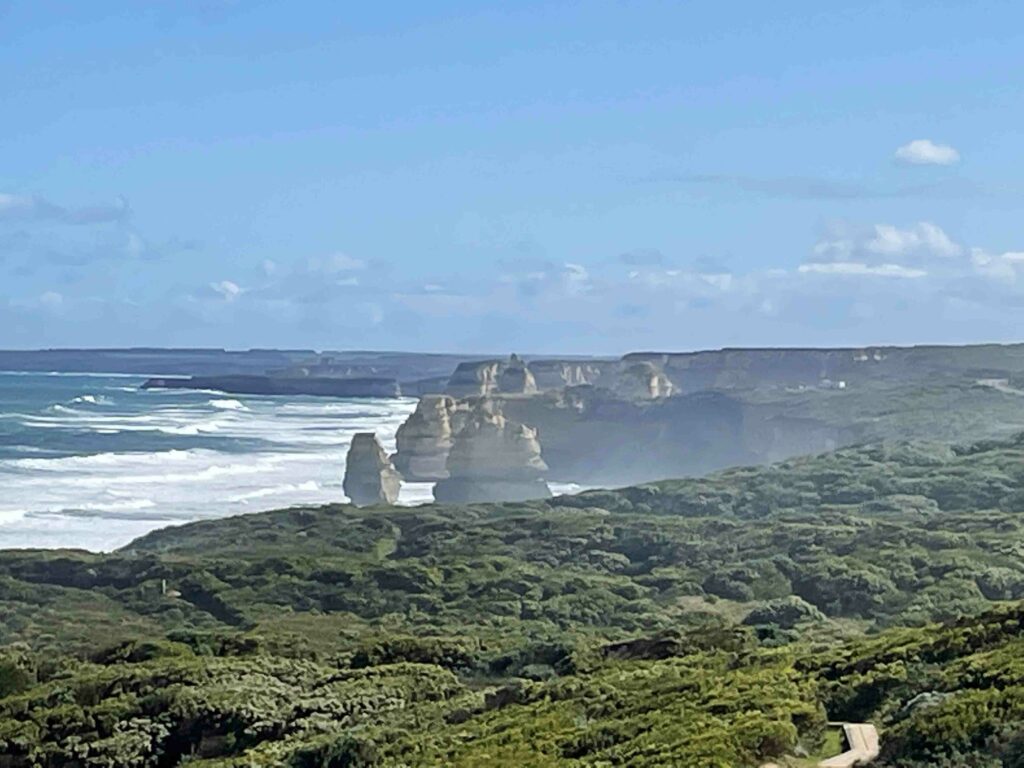
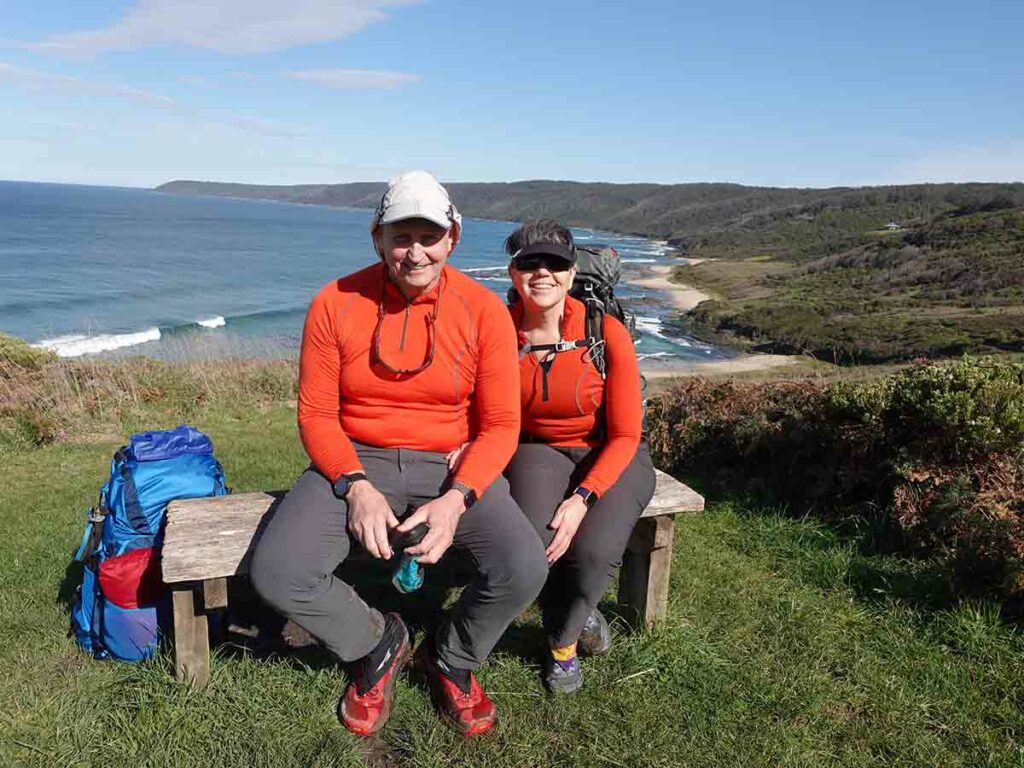
View to the Twelve Apostles
Take it all in
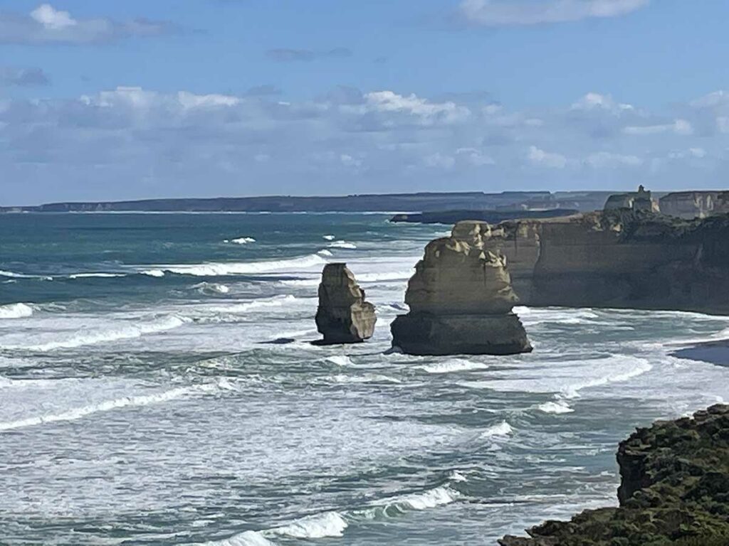
Close up of some of the Apostles
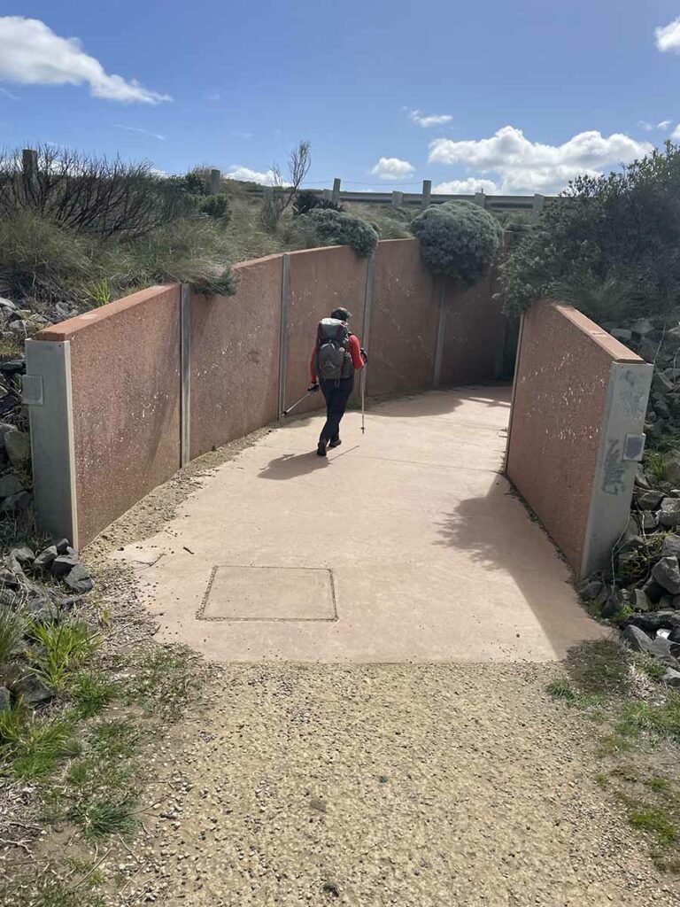
Heading under the road on our final walk to the visitor centre
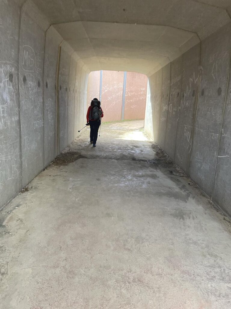
Walking under the great ocean road
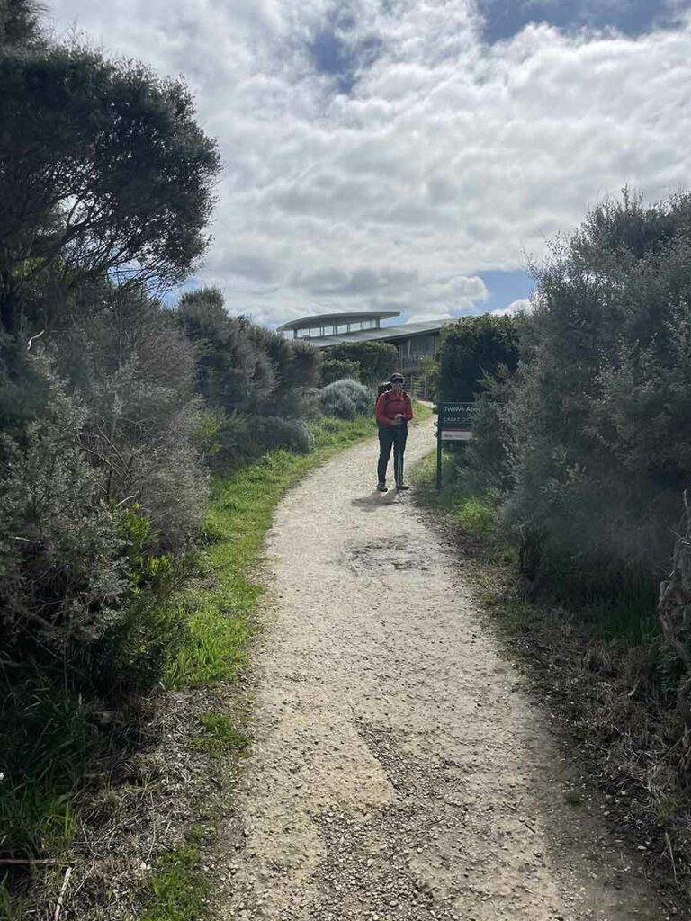
Approaching the Twelve Apostles Visitor Centre
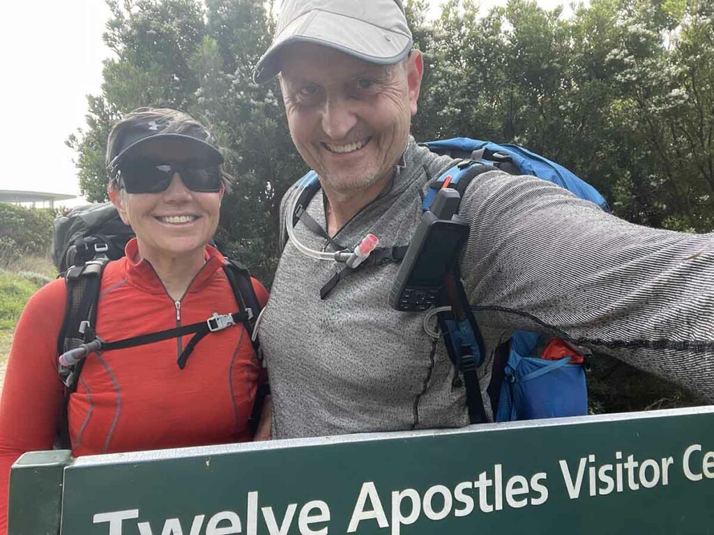
Done and dusted!
Twelve Apostles Visitor Centre
Flora, fauna and the broader environment
- Not a huge wildlife trip but given this was when we were just coming out of winter so this wasn’t a surprise.
- Lots of birds though
- One echidna
- One Death Adder
- Goanna
- Wallabies
- Koalas
- In our case heard but not seen although other hikers saw them
- The spring flowering was just starting so would be better in late spring into October
- We both love the Victorian coastline, it’s different enough to NSW to be exciting to us
Final thoughts
This walk is an easily accessible coastal walk that provides options to suit your hiking style. In talking to a number of local hikers many people choose to do this walk in a series of weekends and I can see why. By the end of the walk we realised that each day is unique rather than being more of the same. So its best to consider this as being not just one 100km+ walk but rather a series of individual walks added together to create a great experience.
Speaking of distances you will find various resources on this hike quoting different distance. The guidebook uses 98.5km and the Parks Victoria website talks about 11okm. My Suunto GPS measured our walk at 104.1km so we have used 105km as the distance for this hike. When you plan this hike use the figure of 3km per hour to plan out your days. If there hasn’t been any rain for a while you will be able to travel faster and in fact on sections without mud we traveled a lot faster.
Speaking of mud it really doesn’t matter how good your footwear is if its muddy – you are going to slip and slide. Having said that avoid footwear with poor grip otherwise you will loose your footing more often than you should. Gill and I came away from this hike with the view that a pair of Crocs or sandals would have been a big plus.
On thing I must mention here is the ‘Decision Points’ along the trail. When you think ‘Decision Point’ it implies that there is a choice and this is not always the case. In some instances you are walking along rock platform for short distance but this relies on having low tides and good weather. Please note that the decision point as you leave the Blanket Bay is NOT a decision point. You really have no other choice but to take the inland route and as mentioned above, after trying the rock platform option we ended up turning back. This sign should be removed and instead say ‘trail this way’. In all fairness, Parks Victoria say not to use any of the decision points as alternatives but in all honesty it would be better not to mention them if they shouldn’t be used.
Overall this is a great walk that is well worth doing. All you need to do is pick the right time that suits your needs.
Trail video
This short video (just over 11 minutes) contains photos and videos to show you the walk from start to finish
In Style
There are a number of companies that provide guiding options on this walk and also include options where you don’t camp. Find out more here
Getting There
Access to the trailhead at Apollo Bay is going to vary. If you are local, the best option is to do a car shuffle. If you have travelled from interstate your options are going to depend on where you are coming from but you can access the trailhead by bus or car
Things to Know
- Phone: The phone signal on this trail is minimal and really erratic with Telstra so it would be even less reliable with other carriers
- In most case you may be able to send text messages and make phone calls at the higher points along the trail but internet access is limited. Even when we did have internet access the signal was usually poor so it drained our phone batteries quite quickly
- Water: Water is available at each of the campsites
- You should filter the water
- Parks Victoria does not top up the water tanks which means they are reliant on rainfall so keep this in mind during mid summer in periods of drought
- Toilets: The only toilets are at the huts so you should bring a trowel for in-between just in case
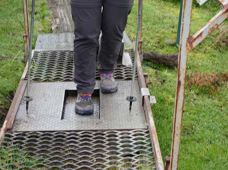
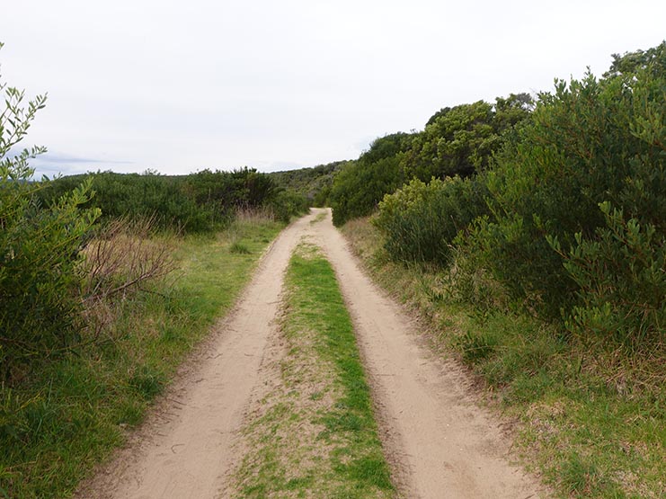
- Trail: This trail consists of formed track, boardwalk sections, and beach/rckk platform walking
- Dogs: Dogs are NOT allowed
- Camping: Only allowed at designated campsites so book early to get your desired dates
- Off-trail accomodation options are available with the best option being through a guiding company
- Other:
- This walk is best done starting at Apollo Bay and finishing off at the Twelve Apostles Visitor Centre
- Its worth taking the guidebook for this hike with you or at least photocopy the relevant pages
- Bring wet weather gear, you definitely need it during the colder months of the year but likely year round
- There are a few foot cleaning stations along this track to help stop the spread root rot. Take the few minutes required to help preserve this trail
- Inlet crossings
- There are two inlet crossing on this trail. One at Parker Inlet and the other at Joanna Inlet. You can’t bypass these crossings. Your only option is to back track out onto the Great Ocean Road and either road walk or get a lift
- Carry a copy of the tide times for this walk
- Pay attention to the tide times and where possible cross at low-lowish tide
- Do your research on how to cross inlets if you aren’t familiar with this practice. The depth and conditions of these inlets will vary greatly so if there is any doubt, don’t cross
- There are two inlet crossing on this trail. One at Parker Inlet and the other at Joanna Inlet. You can’t bypass these crossings. Your only option is to back track out onto the Great Ocean Road and either road walk or get a lift
Suggested Resources
In addition to the Australian Hiker Podcasts and write up the following resources will help with your planning
- Victorian Parks
- Accomodation used at the Twelve Apostles
- Twelve Apostles Motor Inn
- Please note that we picked this motel purely because it was the closest to the visitor centre and they were happy for us to leave their vehicle there while we walked. There are a number of accomodation options that are relatively close to the Twelve Apostles Visitor Centre that you can choose from
- Twelve Apostles Motor Inn
- Transport
- Ride With Us
- This is who we used and they picked us up from our motel
- Vline bus service
- At the time of this write up they ran three days per week so it may not suit your needs which is why we did the vehicle option
- Ride With Us
- Guidebook
- Well worth purchasing to help with your planning and to provide a prompt at the start of each day on the trail
- Read our review of this guidebook here
Equipment suggestions
Everyone has preferences in relation to gear that they carry on a hike. The following are some suggestions on things worth taking based on our trip:
- Three pairs of socks
- Expect to get muddy during the wetter times of the year
- Three pairs of socks will allow you to rotate them through and have a dry pair to put on each day
- Carry a length of cord/clothesline to dry out clothes
- Trowel and toilet paper
- Just in case you need to go in-between campsites
- Rain pants
- In some parts of the trail there are limited seats so rain pants also allowed us to sit anywhere!
- Gaiters
- More to reduce the mud on your clothes rather than for snakes
- Camp shoes
- Its really rare that I will carry more than one pair of footwear on a hike but on this trip its worth it to allow your shoes to dry out at the end of each day. Sandals (and socks) is a good option here
- If its muddy trekking poles are well worth having for stability
Have a look at Tim and Gill’s Multi Day Gear lists to use as a guide if you are quite sure what to take:
Disclaimer
This walk was undertaken by the team from Australian Hiker