Orroral Campground to Orroral Homestead Walking Track ACT(9.6 km)
ACT
Nearest Town
Tharwa
Starting Location
Orroral Campground
Finish location

Orroral Campground
Orroral Campground to Orroral Homestead Walking Track Review
The starting point for this walk is located is at the Orroral Campground so can be undertaken as a day trip as well as providing the option to combine it with an overnight camping trip. This campground has a more natural feel to it being nestled in the bushland located at one end of the Orroral Valley. The nearby Honeysuckle Campground is very different, feeling more like a suburb of Canberra due to the landscaping undertaken when the former tracking station was constructed.
If you haven’t been to this camp ground previously park your car near to the toilet facilities and after reading the very obvious trail head signage you need to head off towards the left of the entry road where the trail formally starts. You are walking past campsites at this stage on a track that is actually two trails, the walk into Orroral Valley itself as well as the shorter 1km circuit travel that takes in the bushland around the camp sites. About 500meters intro the trail you will come across a signposted junction which is hard to miss and and at this stage you follow the signs to the left. Overall this trail is well signposted and you only really need to pay attention once you end up in the valley proper where you are following a series of posts with arrows. The entire walk is relatively flat with the only smallish uphill section being on the return trip as you head back into the wooded area
From the turnoff point you are walking along bush trail which has a very remote feel to it as you wind your way through the small valleys until the trees start to thin and you enter Orroral Valley itself. Orroral Valley is an old farming area and while the centre of the valley was reasonably clear of trees the local farmers expanded that to remove some of the tree growth at the edge of the valley. Once you approach the valley proper the kangaroo population starts to appear and you are almost having to brush them out of the way there are so many in some areas. The smaller joeys and females will move quite quickly once you get too close but the big males will just lay there almost daring you to come closer. I must admit that this is the first time that I had really paid close attention to the claws on the back feet of a large male Kangaroo and am not surprised that they have a high degree of confidence in their own ability to protect themselves.
Once you enter Orroral Valley it almost appears that you can just walk down the centre of the valley itself but this is not the case with the trail skirting the areas of swap that mainly hug the right hand side of the valley but every so often protrude into the centre. The direction signage is very good but you need to remember to keep an eye out for the posts with arrows that tell you which way to go as sometimes they are located at a right angle to where you would expect them to be.
A word of warning here that the swampy areas, which are reasonably easy to spot due to the longer and usually greener grassy growth, is where all the snakes live and we spotted a large Red Belly Black Snake (only after we had startled it) just off the side of the trail. You should always be scanning any trail, as well as off to the sides as you walk, but particularly through these long grassy areas which are either on hard trail or board walk.
As you move your way down the valley the tall Poplars at the Orroral Valley Tracking station become very prominent and provide an easy to follow end point if you which to extend the walk that far. Our destination on this trip was to the Orroral Valley heritage precinct which contains the Orroral homestead which is in reasonably good condition, the adjacent Gregory Homestead which is a set of ruins, and the Woolshed which again is in good condition. Allow at least 30 minutes to take in the heritage buildings which have good interpretation signage that explains the history of this area. If you aren’t extending you walk further down the valley to the tracking station its time to turn around and head back the way you came.
Once we reached the turn off point and walked back onto the circuit trail back near the campground we turned left which allowed us to complete the circuit and provided different views.
While this walk can be done at any time of the year the open expanse in the middle of the Orroral Valley can be a scorcher during the hotter months so either do it early in the day if it’s going to be hot or choose a cooler time of the year if you don’t like the heat. Like many walks in Namadgi doing this walk on a frosty foggy day would be an excellent choice. This was an enjoyable for for us and as always Namadgi never fails to impress.
As mentioned you can also extend this walk to the Orroral Valley Tracking station(former) which will add about 3km (in total) to the walk. You can also choose to do this walk as a one way without the return and either do some car shuffling or have someone pick you up.

Orroral Campground

Trail signage with toilet block just to the right

Caravans and tent at the Orroral campground

Signage at the trail head

Example of interpretive signage on the trail
Turning off the campground circuit trail

Tim on the trail

Out of the trees into the valley

Directional signage in the main valley

Orroral Valley

Walking down the centre of the valley

Crossing over the swamp areas. Keep an eye out for snakes in these areas

Kangaroos on the trail

I’m big and tough and not going to move for anyone

Gregory ruins
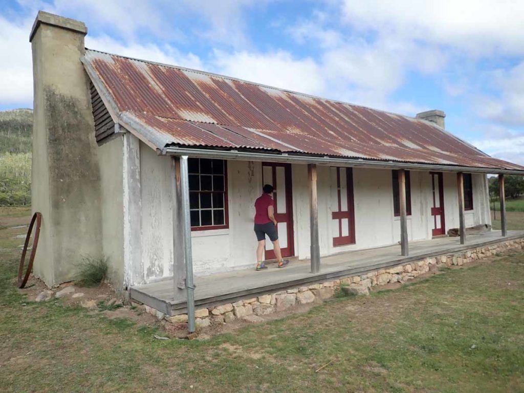
Orroral Homestead

Woolshed

Inside the woolshed

Skink on the trail

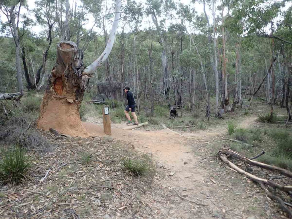
Tree bark at Orroral

Ants and termites in the same place. Turn left back onto the circuit trail to finish your walk in about 500meters
Getting There

Google Map to Orroral campground. The Orroral campground is approximately 54km from the Canberra GPO
Things to Know
- Phone signal is almost non existent on this trail
- Bring you own water
- Keep an eye out for snakes as you move through the sections of trail on the valley floor with long grass
- You can camp at the Orroral campground but there are fees. Details can be found at https://www.environment.act.gov.au/parks-conservation/parks-and-reserves/find-a-park/namadgi-national-park/orroral-campground-namadgi
Disclaimer
This walk was undertaken by the team from Australian Hiker