2020 Australian Alps Walking Track
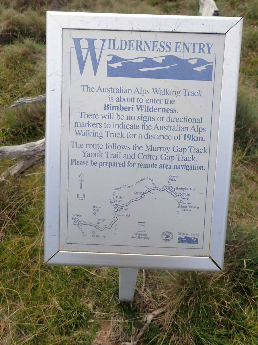 Trail-warning-sign
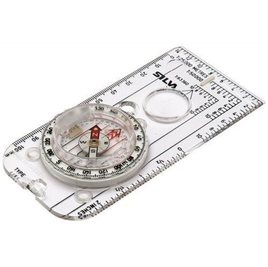 Silva Expedition 54 Southern Hemisphere Plate Compass
The Australian Alps Walking Track (AAWT) is by no means Australia’s longest trail, far from it. But what it lacks in distance it makes up for in complexity. Complexity in planning, complexity in logistics, complexity in navigation, and in many cases high degree of remoteness that means you can’t just pop into town when you feel like it.
Unlike other Australian long distance hiking trails, the AAWT isn’t a continuous footpath. This track consists of formed trails and management tracks, but there are also sections that are unmarked requiring you to follow a compass bearing, land formations and points of interest. The image for this post was just one example on the 112 km section of the AAWT from Kiandra to Tharwa that I did in 2019 to provide me with some background in planning the full trip. You definitely get a sense of the remoteness.
Over the past year one navigation aid has come to market for this trail that will make this trip much easier and that is the Guthook Guide navigation app. While this app has been around for a number of years, the AAWT wasn’t included but is now. I will still carry paper maps and a compass however this app is very helpful both in the planning phase (providing distance to the last/next campsite and elevation profiles) as well as on track (providing an extra degree of comfort, just in case you think you may have gone astray).
In addition to the Guthook app and paper maps, I will also carry a GPS. I’ll download the AAWT GPS file but in my case the GPS is more about logging my trip rather than for navigation. Similar to Guthooks, my GPS allows me to work out where I am so it will be a good backup.
The Australian Alps Walking Track (AAWT) is by no means Australia’s longest trail, far from it. But what it lacks in distance it makes up for in complexity. Complexity in planning, complexity in logistics, complexity in navigation, and in many cases high degree of remoteness that means you can’t just pop into town when you […]