Stony Creek Skyline Track ACT (4.9km)
ACT
Nearest Town
The closest suburbs to the northern trail head are Duffy/Wright, ACT
Starting Location
Cotter Avenue which is the road that runs through the Cotter picnic area

Finish Location
Cotter Avenue
Best Time of the Year to Walk
Year round
Stony Creek Skyline Track Review
I had this walk on my to do list and for some reason list it just slipped my mind. By pure chance the weekend that we picked to do it had been raining quite heavily and as a result we both ended up with wet feet due to the sodden long grass that formed much of the trail. We did however manage to do this walk without the rain falling which vindicated our decision to delay our walk until Sunday, a day later than we normally would.
This walk starts in the Cotter Reserve Recreation area and the best place to park to immediately adjacent to the large playground facility. You walk straight past the playground and almost immediately cross the river on a trail tread shared with the Cotter Dam Discovery Trail. Before you cross there is a detailed information sign just on the side of the path which unfortunately doesn’t contain this walk so be warned. The ACT Government does produce an online map which identifies the walk and it’s worth either printing out, or as in our case, saving it as a photo on my phone just as a prompt.
Once you cross the river turn left and follow the Discovery Trail until you are presented with a gravel road that branches off to the right and becomes the trail itself taking it uphill just past the edge of the Discovery Trail. Follow the gravel road up and you will come across small blue signs on narrow posted that direct you to the first destination point of Moores Hill. This will require you to cross over the road so pay attention to traffic coming from both directions.
The Moore Hill summit is an optional side trip but one well worth doing as it provides some of the best views to the Dam Wall from above. After you have crossed the road follow the signage (that include blue painted arrows on logs, through the path of trees and then turn left top to the summit of Moore Hill. We suggest that you do the Moore Hill side trip first and then continue on to your main destination of the Grasstree Lookout. Once you head back down and rejoin the main track you head left down hill and keep left as you walk parallel to the road for a short distance. At this stage you get views to the Cotter Pumping Station across the river and will walk past the one lane bridge that you more than likely crossed on the way and past a sign that indicates that you are in the Stony Creek Reserve.
Much of the trail up until this point is on old rural grasslands and as you enter the reserve proper the weed growth gets worse and at this point I was thinking through my write up and not being very complimentary. Even as you follow the signs uphill the weed growth stays with you until you get about a third of the way to the summit and at that time its almost as if someone has drawn a line and almost all the weeds dissapear as the vegetation turns into more natural bushland.
The trail up to the Grasstree Lookout is well formed and consists of lots of switchbacks which I’m normally not a fan of but in this case it provides opportunitys for different vistas. As you approach the summit the Grasstrees for which this lookout is named star appearing and on the day we summited it was flowering season which is always a bonus. On reaching the summit there is a park bench to sit and take in this views down in bio the valley below. It’s for this reason that you do the walk. On a fine day it would be a good place for a tea break or for lunch.
Once you’ve taken in the views start your descent back down the hill where again you are provided with views to Casuarina Sands Recreation area and the pump station. While the potential exists to take an alternate route back to the trail head this would require you to walk across the single lane bridge which we would advise against given the amount of traffic that uses this road. Continue back the way you came returning to the trail head past the turnoff to Moore Hill. I originally thought that this walk would end up being close around 5.5km in distance but realised that the original detour up to Moore Hill added 800 meteres on the trip out that we didn’t do on the way back. Instead this walk ended up at 4.9km which is a nice distance for a walk taking us 1 hour and 40 minutes from start to finish
There is walk limited signage on this trail and you do need to pay attention to where you are heading until you get your eye in for the blue trail markers. As mentioned the weed growth on this walk is a detracting feature but the views from Moore Hill as well the top section of the hill a you approach the Grasstree Lookout make this walk well worth doing. If you have the time make a day out of it and do a couple of the other walks contained within this reserve. One option is to head towards the interpretation centre on the Cotter Dam Discovery Trail on the way back down the hill which is only a short detour and one that provides front on views to the Dam wall itself.
Trailhead carpark

BBQ facilities at the trailhead
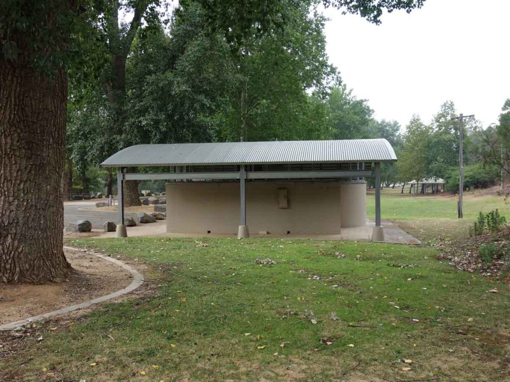
Toilet facilities at the Cotter Recreation Area

Cotter Playground

Walk around the playground

Head towards the stairs

Interpretation signage near the trail start. Follow the Cotter Dam Discovery Trail at this point the Skyline trail is not marked on the sign

Cross the bridge over the Cotter river
The Cotter Dam wa overflowing on the day we did this walk so the river has a good steady flow to it

Turn left

Head up the Gravel road

Head up the stairs

Follow the dirt trail

Trail direction marker

Around the gate

Across the road

A weed but attractive all the same
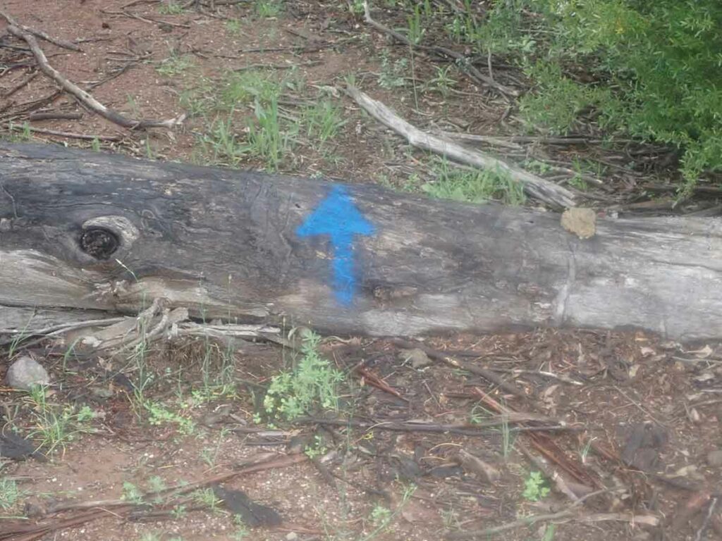
Trail marker

Up to Moore Hill

Moore Hill Summit

View to Cotter Dam. on this day the dam was overflowing
Take the campground arrow to the left once you descend from Moore Hill

Down the hill

Turn left at the gate as you approach the road

Go through the yellow gate

Follow the trail. At this stage you are paralleling the Cotter River

Follow the signage

Lots of weeds!

Switchback on the trail. As get get about a third of the way uphill the weeds disappear

Lomandra in flower

Gill with a flowering Grass Tree

Close up of Grass Tree Flower spike

Almost at the summit

Native Pea Flower

Hibbertia in Flower

Wood Rot Fungus

Gill at Grasstree lookout

View to the Cotter River

Views to the Cotter pump house

Tim crossing over a bridge on the way back down

Male King Parrot

Narrow bridge. Don’t use this as an alternate route as the traffic is busy along this road

Heading home

Back over the road

Almost there

Duck on water

Back to the trailhead
Trail Video
Short trail video from start to finish
Getting There
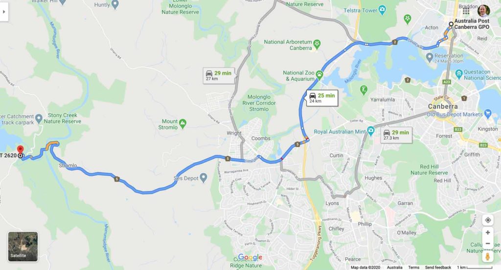
The trail head at the Cotter recreation Area is around 24 km from the Canberra GPO and around a 25 minute drive
Things to Know
- Water is available at the trailhead
- There are great BBQ and picnic facilities available at this trailhead.
- There is an excellent playground for the kids as well
- No dogs allowed
- No camping (camping is available at the nearby Cotter camping area)
- Phone signal is pretty non existent on this trail
Disclaimer
This walk was undertaken by the team from Australian Hiker