Porcupine Walking Track NSW (5.7km)
Kosciuszko National Park
Nearest Town
Jindabyne, NSW
Best Time of the Year to Travel
- For newer hikers – November to mid April
- For experienced hikers who can cope with snow conditions and navigation off trail – year round
Starting/Finish Location
Porcupine Walking Track car park
Porcupine Walking Track Review
As I work my way through the walks in Kosciuszko National Park I was looking forward to doing the Porcupine Walking Track having previously done it during wintertime as a snowshoe trip. While I knew I would enjoy this walk it surprised me and from my perspective ranks as one of the best walks we have done over the past year.
First up this walk really is one for the warmer months but it does share some common trail tread with the ‘Porcupine Trail’ which is the snowshoe version for the snow covered months. Probably the hardest part of this walk is getting to the trailhead (see details below). Take the first turn on the left past the Man From Snowy River Motel which you will come across as you enter the Perisher township. There are signs at this turn and others along the way that will take you through to the trailhead adjacent to the local water supply dam.
Since we originally did this walk a new sealed larger carpark has been installed and while there are plenty of parking spaces this is a busy location so get there early in the day.
Parking is limited consisting of two small pullout areas that will suit about seven cars providing everyone has parked straight.
There is a small interpretive sign at the trailhead and then you will cross a small metal bridge to commence your trail. The trail tread is a well worn single pathway interspersed with the occasional metal mesh or small wooden bridge that takes you across small creek crossings and wet areas. Along the way you will come to two turnoffs, both on the left hand side. The first is well sign posted as a link trail and the second takes you off the main walking trail onto the wintertime snowshoe trail. The snowshoe trail (Porcupine Trail) has its own signage (see below) but if you feel like going off track, this trail is well worth a visit.
To stay on the Porcupine Track ignore both of these turn offs and continue on the well worn path. Your destination is the saddle at the top of the hill and at this stage you will come across directional signage that takes you to the Porcupine Rocks which is the high point of the trail and provides great views across the valley you have walked up as well as the valley on the other side of the ridge line.
On the day I visited this peak the wind gusts were reaching 40km+ so I opted for the nearby adjacent rock outcrop that provided good views but also some protection from the wind gusts. After taking in the views I wandered over to the main rock peak and took in the views from the differing vantage points. The return journey is much quicker and follows the same track you followed on the way out but it does provide views down the valley as you go. While there were plenty of people on the trail the weekday I did this walk it still has that primal almost wilderness feel about it and combined with the shadowing created by the incoming cloud cover, this walk just had a really good feel.
Wildlife was non existent on this day which isn’t surprising and given the wind gusts the birds were also nowhere to be seen. Vegetation consisted of heathland and eucalyptus mallee but what I really loved were the wildflowers spread along the trail including trigger plants which are a favourite of mine.
This is a great walk that also allows you to go off track if you feel so inclined – it is well worth doing.

Close up of trailhead sign

Trail start

Trail sign

Off we go

Trail example near trail start

View to the side of the trail

View on the way up

Link trail turnoff

Snowshoe Track – this is not the walking track

Yellow wildflower

Trail post

Trail markers

Trail example

Grasshopper

Mesh over wet areas on the trail

Summit direction signs

Direction to the summit

Trail sign near the summit

Yarrow, looks pretty but is actually a weed

Approaching the summit

Epicormic growth on a eucalyptus

View to the main summit. On the day I walked this track it was too windy to climb the final summit

Panorama coming off summit

Summit image

Orange wildflower
Yam Daisy

View across the valley on the way back

Leek Orchid on the side of the trail

View on the way down

Vehicle acess to the pumphouse

Trigger plants (Stylidium)

Millipede

Returning to the car park
Walk Video
This short video includes still images and video showing this walk from start to finish
Getting There

Travel to Jindabyne via Cooma and head towards Charlotte Pass. There is a park entry fee which you can pay for as a day or annual pass at the visitor centre in Jindabyne or at the toll gates on nearing the park. The visitor centre in Jindabyne opens at 8:30am most days but check the timings on the website just in case
Once you have entered the park follow Kosciuszko Road until you come to Perisher Valley. The turn to get to the trailhead car park is on the left hand side immediately as you pass The Man from Snowy River Hotel
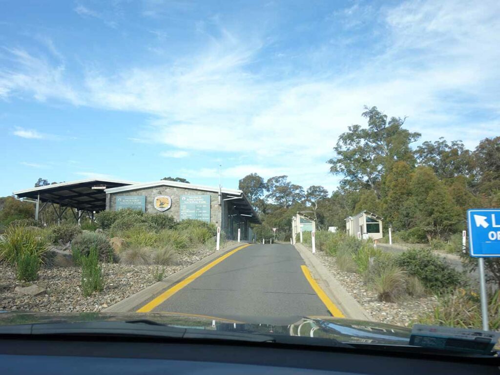
Entering the Kosciuszko National Park

Approaching Perisher

Perisher Valley

The Man from Snowy River Hotel

Turnoff to the trailhead car park immediately as you go past the Man From Snowy River Hotel

Turn right at this turn


Approaching the trailhead

Turn right to the trailhead

Turn right again

Car park
Things to Know
- Phone: There is limited phone signal (Telstra) on this track, mainly at the high points
- Water: You need to bring your own water. There are limited locations to draw water on the trail but if doing so you should filter
- Toilets: There are no toilets at this trailhead with the closest being at Perisher Valley or at the Sawpit Creek Picnic Area located at the Kosciuszko Tourist Park shortly after you enter the park
- Trail: This walk is on formed natural trail including section of mesh
- Dogs: No dogs allowed
- Camping: Camping allowed (Check with Kosciusko National Park on prohibited camping zones)
- Other:
- There are two turnoffs on this trail. The first is a link trail and the second is the snowshoe trail. DO NOT take these turnoffs unless that is your plan
- Unless you are into snow snowshoeing or skiing, do this walk late November to late March. Even then, check the conditions just in case
- Check the weather conditions – snow is possible in most months of the year
- Bring a broad brimmed hat, long sleeved top and long pants as the UV index can be brutal in the Alps (see below)
- Wear long sleeves and pants to ward off the March flies
Disclaimer
This walk was undertaken by the team from Australian Hiker