Mount Bushwalker NSW (7.4 km)
Morton National Park
Nearest Town
Milton-Ulladulla
Starting Location
Mount Bushwalker carpark
Finish Location
Mount Bushwalker carpark
Best Time to Travel
Year round. The trail gets very wet after periods of rain. The best time to go is when it has been dry for a while. Springtime also has the best wildflowers although you will see something interesting at anytime of the year
Mount Bushwalker Summary
This was one of the many trails impacted by the fires of 2019-20 so the images shown in this review are likely to be different to reality, particularly at the summit highpoint. The first time I did this walk was after a three week period of heavy rain. I had only just done the Overland Track in Tasmania about a month before and the trail conditions on this day reminded me of that trail with lots of boardwalks, mud and tree roots. The trail is rated with a difficulty of 4 which seems high given that it is not particularly long or steep however if the trail is wet you need the ability to pick your way though wet muddy tracks and to be able to maintain your footing. Unlike the Overland Track the boardwalks don’t have wire on them to provide a textured surface so the boards tend to be very slippery if they are wet. The mud can also be deep if you step off the artificial surfaces. Those were the negatives.
There are however lots of positives. The trail is relatively easy to follow – if you do take the wrong turn it soon becomes clear you have gone off trail. It took me a while to work out that there are yellow paint marks on the rocks to highlight the way but this is not actually identified on any signage so you need to work it out for yourself. The trail incline is very gradual from the carpark to the peak going across natural trail, boardwalks and varying types of wooden ‘stepping stones’. You will also walk across sections of natural rock.
Most trails I have done in southern coastal NSW are all very similar, however the Mount Bushwalker trail is very different and as mentioned reminded me more of Tasmania. This surprised me which is rare when I do a walk these days. As much as I like doing the very well known nearby Pigeon House Mountain, this trail is not as steep and also not as as high, the bush is wilder and as a result you feel closer and more connected to the valleys and more immersed in the environment.
The vegetation is reasonably dense but doesn’t require any bush bashing to get to your goal. It’s also variable and due to the relatively small number of people on the trail, the birdlife and animal life is more numerous than trails such as Pigeon House Mountain. While mid spring is probably the best time to do this walk with much of the native vegetation in flower there is always something to see throughout the year. On this trip we watched a pair of Black Cockatoos feeding on Banksia seeds, not too bothered by us being there.
This is a trail well worth doing in its own right so I will do it again at different times of the year to experience the differences in the plant and animal life. In addition this would be an excellent training walk (particularly just after it has rained) for those planning on doing some longer trails and wanting to gain experience.
Getting There

- Head north from Milton along the Princes Highway and turn onto Porters Creek Road
- Travel along Porters Creek Road turning right, the road becomes Bushwalker Road. The Mount Bushwalker carpark is 14 km from the highway and well signposted. If you go too far you will come across a sign saying 4WD drive vehicles only (this sign is less than 100 metres past the carpark)
- The road is in reasonably good condition and will suit standard cars
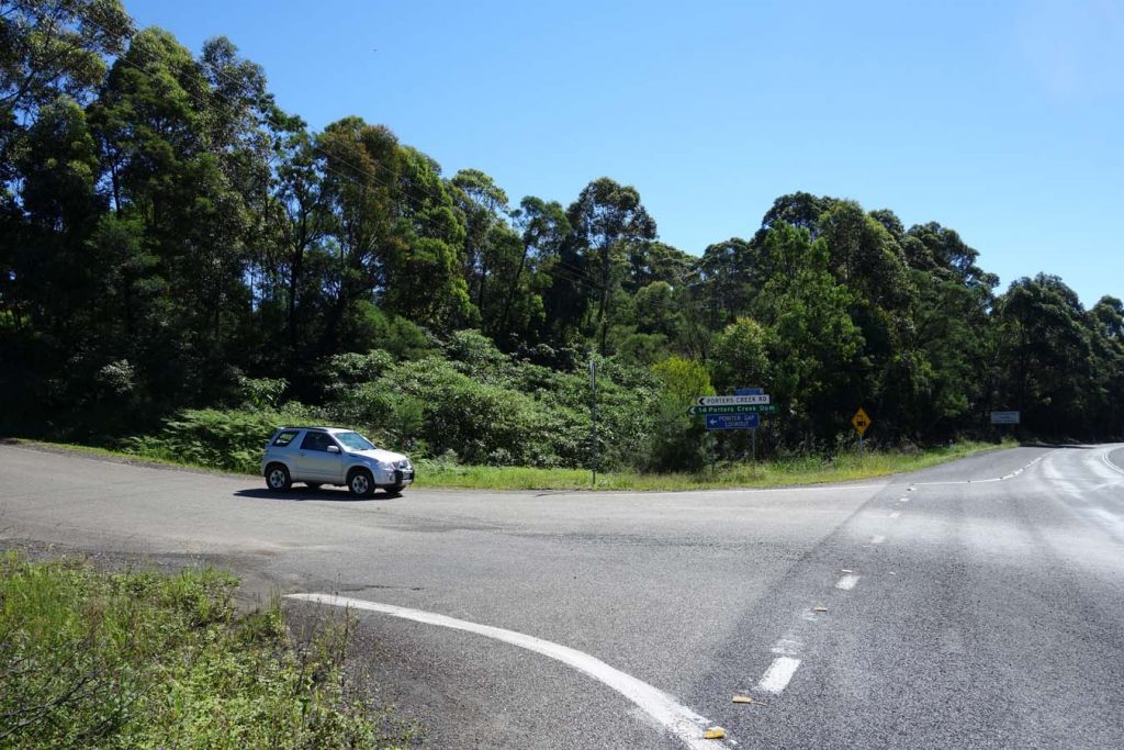
The turn off onto Porters Creek Road on the left side of the highway

Keep to the right when given a choice of turn offs

Mount Bushwalker carpark. The carpark can cope with about 14 vehicles
Things to Know
- Phone: Phone signal is variable on this trail and not always reliable (Telstra)
- Water: Bring your own water.
- Toilets: There are no toilets on this trail
- Trail: This walk is on formed trail including boardwalks but some sections can be muddy after wet weather
- Dogs: Dogs not allowed
- Camping: Camping allowed (Check with Kosciusko National Park on prohibited camping zones)
- Other:
- This track may be closed during high fire danger or heavy rains
- Check the NSW parks website before visiting
- The trail can get very wet and boggy after periods of heavy rain. Come prepared with footwear that can handle the water and has good traction
- The boardwalks can get very slippery
- You will come close to the edge of drop offs so be careful if you do go off trail
- This is an area that was used for artillery practice in the past. Don’t pick up anything odd looking as it may be uenexploded ordinance
- This track may be closed during high fire danger or heavy rains

Yellow direction markers on the rocks. Most examples of this marker type are just yellow dots

Wet muddy trail after a period of heavy rain

Wooden stepping stones. Slippery when wet

There are some small sections of metal boardwalk but mostly wooden boards which are slippery when wet

The trail flooded after heavy rain

View from the top

Black Cockatoo

Wildflower

Sundew – carnivorous plant
Disclaimer
This walk was undertaken by the team from Australian Hiker