Burwood Trail NSW (1.8km)
Glenrock State Conservation Area
Nearest Town
Newcastle, NSW
Starting Location
Burwood Walking Trail – trail head

Burwood Walking Trail has limited signage. The trail head is where most of it is located

Parking is limited and this corner with the water tank is only about 30 metres uphill from the trail head and a good choice if you get there early
Finish Location
Burwood Walking Trail – trail head
Best Time to Travel
Year round. Start early in the day to avoid the crowds and to get the most of of the bird life
Whats special?
A quick little walk that accessible to walkers of all fitness levels.
Burwood Trail Review
Many serious bushwalkers would ask why bother as this walk is so short? Sometimes the short walks are good options for any number of reasons. In our case we chose to do this walk as we were in Newcastle (NSW) for a family commitment for the weekend and only had a limited amount of time and we were glad we did.
The hardest things about this walk is finding a car park as you often need to compete with the surfers who access the ocean along the same area. parking can be a bit hard, particularly if you have a low slung car so arriving early in the morning if a good choice to ensure the walk to the trail head isn’t longer than the walk itself. Another reason for starting early on this walk is the birdlife. NSW Parks recommend that you bring binoculars and while I’m not a birdo I wish I had brought a pair with me as the Bellbirds in particular provided a good chorus for the middle half of the walk as they tried to outdo each other.
This walk is on a shared path so while we did come across a number of cyclists but there were no horses on the day which is always a possibility. The trail itself is pretty much natural all the way from start to end and while there is a change in altitude its not going to tire you being so short. The bushland consists of tall trees with low undergrowth and surprisingly enough i enjoyed they vegetation mainly due to Eucalyptus bark which is different to what I am used to.
There is limited signage on this trail but its not really necessary however it would be good to have a sign to tell you to turn around at the end when you reach the shallow creek. It seems that your just expected to know this. The trail really ends at the point where the creek drops down hill an give you a chance to sit on the convenient rocks to just take in the scenery which is something that I don’t often do.
While this walk is not really spectacular is has enough going for it and if you don’t have time to do the longer nearby Yuelarbah Walking Track then its a good option, in particular for the bird life.

Shared trail sign. keep and eye out for both bikes and horses on this trail

The trail is in good condition and easy to walk on


There is some really nice bark on this trail if that’s what you’re into

This tree sap was almost black

No horses on the day we walked this trail but a number of bikes

The turn around point on this trail and a good place to sit and enjoy the world
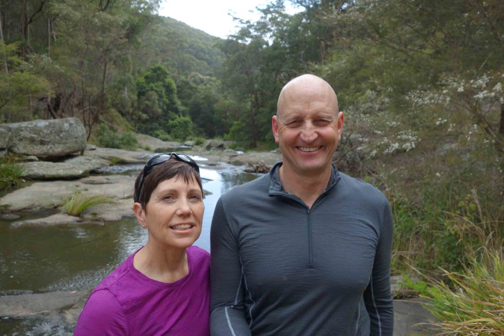
Gill and Tim at the turn around point

If you cross over the creek you will find this sign pointing back to the Burwood Trail
Getting There

The Burwood Trail is located in the Glenrock State Conservation Area and is managed by the NSW National Parks and Wildlife Service. The road to this trail head is then that will take you to the scout camp. If you drive about 80 metres further than the trail head you will reach the scout camp.

Scout Camp Road turnoff that will take you to the trail head
Things to know
- Phone: There is good phone signal on this track
- Water: Bring your own water
- Toilets: There are no toilets on this trail
- Trail: This trail consists of formed track
- Dogs: No Dogs allowed
- Other:
- Parking is limited at the trail head
- NSW parks recommend bringing binoculars for bird watching and this is definitely a trail to for them
- The trail access road may be closed in conditions of poor weather or fire danger
- You may come across horses on this trail
Disclaimer
This walk was undertaken by the team from Australian Hiker