Australian Hiker’s Multi-day Australian Bucket List Hikes
Oh! The places we'll go!
Oh! The Places You’ll Go!
by Dr. Seuss
Congratulations!
Today is your day.
You’re off to Great Places!
You’re off and away!
In this article we identify our bucket list of Australian-based multi-day hikes. Each of these hikes, regardless of their length, has something that resonates with us (particularly Tim) and while they may not be your cup of tea, they are all on our ‘to do’ list for the coming years. Our bucket list hikes range from 54 km all the way up to the longest trip on the list at around 1200 km.
Use these walks as a guide and hopefully it will spark some enthusiasm for you to add one or more of these walks to your bucket list – maybe it will inspire you to try something you hadn’t thought about!
1. Uluru Kata Tjuṯa Signature Walk (NT)
- Distance: 54 km
- State: Northern Territory
- Start point: Kata Tjuta
- End point: Uluru
- Duration: 5 days
- Best time: Open April to October (closed in the high fire season)
This walk, located in Australia’s Northern Territory starts at Kata Tjuta and after travelling 54 km in luxury over five days, finishing at Uluru. We are both fans of desert based walks and this one fits the bill.
It’s worth noting that this walk is still under construction and isn’t due to open until 2026 but once bookings officially do open, it will book out fast. So, if you are keen to do this walk in the next few years then it is worth putting your name on the mailing list.
The Uluru Kata Tjuṯa Signature Walk has been developed in partnership with the local Anangu community and will be constructed on Indigenous land, previously inaccessible to the general public.
Uluru Kata Tjuṯa Signature Walk Website

2. Heyson Trail (SA)
- Distance: 1200 km
- Start: South Australia
- Start point: Cape Jervis or Parachilna Gorge
- End point: Parachilna Gorge or Cape Jervis
- Duration: 40-50 days
- Best time: Open April to October (closed in the high fire season)
Outside of the National Trail (formerly the Bicentennial Trail) this is Australia’s longest recognised trail and the longest dedicated hiking trail. The Heysen Trail passes through some of the most scenic parts of South Australia including national parks, state forests and the spectacular Flinders Ranges.
This trail also passes through the Barossa Valley so if you feel so inclined you can stop off at a winery on the way through. The northern section of this trail is remote and rugged while the southern section is more populated and more suited to newer walkers. This trail really showcases what South Australia has to offer.
At 1200 km in length many walkers do this trail in sections with only the more hard-core hikers doing this as a single thru hike.

Heysen Trail trail logo
3. Australian Alps Walking Track (VIC-NSW-ACT)
- Distance: 650 km
- States: Victoria, New South Wales and Australian Capital Territory
- Start point: Walhalla or Canberra (Namadgi Visitor Centre)
- End point: Canberra or Walhalla
- Duration: 28-40 days
- Best time: Open year round but October to May is best to avoid snow conditions
This trail is by no means the longest trail on this list, but it is one of the most logistically challenging. If you take on this trail you will be passing through some very remote alpine wilderness areas and depending on the time of the year, there may be snow. You may not see people for days on end.
While a GPS may keep you on track, you really need to have good navigation ability (including a compass!) for this trail which passes through two states and one territory, a variety of ecosystems and Australia’s tallest mountain amongst others.
This trail passes close to a number of ski resorts but it doesn’t pass directly through any towns and as such you will either need to arrange someone to meet you at strategic locations to resupply your food, or cache food (hide food in the bush) along the way prior to your trip.
Facilities are scant along this trail and you really are camping out with what you carry on your back or collect at strategic locations along the way. This one is the ultimate in wilderness hiking!
Australian Alps Walking Track Website
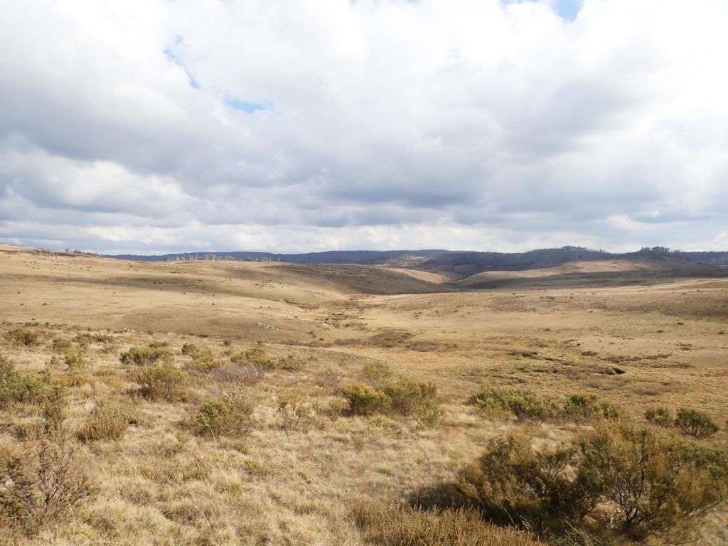
The Australian Alps Walking Track is often remote and unmarked. There is a trail in this image and to get to this point there is a sign that directs you to follow a compass bearing
4. Jatbula Trail (NT)
- Distance: 62 km
- State: Northern Territory
- Start point: Nitmiluk Gorge
- End point: Leliyn (Edith Falls)
- Duration: 5-6 days
- Best time: Open June to September
The hike follows the western edge of the Arnhem Land escarpment over a sandstone plateau and through woodlands, open forest, monsoon forest and riverine landscapes. Bookings are required for this trail and given it is a very popular walk, it can be very difficult to get a place.

Jatbula Trail (image: jatbulatrail.com.au)
5. Grampians Peaks Trail (VIC)
- Distance: 164 km
- State: Victoria
- Start point: Mt Zero
- End point: Dunkeld
- Duration: 13 days
- Best time: Open June to September. Bookings are required for campsites
The relatively new Grampians Peaks Trail is a challenging 164 km hike through remote Victorian bushland. This one is designed to be undertaken as a 13 day hike and aimed at experienced long-distance hikers.

Grampians Peak Trail hut (image: https://www.parks.vic.gov.au/places-to-see/parks/grampians-national-park/things-to-do/grampians-peaks-trail)
6. Great Southern Walk (NSW)
- Distance: 67 km
- State: NSW
- Start point: Kurnell Peninsula
- End point: Sublime Point, Illawarra
- Duration: 3-6 days
- Best time: Open year round
- This walk was due for completion by the end of 2024 but is now looking like sometime in 2026
The Great Southern Walk will incorporate existing walking tracks through the Kurnell Peninsula, the iconic Royal Coast Track and tracks through the Illawarra Escarpment. There will also be some new connecting tracks in both the Royal National Park and the Illawarra Escarpment State Conservation Area as well as upgraded tracks in Kamay Botany Bay National Park.
This will be another great walk that includes stunning coastal landscapes and places of national heritage significance.

Great Southern Walk map (image: NSW Department of Environment and Heritage)
7. Great South Coast Walk (NSW-VIC)
- Distance: 660-680 km
- States: New South Wales and Victoria
- Start Point: Bundeena, NSW
- End Point: Mallacoota, Victoria
- Duration: 25-35 days
- Best time: Open year round but keep an eye on fire conditions during the hotter months
This walk is more of a route rather than a trail starting at Bundeena (NSW) in the north and finishing at Mallacoota (VIC) in the south combining existing walking tracks and beach walking.
Generally considered a moderately challenging route. This trail is great for backpacking, birding, and camping, and it’s unlikely you’ll encounter many other people while exploring except on the pre existing trails that make up this walk
Great South Coast Walk Website
Listen to our podcast interview on this walk at 88- The Great South Coast Walk

Great South Coast Walk map
8. Great South West Walk (Vic)
- Distance: 250-263 km
- States: Victoria
- Start Point: Portland, Victoria
- End Point: Portland, Victoria
- Duration: 12-15 days
- Best time: Autumn / Spring
This walk, located towards the western border of Victoria is a loop with one half travelling through bushland and the other half being a coastal walk. The Alps has sections ranging from easy, easy-medium, to medium with none of the days classed as hard.
Camping is is designated walk in campgrounds along the way for a minimal fee.
9. Lavender Federation Trail (SA)
- Distance: 325 km
- States: South Australia
- Start Point: MurrayBridge, South Australia
- End Point: Clare, South Australia
- Duration: 14-16 days
- Best time: March – November
The Lavender Federation Walking Trail is a linear walking trail through diverse countryside traversing the eastern flanks of the Mt Lofty Ranges. It begins at Murray Bridge and traverses the Barossa, Goyder, Mid North and the Clare Valley regions to Clare. Thi trail was totally built by volunteers.
Camping is not permitted on the trail itself however there are camping options if you don’t want to use commercial options.
Lavander Federation Trail Website
10. Goldfields Track (VIC)
- Distance: 210 km
- States: Victoria
- Start Point: Bendigo, Victoria
- End Point: Mount Buninyong, Victoria
- Duration: 8-10 days
- Best time: March – November
The Goldfields Track is a 210km track through some of central Victoria’s most historic towns and beautiful forests and can be done either as a walk of a bike ride. The essence of the Goldfields Track is its environmental diversity.
11. Larapinta Trail (NT) AGAIN
- Distance: 223 km
- States: Northern Territory
- Start Point: Alice Springs or Mount Sonder, Northern Territory
- End Point: Mount Sonder or AliceSprings, Northern Territory
- Duration: 12-18 days
- Best time: April – September
Australia’s premier arid environment trails and still one of our favourite walks. This was the first long distance trail we did as Australian Hiker and while I don’t like repeating long distance trails this one isn exception that I’d like to do again at some stage.
Our 2016 Larapinta Trail write up
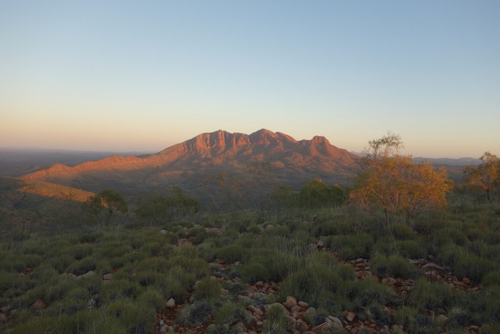
An image taken on the morning of day 2 of our 2016 westbound trip
Final thoughts
I’m a big fan of multi-day, and even multi-week walks including the very large ones. I know this doesn’t suit everyone’s hiking style but it may just excite you enough to try something different.
And remember, the option is there for several of these walks to be done in sections, or even just small pieces which means you can pick the length that suits you and come back later to do the next section.
Given this is our ‘bucket list’ of multi-day Australian hikes we’d like to explore, we may never get through the list so we may just have to settle for living vicariously through the experiences of others. Maybe that includes you!
Last updated
24 March 2026